7 Hidden Gem Trails in US National Parks
Maya Lin
Maya Lin is a travel journalist and outdoor enthusiast who believes the best trips combine rugged adventures with urban comforts. After spending six years backpacking across four continents, she founded Trail & Town Guide to help fellow travelers navigate both hidden mountain passes and bustling city neighborhoods with confidence.
If you have ever stood in a National Park shuttle line at 9 a.m. holding a granola bar like it is a golden ticket, you already know the truth: the most famous trails are not always the best trails. The good news is that most “crowded park” problems are really “crowded corridor” problems. Step a mile or two away from the iconic viewpoints and you can still find the version of the parks that made you fall in love with them in the first place.
Below are seven lesser-hyped routes in big-name US National Parks that deliver the views without the human traffic jam. I am keeping this list practical, with what to expect on the ground, when to go, and how to hike them with a lighter footprint. Distances and elevation are approximate, so always cross-check with the official NPS site (and current conditions) before you lace up.
Before you go: skip the crowds
- Start early or start late: Sunrise hikes are still the easiest crowd hack. For shorter trails, a late afternoon start can also be magic, especially in shoulder season.
- Aim for second-tier trailheads: Trailheads that are not on the main scenic drive often stay calmer even in peak months.
- Check road access: Several of these hikes rely on seasonal roads. Verify current conditions on the official NPS site before you commit.
- Know the reservation reality: Some parks use timed entry, vehicle reservations, or day-use permits in peak season. Check requirements before you leave home.
- Carry more water than you think: Quieter trails can mean fewer turnaround options and less shade.
- Pack for the conditions: Sun protection in the desert, traction in shoulder season, and an eye on afternoon storms above treeline go a long way.
- Leave No Trace, especially on hidden gems: These places stay special because they are not getting loved to death.
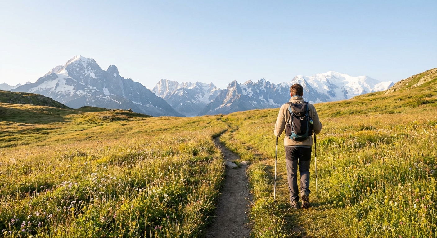
1) Deer Mountain Trail (Rocky Mountain National Park, Colorado)
Why it is a gem: If you want a high-payoff summit view near Estes Park without the Bear Lake circus, Deer Mountain is your friend. It is a steady climb through pine forest that opens to a rounded summit with sweeping vistas of Longs Peak and the Mummy Range.
Quick facts
- Distance: about 6 miles round trip
- Difficulty: moderate, sustained uphill
- Elevation gain: roughly 1,200 feet
- Typical time: about 3 to 5 hours
- Best season: late spring through fall; winter often requires traction
Local tips
- Trailhead clarity: Most hikers start from the Deer Ridge Junction Trailhead (near Park Entrance Road). Confirm the exact trailhead name and parking location in the park map before you go.
- Wind is real: The summit can be surprisingly breezy. Pack a light layer even on bluebird days.
- Town comfort: Post-hike, reset in Estes Park with a warm drink and something that is not a smashed bar at the bottom of your pack.
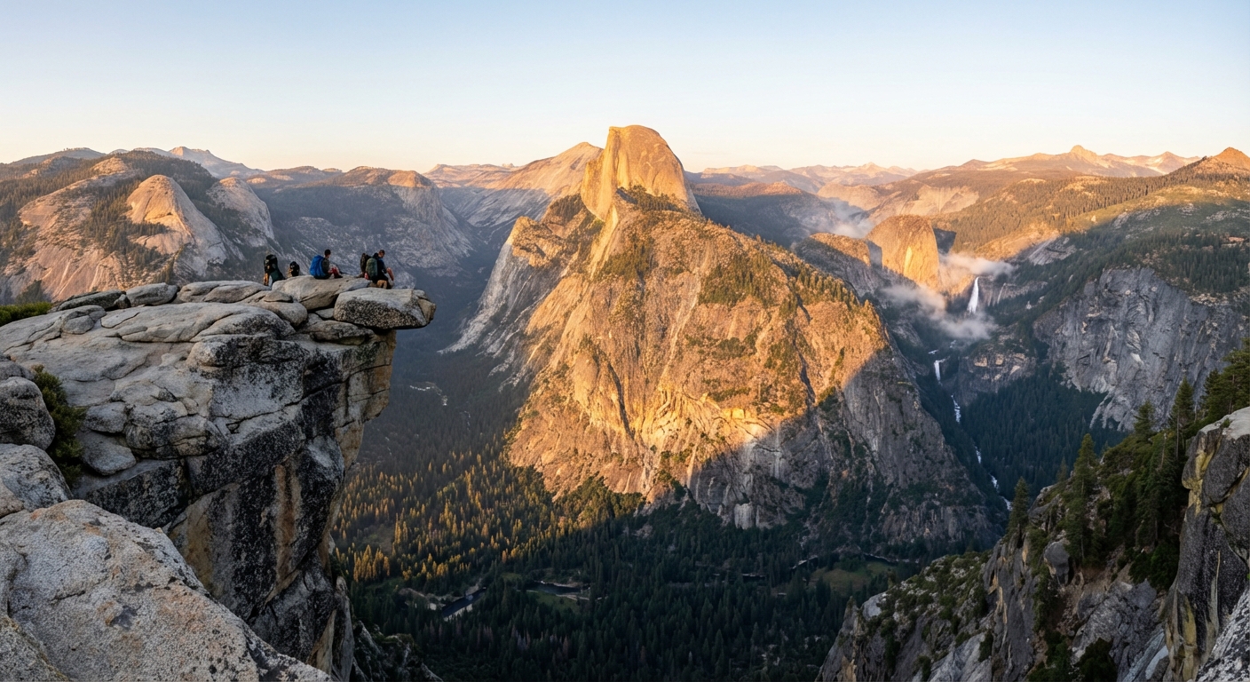
2) North Dome via Porcupine Creek (Yosemite National Park, California)
Why it is a gem: Everyone wants the classic Half Dome photo. Most people do not realize you can stare straight across at it from North Dome with far fewer neighbors. The route from the Tioga Road area is a longer day hike, but the payoff is one of Yosemite’s most dramatic front-row seats.
Quick facts
- Distance: about 9 to 10 miles round trip
- Difficulty: moderate to strenuous due to mileage and rolling elevation
- Typical time: about 5 to 7 hours
- Best season: summer through early fall, depending on Tioga Road access
Local tips
- Road access check: This hike depends on Tioga Road being open. In big snow years, it opens later.
- Trailhead naming: Guides often reference Porcupine Creek Trailhead in the Tioga Road corridor. Confirm the start point on the official map (you may also see references to Porcupine Flat in the same area).
- Permits and entry: Yosemite sometimes uses entry reservations and parking can be tight. Check current rules and arrive early.
- Cliff awareness: North Dome has sheer drop-offs. Keep extra distance if you are hiking with kids or anyone uneasy with exposure.
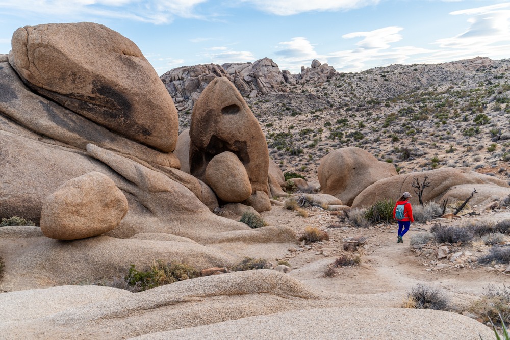
3) Split Rock Loop (Joshua Tree National Park, California)
Why it is a gem: Joshua Tree crowds tend to cluster at the same photogenic rock piles close to the road. Split Rock is the antidote: a choose-your-own-adventure loop through classic Mojave scenery with big boulders, open desert views, and enough trail miles that many visitors skip it. You get the Joshua Tree vibe without feeling like you are standing in a line for a photo.
Quick facts
- Distance: about 2.5 miles for the basic loop; longer options if you add spur trails
- Difficulty: easy to moderate
- Typical time: about 1.5 to 3 hours (longer if you explore)
- Best season: fall through spring; avoid hot mid-day summer hiking
Local tips
- Timing matters: Start at sunrise in warm months. Desert heat is not an attitude problem.
- Water and sun: Carry extra water plus electrolytes, and bring a brimmed hat and sunscreen.
- Navigation note: Wayfinding can be a mix of signs and open desert. Stay oriented and do not assume every boot path is the trail.
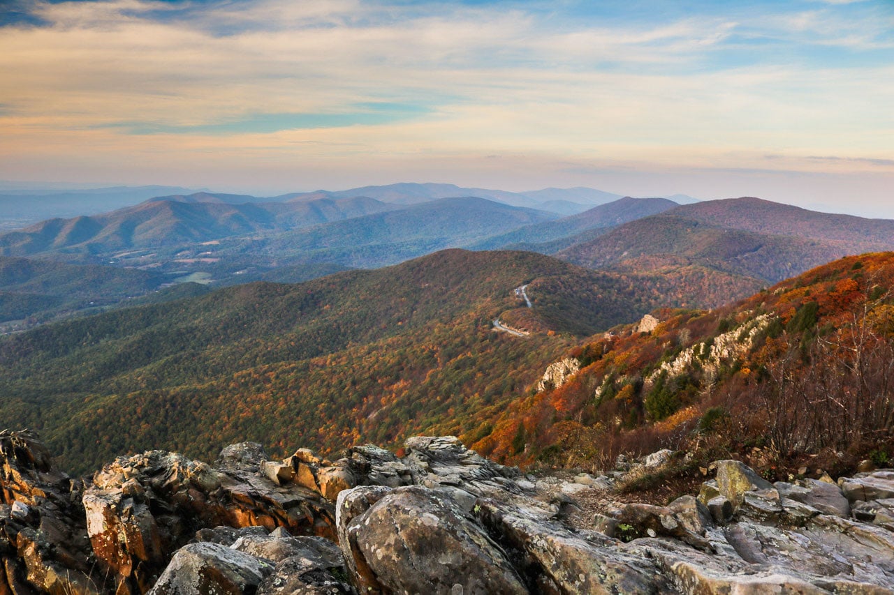
4) Stony Man via Little Stony Man (Shenandoah National Park, Virginia)
Why it is a gem: Shenandoah is full of short overlook hikes, but many get busy because they are right off Skyline Drive. This route adds Little Stony Man, turning a popular viewpoint into a more satisfying outing with extra scenery and, often, fewer people once you move past the first overlook.
Quick facts
- Distance: about 3.5 to 4.5 miles, depending on the loop variation
- Difficulty: easy to moderate
- Typical time: about 2 to 3.5 hours
- Best season: spring wildflowers and fall foliage are standouts
Local tips
- Pick the loop on purpose: To include Little Stony Man and avoid accidentally doing a quick out-and-back, map your exact route before you start and follow junction signage carefully.
- Go midweek: Weekends bring DC and Richmond traffic. Tuesday and Wednesday are noticeably calmer.
- Pack a rain shell: Ridge weather changes quickly, even on short hikes.
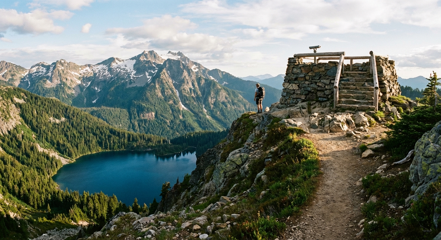
5) Apgar Lookout (Glacier National Park, Montana)
Why it is a gem: Glacier has world-class headline hikes, and they can feel like it, especially in July. Apgar Lookout is a quieter, forested climb that ends with a fire-lookout-style perch and a big view over Lake McDonald and the surrounding peaks. It is not “easy,” but it is the kind of steady, honest trail that rewards you with space to breathe at the top.
Quick facts
- Distance: about 7 miles round trip
- Difficulty: strenuous due to sustained uphill
- Elevation gain: roughly 1,800 to 2,000 feet
- Typical time: about 4 to 6 hours
- Best season: summer through early fall, once trails are snow-free
Local tips
- Be bear aware: Carry bear spray, know how to use it, and hike in a group when possible.
- Check closures: Glacier uses wildlife and habitat closures, and conditions can change week to week. They are not suggestions.
- Town comfort: Afterward, Lake McDonald area sunsets and a simple snack back in Apgar feel like a victory lap.
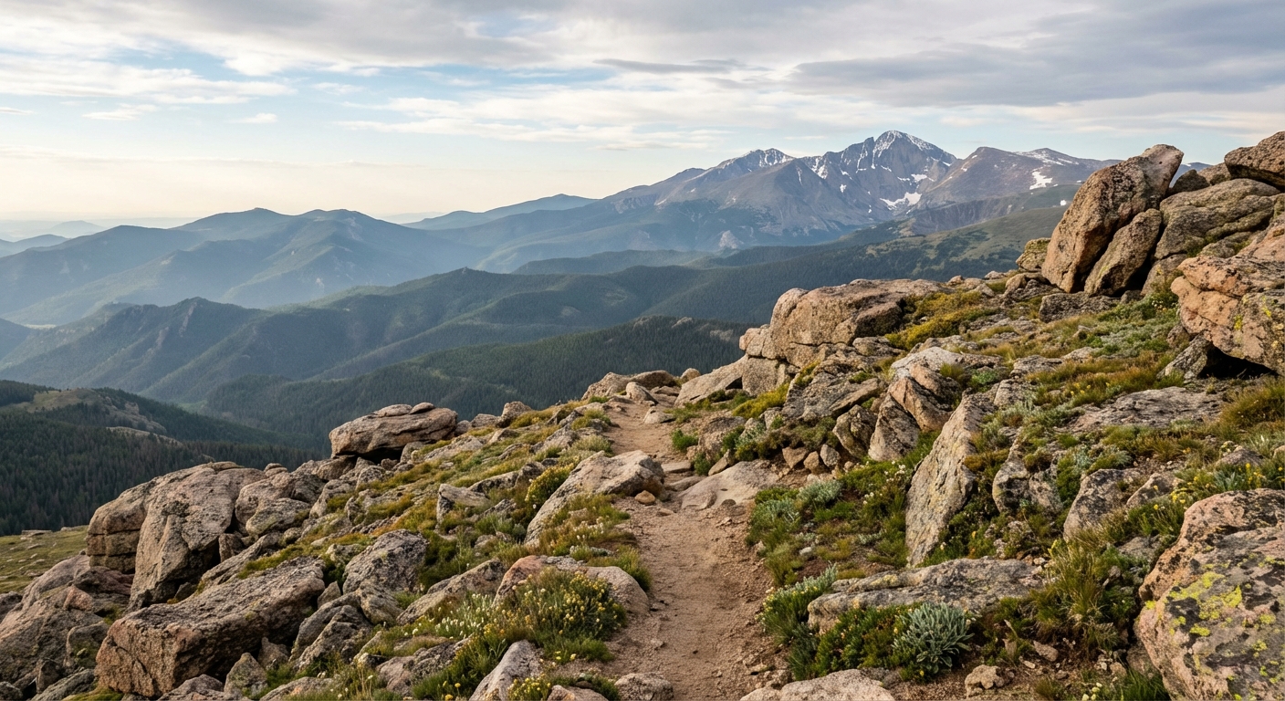
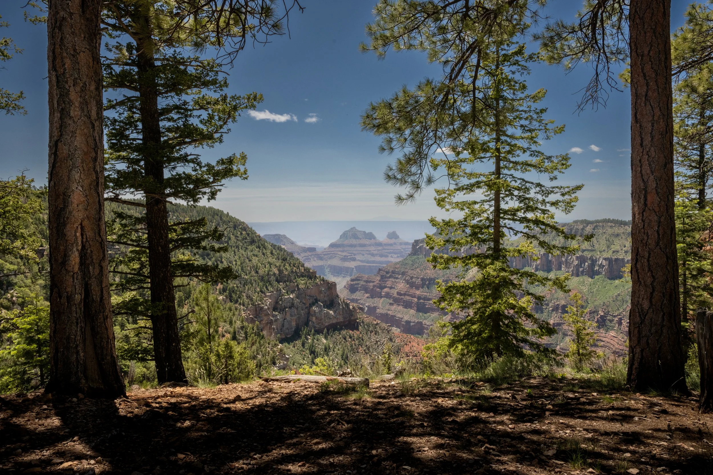
6) Widforss Trail (Grand Canyon National Park, Arizona)
Why it is a gem: The South Rim is iconic, and also reliably packed. For a calmer Grand Canyon experience, the North Rim delivers cooler temps, fewer visitors, and trails that feel like a conversation with the canyon instead of a group chat. Widforss is a classic for a reason: it wanders through pine and aspen, then opens to wide-angle canyon views that make you stop mid-step.
Quick facts
- Distance: about 10 miles round trip to Widforss Point
- Difficulty: moderate (long but not overly steep)
- Typical time: about 5 to 7.5 hours
- Best season: late spring through fall; North Rim services and roads are seasonal
Local tips
- North Rim reality check: It is farther, quieter, and more remote. Fuel up before you arrive and keep an eye on driving times.
- Seasonal access: The North Rim closes in winter and opening dates vary. Confirm road status before you build your day around it.
- Golden hour is everything: Aim for late afternoon when the canyon starts doing its light-and-shadow magic.
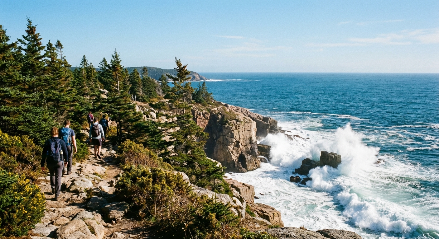
7) Sand Beach to Great Head (Acadia National Park, Maine)
Why it is a gem: Acadia gets busy fast, especially around Jordan Pond and Cadillac Mountain. This coastal route starts at a well-known spot, then quickly peels into a rugged headland with ocean views, rocky footing, and that salty Maine air that makes everything taste better later at dinner.
Quick facts
- Distance: about 1.5 to 2 miles for the loop, depending on options
- Difficulty: moderate due to uneven rocks and short climbs
- Typical time: about 1 to 2 hours
- Best season: late spring through fall; early morning is quietest
Local tips
- Direction: Either direction works, but many hikers prefer going counterclockwise for smoother flow on the rocky sections. Check the trail signs at the start.
- Watch the footing: Granite can be slick when damp or foggy.
- Check for updates: Coastal routes can see occasional reroutes or short-term closures due to erosion or storm impacts. Look for posted notices.
- Town comfort: Bar Harbor is right there for a hot meal, a warm shower, and a bakery stop that feels extremely earned.
Keep it quiet out there
One more Trail & Town reminder: lesser-known trails stay wonderful when we hike them thoughtfully. Keep voices low, pack out every crumb, avoid cutting switchbacks, and do not feed wildlife even if it is aggressively cute. If you want to level up your crowd-avoidance skills, build your day around timing and trailhead choice, then reward yourself with an urban comfort after, whether that is a local bakery, a hot shower, or the best latte you can find within a ten-minute drive.
If you tell me which park you are visiting and your ideal mileage (or hours), I can suggest a few more quieter options that fit your pace.