Best Day Hikes in Capitol Reef National Park
Maya Lin
Maya Lin is a travel journalist and outdoor enthusiast who believes the best trips combine rugged adventures with urban comforts. After spending six years backpacking across four continents, she founded Trail & Town Guide to help fellow travelers navigate both hidden mountain passes and bustling city neighborhoods with confidence.
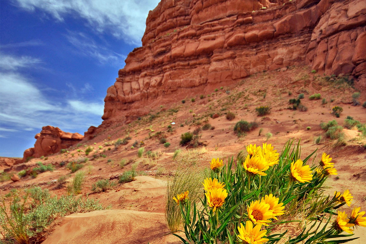
Capitol Reef is the Utah park that quietly steals the show. It has slickrock domes and narrow canyons like its flashier neighbors, but the vibe is more small-town bakery than big-city rush. You can hike to a natural arch before lunch, wander a shaded wash in the afternoon, then be back in Torrey for a proper espresso and a real bed. That balance is why I love it.
This guide is built for day hikers and road trippers: short-to-moderate trails, seasonality tips, where each hike sits along the park roads, and two simple ways to pace it all without turning your vacation into a death march.
Before you hike: quick logistics
Entrance fees
Capitol Reef charges an entrance fee, but the detail that trips people up is where it applies.
- Highway 24 runs through the park and is generally free to drive as a state highway.
- The fee is typically collected for the Scenic Drive and for trailhead parking in the developed Fruita area (and other fee-required areas).
The standard options are:
- Private vehicle pass (valid for 7 days)
- Motorcycle pass (valid for 7 days)
- Per-person entry (for walk-ins or cyclists, valid for 7 days)
- America the Beautiful annual pass (worth it if you are linking multiple national parks)
Fees and exact prices can change, so double-check the current details on the official NPS Capitol Reef page before you go.
Where “along the scenic drive” actually means
Most visitors base out of the Fruita Historic District near the visitor center. From there, you have two main corridors:
- Highway 24: runs east to west through Fruita. Several classic trailheads start right off this road.
- Capitol Reef Scenic Drive: a paved road that heads south from Fruita into the heart of the Waterpocket Fold scenery. Trailheads for Grand Wash and Capitol Gorge sit near the end.
There are also rougher routes like Notom Bullfrog Road and Cathedral Valley Road, but the hikes in this list focus on the most accessible day-trip favorites.
Seasonality and safety
- Best seasons: Spring and fall for comfortable temps and longer hiking windows.
- Summer: Start at sunrise, carry more water than you think you need, and be cautious in canyons and washes during monsoon storms. Flash floods are real.
- Winter: Crisp hiking weather, fewer people. Expect icy patches and colder canyon shade. Some side roads can be slick or temporarily impassable.
Bring sun protection, a map downloaded offline, and at least 1 liter of water for short hikes, 2 to 3 liters for longer or hotter days.
Best day hikes (short to moderate)
Distances below are round-trip unless noted. Conditions change with weather and trail work, so treat times as estimates.
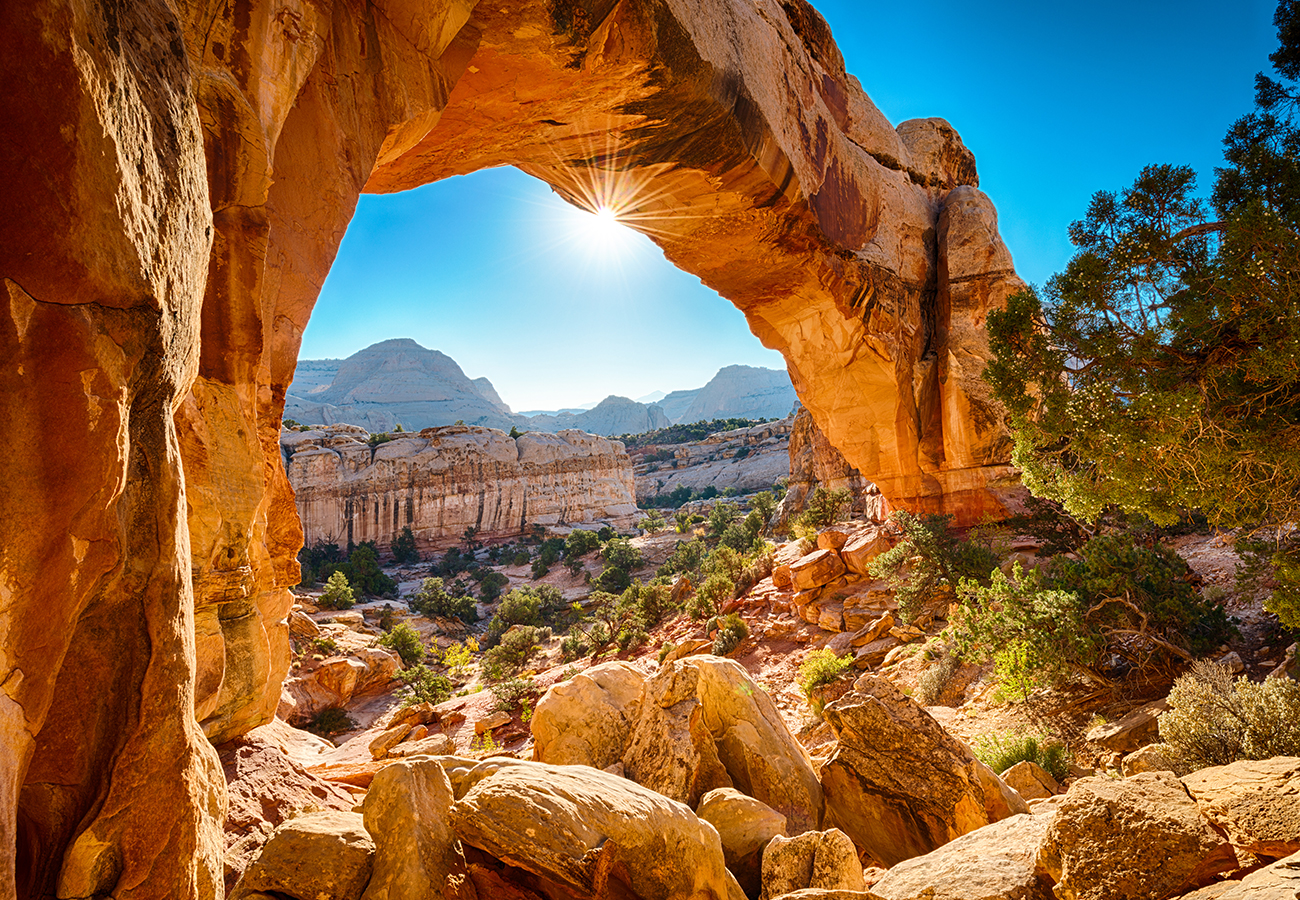
Hickman Bridge
Why go: The best “big payoff, moderate effort” hike in Fruita. You climb through red rock and small canyon views to a massive natural bridge that looks like it was placed there for a postcard.
- Distance: about 1.7 miles
- Difficulty: Moderate (short but with steady climbing)
- Seasonality: Great year-round. Hot in summer midday.
- Where it is: Off Highway 24 near Fruita, a short drive from the visitor center.
- Time: 1 to 1.5 hours
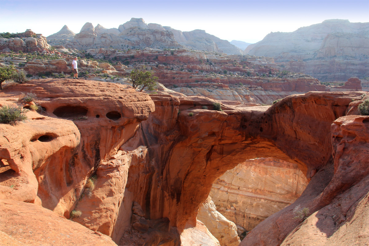
Cassidy Arch
Why go: If you want one hike that feels like you earned it, this is the one. The trail climbs into Grand Wash and ends at an arch you can stand on top of, looking down into the canyon below. It is dramatic, exposed, and unforgettable.
- Distance: about 3.3 miles
- Difficulty: Moderate to strenuous (exposure, elevation gain, slickrock)
- Seasonality: Best in spring and fall. In summer, hike early and avoid stormy afternoons.
- Where it is: Grand Wash trailhead area near the end of Capitol Reef Scenic Drive.
- Time: 2.5 to 4 hours
My note: If heights make you nervous, you can still enjoy the arch viewpoint without stepping onto the very top. The exposure is optional. The sun is not.
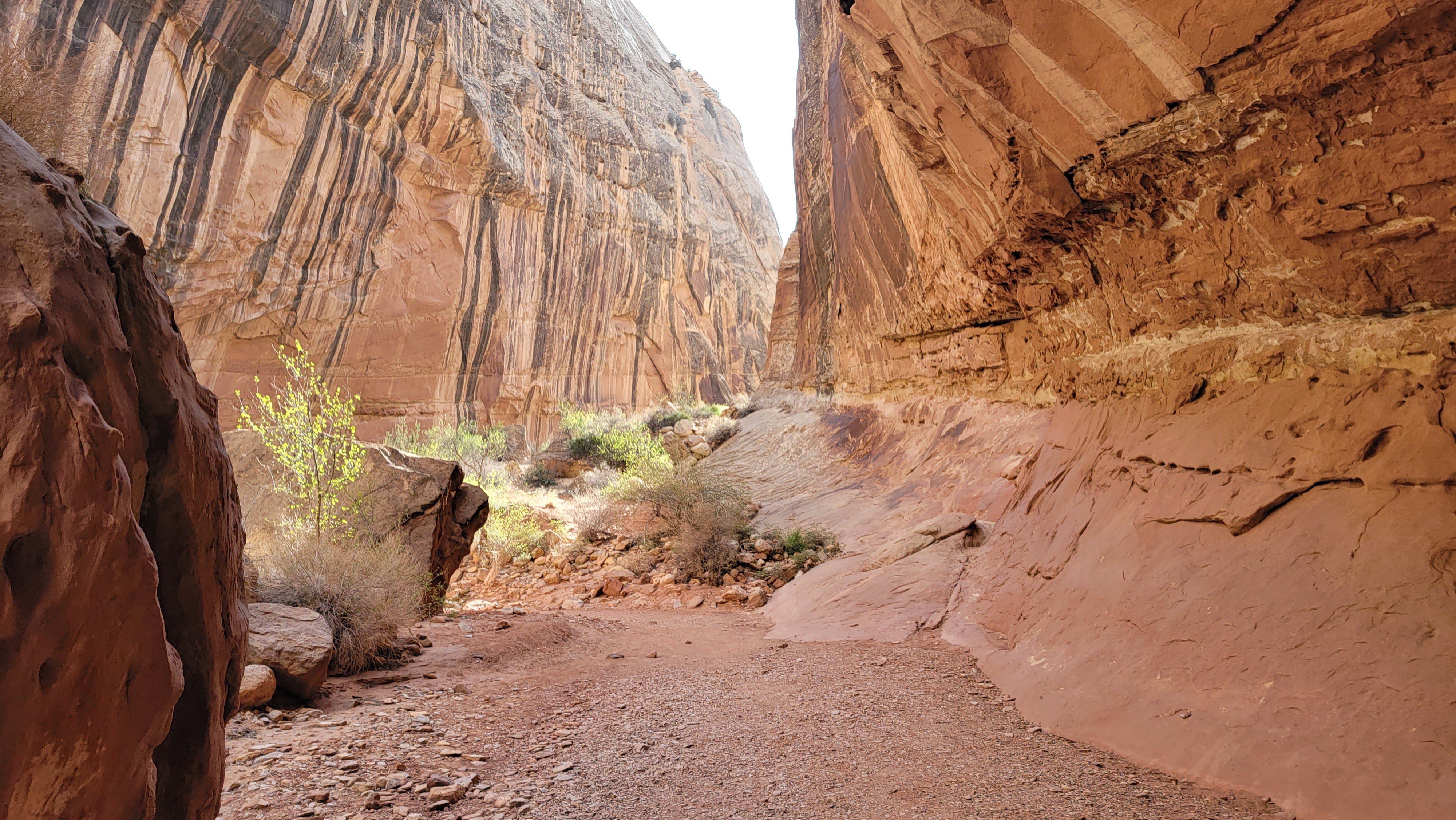
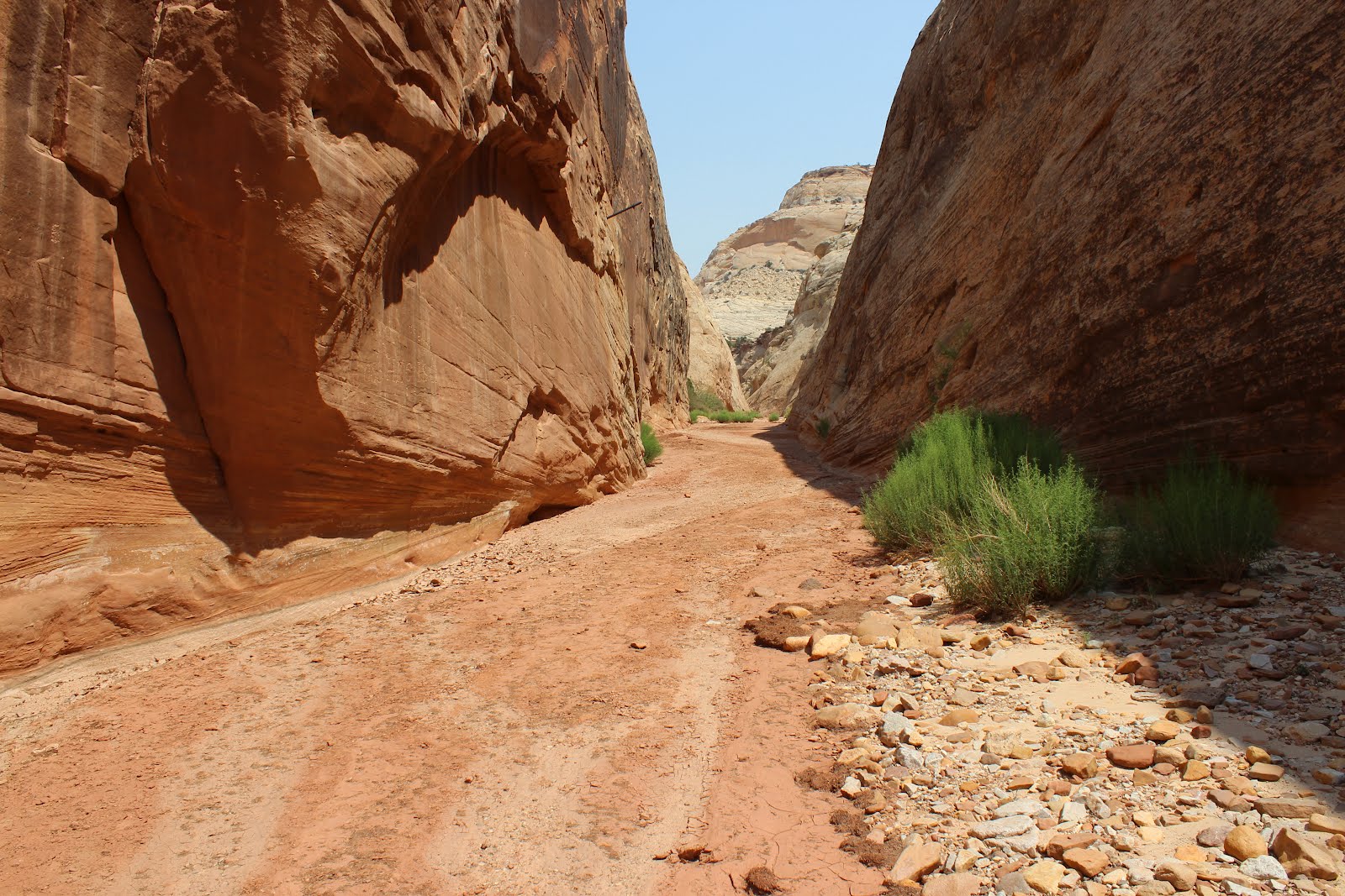
Grand Wash
Why go: A classic wash walk between canyon walls, with a choose-your-own-adventure distance. It is simple, scenic, and perfect when you want to move your legs without committing to a steep climb.
- Distance: 2 to 4+ miles depending on turnaround (many people do 2 to 3 miles)
- Difficulty: Easy to moderate (mostly flat, sandy in places)
- Seasonality: Excellent in hot weather because canyon shade helps. Avoid during storm risk due to flash flooding.
- Where it is: Near the end of Capitol Reef Scenic Drive.
- Time: 1 to 2.5 hours depending on how far you go
Trail tip: Wear shoes you do not mind getting dusty. Sandy washes have a way of finding every seam.
Capitol Gorge and the Pioneer Register
Why go: This is Capitol Reef’s most approachable “slot canyon” style stroll. The gorge walls tighten, the light gets moody, and the Pioneer Register adds a slice of human history. It is also one of the best hikes to pair with a short scenic drive because the trailhead sits at the end of a beautiful canyon road.
- Distance: about 2 miles to the Pioneer Register and back (optional side trip to the Golden Throne viewpoint adds distance and elevation)
- Difficulty: Easy to moderate
- Seasonality: Great in shoulder seasons and winter. In summer, go early and avoid storms.
- Where it is: End of Capitol Gorge Road (a graded dirt road off the Scenic Drive area)
- Time: 1 to 2 hours (longer with side trips)
Leave No Trace note: The Pioneer Register contains historic carvings. Please do not add your name. Let the story stay intact.
Goosenecks Overlook
Why go: Tiny effort, huge view. This is one of the best sunset stops in the park, especially if your legs are cooked or you are traveling with mixed-energy friends.
- Distance: about 0.2 miles
- Difficulty: Easy
- Seasonality: Year-round
- Where it is: Off a short spur road from Highway 24, west of Fruita.
- Time: 10 to 30 minutes
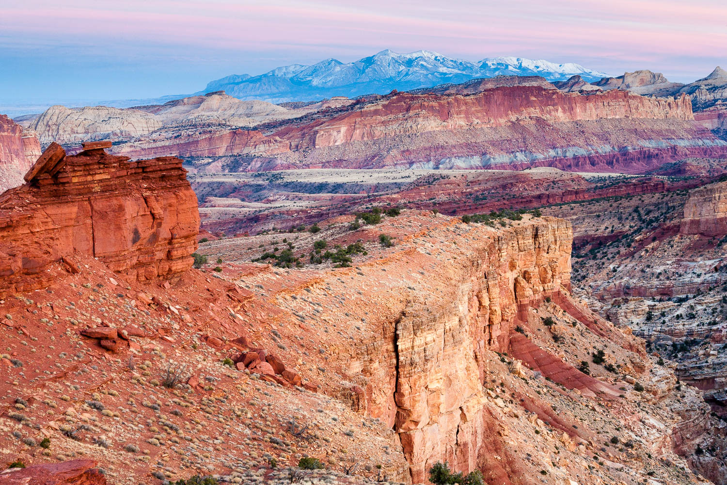
Sunset Point and Panorama Point
Why go: If you want maximum views in minimal time, this is the cleanest combo in the park. Sunset Point delivers that “how is this real” light on the cliffs, and Panorama Point stacks on a wider sweep over Fruita and the Waterpocket Fold.
- Distance: Sunset Point is about 0.8 miles. Panorama Point is about 0.4 miles. You can do both from the same parking area.
- Difficulty: Easy to moderate (short, with some uneven footing)
- Seasonality: Great year-round. Very exposed to sun and wind.
- Where it is: From the same general pull-off area as Goosenecks Overlook, off Highway 24.
- Time: 30 to 60 minutes for both, longer if you linger (and you will)
Timing tip: Despite the name, I like Sunset Point in the morning when the air is crisp and the crowds are minimal. Save Goosenecks for late-day glow.
Quick clarity: The Rim Overlook trail is a different hike entirely. It is much longer and more strenuous, and it starts near the Hickman Bridge area.
Pick your pacing: 1 day or 2
If you only have 1 day
This plan hits the essentials with smart driving flow and avoids backtracking.
- Early morning: Hickman Bridge (cool temps, great light)
- Late morning: Scenic Drive out to Grand Wash trailhead
- Midday: Grand Wash out-and-back (go as far as feels good)
- Afternoon: Capitol Gorge to Pioneer Register
- Golden hour: Goosenecks Overlook for sunset
If you are feeling ambitious, swap Grand Wash for Cassidy Arch, but keep an early start and watch the weather.
If you have 2 days
Two days lets you do the “big hike” and still have energy to enjoy Fruita.
- Day 1: Hickman Bridge + Sunset Point/Panorama Point, then explore Fruita (orchards when in season, historic district, easy strolls)
- Day 2: Cassidy Arch as your main event, plus either Grand Wash or Capitol Gorge depending on heat and time
With an extra evening, Torrey is ideal for a comfortable base. You get restaurants, solid lodging, and that small-town pause that makes a desert trip feel sustainable instead of frantic.
How Capitol Reef fits a Utah parks loop
Capitol Reef sits between the better-known heavy hitters, which makes it a perfect connective stop on a classic Utah loop. It pairs especially well with places that contrast its quiet, orchard-and-canyon feel.
A simple loop
- Zion (big canyon energy, iconic hikes)
- Bryce Canyon (hoodoos and sunrise amphitheaters)
- Capitol Reef (scenic drive day hikes and Fruita charm)
- Canyonlands Island in the Sky (big overlooks with less overlap than Arches)
- Return via Scenic Byway 12 or I-70 depending on your route
Town Wander already covers the Moab and Arches scene elsewhere, so think of Capitol Reef as your reset button. It delivers classic Utah geology with fewer crowds and lower logistical stress, which is exactly what you want mid-loop.
Practical tips I wish I heard sooner
- Start with the park map, not your phone. Cell service can be patchy. Download offline maps before you arrive.
- Bring a headlamp. Even for day hikes. It is cheap insurance if a hike runs long.
- Plan for sun exposure. Many trails feel short on paper but bake in midday heat.
- Watch the sky. If you are hiking in a wash or gorge and thunder is in the forecast, choose a higher, open trail instead.
- Leave time for Fruita. The historic district and orchards add texture to your trip, and they are part of what makes Capitol Reef feel different from the rest of the Utah park circuit.
Quick trail picker
If you want the fastest match to your mood, use this:
- One iconic moderate hike: Hickman Bridge
- Most dramatic payoff: Cassidy Arch
- Best easy canyon stroll: Capitol Gorge
- Flexible, family-friendly miles: Grand Wash
- Best sunset with minimal effort: Goosenecks Overlook
- Fastest big views combo: Sunset Point + Panorama Point
Capitol Reef rewards the traveler who shows up early, drinks water like it is their job, and leaves a little space in the day for wandering. If you do that, this park will feel like your own secret, even when the parking lots are full.