Best Day Hikes in Great Smoky Mountains National Park
Maya Lin
Maya Lin is a travel journalist and outdoor enthusiast who believes the best trips combine rugged adventures with urban comforts. After spending six years backpacking across four continents, she founded Trail & Town Guide to help fellow travelers navigate both hidden mountain passes and bustling city neighborhoods with confidence.
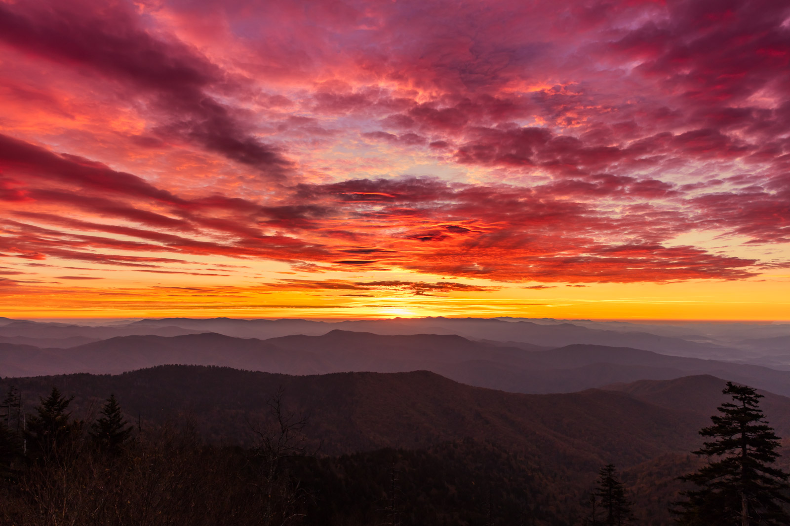
The Great Smoky Mountains are America’s most-visited national park for a reason. You can wake up to mist curling through old-growth hollows, hike to a waterfall that sounds like distant thunder, and still be back in town for a proper dinner and a strong local coffee. This list rounds up the best day hikes in Great Smoky Mountains National Park, with the details you actually need: distance, elevation gain, difficulty, and how to time your hike so you spend more minutes in quiet forest and fewer in parking-lot gridlock.
Quick note on trail names: You’ll often see “Clingmans Dome” written as “Kuwohi” as the park updates names to reflect Cherokee heritage. You may also see “Charlie’s Bunion” spelled without the apostrophe as “Charlies Bunion.”
Know before you go
- Parking tags (Park It Forward): If you park anywhere in the park for more than 15 minutes, you need a valid parking tag (daily, weekly, or annual). Buy it ahead of time or at visitor centers and kiosks when available. Display it properly so you do not turn your hike into a ticket story.
- Dogs: Dogs are allowed in very limited areas in GSMNP and are not allowed on the hikes in this list. The two main dog-friendly options in the park are Gatlinburg Trail and Oconaluftee River Trail (both relatively flat). If hiking with your dog is non-negotiable, plan around those.
- Parking and starts: For popular trailheads (Alum Cave, Chimney Tops, Ramsey Cascades, Laurel Falls), arrive before 8:00 am on weekends and peak fall color days. If you can swing it, hike midweek.
- Wildlife safety: Keep distance from bears and elk. Store food securely and never approach for photos. If a bear is on trail, give it space and be ready to turn around.
- Leave No Trace: Stay on trail, pack out trash, and avoid trampling vegetation at overlooks and balds.
- Weather reality check: Conditions change fast with elevation. A sunny Gatlinburg morning can mean wind and 20 degrees cooler on a ridge.
- Water and restrooms: Bring your own water. Some trailheads have restrooms, many do not. Plan accordingly.
At-a-glance: top Smokies day hikes
| Hike | Area | Distance | Elevation gain | Difficulty | Why go |
|---|---|---|---|---|---|
| Alum Cave to Mount LeConte (via Alum Cave Bluffs) | Newfound Gap Road | 11.0 mi out-and-back | ~2,800 ft | Hard | Iconic bluffs, lodge area, big-mountain payoff |
| Alum Cave Bluffs (to the bluffs only) | Newfound Gap Road | 4.4 mi out-and-back | ~1,100 ft | Moderate | Best “big scenery” hike for the time |
| Chimney Tops | Newfound Gap Road | 3.3 mi out-and-back | ~1,400 ft | Hard | Short, steep, panoramic finish |
| Ramsey Cascades | Greenbrier | 8.0 mi out-and-back | ~2,200 ft | Hard | Tallest waterfall in the park, lush forest |
| Charlies Bunion | Newfound Gap / Appalachian Trail | 8.0 mi out-and-back | ~1,600 ft | Hard | AT ridgeline views with a dramatic cliff overlook |
| Grotto Falls | Roaring Fork | 2.6 mi out-and-back | ~600 ft | Easy to Moderate | Walk behind a waterfall (seasonal flow varies) |
| Laurel Falls | Near Gatlinburg | 2.6 mi out-and-back | ~300 ft | Easy | Classic family-friendly waterfall |
| Andrews Bald | Kuwohi area | 3.6 mi out-and-back | ~800 ft | Moderate | Cool spruce-fir forest and an open bald |
| Mount Cammerer (via Low Gap) | Cosby | 11.2 mi out-and-back | ~3,000 ft | Hard | Fire tower views without the heaviest crowds |
| Abrams Falls | Cades Cove | 5.2 mi out-and-back | ~600 ft | Moderate | Wide waterfall and riverside walking |
Distances and elevation gains are approximate and can vary by GPS track and minor route choices. Always check current conditions and closures before you go.
1) Alum Cave Bluffs (and Mount LeConte, if you’re up for it)
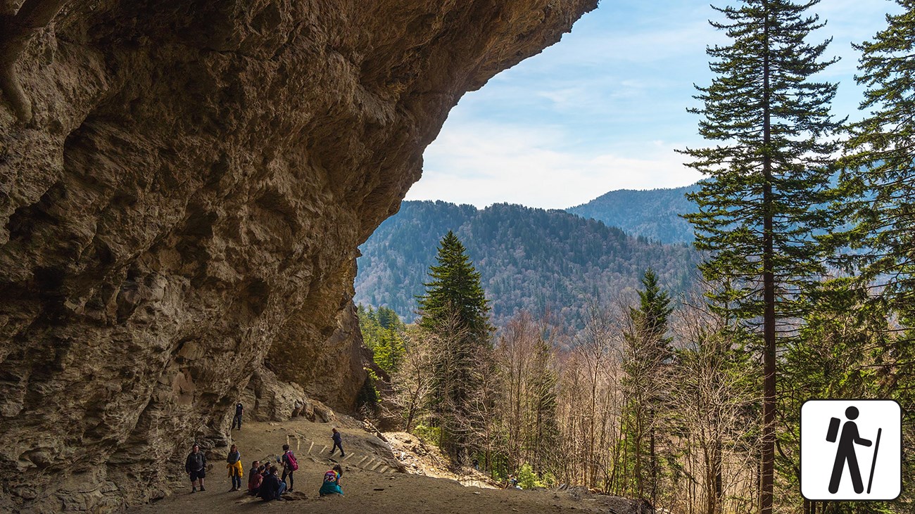
Alum Cave Bluffs (turnaround option)
- Distance: 4.4 miles out-and-back
- Elevation gain: ~1,100 feet
- Difficulty: Moderate
- Best for: Big payoff without committing to an all-day summit push
This is the Smokies hike I recommend when someone wants that “I hiked in a national park” feeling in half a day. You get log bridges, a narrow corridor called Arch Rock, and then the main event: the bluffs, a dramatic concave overhang that makes the forest feel cathedral-quiet when it is not peak-hour busy.
Mount LeConte (continue past the bluffs)
- Distance: ~11.0 miles out-and-back (to LeConte via Alum Cave)
- Elevation gain: ~2,800 feet
- Difficulty: Hard
- Best for: A full-value mountain day with classic Smokies terrain
If you have the legs and the daylight, continuing to the LeConte high country is unforgettable. Expect a long steady climb and cooler air near the top. The lodge area is a fun “town in the clouds” vibe, even if you are only passing through for a snack break.
Crowd strategy: Arrive early, and aim for weekday mornings. In peak fall weekends, this trailhead can fill shockingly fast.
Seasonal tip: Spring brings wildflowers; late fall and winter can mean icy stretches on shaded sections. Traction can be helpful when conditions are slick.
2) Chimney Tops
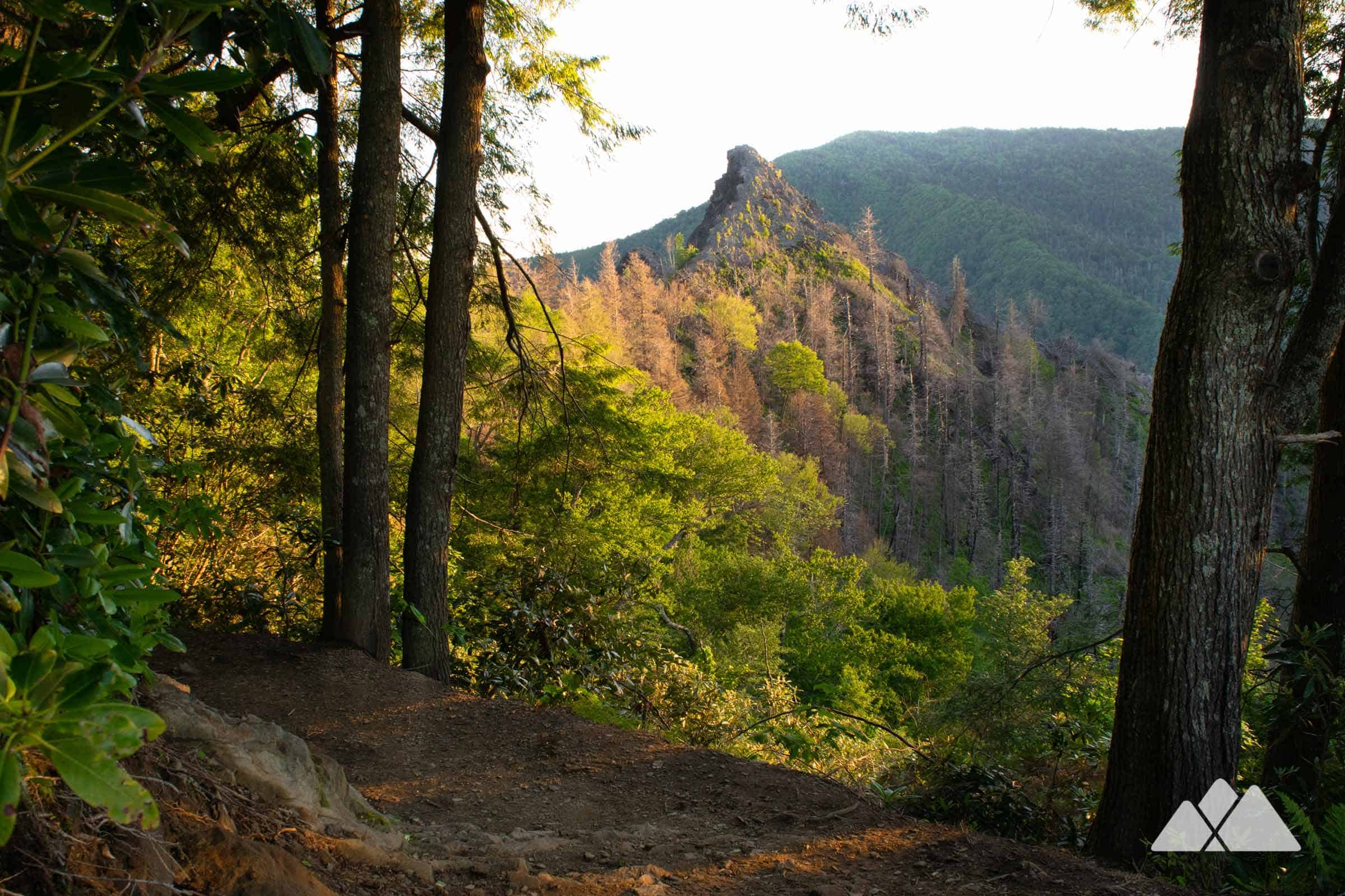
- Distance: ~3.3 miles out-and-back
- Elevation gain: ~1,400 feet
- Difficulty: Hard (short but steep)
- Best for: Maximum views for minimum miles
Chimney Tops is a leg-burner that wastes zero time getting to business. You climb immediately, cross a few small streams, then grind up a staircase-like finish. The trail ends at an overlook area with expansive views. Respect barriers and signage and avoid scrambling onto exposed rock, especially when wet or icy. The actual Chimney Tops summit remains closed due to the 2016 fires and the ongoing safety issues in that area, which is why the end-of-trail fencing is not a suggestion.
Crowd strategy: This is a sunrise favorite. If you want breathing room, go after 3:00 pm on a long summer day and enjoy the softer light.
Seasonal tip: Winter and early spring can be slick on the steep upper section. In summer, start early to dodge heat and humidity.
3) Ramsey Cascades
- Distance: ~8.0 miles out-and-back
- Elevation gain: ~2,200 feet
- Difficulty: Hard
- Best for: The park’s tallest waterfall and a deep-forest feel
Ramsey Cascades is the kind of hike that makes you forget how close you are to busy gateways like Gatlinburg. The trail follows a creek for long stretches, with footbridges, mossy rocks, and that damp, earthy smell that feels like the Smokies in one breath. The final cascade is a powerful tiered waterfall, especially impressive after rain.
Crowd strategy: Because it is longer and more demanding, it is often quieter than the famous short waterfalls. Still, start early for parking and to avoid afternoon storms in summer.
Seasonal tip: Spring and early summer usually bring stronger flow. After heavy rain, watch footing on wet roots and rocks.
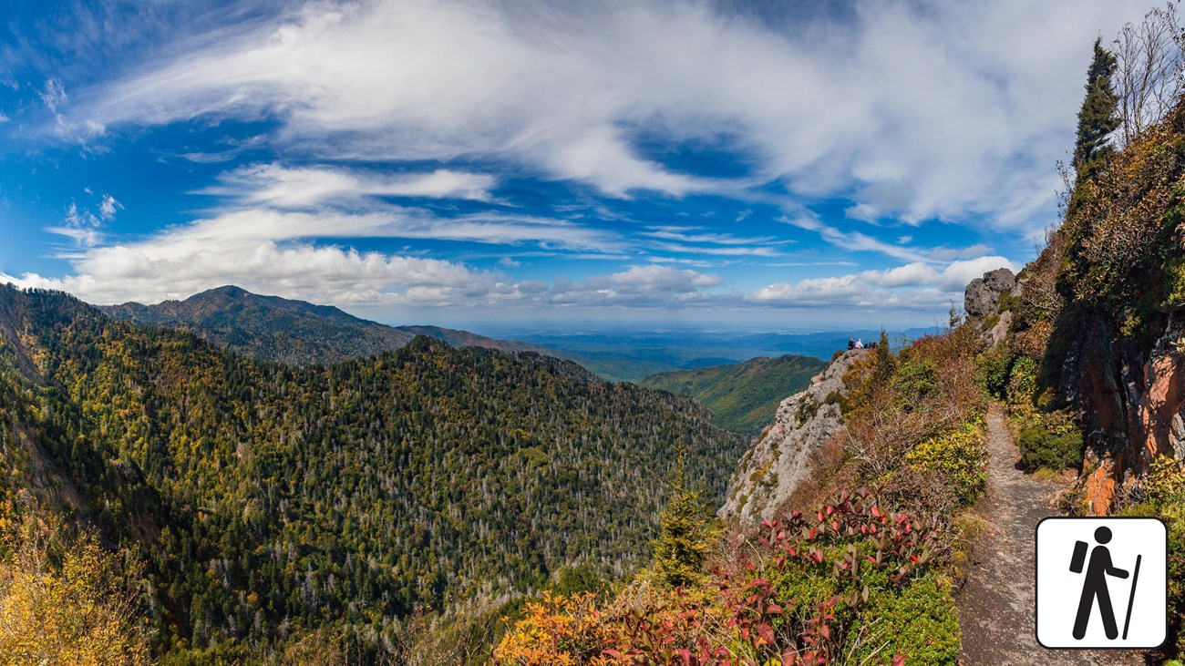
4) Charlies Bunion (Appalachian Trail classic)
- Distance: ~8.0 miles out-and-back
- Elevation gain: ~1,600 feet
- Difficulty: Hard
- Best for: A ridge walk with long views and a dramatic payoff
This is my go-to for people who want a taste of the Appalachian Trail without turning it into a thru-hike fantasy. You start at Newfound Gap and follow the AT along a high ridgeline, with frequent glimpses into Tennessee and North Carolina. The bunion itself is a rocky outcrop with a serious drop-off. It is spectacular, and it is not the place to zone out near the edge.
Crowd strategy: Hike midweek, or start early and you can often enjoy the overlook before the midday wave arrives.
Seasonal tip: Wind exposure can make this feel much colder than lower elevations. In fall, layers are everything.
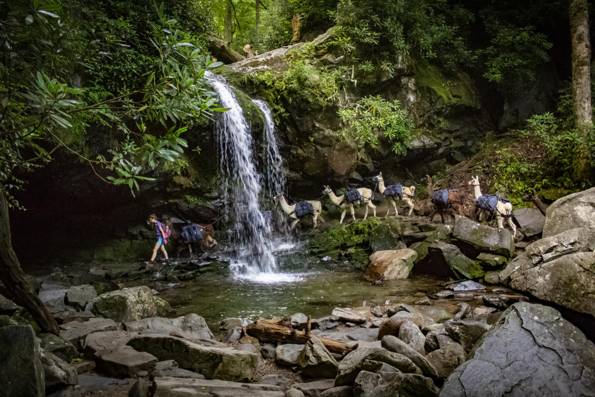
5) Grotto Falls (the waterfall you can walk behind)
- Distance: ~2.6 miles out-and-back
- Elevation gain: ~600 feet
- Difficulty: Easy to Moderate
- Best for: A fun, unique waterfall experience close to Gatlinburg
Grotto Falls is a crowd-pleaser that still feels special. The trail climbs steadily through leafy forest and ends at a curtain-like waterfall where you can walk behind the flow when conditions allow. Expect damp rocks and spray near the falls.
Crowd strategy: Pair this with an early drive on the Roaring Fork Motor Nature Trail. Go in the morning and you will often beat the tour-bus energy.
Seasonal tip: Water flow varies. Late summer can be thinner, while spring is often at its best.
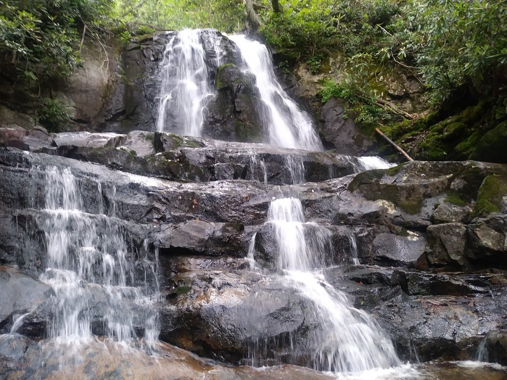
6) Laurel Falls (easy classic, big crowds)
- Distance: ~2.6 miles out-and-back
- Elevation gain: ~300 feet
- Difficulty: Easy
- Best for: Families, first-timers, and a quick waterfall win
Laurel Falls is popular for a reason: it is relatively short and delivers a solid waterfall payoff. It is also one of the busiest trails in the park, and the path can feel narrow when traffic is heavy.
Crowd strategy: Go early, go late, or go in the off-season. If you want a quieter waterfall day, consider Grotto Falls or Abrams Falls instead.
Seasonal tip: Shoulder seasons bring fewer people, but watch for icy patches in winter.
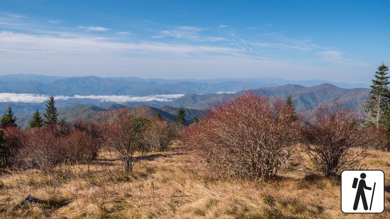
7) Andrews Bald (Kuwohi area)
- Distance: ~3.6 miles out-and-back
- Elevation gain: ~800 feet
- Difficulty: Moderate
- Best for: Cool high-elevation hiking and an open-view finale
If you like your hikes with a side of mountain air conditioning, head high. Andrews Bald starts near the Kuwohi area and drops into fragrant spruce-fir forest before climbing back up to an open bald. It is a great option when lower elevations feel muggy.
Crowd strategy: Many visitors stop at the Kuwohi viewpoints and leave. If you continue on foot, the trail thins out.
Seasonal tip: Summer is pleasantly cool. In winter, this area can see snow and ice, so check road conditions.
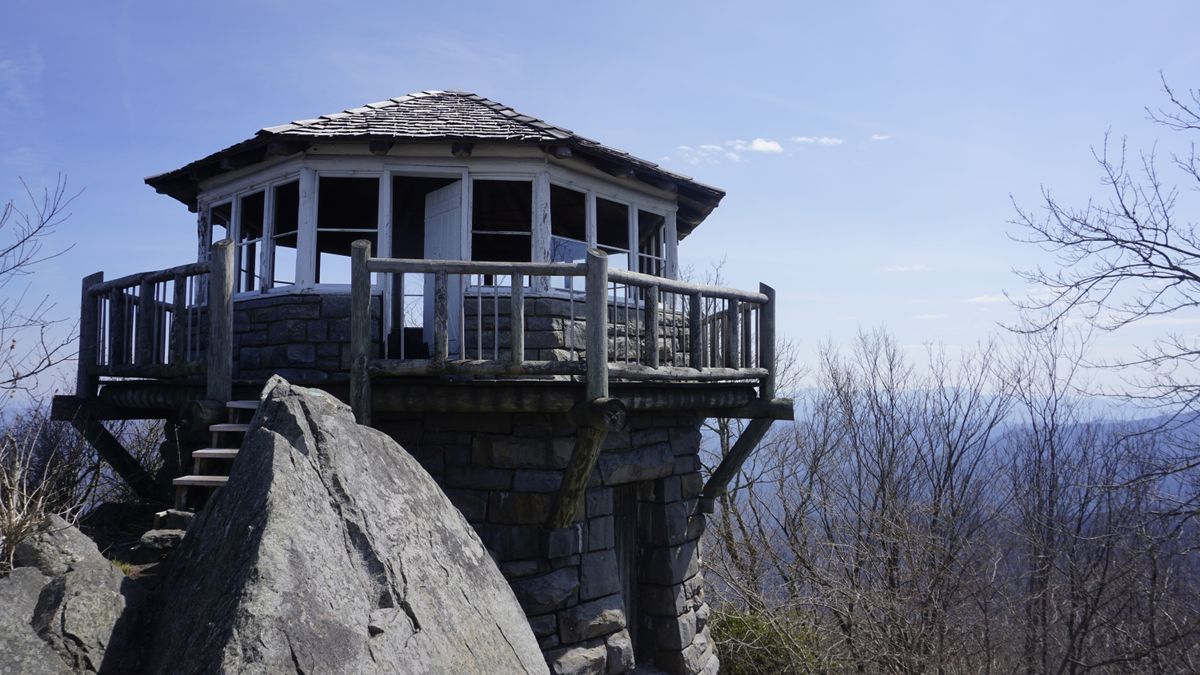
8) Mount Cammerer (fire tower views without the main-corridor chaos)
- Distance: ~11.2 miles out-and-back (via Low Gap Trail)
- Elevation gain: ~3,000 feet
- Difficulty: Hard
- Best for: A classic fire tower and big ridgeline views
Mount Cammerer is for hikers who want a full-day challenge and a unique summit structure at the end. The fire tower sits dramatically on a rocky perch, making the finish feel earned in the best way. Compared with the most famous corridor hikes, this can feel quieter, especially on weekdays.
Crowd strategy: Start early for a relaxed pace. This is a longer day, and you do not want to rush the descent.
Seasonal tip: Fall is stunning here. In spring, expect muddy sections after rain.
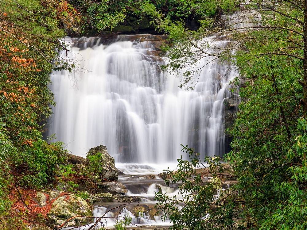
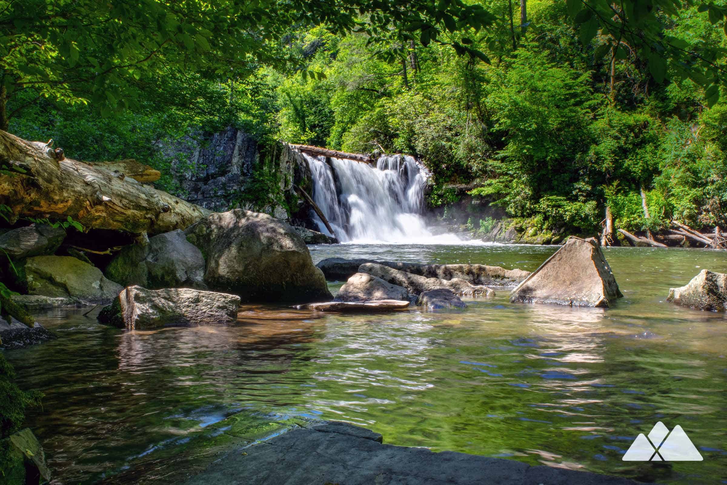
9) Abrams Falls (Cades Cove favorite)
- Distance: ~5.2 miles out-and-back
- Elevation gain: ~600 feet
- Difficulty: Moderate
- Best for: A scenic river hike plus a wide waterfall payoff
Abrams Falls is a great middle-ground hike: long enough to feel like a real outing, approachable enough for many casual hikers. The waterfall is broad and powerful, and the pool can look deceptively inviting. Avoid swimming in fast-moving water and stay alert on slick rocks.
Crowd strategy: Cades Cove gets very busy. If you can, hike early, then do the scenic loop drive afterward while everyone else is arriving.
Seasonal tip: Summer brings heat and crowds. Spring and fall are more comfortable for this mid-elevation trail.
Seasonal tips for avoiding crowds
Spring (March to May)
- Best for: Wildflowers, strong waterfalls
- Crowd hack: Start early and aim for midweek. Spring break can spike visitation.
- Watch for: Rainy days and slick roots.
Summer (June to August)
- Best for: Long daylight and high-elevation relief
- Crowd hack: Choose longer hikes (Ramsey, Cammerer) or hike late afternoon.
- Watch for: Humidity, afternoon storms, and full parking lots by mid-morning.
Fall (September to November)
- Best for: Crisp air and color, especially at higher elevations
- Crowd hack: Weekdays are gold. If you only have weekends, arrive at trailheads before 8:00 am.
- Watch for: Big temperature swings between valleys and ridges.
Winter (December to February)
- Best for: Solitude and clear views on cold, bright days
- Crowd hack: Many visitors stay in town. Trails can be quieter, but conditions are more serious.
- Watch for: Ice on shaded trails, possible road closures at higher elevations.
My day-hike packing list
- 1 to 2 liters of water (more in summer)
- Snacks with real staying power (nuts, jerky, sandwich, or a wrap)
- Rain layer or light shell (the Smokies earn their name)
- Warm layer for ridgelines, even in shoulder seasons
- Headlamp (especially for LeConte, Cammerer, or any “just one more viewpoint” day)
- Traction device in winter conditions (when icy)
- Offline map downloaded ahead of time
If you want a simple rule: pack for the temperature at the highest point you will reach, not the one at your car.
Build your perfect day
If you want one iconic hike
Alum Cave Bluffs is the most efficient “classic Smokies” experience for most visitors.
If you want a short burn with big views
Chimney Tops, ideally early or late to avoid the busiest window.
If you want waterfalls and quiet forest
Ramsey Cascades for the full day, or Grotto Falls for a shorter outing.
If you want a ridgeline walk
Charlies Bunion for Appalachian Trail energy and wide-open scenery.
Final Smokies note
The best day hikes in Great Smoky Mountains National Park are popular because they are genuinely excellent. The trick is not finding a secret trail. It is choosing the right hike for your time and fitness, then timing it like a local: early starts, weekday flexibility when possible, and a willingness to trade the “most famous” trail for a slightly longer one that fits your style.
If you tell me where you are staying (Gatlinburg, Cherokee, Townsend, or Bryson City) and your ideal mileage, I can help you pick the best two or three hikes to build a Smokies-perfect long weekend.