Best Hikes in Saguaro National Park
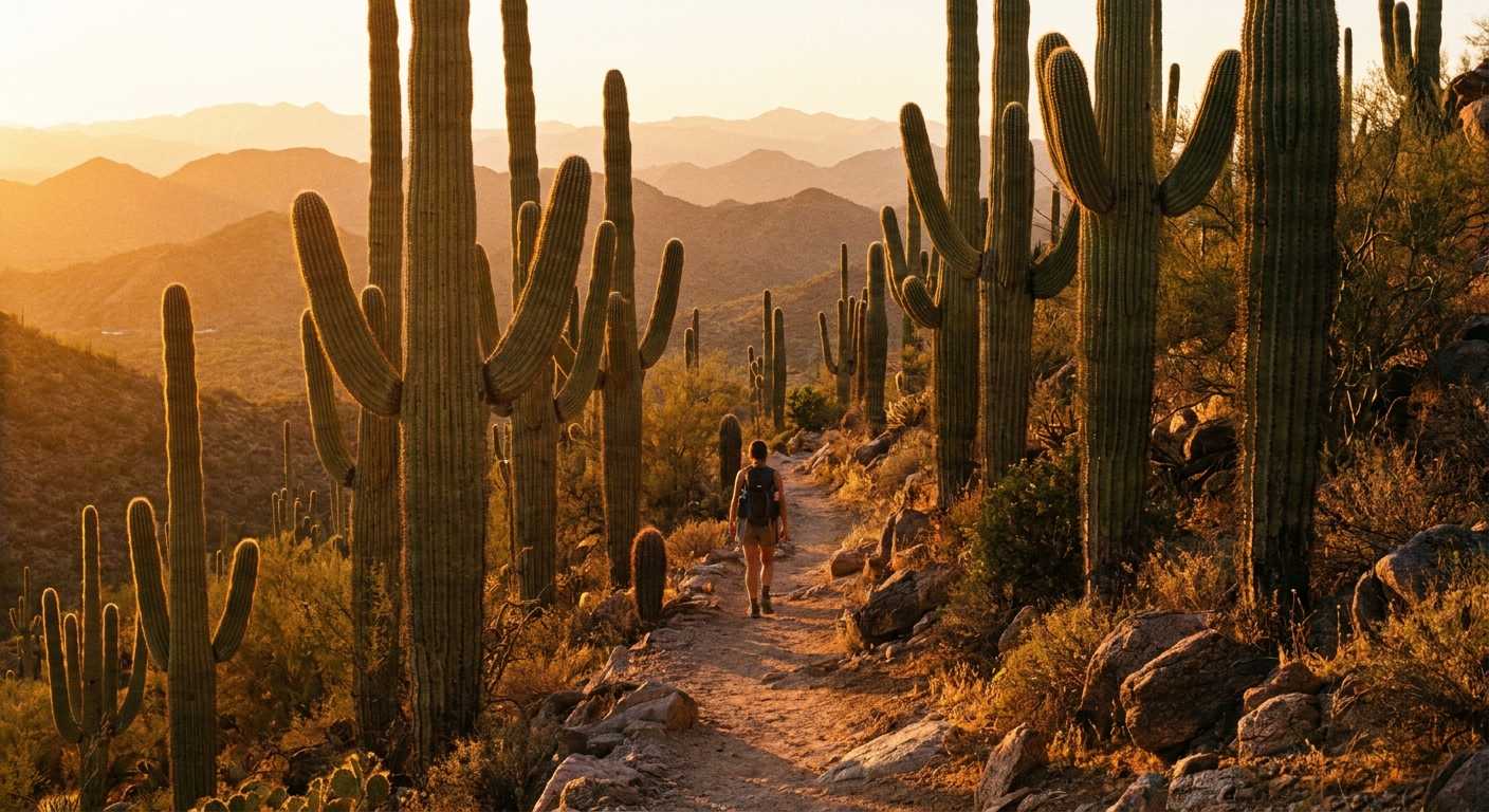
Saguaro National Park is two districts in one, split by the city of Tucson. That is the magic. You can hike through a forest of iconic cacti at sunrise, clean up, then be back in town for a proper espresso and tacos by lunch. The trick is picking the right district and the right trail for the day’s heat, your time window, and how much climbing you actually want.
This guide breaks down the best hikes on both sides of the park, with practical details I wish someone had handed me before my first “it’s a dry heat” miscalculation.

Quick basics: East vs West
Saguaro National Park West is the Tucson Mountain District. Think: dense saguaro “forests,” quick access from central Tucson, and excellent shorter hikes that shine at sunset. Because it sits at lower elevation and is exposed, it often feels hotter than you expect.
Saguaro National Park East is the Rincon Mountain District. Think: more elevation variety, longer options once you leave the popular loops, and a slightly cooler feel as you gain height, though the desert sun still plays hardball.
- Best for first-timers: West for iconic scenery with minimal effort.
- Best for longer miles and solitude: East, especially once you leave the busiest loops.
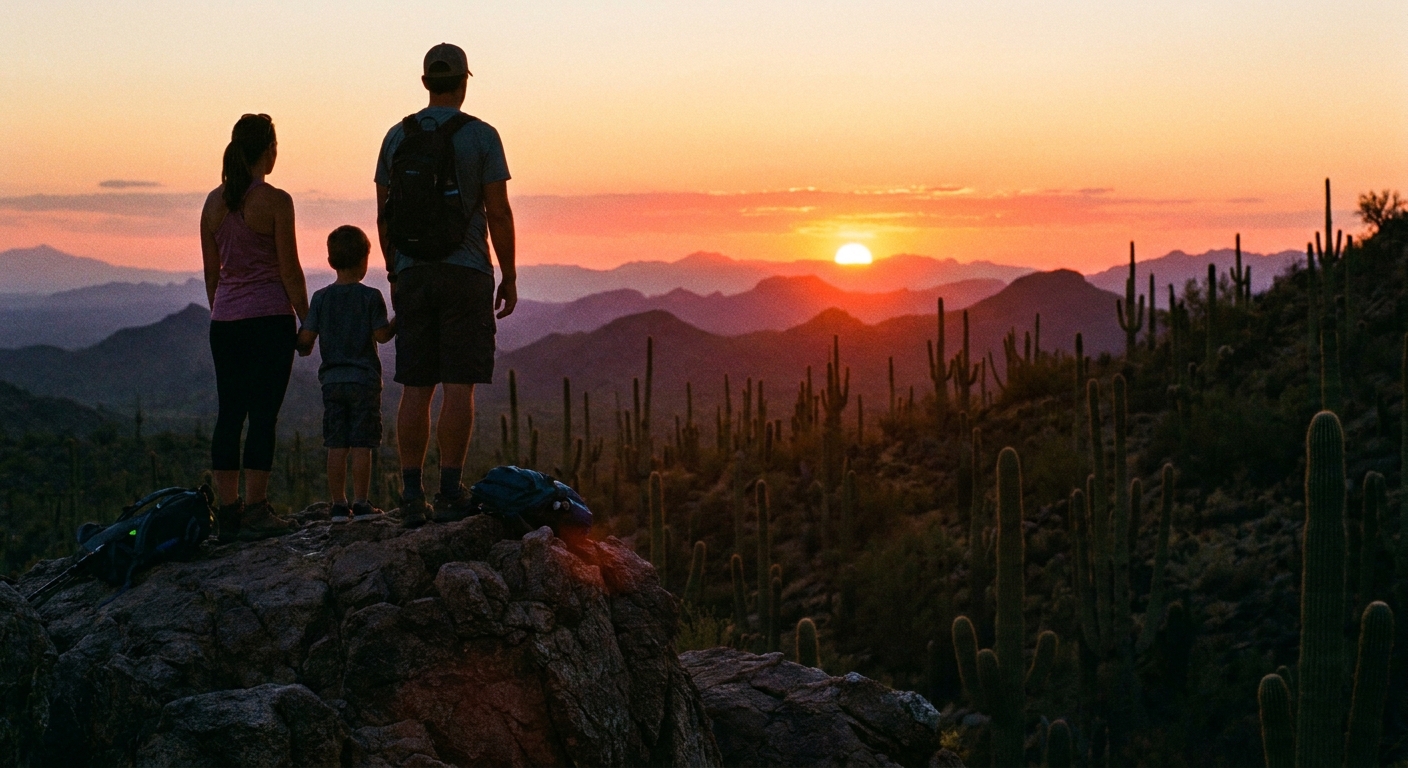
- Best time of day: Sunrise year-round, and sunset in cooler months. In summer, plan early and be done before late morning.
One key logistics note: the two districts are not connected by an internal park road. Switching sides means driving through Tucson.
Park logistics
- Visitor centers: West has the Red Hills Visitor Center. East has the Rincon Mountain Visitor Center. Both are worth a quick stop for current trail conditions, water reminders, and closure updates.
- Hours: the park itself is generally open daily, but visitor center hours vary by season. Check the NPS site the day you go.
- Fees: you will need a park pass for entry areas. America the Beautiful passes work here.
- Cell service: can be spotty, especially once you are away from main roads. Download your map for offline use.
Best hikes in the West district
If you want that classic postcard moment of saguaros stacked against a cotton-candy sky, start here.
Valley View Overlook Trail
Why it’s great: A short, family-friendly walk with a surprisingly big payoff, especially for sunset. The trail leads to a rocky overlook where the desert seems to ripple all the way to distant ranges.
- Distance: about 0.8 miles round trip
- Elevation: minimal
- Time: 20 to 40 minutes
- Difficulty: easy, with a few rocky spots
- Trailhead: Valley View Overlook area on Bajada Loop Drive
- Good for: sunset, quick visits, photographers
King Canyon to Wasson Peak
Why it’s great: This is the West district’s classic summit day. Wasson Peak delivers sweeping views over Tucson, the surrounding mountain ranges, and a sea of saguaros below. Start early and bring more water than you think you need.
- Distance: commonly about 7 to 8 miles round trip via King Canyon Trail (exact mileage depends on which connectors you take)
- Elevation: roughly 2,000 feet of gain (varies by route)
- Time: 4 to 6 hours
- Difficulty: moderate to strenuous, steady climbing and exposure
- Trailhead: King Canyon Trailhead (West district)
- Good for: hikers who want a summit, cooler-season challenges
Trail note: There are a few ways to tag Wasson Peak, including loop options that use signed connectors. Distances can swing by more than a mile depending on your choices, so confirm your exact route on the current NPS map before you go.
Hugh Norris Trail
Why it’s great: A longer, rolling trail with constant saguaro scenery and a more remote feel the farther you go. I like it because it is a true choose-your-own day. You can do a mellow out-and-back or keep going if the weather is kind.
- Distance: out-and-back, easy to tailor (many people turn around at 3 to 5 miles total; longer days can push close to 10 miles round trip)
- Elevation: rolling ups and downs
- Time: 1.5 to 5 hours depending on turnaround
- Difficulty: moderate
- Trailhead: Hugh Norris Trailhead off Bajada Loop Drive
- Good for: quieter desert hiking without a full-on summit push
Desert Discovery Trail
Why it’s great: A short loop that helps you learn what you are looking at. Perfect if you are arriving midday, traveling with kids, or want a low-commitment option before a bigger hike tomorrow.
- Distance: about 0.5 miles loop
- Elevation: minimal
- Time: 20 to 30 minutes
- Difficulty: easy
- Trailhead: near Red Hills Visitor Center
- Good for: first-time visitors, quick leg stretch
Accessibility note: This is often the most accessible trail-style experience in the West district, but surfaces and details can change. If accessibility is a must, confirm the current conditions with the visitor center.
Best hikes in the East district
The East district is where I go when I want the desert plus a little more breathing room. It’s still saguaro country, but you will also feel the Rincon Mountains rising behind you, which adds drama and sometimes a whisper of cooler air.
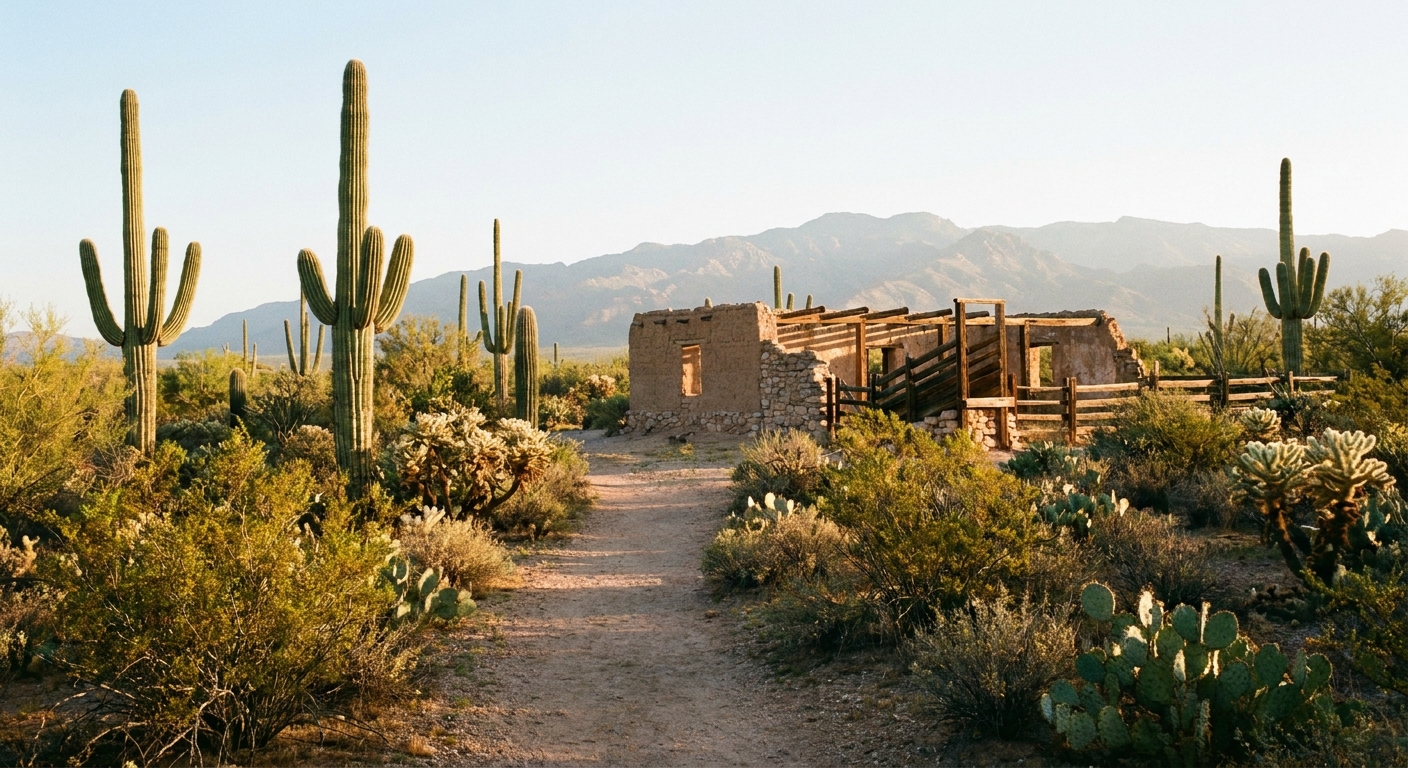
Freeman Homestead Trail
Why it’s great: This is one of my favorite “slow travel” hikes in the park. It is short, accessible-feeling, and packed with classic Sonoran Desert scenery. Great for sunrise when the light turns the cactus spines into tiny halos.
- Distance: about 1 mile (often done as a short loop with spurs, depending on where you start)
- Elevation: minimal
- Time: 30 to 45 minutes
- Difficulty: easy
- Trailhead: signed parking area near the Freeman Homestead / Cactus Forest area (East district)
- Good for: sunrise, families, quick nature fix
Loma Verde Loop
Why it’s great: If you want a satisfying loop without committing to an all-day trek, this is a sweet spot. You will get a steady rotation of saguaros, washes, and mountain views. It’s also a strong option for winter and shoulder seasons when you can comfortably stay out longer.
- Distance: roughly 3.5 to 4 miles as a loop (most commonly using Loma Verde plus a connector like Squeeze Pen and a wash trail such as Javelina Wash, depending on your exact plan)
- Elevation: mostly flat with gentle rollers
- Time: 1.5 to 2.5 hours
- Difficulty: moderate
- Trailhead: Loma Verde Trailhead (East district)
- Good for: half-day hiking, trail runners, visitors who want variety
Trail note: “Loma Verde Loop” can mean a few slightly different combinations. If you like certainty, decide your exact connector trails before you leave the parking lot and pin the route offline.
Garwood Trail to Wildhorse Tank
Why it’s great: This one gives you a bit more elevation work and a different feel than the flatter loops. After rains, seasonal water can appear in tanks, though it is never guaranteed. Either way, the climb earns wide-open views across the cactus-studded foothills.
- Distance: often around 3 to 4 miles round trip depending on your turnaround point
- Elevation: moderate gain for the mileage, with steeper sections
- Time: 2 to 3 hours
- Difficulty: moderate
- Trailhead: Garwood Trailhead (East district)
- Good for: a workout with a shorter time commitment
Tanque Verde Ridge
Why it’s great: This is an East district classic for seasoned hikers. You earn a ridgeline perspective that makes Tucson feel like it is floating at the edge of the desert. It is exposed for much of the way, so timing and water matter more than ego.
- Distance: long out-and-back, commonly 8 to 10+ miles round trip depending on your endpoint
- Elevation: significant gain and sustained climbing
- Time: 4 to 7 hours
- Difficulty: strenuous
- Trailhead: Tanque Verde Ridge Trailhead (East district)
- Good for: cooler months, experienced hikers, big-view days
Trail note: If you want a clear benchmark, pick a turnaround point before you start (a specific saddle, viewpoint, or mileage goal) and stick to it. This route makes it very easy to say “just a little farther” until your water says otherwise.
How to pick your hike
If you only have 2 hours
- West: Valley View Overlook Trail plus a scenic drive on Bajada Loop Drive
- East: Freeman Homestead Trail plus a short add-on if the temperature is friendly
If you want the most iconic saguaro scenery
- West is usually the winner for density and drama. Pair Desert Discovery Trail with Valley View Overlook.
If you want a real workout
- West: Wasson Peak via King Canyon (or a longer loop variation)
- East: Tanque Verde Ridge
If you’re with kids or new hikers
- Choose short loops and overlooks, then spend the “saved energy” on spotting lizards, birds, and cactus blooms.
Best seasons and timing
- Oct to Apr: prime hiking weather for most people.
- May and Sep: shoulder season. Start early, shorten your mileage, and be honest about heat.
- Jun to Aug: extreme heat risk. If you hike, do it at dawn, keep it short, and consider swapping in indoor Tucson plans if temperatures are brutal.
Desert tips I actually use
Saguaro hikes are not technically complicated, but they are physically unforgiving when you underestimate sun and dryness.
- Start early: sunrise is your best friend, especially from late spring through early fall.
- Carry more water than you think: there is very little shade, and you will lose water faster than you feel it. Electrolytes help.
- Baseline water guide: for short, easy hikes, I plan at least 1 liter per person. For moderate to long hikes, 2 to 3+ liters, and more in hot weather. Your needs vary, but the desert does not forgive wishful thinking.
- Sun protection is not optional: wide-brim hat, sunscreen, and sunglasses. Long sleeves can be cooler than a tank top when the sun is intense.
- Watch footing: rocky sections and loose gravel can sneak up on you, particularly on steeper trails.
- Respect wildlife: give rattlesnakes space, do not approach javelina, and never feed animals.
- Stay on trail: desert soils and cactus ecosystems are fragile, and it is easy to step on spines you did not see.
- Have a map that works offline: do not count on cell service to rescue your navigation mid-hike.
My personal rule in Saguaro: if I am debating whether I packed enough water, I did not.
What to pack
- Water: bring a bottle or hydration reservoir you will actually drink from
- Electrolytes: tabs or powder
- Sun gear: hat, sunscreen, sunglasses
- Footwear: trail runners or hiking shoes with good grip
- Snack: salty plus something easy like a bar or fruit
- Navigation: downloaded map for offline use, especially if you plan longer routes
- Light layer: mornings can be cool in winter, and desert temps can swing
After-hike Tucson
This is my favorite part of the Saguaro experience. You can do the rugged thing, then reward yourself with the city’s best comforts without a long drive.
My go-to post-hike plan: finish by late morning, then aim for coffee and lunch in Downtown or the Mercado District. Both are easy to build into a day and feel appropriately celebratory after a sun-soaked hike.

FAQ
Which side is better for hiking?
For iconic, dense saguaro scenery and shorter crowd-pleasing hikes, go West. For longer loops, more variety, and a quieter feel once you get away from the most popular trailheads, go East.
When is the best time of year to hike?
Fall through spring is the comfort zone for most visitors. Summer hiking can be dangerous due to heat and exposure, so stick to very early starts and shorter routes, and consider alternatives if it is extremely hot.
Do I need a permit?
Most day hikes do not require a permit, but you will need a park pass for entry areas. Backcountry camping does require a permit, and rules can change. Always verify current conditions, closures, and regulations on the National Park Service site before you go.
Are these distances exact?
Many routes in Saguaro can be linked in multiple ways, and official mileage can vary by connector and turnaround. Treat the mileages here as practical planning numbers, then confirm your exact route on the current NPS map before you hike.