Big Four Ice Caves: How Close to Go

Maya Lin
Maya Lin is a travel journalist and outdoor enthusiast who believes the best trips combine rugged adventures with urban comforts. After spending six years backpacking across four continents, she founded Trail & Town Guide to help fellow travelers navigate both hidden mountain passes and bustling city neighborhoods with confidence.
The Big Four Ice Caves are one of those Pacific Northwest stops that sounds like a gentle, family-friendly stroll to something magical. The stroll part is mostly true. The magical part is too. The “ice caves” part is where people get hurt.
I have been here in different shoulder seasons, and what always sticks with me is how quickly the vibe changes as you near the basin. You go from easy forest walking to a wide open amphitheater of rock, water, and debris with an enormous avalanche fan at the base of Big Four Mountain. It is stunning, loud, and constantly changing.
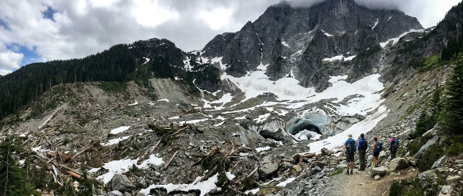
So how close should you go?
If you only read one thing on this page, make it this: do not approach the cave openings or walk onto the snow and debris field below them. Treat the caves as a look-but-do-not-enter attraction.
To be crystal clear: there is not an officially “safe” spot in the basin just because other people are standing there. My personal rule is to stay on the maintained trail and boardwalk, and stop at the end of the maintained route, where most people pause to look out.
Why? The “caves” are not stable caverns. They are temporary openings in avalanche debris where meltwater carves tunnels and chambers through snow and ice. Roofs can collapse without warning, even on cool days. Rockfall and icefall are also common hazards in the basin, and running water can hollow out voids under the surface.
A practical rule of thumb
- Go as far as the maintained boardwalk and trail comfortably allow, then stop.
- If you are leaving the boardwalk to step onto snow, ice, or avalanche debris, you are already too close.
- If you can hear water rushing under the snow, you are absolutely too close.
You can still get great photos from the end of the maintained route, especially with optical zoom or a telephoto lens. If you want the caves to look bigger in your frame, zoom in rather than walking closer.
What the walk is actually like
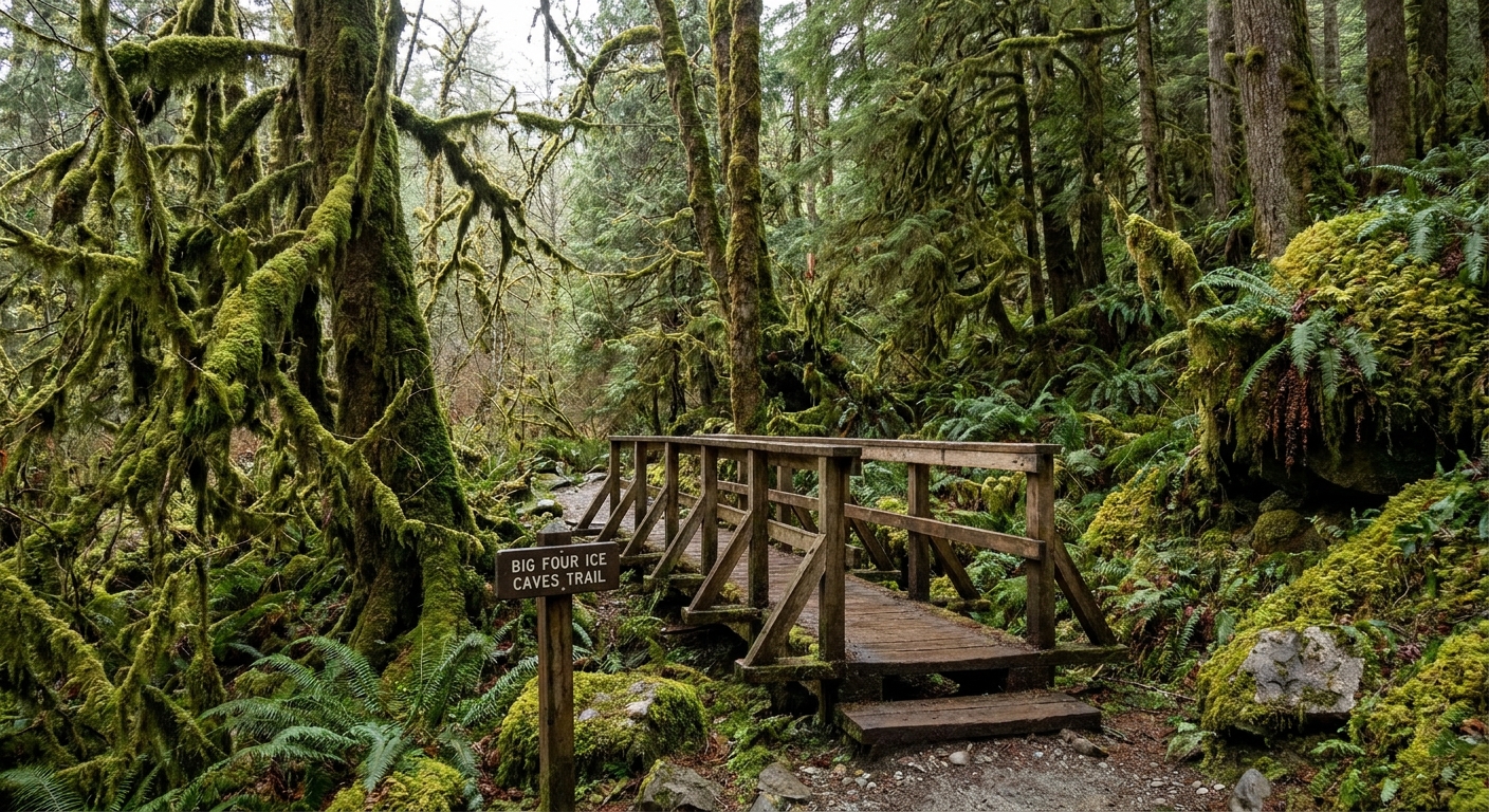
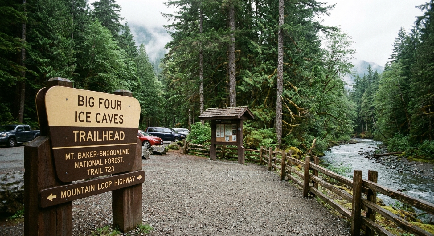
This is one of the easiest “big payoff” walks off the Mountain Loop Highway, near Granite Falls, at the Big Four Picnic Area trailhead. The path is short and generally mellow, and the boardwalk sections make it feel more accessible than a typical mountain trail. That said, conditions vary and the final stretch toward the basin can feel slick or muddy depending on season.
At a casual pace, plan on about 60 to 90 minutes round trip, plus however long you linger at the viewpoint.
Orientation-wise: you start in the woods, follow a mix of gravel path and boardwalk, and end at the basin edge facing the avalanche fan under Big Four Mountain. That last open area is where people get tempted to wander onto the debris field.
Distance and terrain
The route is a short, mostly flat walk with a mix of forest path, gravel, and boardwalk. Think “easy outing” rather than “hike,” but still plan for wet feet and unpredictable mountain weather.
- Distance: about 2.2 miles round trip (this can vary a bit depending on current trail alignment and where you stop).
- Elevation gain: roughly 200 feet (also varies slightly by source and route updates).
- Boardwalk: helps keep you off sensitive wet areas and reduces mud in places.
- Trail surface: can be muddy, with puddles and slick spots, especially after rain.
- Accessibility note: the boardwalk helps, but surfaces can be uneven and slick. It is not reliably stroller or wheelchair friendly.
- Exposure: once you reach the basin, you are in a wide open area that can feel colder and windier than the forest.
Before you go, check current conditions and posted warnings at the trailhead. This area changes fast, and seasonal closures, blowdowns, or high water can affect the experience.
Why the caves can collapse
The cave openings are not permanent structures. They form when avalanche debris piles deep in the basin and meltwater cuts pathways through it. As the season warms, roofs thin and undercut sections fail. A cave that looks solid one moment can partially collapse the next.
Two things can be true at once: the caves are beautiful to see, and getting close is not worth the risk. People have been seriously injured and killed here in past collapses, which is why I treat this as a view-from-a-distance stop, not an up-close adventure.
Common misconceptions
- “It is cold today so it is safe.” Collapse is not only about air temperature. Water flow and internal melting matter.
- “We will just stand at the entrance.” The entrance is often the most unstable zone, where overhangs fail.
- “Other people are down there.” Crowds are not a safety rating.
Seasonal timing
Big Four is a year-round place, but it is not a year-round “ice cave” experience. The look and the risk change constantly.
Spring and early summer
As temperatures rise, meltwater increases and the caves can become more undercut. This is also when you are most likely to hear water running under the debris field. That sound is a giant red flag.
It is also worth saying plainly: this basin sits beneath big avalanche terrain. Even if you are not thinking about avalanches in a “summer hike” way, you are still looking at an active runout zone.
Late summer and fall
By late season, the “caves” may shrink, disappear, or look very different. You might see less dramatic ice, but the basin is still dynamic, and rockfall can be more noticeable as snow melts out.
Winter
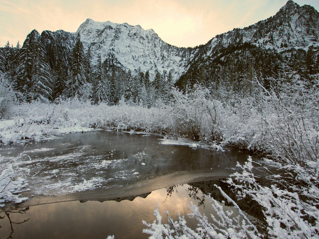
In winter, the area can be avalanche-prone and the basin fills with snow. Even if the walk looks easy at the start, the environment you are approaching is serious mountain terrain. If you do not have winter travel experience, this is a place to be conservative and turn around early. Stay well back from the basin and any avalanche debris.
One more practical winter note: the Mountain Loop Highway often has a seasonal gate closure. Where that gate sits, and what it blocks, can change by year, but the impact is the same: it can add a lot of road-walk mileage. Check current Snohomish County and USFS road status before you drive out.
Where to stand for a good view
The best “worth it” view is typically from the end of the maintained trail and boardwalk, where people naturally stop and look out across the avalanche fan. From here, you can often see the openings and any blue tones in the ice when they are present, without gambling on unstable snow.
Photo tips
- Use optical zoom or a telephoto lens instead of walking closer.
- Photograph people for scale from the maintained route, not from the debris field.
- Go earlier in the day for softer light in the basin and fewer people in frame.
What to pack
I am a carry-on only traveler even when I am hopping between cities and trailheads, and Big Four fits nicely into that mindset. Small pack, but do not skip the boring stuff that keeps you warm and dry if the weather turns.
- Parking pass: a Northwest Forest Pass (or an America the Beautiful Interagency Pass) is typically required for parking here. Confirm current requirements before you go.
- Waterproof shoes or trail runners you do not mind getting muddy.
- Rain shell even if the forecast looks decent.
- Warm layer for the basin, which can feel chilly.
- Snacks and water because the walk is short but the stop often turns into a linger.
- Bug spray in warmer months.
There are usually restrooms at the trailhead (often vault toilets), but do not treat it as a guarantee. Facilities can close for maintenance or seasonally.
Good etiquette matters
This is a high-traffic spot, and the combination of boardwalk, wet ground, and curious kids running ahead can create a little chaos. A few small choices make the experience better for everyone.
- Stay on the trail and boardwalk to protect fragile wetland areas.
- Keep dogs close, especially near the basin where people stop abruptly for photos.
- Do not throw rocks or snow toward the caves. It adds hazard and can destabilize overhead snow and ice.
- Pack out everything, including coffee cups and snack wrappers.
Make it the quick stop
Big Four is a perfect “stretch your legs” destination on a Mountain Loop Highway day. It is scenic payoff without committing to an all-day sufferfest, which is sometimes exactly what you want between bigger hikes or after a late breakfast in town.
I like pairing it with a slow lunch back in Granite Falls or a coffee stop before driving farther along the loop. If you are chasing longer alpine days, save those for dedicated pages and plan them like the bigger objectives they are.
FAQ
Can you go inside the Big Four Ice Caves?
You should not. The cave roofs can collapse without warning, and conditions change daily. A smart visit is viewing from a distance, staying on the maintained route.
Are the ice caves always there?
No. The formations change every season. In some periods the openings are small or absent, and in others they are more dramatic. Never plan on a guaranteed “walk into an ice cave” experience.
Is the walk kid-friendly?
The walk itself can be kid-friendly in terms of distance and grade, but the basin is where supervision matters most. The hazard is not the walking, it is the temptation to wander onto unstable snow and debris near the caves.
What is the biggest danger?
Collapse of the snow and ice cave structures, plus rockfall and icefall hazards in the basin. Meltwater can also create hidden voids under the snow that are not obvious from the surface. In colder months, the basin is also part of an avalanche path.