Bryce Canyon Day Hikes and Red Canyon
Maya Lin
Maya Lin is a travel journalist and outdoor enthusiast who believes the best trips combine rugged adventures with urban comforts. After spending six years backpacking across four continents, she founded Trail & Town Guide to help fellow travelers navigate both hidden mountain passes and bustling city neighborhoods with confidence.
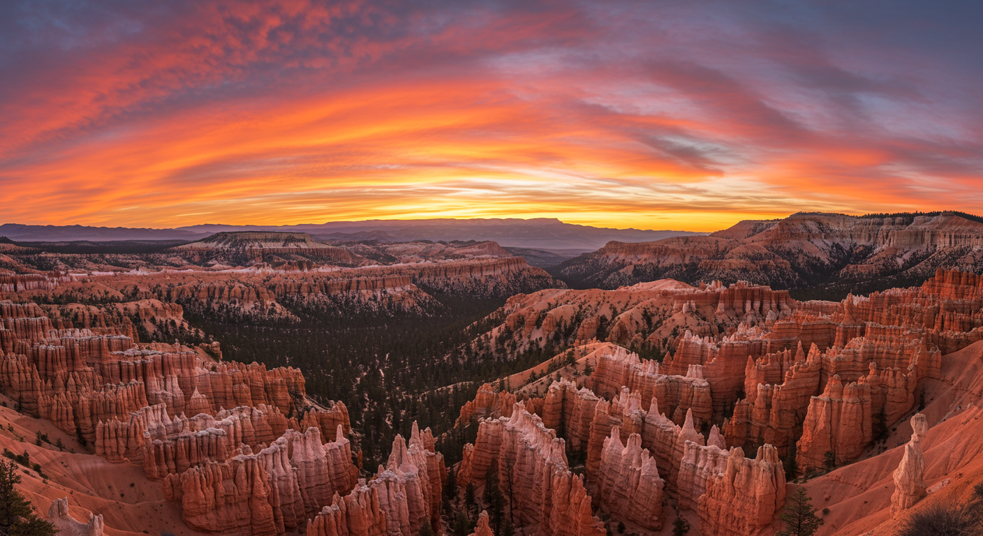
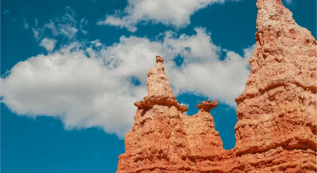
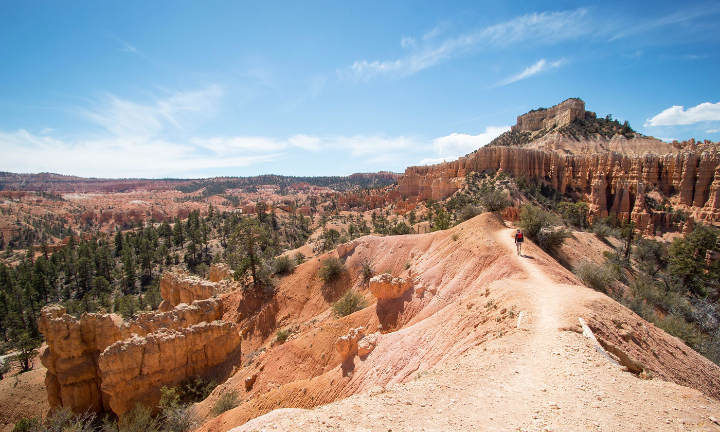
Bryce Canyon looks like someone tipped a box of pink-orange crayons across a high desert amphitheater and then, just for drama, carved every last crayon into a hoodoo. It is famous for sunrise viewpoints, sure, but the real magic happens once you drop below the rim and start weaving between the spires.
This guide focuses on the day hikes that show off Bryce at its best: Navajo Loop, Queens Garden, Peek-a-Boo Loop, and the all-time favorite long loop, Fairyland. I’m also adding a local secret that is not really a secret but still feels like one: Red Canyon, just outside the park on Scenic Byway 12, where you can walk through similar red rock scenery with a fraction of the crowd. Finally, you’ll get practical bases for dining and lodging in Bryce Canyon City and Tropic.
Before you hike
Elevation and effort
Bryce Canyon sits around 8,000 to 9,000 feet. Even “short” trails can feel spicier than their mileage suggests. Drink more water than you think you need, pace your climbs, and do not be surprised if you are a little winded on the switchbacks back to the rim.
One thing that surprises first-timers: most of Bryce’s famous hikes start with a downhill and end with an uphill. Save a little gas for the last mile.
Shuttle and parking
- Entrance fee: Bryce Canyon National Park charges an entrance fee per vehicle or per person. If you are hitting multiple Utah parks, an America the Beautiful annual pass can be a good deal. Check the current fee before you go since rates can change.
- Shuttle (seasonal): In the busy months, the Bryce Canyon Shuttle can be the difference between a smooth morning and a parking-lot spiral. If it is running during your visit, consider using it to reach the main amphitheater viewpoints and trailheads, especially around Sunrise Point, Sunset Point, and Bryce Point.
- Where to catch it: If you are staying outside the park, the shuttle is often easiest if you park in Bryce Canyon City near the shuttle stop and ride in, instead of hunting for a spot at Sunrise or Sunset. Check the official shuttle page for the current route, stops, and hours.
Best time of day
- Early morning: Cooler temps, calmer trails, and those dramatic shadows that make the hoodoos look extra sculpted.
- Midday: Bright light makes photos vivid, but it is also peak crowd time.
- Late afternoon: Softer light and fewer people. Just watch your turnaround time so you are not hustling out at dusk.
Weather and safety
- Summer storms: Afternoon thunderstorms can build fast. If you hear thunder, move off exposed viewpoints and ridgelines and start working your way toward safer ground.
- Winter and ice: Steep sections can be slick. Microspikes help a lot, and trekking poles are a surprisingly great upgrade for confidence on the way down and on the climb back up.
- Heat and sun: High elevation sun is no joke, even when the air feels cool.
What to pack
- Water: At least 1 liter for short loops, 2 to 3 liters for Peek-a-Boo or Fairyland, especially in summer.
- Layers: Rim temps can be chilly even when the canyon feels warm.
- Traction: In winter and shoulder season, trails can be icy. Microspikes are a smart, small add.
- Sun protection: Hat, sunscreen, sunglasses.
- Snacks: There are not many services once you drop in.
Bryce is the rare park where the “hard part” is often the last mile. Save a little gas for the climb back to the rim.
Best day hikes
These routes are the day-hike sweet spot: big scenery, manageable logistics, and enough options to mix and match based on your time and legs.
Quick note on stats: Distances and elevation gain can vary a bit depending on mapping, connector choices, closures, and where you start. For the most current numbers, cross-check with the NPS trail descriptions and current conditions.
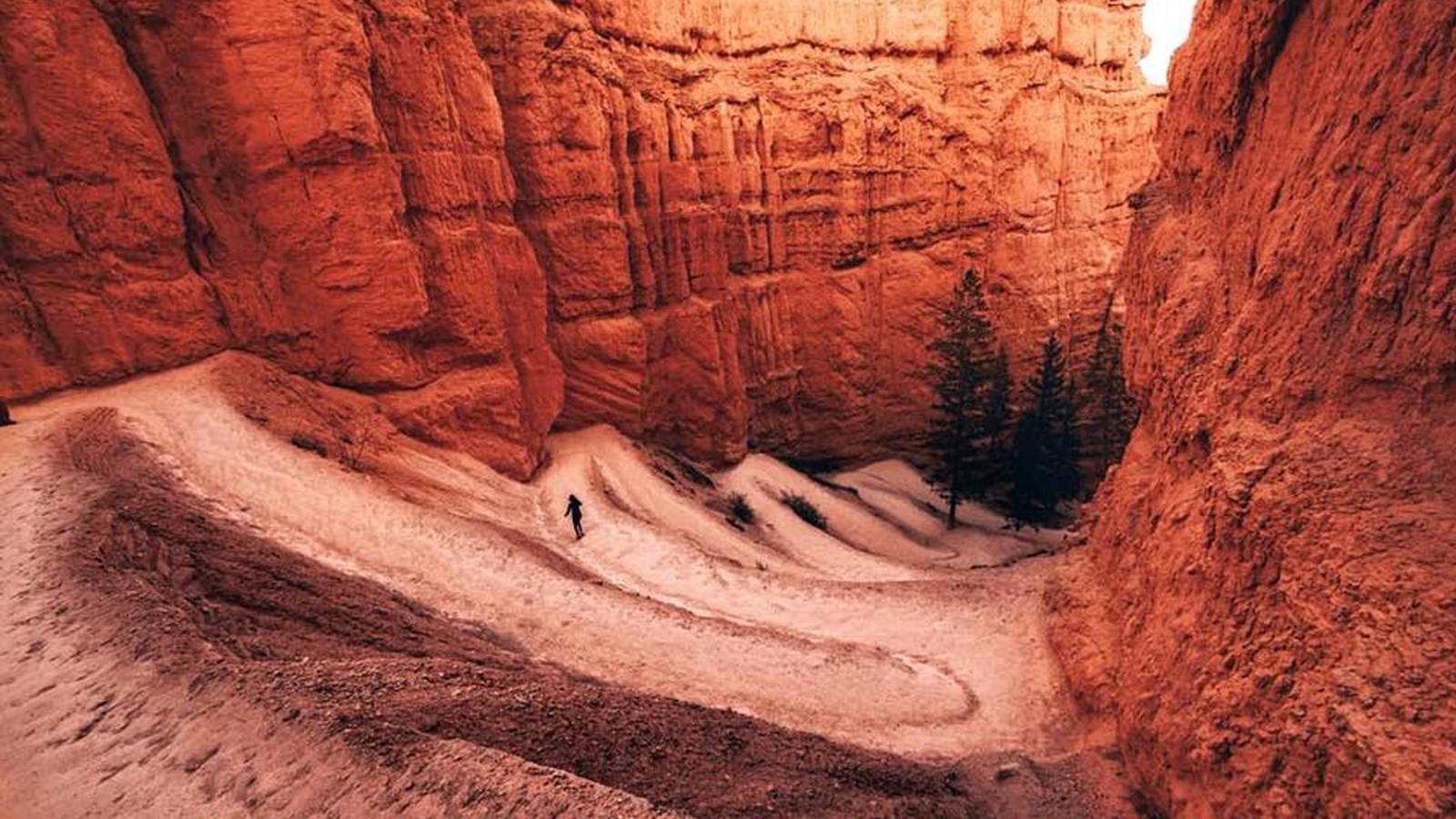
Navajo Loop
This is the classic Bryce descent, and it earns its hype. You drop quickly into the amphitheater and immediately feel surrounded by towering hoodoos. The famous switchbacks and narrow walls make it feel like an adventure even for casual hikers.
- Trailhead: Sunset Point
- Distance: about 1.3 to 1.5 miles loop (varies by branch and conditions)
- Elevation gain: about 500 to 550 feet
- Why do it: Iconic hoodoo corridors and a dramatic descent right from the rim.
- Good for: First-timers with limited time.
- Know before you go: Sections may close in winter due to rockfall or ice. Check current conditions before committing.
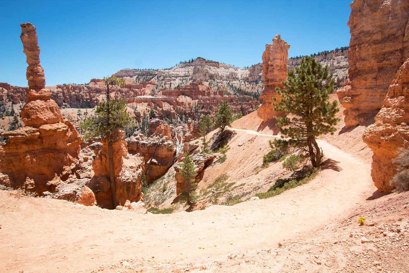
Queens Garden
If you want the best “wow” per mile in Bryce, Queens Garden is hard to beat. The grade is friendlier than some routes, and the hoodoos feel close enough to touch as the trail winds through sandy, peach-colored corridors.
- Trailhead: Sunrise Point
- Distance: about 1.8 miles out and back
- Elevation gain: about 300 to 450 feet (depends on turnaround and mapping)
- Why do it: Approachable, scenic, and easy to combine with Navajo Loop.
- Good for: Families, casual hikers, and anyone acclimating to the elevation.
- Trail tip: If you are choosing only one short hike, Queens Garden is a strong contender.
Navajo + Queens Garden combo
If you have half a day, this combo is the Bryce Canyon greatest-hits album. You get the drama of Navajo’s descent plus the open, wandering beauty of Queens Garden, with a satisfying climb back to the rim.
- Start points: Sunset Point and Sunrise Point (easy walk along the Rim Trail between them)
- Typical direction: Down Navajo from Sunset Point, connect across the amphitheater, then up Queens Garden to Sunrise Point (many people prefer going up Queens Garden because it is a steadier climb)
- Distance: about 2.9 to 3.1 miles loop (depending on which Navajo branch is open and which connectors you take)
- Elevation gain: about 600 feet
- Why do it: The most efficient way to see a lot of Bryce below the rim.
- How it feels: Moderate, with a punchy final climb.
- Timing: Start early if you want a calmer experience on the switchbacks and tighter sections.
Peek-a-Boo Loop
Peek-a-Boo is where Bryce starts to feel like a maze in the best possible way. More mileage, more elevation change, and more moments where you round a bend and the amphitheater rearranges itself into a totally new scene.
- Trailhead: Commonly accessed from Bryce Point via the Peek-a-Boo Loop Trail, or linked in from Queens Garden or Navajo
- Distance: about 5.5 miles loop
- Elevation gain: about 1,400 to 1,600 feet (varies based on access route and counting method)
- Why do it: Bigger views and fewer people than the shortest classics.
- Good for: Stronger day hikers who want a more immersive loop.
- Logistics: Many hikers access Peek-a-Boo via the Queens Garden or Navajo connections, creating longer, unforgettable combos.
Fairyland Loop
Fairyland is the full-day Bryce experience and my personal pick if you only have one big hiking day. It is longer, quieter, and consistently beautiful, with sweeping amphitheater views and long stretches where you feel like you have your own corner of the canyon.
- Trailhead: Fairyland Point
- Distance: about 7.8 to 8.0 miles loop
- Elevation gain: about 1,500 to 1,650 feet
- Why do it: All-day immersion and a more peaceful vibe than the busiest amphitheater routes.
- Good for: Fit hikers who want a single, memorable flagship hike.
- Start early: This one is best before the sun is high and the parking areas fill.
Suggested itineraries
2 to 3 hours
- Hike Queens Garden or Navajo Loop depending on conditions and crowds.
- Add a rim viewpoint stop for sunrise or late light.
Half day
- Do the Navajo + Queens Garden combo.
- Grab lunch in Bryce Canyon City, then cruise scenic overlooks.
Full day
- Start early with Fairyland Loop or a Peek-a-Boo combo route.
- Finish with sunset on the rim, then reward yourself with a real meal in Tropic.
Viewpoints
If you only do a few rim stops, make them count.
- Sunrise: Sunrise Point and Inspiration Point tend to light up fast and beautifully.
- Sunset: Sunset Point is the classic for a reason. Bryce Point is also excellent for big, sweeping amphitheater views.
Small reality check: “Sunrise Point” is not always the best sunrise and “Sunset Point” is not always the best sunset. The best one is the one where you can actually park or hop off the shuttle without stress.
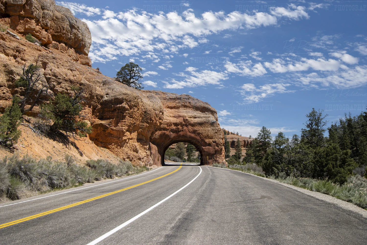
Red Canyon
If Bryce feels busy, or if you are doing a Zion to Bryce road trip and want a bonus stop that still delivers that red-rock magic, Red Canyon is your move. It sits along Utah Scenic Byway 12 near the entrance to Dixie National Forest, and it has its own mini hoodoos, red cliffs, and forest-meets-desert scenery.
It is not a carbon copy of Bryce geologically, but the look and vibe hit a similar note: sculpted rock, bold color, and that satisfying feeling of walking through stone.
What I love about Red Canyon is the vibe: more locals, more quiet, and a sense that you can actually hear the wind move through the pines.
- Why go: Similar look and color palette to Bryce, fewer crowds, easy access from the highway.
- Best for: A short hike, a leg-stretch stop, or a Plan B when Bryce parking is wild.
- Pair it with: A drive on Scenic Byway 12 toward Escalante if you have extra time.
Where to stay
Bryce Canyon City
This is the small cluster of lodging and services right outside the park entrance. You stay here for one reason: maximum convenience for early starts and minimal driving.
- Pros: Fast access to the park, easy sunrise starts.
- Cons: Limited dining variety, can be pricier during peak season.
Tropic
Tropic is a small, friendly town a short drive away with more of that lived-in feel. If you like ending a big hike with a quieter evening and a better chance of a laid-back meal, Tropic is a great base.
- Pros: Calmer vibe, good access to Bryce and nearby scenic drives.
- Cons: A bit more driving to trailheads and viewpoints.
Where to eat
Bryce days tend to run early and end dusty, so plan at least one meal that feels like a reward. Options can change seasonally, and small-town hours can be delightfully unpredictable, so do a quick hours check when you roll into town.
Bryce Canyon City
- Valhalla Pizzeria and Coffee Shop: A go-to for an easy post-hike meal and caffeine that does its job. (Double-check seasonal hours.)
- The Lodge at Bryce Canyon: A classic in-park option when you want to keep driving to a minimum. Dining venues and hours can vary by season, so confirm what is open during your visit.
Tropic
- i.d.k. Barbecue: The kind of casual, satisfying spot that tastes even better when your legs are tired. (Confirm days and hours.)
- Rustler’s Restaurant: A straightforward local standby for a sit-down meal after a big day. (Confirm days and hours.)
- Coffee note: If you are like me and judge a town by its espresso, ask what is open when you arrive and do not wait until 7 a.m. to figure it out.
If you are hiking Fairyland or a long Peek-a-Boo combo, pack a real lunch and eat it on the trail. Bryce’s viewpoints make surprisingly excellent picnic tables.
Leave no trace
Bryce’s trails are durable, but its ecosystems are still fragile. Stay on trail to protect cryptobiotic soil, pack out all trash, and give other hikers room on narrow sections. If you are visiting in winter, step carefully on icy slopes and do not shortcut switchbacks.
- Stay on established trails, especially in sandy or crusted soil areas.
- Pack out food scraps, not just wrappers.
- Keep voices low in the amphitheater. It is part of the magic.
Quick checklist
- Pick your hike: Queens Garden for short and sweet, Peek-a-Boo for bigger adventure, Fairyland for the full-day standout.
- Start early: Better light, cooler temps, fewer crowds.
- Know the finish: Expect the climb back to the rim.
- Use the shuttle if it is running: Especially in peak season when parking gets spicy.
- Bring layers and water: High elevation weather swings are real.
- Pack traction if needed: Microspikes and trekking poles can make steep sections much safer in winter and shoulder season.
- Add Red Canyon: Especially if you want a quieter second act.
- Base smart: Bryce Canyon City for proximity, Tropic for a calmer stay and more local feel.
If you’re building a Utah road trip that links Zion, Bryce, and beyond, Bryce Canyon is the perfect middle chapter: rugged enough to earn your sore legs, and close enough to town comforts that you can still end the day with a hot meal and a solid bed.