Chiricahua National Monument: Hoodoo Loops and Day Plans
Chiricahua National Monument is one of those Arizona places that makes you stop mid-sentence. Hoodoos stacked like stone totems. Narrow rhyolite fins that look carved by a patient sculptor. And quiet trails where a quick “one loop” somehow turns into a full-on wandering session.
The trick is that Chiricahua can be perfect in half a day or amazing as a full day, depending on which loop you choose and how you handle the park’s simple but important flow: visitor center, then up the scenic drive, then hike.

Below are easy versus moderate loop options with trail names you can match to NPS maps and trail signs (plus the common “visitor nickname” versions), a practical trailhead strategy, and the logistics that make it easy to pair Chiricahua with Willcox wine tasting or a Tucson base.
Quick facts
- Entrance fee: None as of April 2026. (Fees can change, so it is always worth a quick check.)
- Best time to hike: Morning and late afternoon. Midday sun is intense even when the air feels cool.
- Elevation: You are in “sky island” country. Expect higher elevation than the low desert, cooler mornings, and big temperature swings.
- Sun exposure: Many sections are exposed. The rock amplifies heat and glare. A brimmed hat and sunglasses feel non-negotiable.
- Trail character: Rock gardens, narrow passageways, and short steep segments on the moderate loops. Easy options exist, but the best hoodoo immersion is usually on moderate terrain.
- Cell service: Spotty. Download maps ahead of time.
Visitor center to trailheads
Chiricahua’s layout is straightforward once you understand it: the visitor center sits lower, while the main hoodoo hiking zone is accessed via the scenic drive to higher-elevation trailheads like Massai Point and Echo Canyon.
Suggested flow
- Start at the visitor center for current conditions, water availability, and a quick trail recommendation based on your timing and comfort level.
- Drive the scenic road up and choose one primary hike, then add viewpoints as bonus stops.
- Hike first, viewpoints second if you are visiting midday. The earlier you get on trail, the happier you will be.
Parking note: Upper trailheads, especially Echo Canyon, have limited parking. If you want the classic loops (and a calmer start), arrive early or aim for late afternoon.
Restrooms: You will find restrooms at the visitor center and at several upper-area stops (commonly including Massai Point). Still, treat it like a remote park. Use facilities when you see them.
Driving time note (important): The estimate to “Chiricahua” depends on whether you mean the visitor center or the upper trailheads. From the visitor center, you still have the scenic drive up to places like Massai Point and Echo Canyon, which adds time.
If you only have a half day, pick one loop and do it well. If you have a full day, plan for one moderate loop plus a shorter add-on, with a long lunch break in the shade.
Easy walks
If you want hoodoos without committing to a longer, steeper loop, you can still get a satisfying “Chiricahua feel” by focusing on short walks near key stops along the scenic drive.
Plan A: Viewpoints and short trails
- Who it is for: Families, first-timers, anyone arriving late, or travelers pacing themselves for a longer road trip.
- Time: About 2 to 3.5 hours including driving the scenic road and lingering at viewpoints.
- What you will see: Big hoodoo panoramas and close-up rock textures without a major elevation change.
Good easy picks:
- Massai Point Nature Trail (Massai Point Trail): A short, high-reward walk at the Massai Point area with wide views and that first “wait, this place is unreal” moment.
Where to start: Massai Point parking area (upper scenic drive).
Hike stats (approx): 0.5 mi loop, minimal elevation gain, 15 to 30 minutes on foot. - Lower canyon walk near the visitor center (Bonita Canyon area): If you want something gentler and greener, start near the visitor center and explore the lower canyon trails that follow the Bonita Canyon drainage. This is the sky island transition in real time, with more shade than the rock corridors up high.
Where to start: Visitor center area trailheads (lower monument).
Trail name note: Visitors often refer to this area as “Bonita Canyon” or “Bonita Creek,” but the signed trail names can vary by segment. Check the current NPS map at the visitor center so you can match the exact names on the ground.
Hike stats (approx): 1 to 3 miles out-and-back depending on how far you wander, mostly gentle grades, 30 to 90 minutes on foot.
Bring lunch or snacks and treat this like a “slow scenic day,” where the main event is the landscape, not the mileage.
Short loop option
Plan B: Echo Canyon sampler
Even short hikes here can feel like stepping into a stone maze. If you are comfortable with uneven footing, choose a short option near the main hoodoo concentrations rather than spending all your time behind the windshield.
- Who it is for: Travelers who want a taste of the rock corridors without a bigger commitment.
- Time: About 1 to 2 hours of hiking, plus scenic stops.
- Tip: Start earlier than you think. Shade is precious, and the rock can radiate heat.
Simple, sign-friendly idea: Do an out-and-back on the Echo Canyon Trail from the Echo Canyon trailhead, then turn around once you hit the tight corridor sections and feel like you got your fill (or at the first major signed junction that makes your map-reading brain happy). It is the easiest way to get the “slot-like” vibe without committing to a longer circuit.
Where to start: Echo Canyon Trailhead (upper scenic drive).
Hike stats (approx): 1.5 to 3 miles round trip depending on turnaround point, moderate footing, 45 to 90 minutes on foot.
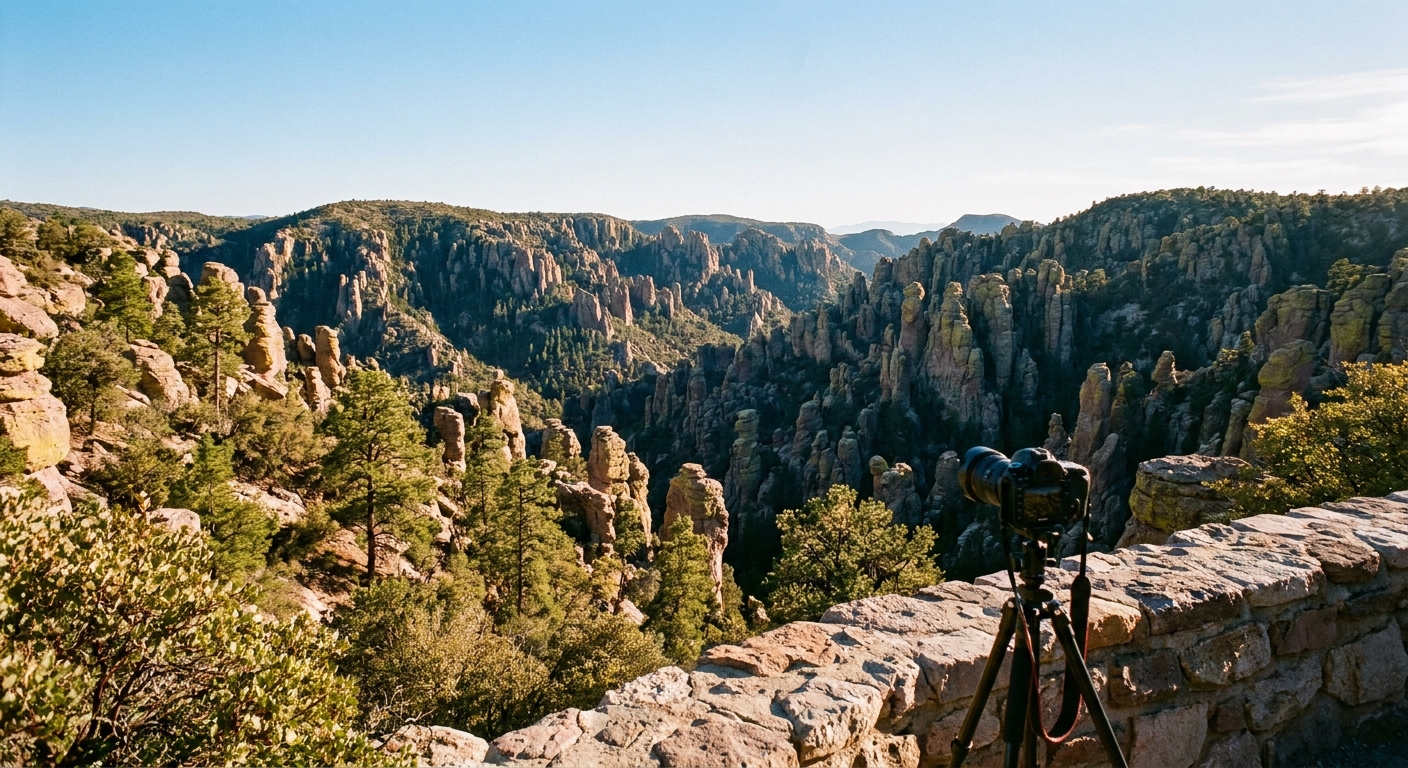
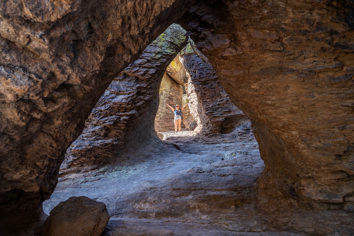
Moderate loops
If you have the legs for it, moderate loops are where Chiricahua becomes unforgettable. You get the narrow passages, the hoodoo “cathedrals,” and the feeling of hiking through a geological daydream.
What “moderate” means here
- Footing: Rocky and uneven in places, especially in the hoodoo corridors.
- Grade: Short steep segments are common. It is not constant climbing, but it is enough to feel in your calves.
- Exposure: Expect stretches with little shade. Plan water accordingly.
Half-day moderate
If you can only hike once, choose one moderate loop in the heart of the rock formations and give yourself time to wander the side spurs and viewpoints. Chiricahua rewards curiosity. The best photos often happen when you stop trying to “cover ground” and start noticing the shapes.
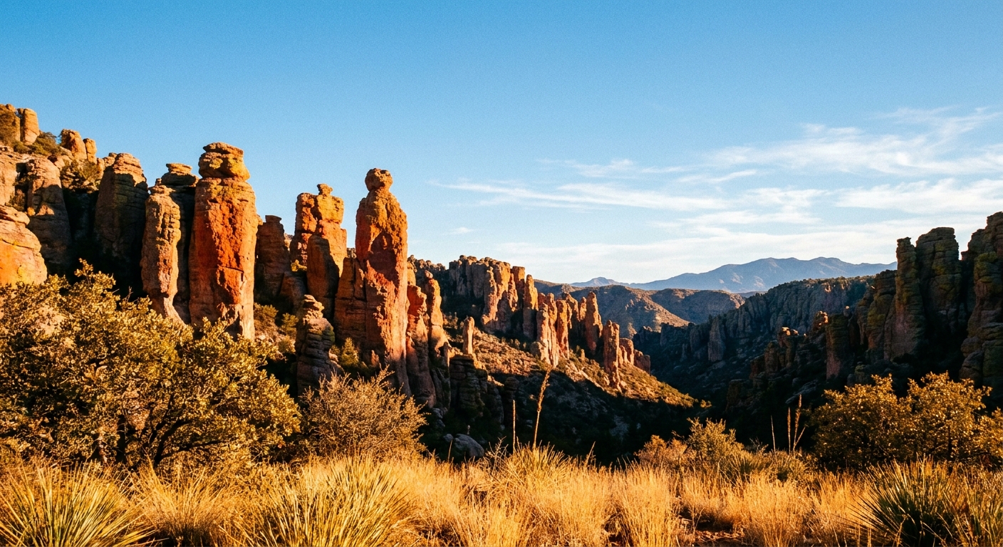
Best signature choice (common visitor term): Heart of Rocks Loop.
How it shows up on official maps: This is typically done via a combination of signed trails, most commonly using the Big Loop Trail with connectors through the Heart of Rocks area (often including segments like Ed Riggs Trail and spurs that lead you past the famous formations). Exact routing can vary with your start point and which junctions you choose, so follow the NPS map and trail signs.
Where to start: Most people start from either the Echo Canyon Trailhead or the Massai Point area and connect into the Big Loop system.
Hike stats (approx): 4.5 to 6 miles, 800 to 1,200 ft elevation change, 2.5 to 4.5 hours on foot depending on route and photo stops.
- Time: Roughly 3 to 5 hours total including drive, hike, and a few stops.
- Pacing tip: Snack every 45 to 60 minutes. The dry air makes it easy to forget you are burning more energy than you think.
Full-day moderate
A full day is ideal if you want both the hoodoo labyrinth and a quieter second trail later. The best rhythm is: hike your main loop in the morning, take a long break, then add a shorter walk for golden-hour light.
Classic combo (common visitor terms): Echo Canyon Loop plus Heart of Rocks Loop.
How it shows up on official maps: The “Echo Canyon Loop” people talk about is usually a circuit built from the Echo Canyon Trail plus connecting segments such as the Ed Riggs Trail and portions of the Big Loop Trail (route depends on your chosen junctions). This is exactly why grabbing the current NPS map at the visitor center helps. You can match your loop to the actual trail names on the signs.
Where to start: Echo Canyon Trailhead is the most common, but if parking is tight, start at Massai Point and build your loop from there using the Big Loop system.
Hike stats (approx): 7 to 10 miles total for a combined day, 1,200 to 1,800 ft elevation change, 4.5 to 7.5 hours on foot.
- Time: 6 to 9 hours at a relaxed pace with breaks.
- Break strategy: Aim for shade at lunch. Even on cooler days, sun exposure adds up.
Trail maxim: Chiricahua is a rare place where a “short” hike still feels like a big experience. If your schedule is tight, choose fewer miles but better terrain: the rock corridors over the roadside overlooks.
Safety and conditions
Chiricahua is friendly, but it is not a casual city park. A few small realities make the day go smoother.
- Water: Potable water availability can be limited and seasonal. Fill up when you can, and confirm current water status at the visitor center.
- Road and weather: The upper elevations can see snow or ice in winter. In summer, monsoon storms can bring lightning and sudden downpours, especially in the afternoon. If clouds build fast, do your exposed hiking early and keep an eye on the sky.
- Heat and sun: Pale rock reflects light like a mirror. Sunburn and dehydration happen faster than you think.
- Dogs: Pet rules can vary by park unit and can change. If you are traveling with a dog, confirm current pet policy on the official NPS page or at the visitor center before you plan a longer loop.
Wildlife spotting
Chiricahua sits in a sky island ecosystem, which means you get a blend of desert and mountain species. Wildlife is never guaranteed, but it is common to see movement if you hike quietly and start early.
What you might see
- Birds: Listen for calls in the pines and watch for quick flashes of color around flowering plants.
- Mammals: Deer and smaller critters are more likely at dawn and dusk.
- Reptiles: Sunny rocks attract them. Watch where you step and where you place your hands.
Respectful habits
- Keep distance and use your phone zoom instead of approaching.
- Stay on trail. The fragile edges around hoodoos and plants do not recover quickly.
- Pack out all food scraps. Even “natural” leftovers change animal behavior.
Weather and sun
Chiricahua can surprise people who expect low-desert conditions. Mornings can be crisp, midday can be intense, and afternoons can swing fast with wind or storms depending on season.
What to wear and carry
- Water: Carry more than you think you need. Dry air masks sweat.
- Sun protection: Hat, sunglasses, sunscreen. The light off pale rock is bright.
- Layers: A light insulating layer for mornings and a wind layer for ridgelines.
- Footwear: Shoes with solid grip. The rock corridors and gravel can be slick.
If you are visiting in warmer months, start early and plan to be back near the car or in shade during the hottest stretch of the day.
Half day vs full day
Choose a half day if
- You are road-tripping and Chiricahua is a highlight stop, not the only destination.
- You want one great loop or a couple of short trails plus viewpoints, without rushing.
- You plan to pair it with Willcox food or wine later.
Choose a full day if
- You want a moderate hoodoo loop and a second shorter hike.
- You like slow travel: long photo stops, wildlife watching, snack breaks.
- You want to experience both morning and late afternoon light on the rocks.
If you are on the fence, go full-day. Chiricahua is remote enough that you will be glad you did not treat it like a quick detour.
Willcox and Tucson
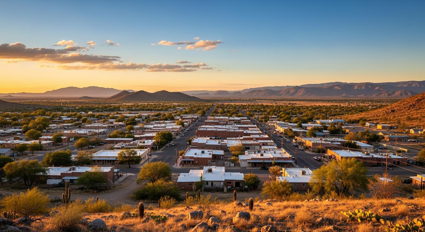
Option 1: Base in Willcox
Willcox is the practical pairing for Chiricahua. It is closer (about 40 minutes to the visitor center, give or take) and makes early starts easier, which matters for both heat and parking at upper trailheads. Keep in mind you will still add time to reach the upper scenic drive trailheads like Massai Point and Echo Canyon.
Willcox also has an easygoing small-town vibe and a growing wine scene that feels tailor-made for a post-hike unwind.
- Best for: Maximizing trail time and minimizing driving fatigue.
- Ideal plan: Chiricahua in the morning, then a late lunch and a relaxed afternoon in Willcox.
Option 2: Base in Tucson
Tucson is my pick if you want your trip to blend rugged scenery with city comforts: great coffee, excellent food, and more lodging choices. The tradeoff is drive time (roughly 2 hours to the visitor center each way, depending on where you start in town), plus extra time up the scenic drive to the upper trailheads.
- Best for: Travelers who want museums, restaurants, and a bigger city base.
- Ideal plan: Pre-dawn departure, one moderate loop, quick viewpoint stops, then return for a Tucson dinner.
Packing list
- 2 to 3 liters of water per person for moderate hiking days
- Salty snacks plus something you will actually eat even when it is hot
- Sun hat, sunglasses, sunscreen
- Light layers for temperature swings
- Trail shoes with grip
- Offline map downloaded
- Small trash bag for packing out everything
Final notes
Chiricahua is the kind of place that rewards a calm, unrushed approach. Pick a trail that matches your energy, start earlier than you think you need to, and leave space for the small moments: the echo of wind in the rocks, the sudden appearance of a bird in the pines, the way the hoodoos change color as the sun shifts.
Then, when you roll back into Willcox or Tucson, do what I always do after a dusty hike: find a good local coffee, sit somewhere with shade, and let the day settle into your bones.