Colchuck Lake Day Hike From Stuart Lake Trailhead

Maya Lin
Maya Lin is a travel journalist and outdoor enthusiast who believes the best trips combine rugged adventures with urban comforts. After spending six years backpacking across four continents, she founded Trail & Town Guide to help fellow travelers navigate both hidden mountain passes and bustling city neighborhoods with confidence.
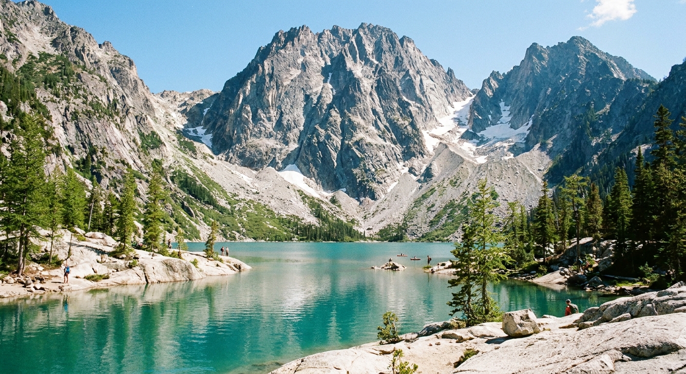
Colchuck Lake is one of those Washington hikes that somehow feels like it belongs on a postcard and a grind-set motivation poster at the same time. You earn it. The trail starts politely in the forest, ramps up with switchbacks, then ends in a classic Alpine Lakes Wilderness finale: granite, boulders, and a turquoise basin tucked under Dragontail Peak and Colchuck Peak.
This guide is only for the day hike to Colchuck Lake from the Stuart Lake Trailhead, with a clean turnaround at the lake. The other routes that start from this same trailhead (including the Lake Stuart fork and anything involving Aasgard Pass) deserve their own deep dive.
At a glance
- Trailhead: Stuart Lake Trailhead (near Leavenworth, Washington)
- Route: Stuart Lake Trailhead to Colchuck Lake (out and back)
- Distance: about 8 miles round trip
- Elevation gain: about 2,300 to 2,400 feet
- Time: 5 to 8 hours for most hikers, depending on breaks and boulder hopping comfort
- Difficulty: Strenuous, with a rocky finish and a boulder field near the lake
- Permits: Self-issue wilderness permit at the trailhead for day hiking (no advance lottery for the day hike itself)
My quick take: If you are deciding between Colchuck and Lake Stuart for a single day, Colchuck is the bigger visual payoff. If you are deciding between Colchuck and “a relaxed Saturday hike,” Colchuck is not relaxed. It is worth it anyway.
Getting to the trailhead
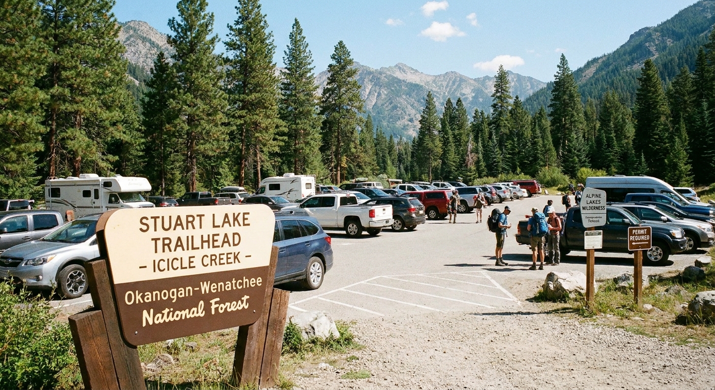
The Stuart Lake Trailhead sits up the Icicle Creek corridor outside Leavenworth. The last stretch is on a forest road that can be dusty, washboarded, and full of potholes later in the season. Most standard cars make it in dry conditions if you drive slowly and patiently. After heavy rain or early season thaw, higher clearance helps.
Parking realities
- Arrive early: This trailhead is famous. On summer and early fall weekends, “full by morning” is normal.
- Have a backup plan: If the lot is full, do not block the road or squeeze into fragile shoulders. Turn around and choose a different hike for the day if you cannot park legally.
- Display passes as required: This is typically a Northwest Forest Pass area. Rules can change, so confirm current requirements before you go.
Best season
You can hike to Colchuck in a long shoulder season, but conditions change dramatically with snow.
- Prime window: mid-summer through early fall, when the lake is mostly snow free and the boulder field is easier to navigate.
- Early season (spring to early summer): Expect lingering snowfields, wet rocks, and route-finding challenges near the lake. Microspikes can be helpful. An ice axe may be appropriate depending on coverage and firmness. If you are not comfortable assessing snow travel risk, pick a lower elevation hike.
- Late fall: Shorter days, colder mornings, and early storms. The trail can turn icy fast.
- Winter: A different sport entirely. Only for experienced winter travelers with the right equipment and avalanche awareness.
Smoke season is the wild card. Even if the forecast is sunny, check regional air quality and be willing to pivot. Colchuck’s views are the whole point, and smoke can make it feel like you hiked into a beige screen saver.
What to pack
I love a streamlined kit, but Colchuck is not the place to go minimalist with essentials. The hike is steep enough that small problems become big ones if you are underprepared.
Day hike essentials
- Plenty of water (and a filter if you want to refill)
- High-calorie snacks and lunch
- Layers: a light insulating layer even on warm days
- Rain shell
- Headlamp (yes, even for a “day” hike)
- Navigation: downloaded map for offline use
- Sun protection: sunglasses, sunscreen, hat
- First aid basics and blister care
- Trekking poles (especially helpful for the descent)
Footwear tip
Trail runners can work if you are confident on rocks, but a shoe with a bit more protection and grip is nice once you hit the boulder field. Whatever you wear, make sure it is broken in. This is not a “new boots” test day.
The route
This hike is straightforward in concept: follow the main Stuart Lake Trail until the junction, take the left fork toward Colchuck Lake, grind uphill, then pick your way through the boulders to the shoreline. In practice, the last mile tends to slow people down, so plan your timing accordingly.
0.0 to about 1.7 miles
From the trailhead, the path climbs gradually through forest. It is the kind of trail that lets you warm up without making you immediately question your life choices. Enjoy it while it lasts.
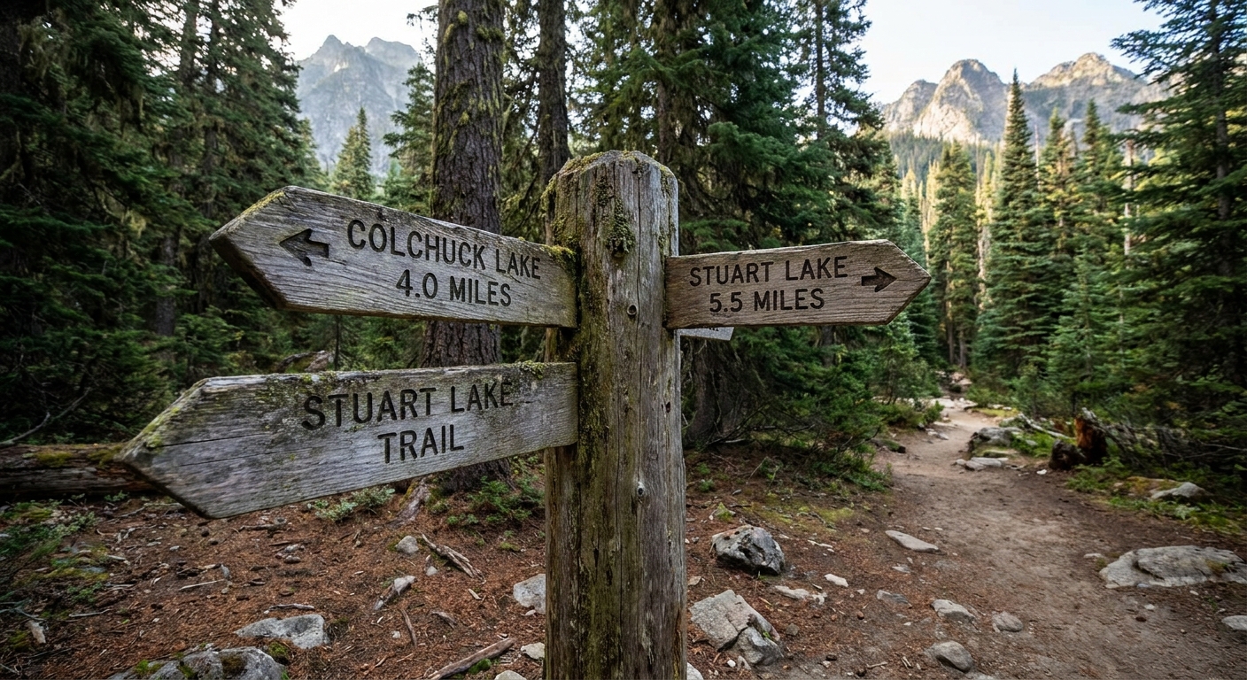
Around 1.7 miles: the junction
You will reach a signed split for Colchuck Lake and Stuart Lake. For Colchuck, you want the left fork toward Colchuck Lake.
If you are hiking with friends who love “seeing where this goes,” this is the moment to be annoyingly responsible. Double-check the sign, confirm with your map, then commit.
The climb
After the junction, the Colchuck Lake trail gets serious. You will climb through long switchbacks with occasional openings where you can catch your breath and peek at peaks. This section is all about pacing.
Pacing that works
- Start slower than you think: If you burn out early, the boulder field later feels brutal.
- Snack before you feel desperate: A bite every 30 to 45 minutes keeps energy steadier than one sad sandwich at the end.
- Drink consistently: Dehydration sneaks up fast on steep grades.
The boulder field
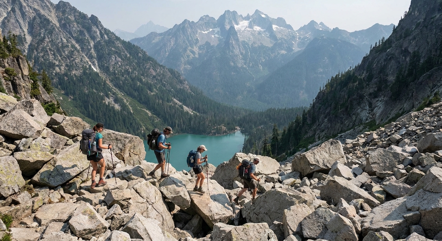
The final approach includes a boulder field that can feel like the hike’s personality shifts from “trail” to “choose your own granite adventure.” The rocks range from stable to wobbly, and gaps between boulders can swallow a trekking pole tip or an ankle if you rush.
My boulder rules
- Slow is smooth: Move one deliberate step at a time. This is where injuries happen.
- Test before you commit: Put weight on a rock gently first, then step fully.
- Hands are tools: Do not be shy about using hands for balance.
- Give space: Avoid stacking people on the same line. Falling rock is rare here, but slips are common.
- Wet rock caution: After rain or early season melt, traction changes. Treat dark, slick granite like it is trying to embarrass you.
You will see multiple worn paths through the boulders. In general, aim for the most obvious, most traveled line, and avoid creating new routes. Staying on durable surfaces helps protect the fragile alpine environment around the lake.
At the lake
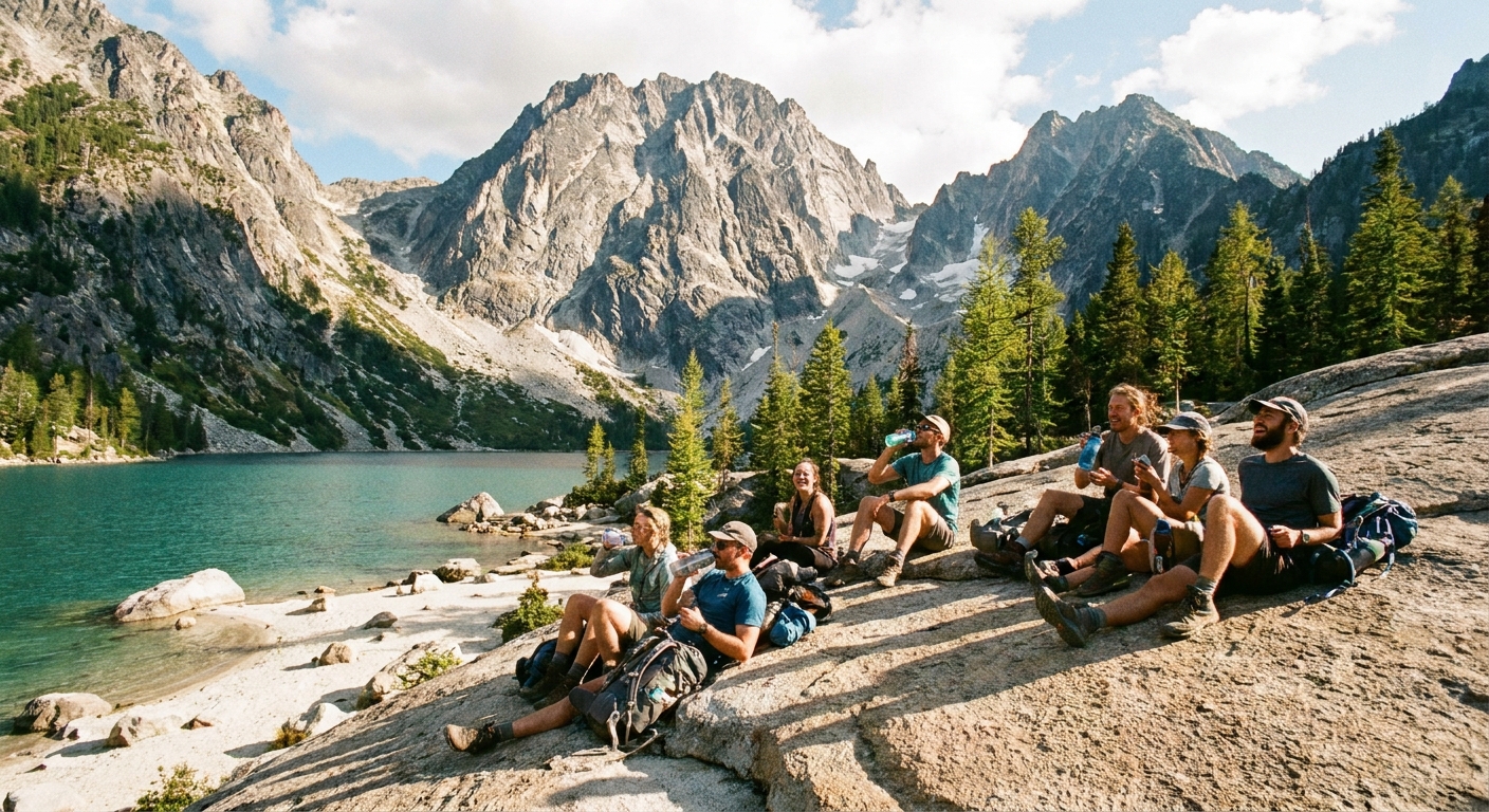
When the lake finally appears, it is usually a full-stop moment. The water often glows an unreal blue-green, and the steep walls of Dragontail and Colchuck Peaks make the basin feel dramatic and enclosed, like a natural amphitheater.
A clean turnaround plan
If your goal is a Colchuck Lake day hike and you want a clean turnaround (no extra route complexity), here is a simple plan that works well for most hikers:
- Tag the shoreline: Choose a stable rock or a durable spot near the water where you can comfortably sit without trampling vegetation.
- Take a 20 to 40 minute break: Eat lunch, layer up if it is breezy, and enjoy the view.
- Optional micro-wander only: If you want more angles for photos, stroll along the shoreline for a short distance, staying on rock and established use paths. Avoid heading higher into steep gullies or sketchy terrain.
- Set a hard turnaround time: I like turning around no later than early afternoon, depending on season, because the descent is long and the boulders are slower when your legs are tired.
- Head back the way you came: Retrace your route through the boulders and down the switchbacks.
This turnaround plan keeps your day hike focused, scenic, and safer, especially if this is your first time on this trail.
Time planning
Colchuck is famous, but it is not short. Build a plan that leaves you margin.
- Up to the lake: commonly 2.5 to 4.5 hours, depending on fitness, breaks, and boulder comfort
- At the lake: 20 to 60 minutes
- Back down: commonly 2 to 3.5 hours
If you are slower on steep descents or you know rocks make you cautious, budget extra time. The hike out can feel longer than the hike in.
Etiquette and Leave No Trace
This area gets loved hard. The best thing we can do is keep it from getting loved to death.
- Pack out everything: Yes, including food scraps.
- Stay on durable surfaces near the lake: Rock and established paths beat creating new social trails.
- Bathrooms: Use toilets if available at the trailhead. In the backcountry, follow local guidance and Leave No Trace practices.
- Keep groups manageable: Large groups clog the boulder field and stress shoreline areas.
- Let faster hikers pass: Especially on narrow sections and in the boulders where a little space improves safety.
Safety notes
Late-day fatigue
The boulder field is the crux for many hikers. It is also the first thing you hit on the way back, when legs are fresh, and the last thing you hit on the way out of the basin, when legs are tired. Save mental focus for that last pass.
Fast weather changes
Alpine basins make their own drama. A sunny trailhead does not guarantee a calm lake. Bring a layer and a shell, even if it feels silly at 7 am.
Turn around early
There is no shame in stopping short. If thunderstorms build, if smoke rolls in, if your knees start screaming, the best call is often the boring one: turn around.
FAQ
Do I need a permit?
For a typical day hike, you generally complete a self-issue wilderness permit at the trailhead. Overnight permits and lottery systems apply to other plans in the broader area, but for a straightforward day hike, you are usually not dealing with an advance lottery. Always confirm current rules before you go.
Is it good for beginners?
If “beginner” means new to steep hiking and rocky terrain, this one is a reach. The mileage and elevation are demanding, and the boulder field adds complexity. Strong beginners who train a bit and start early can do it, but this is not a casual first hike.
Are dogs allowed?
No. Dogs are not allowed on the Colchuck Lake trail. This is part of the Enchantments management area, and the no-dogs rule is there to protect a fragile alpine environment and wildlife. Leave your dog at home for this one and pick a different Icicle Creek hike that is dog-friendly.
Is there cell service?
Expect spotty to none. Download maps ahead of time and do not rely on a signal for navigation or weather updates.
Post-hike in Leavenworth
After Colchuck, I want two things: carbs and a good coffee. Leavenworth is close enough to make that happen without feeling like you are committing to a whole second expedition. I usually do a quick stretch at the car, swap socks if I have them, and head townward for something warm and easy.
The hike is rugged, but the recovery does not have to be. That is the whole Trail and Town philosophy in one day.