Easy Hikes Near Salt Lake City
Salt Lake City is my favorite kind of outdoorsy town: you can grab a cappuccino downtown, be on a trail 20 minutes later, and still make it back for tacos and a sunset walk through the city. If you are new to hiking, traveling with kids, easing back into movement, or just want maximum views for minimum sweat, these are the beginner-friendly hikes near Salt Lake City I recommend again and again.
One quick reality check: in SLC, “easy” can still mean uphill, sun, and altitude. I call out the steeper ones so you can pick what fits your day.
All distances below are approximate and can vary depending on the exact trailhead, the route you take, and how far you wander once the views get good.

Quick trail rules
- Start early in summer. Salt Lake City heat bounces off the foothills. Morning is cooler and you will dodge peak crowds.
- Bring traction in winter. Many beginner-friendly trails become slick hardpack. Microspikes turn a sketchy walk into a comfortable one.
- Expect parking to fill fast. Popular trailheads in Millcreek Canyon and Big Cottonwood Canyon can be packed on weekends.
- Leave the wildflowers. Utah’s foothill blooms are fragile. Photos last longer than bouquets.
- Know the dog rules. Policies vary by canyon and can change seasonally. City Creek Canyon and the Cottonwoods are the big ones to double-check before you go.
Close to town
1) Ensign Peak
Why go: The classic quick-hit viewpoint over downtown and the Oquirrhs. If you have one spare hour in Salt Lake City, make it this.
- Distance: about 0.8 to 1.1 miles round trip (varies by starting point)
- Elevation gain: about 350 to 450 feet
- Time: 30 to 60 minutes
- Good for: Sunrise, sunset, first-timers who want a payoff
Local tip: It is short but steep, so take it slow and enjoy the switchbacks. After, head back into the Avenues for a coffee and a pastry.
2) City Creek Canyon (Lower Canyon Road)
Why go: A shady, gentle walk that feels surprisingly wild for being minutes from downtown. Great for a jet-lag reset or an easy morning stroll.
- Distance: flexible out-and-back, do 2 to 6 miles round trip
- Elevation gain: gradual
- Time: 1 to 2.5 hours
- Good for: Shade, casual walks, spring and fall
Local tip: Treat it like a choose-your-own-adventure. Turn around whenever you feel like it, then spend your extra energy exploring downtown galleries or the Capitol area.
Rules note: City Creek Canyon has specific access rules that can change by season and day, including vehicle closures and restrictions for dogs and bikes in certain areas. Check the City Creek Canyon website or posted signage before you head up.
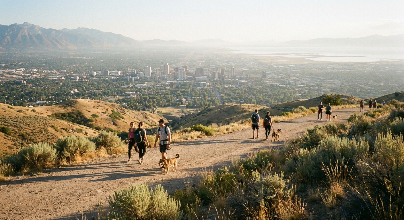
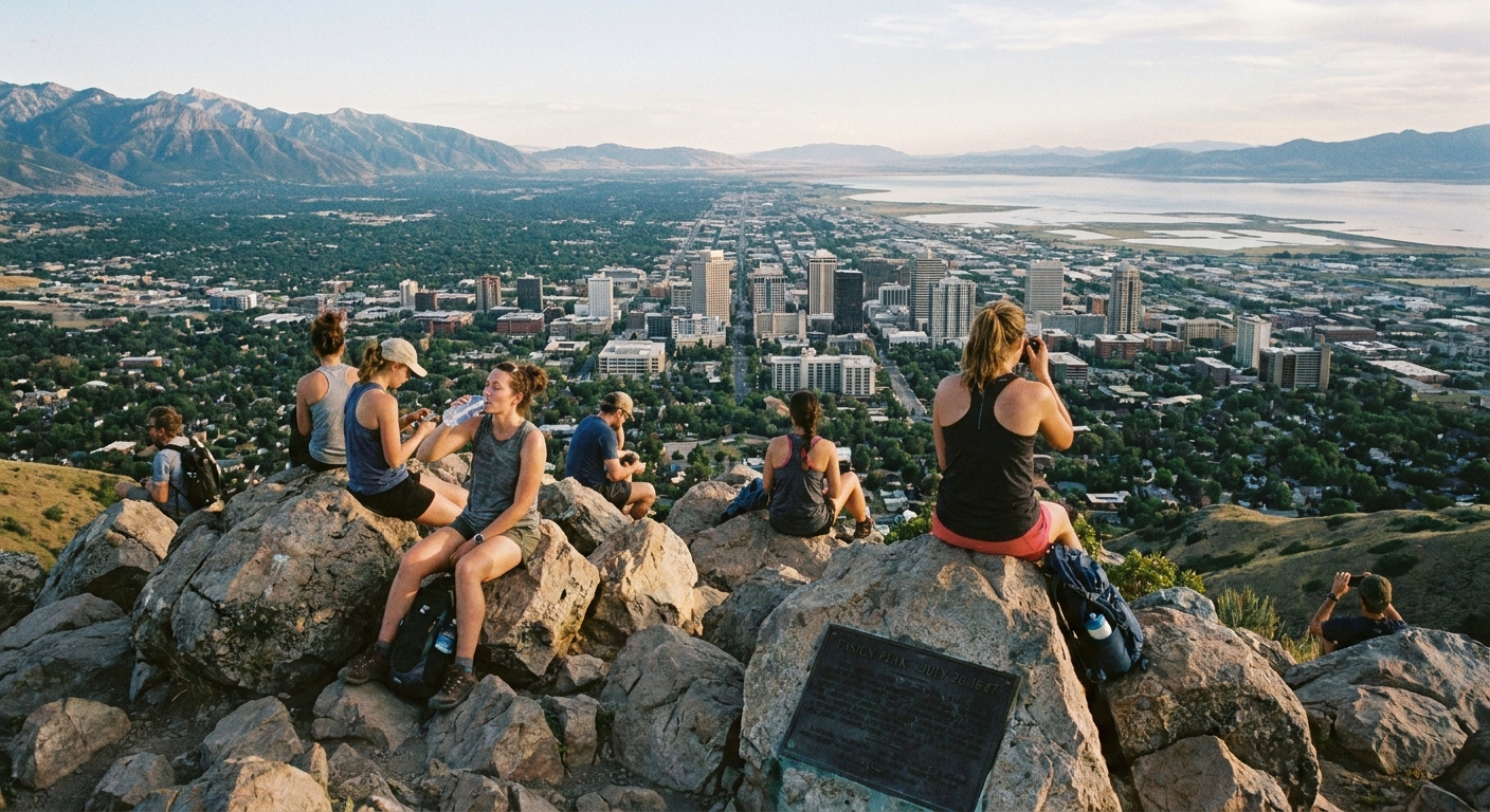
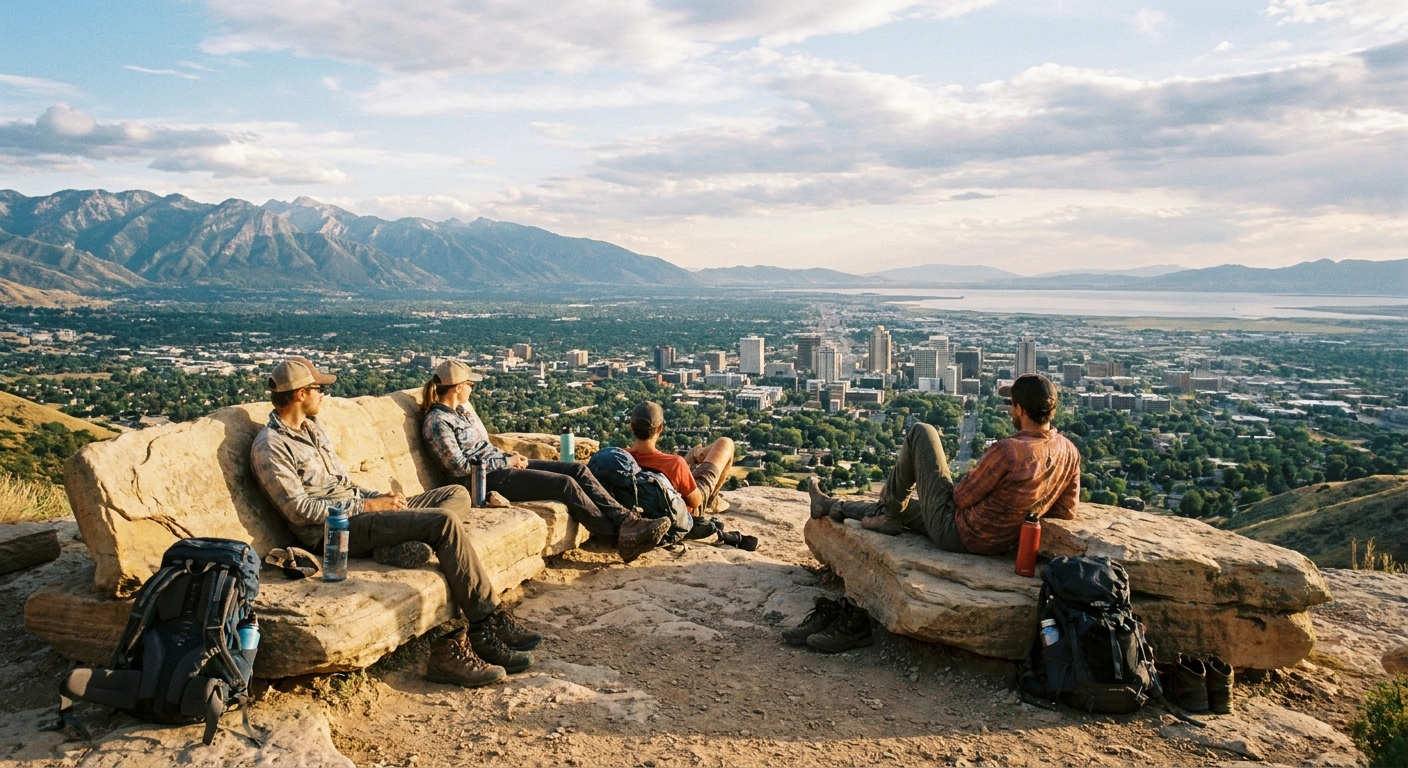
3) Living Room Lookout
Why go: A local favorite with natural rock “furniture” at the viewpoint and a wide-angle city panorama.
- Distance: about 2.5 to 2.7 miles round trip (most common starts)
- Elevation gain: about 900 to 1,000 feet
- Time: 1.5 to 2.5 hours
- Good for: Strong beginners, sunset hangs
Heads up: This is still “easy-ish” by Salt Lake City standards but it climbs steadily. Wear grippy shoes and bring water even if it feels short.
4) Bonneville Shoreline Trail (BST) from the Avenues
Why go: The BST is basically Salt Lake City’s scenic sidewalk in the foothills. You get views without committing to a big climb, and you can pick any out-and-back distance that fits your day.
- Distance: 2 to 5 miles round trip (choose your turnaround)
- Elevation gain: rolling and moderate
- Time: 1 to 2.5 hours
- Good for: Low-commitment mileage, trail running, golden hour
Where to start: For a straightforward visitor-friendly access point, look for BST entrances near the Avenues above downtown (for example, the area near 11th Avenue and Terrace Hills). There are multiple connectors, so use a map app and pick the closest legal parking to your chosen entry.
Local tip: If it has rained recently, some sections can be muddy. Give it a day to dry out to protect the trail and your shoes.
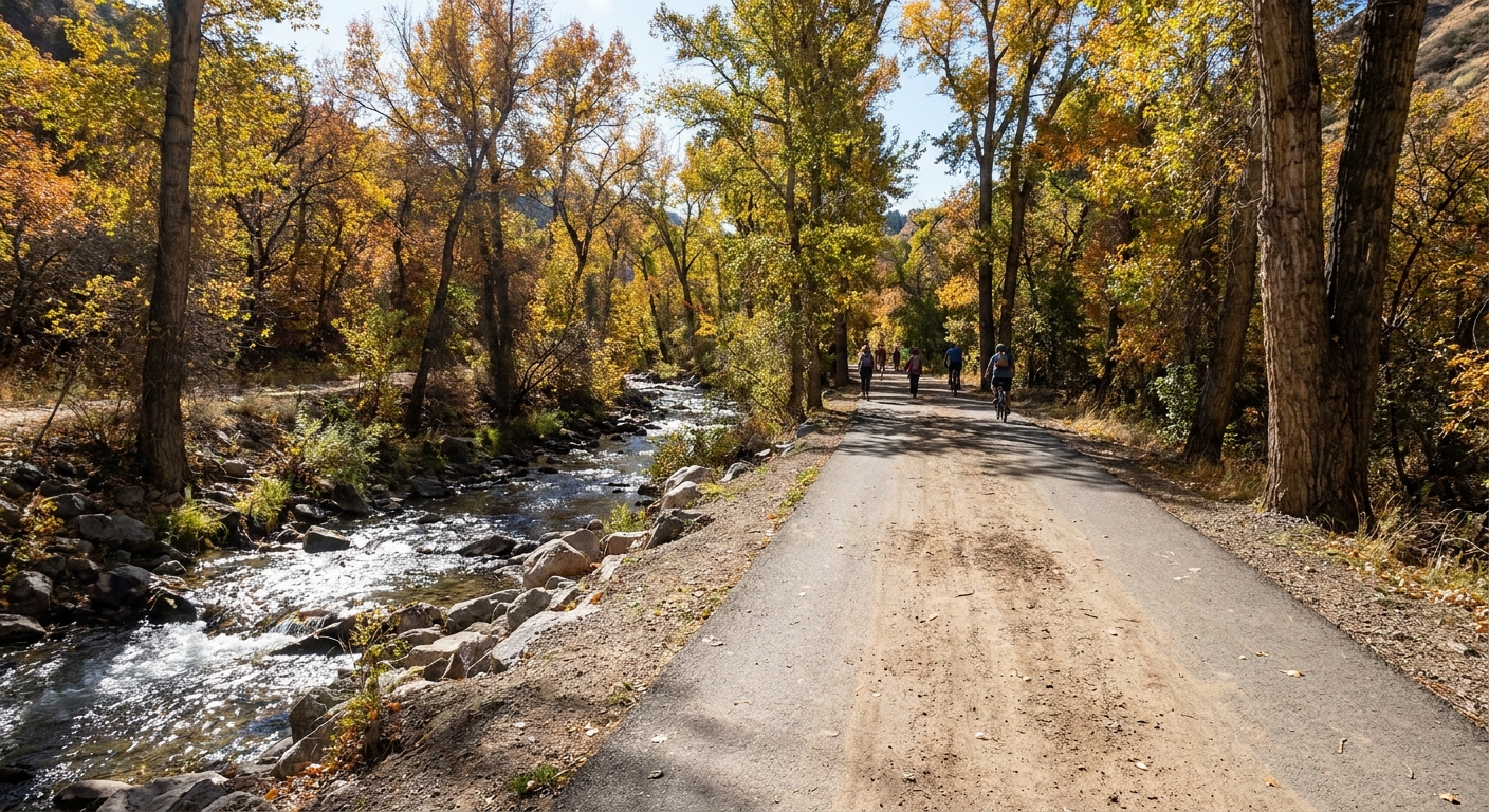
Easy canyon walks
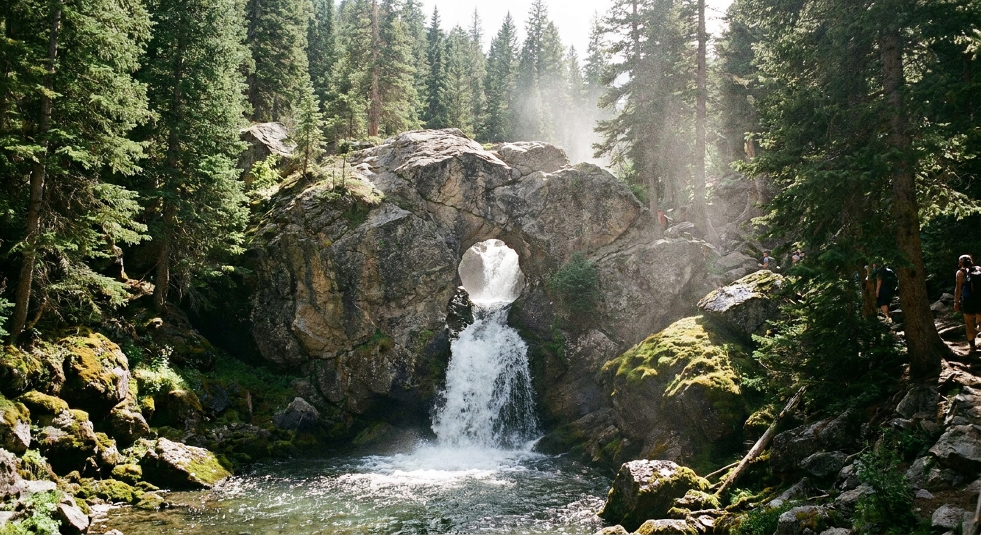
5) Donut Falls (Big Cottonwood Canyon)
Why go: A kid-friendly classic with a waterfall that spills through a donut-shaped rock opening. It feels like a real destination hike without being long.
- Distance: about 2.8 to 3.2 miles round trip (route and measurement varies)
- Elevation gain: about 400 to 500 feet
- Time: 1.5 to 2.5 hours
- Good for: Summer heat escapes, fall color, families
Safety note: The final approach near the falls can be slick, especially with kids. Enjoy the view from stable ground and skip risky scrambling when water is high.
Logistics note: Big Cottonwood trailheads get crowded fast on weekends, and parking can be limited. If you can, go early or aim for a weekday.
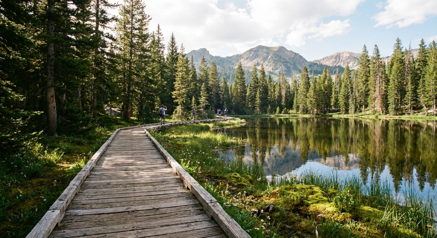
6) Silver Lake Boardwalk (Brighton area)
Why go: A flat, accessible loop with boardwalk sections, mountain reflections, and the chance of spotting moose in the quieter hours.
- Distance: about 0.9 miles loop
- Elevation gain: minimal
- Time: 30 to 60 minutes
- Good for: Very easy walks, visitors at altitude, photographers
Wildlife note: Moose are incredible and unpredictable. Give them lots of space, never try to get closer for a photo, and back away calmly if one is near the boardwalk.
Local tip: Bring a light jacket even in summer. The air up here can feel 15 degrees cooler than Salt Lake City.
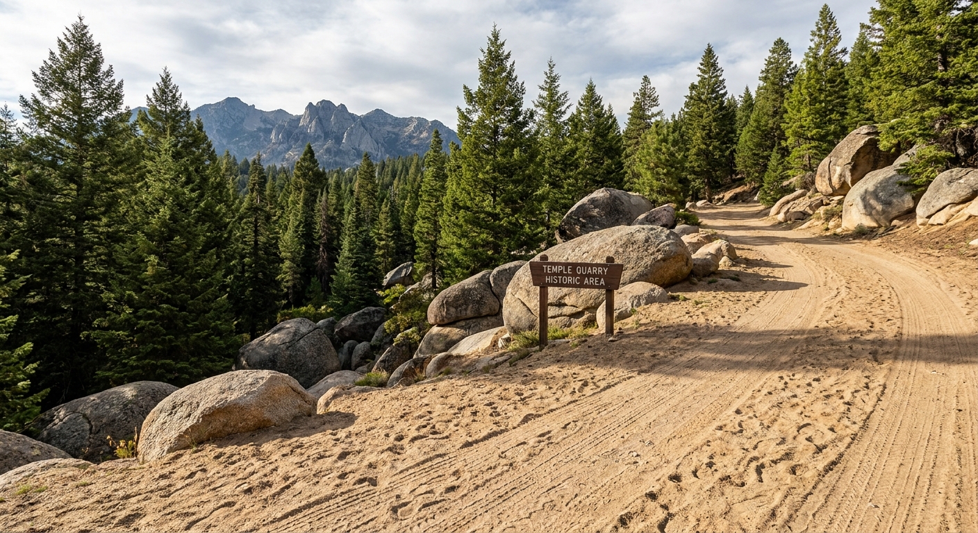
7) Temple Quarry Trail (Little Cottonwood Canyon)
Why go: An actually easy canyon walk with history, huge granite blocks, and big Little Cottonwood scenery. It is one of my favorite options when you want cooler air without a cardio-heavy climb.
- Distance: about 2 to 3 miles round trip (depending on where you turn around)
- Elevation gain: low and gradual
- Time: 1 to 1.5 hours
- Good for: Beginners, families, mellow weekday mornings
Local tip: Keep an eye out for interpretive signs and remnants of the quarry area. This is a great “stretch your legs” stop if you are driving up canyon anyway.
West side and valley edges
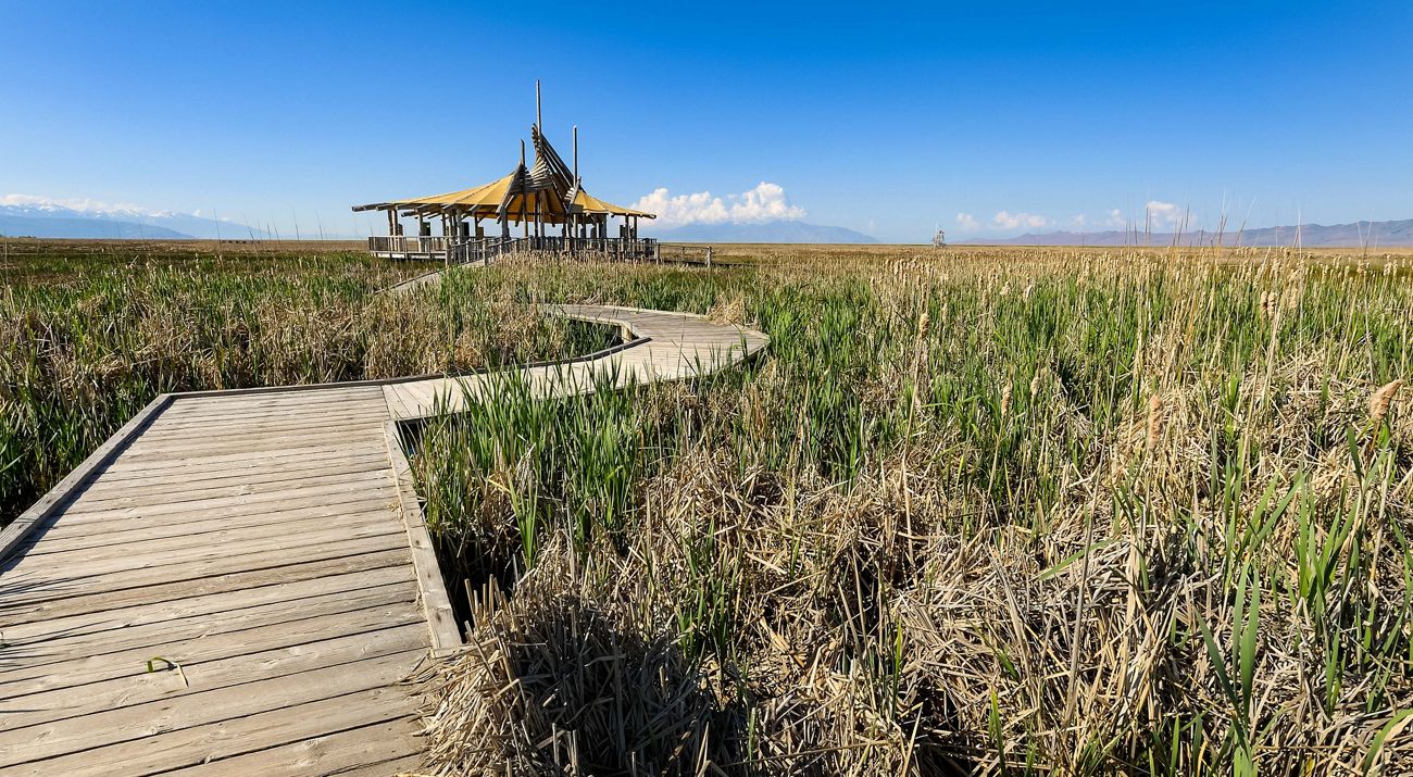
8) Great Salt Lake Shorelands Preserve (Layton area)
Why go: A flat, educational wetland walk with boardwalks and big sky energy. It is a different kind of Utah beauty, especially at sunset.
- Distance: about 1 to 2 miles round trip depending on open segments
- Elevation gain: none
- Time: 45 minutes to 1.5 hours
- Good for: Birding, families, low-impact walks
Heads up: Bring bug spray in warm months. Wetlands do what wetlands do.
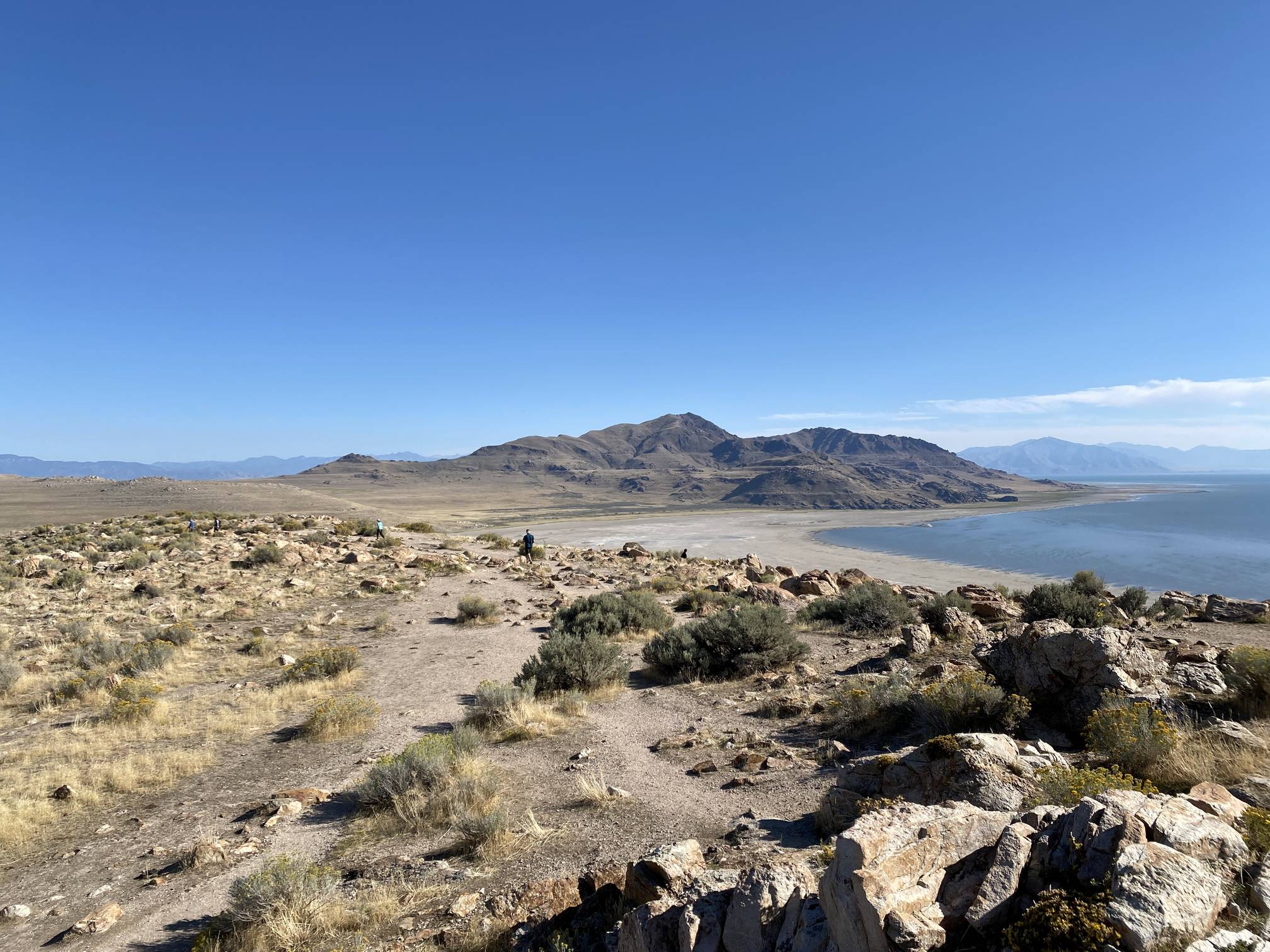
9) Antelope Island: Buffalo Point (to the first viewpoint)
Why go: Desert island hiking with sweeping lake views, and the chance to see bison from a respectful distance. Do it at sunrise or near sunset for cooler temps and better light.
- Distance: about 1 to 2 miles round trip to the first viewpoint (turnaround varies)
- Elevation gain: modest
- Time: 45 minutes to 1.5 hours
- Good for: Dramatic views, shoulder seasons, photographers
Fee note: Antelope Island is a Utah State Park and typically requires a day-use entry fee. Check the current rate and hours before you go.
Wildlife note: Bison are not background props. Give them lots of space, never approach for photos, and turn around if they are on the trail.
Best times to go
- Spring (April to June): Foothills turn green, wildflowers pop, and lower trails dry out first. Expect muddy patches after storms.
- Summer (July to August): Go early, choose canyon trails for cooler air, and carry more water than you think you need.
- Fall (September to October): My favorite season here. Crisp air, golden aspens in the canyons, and fewer afternoon thunderstorms.
- Winter (November to March): Many “easy” paths get icy. Bring microspikes and pick sunny foothill routes for the best odds.
What to pack
I am a carry-on only person in airports and I keep the same energy on day hikes: light, simple, and ready for small surprises.
- Water (at least 1 liter per person for anything over an hour)
- Sun protection: hat, sunglasses, sunscreen
- Layers: a light insulating layer even in shoulder season
- Snacks: something salty, something sweet
- Good shoes: trail runners are perfect for most of these
- Microspikes in winter or if conditions are icy
- A small bag for trash, including peels and tissues
Pair it with the city
The best Salt Lake City days have a little dirt and a little city. After your hike, consider a slow wander through the 9th and 9th area, a browse at a local bookstore, or a long coffee break somewhere you can people-watch. Your legs will thank you, and you will get a clearer sense of the city’s rhythm beyond the trailhead.
My favorite way to plan: choose one “view” hike in the morning, then keep the afternoon open for neighborhoods, museums, or a long lunch. It makes the outdoors feel like part of the city, not an escape from it.
Before you go
Trail conditions, parking rules, and seasonal closures can change quickly around Salt Lake City, especially in Big Cottonwood and Little Cottonwood. Check the latest updates from the relevant land manager, and if you are visiting on a weekend, build in extra time for canyon traffic and full lots.
If your first-choice trailhead is packed, do not force it. The good news is there is almost always another beginner-friendly option nearby.