El Malpais National Monument: Lava Tubes and La Ventana

Maya Lin
Maya Lin is a travel journalist and outdoor enthusiast who believes the best trips combine rugged adventures with urban comforts. After spending six years backpacking across four continents, she founded Trail & Town Guide to help fellow travelers navigate both hidden mountain passes and bustling city neighborhoods with confidence.
El Malpais National Monument is New Mexico doing what it does best: turning geology into a full-blown personality. One minute you are rolling through pinyon-juniper high desert, the next you are standing on a frozen river of lava that looks like it cooled yesterday. And somehow, tucked inside all that black rock are walkable lava tubes, big sky overlooks, and a natural arch you can reach with a simple roadside pullout.
This guide is built for first-timers coming from Grants. We will cover the two most popular caving areas (Big Tubes and El Calderon), what the trail surfaces really feel like underfoot, where to stop for La Ventana Arch, and the best scenic pauses on NM-53 and NM-117, with realistic routing, drive time ranges, and the kind of safety notes you will be glad you read.
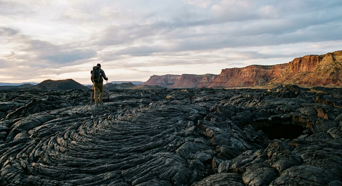
Quick plan from Grants
Grants is the easiest base for El Malpais. You have groceries, gas, and an actual bed, then you can be on lava fast.
- Grants to El Malpais Visitor Center (in Grants, off I-40): about 5 to 10 minutes (or basically “already there” depending on where you are staying)
- Grants to El Calderon area (NM-53): about 30 to 45 minutes
- Grants to La Ventana Arch pullout (NM-117 side): about 30 to 50 minutes depending on where you start in Grants and traffic through town
- Grants to Big Tubes area trailheads: about 60 to 90 minutes in good conditions, and longer if the dirt road is slow or rutted
Important routing note: NM-53 and NM-117 do not connect through the monument. The lava flows in between are not a drive-through situation. To go from one side to the other, you typically return north to I-40 and then come back down.
My favorite first-day flow: pick one side as your main focus, then add the other side only if you have time and daylight. If you want caves, base your day on NM-53 (El Calderon and possibly Big Tubes). If you want easy viewpoints and the arch, base your day on NM-117 (La Ventana area).
Reality check: drive times look short on paper, but plan extra for rough roads, parking, gearing up at trailheads, and the fact that you will stop every five minutes to stare at a crater.
Before you go
Permits and visitor center timing
Some caves in El Malpais require a free caving permit, and requirements can change with wildlife protections and resource concerns. Your smartest move is to stop at the El Malpais Visitor Center in Grants first to confirm what is currently open, what needs a permit, and any special instructions for the day.
- Permits are typically issued in person during visitor center hours. After-hours and self-service options can vary, so do not assume you can “just pick it up later.”
- Bring ID and be ready to share a basic trip plan.
- Group size rules may apply for certain caves.
- Seasonal closures can happen, especially for bat protection.
If you do one thing for sustainable travel here, let it be this: follow the permit system and closures. Lava tube ecosystems are more fragile than they look, and bats are not optional in the desert.
Cave ethics and cave health
This is the part that protects the place for the next person and the bats living there.
- White-nose syndrome precautions: follow ranger guidance. A good default is to avoid wearing or bringing cave gear (shoes, packs, helmets, lights) that has been used in other caves, especially out of state.
- Do not touch cave walls or features: oils from hands can damage delicate surfaces, and it is surprisingly easy to break fragile formations.
- Pack out everything: even “small” items like snack wrappers and spent batteries.
Common seasonal and temporary closures
El Malpais conditions shift through the year. Closures and access changes can be driven by:
- Bat roosting seasons and wildlife management
- Snow and ice making trail and cave entrances hazardous
- Monsoon storms and lightning risk on exposed lava
- Road conditions after heavy rain or winter weather
Because these changes can be short-notice, treat the visitor center as your live update, not a formality.
Safety hazards people underestimate here
- Sharp lava: it is basically natural broken glass in rock form. A slip can shred hands, knees, and shoe soles quickly.
- Monsoon lightning: summer afternoons can bring fast-moving storms. Lava fields are exposed and feel like the last place you want to be holding trekking poles.
- Getting lost: cairns and routes can be subtle on black rock. Offline maps help. So does turning around before you are tired.
- Cold in caves: even in summer, caves can be chilly. Bring a layer.
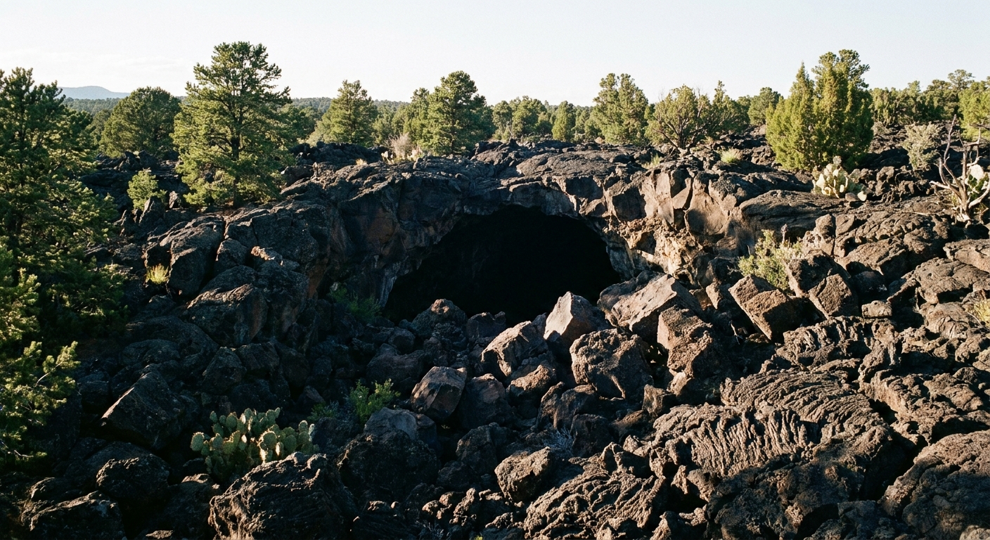
Big Tubes
The Big Tubes area is where many visitors get their first true lava tube “walk into the earth” moment. These are some of the largest tube systems in the monument, and they can feel like natural subway tunnels carved by flowing lava.
Getting there
Big Tubes access is via County Road 42, which may also be labeled as BIA 42 on some maps and signs. It is unpaved, can be rough, and is notorious for turning into a bad idea when wet. In many conditions, a high-clearance vehicle is strongly recommended. After rain, especially during monsoon season, it can become deeply muddy, rutted, or impassable.
If you are in a low-clearance car, if storms have rolled through recently, or if you simply do not want to gamble with traction, choose El Calderon instead and save Big Tubes for a drier day.
Navigation note
Do not count on cell service or perfect GPS behavior on the back roads. Signage can be limited, and conditions change fast after storms. Confirm the current route and road status at the visitor center, download offline maps before you leave town, and if the road looks questionable, trust your eyes and turn around.
What it is like
Expect rough, uneven volcanic terrain leading to cave entrances. Inside, it is dark, cool, and textured with lava drips and ripples that look like someone froze a wave in stone. You will absolutely want a headlamp and a backup light. Phone flashlights are not enough once you are a few bends in.
Gear I consider non-negotiable
- Sturdy shoes with thick soles and good grip
- Headlamp + spare batteries (and ideally a second light)
- Work gloves if you expect to use hands for balance on sharp rock
- Long pants if you bruise easily, or if you want fewer lava scrapes
- Water even if the hike is short, because the sun is intense
Timing tips
Go early. Not just for crowds, but because you will be walking across exposed lava where the heat builds fast. In monsoon season, aim to be off exposed rock before storms typically pop up in the afternoon, and do not take CR 42 or BIA 42 if rain is in the forecast.
Leave No Trace note: do not touch fragile features, do not stack rocks, and stay aware of where your feet land. The “crunch” you hear is often delicate surface material breaking down.
El Calderon
If Big Tubes is about going deep, El Calderon is about walking on the surface of a volcanic story. This area is known for its crater landscape and for monument caves like Bat Cave and Junction Cave (check current access and permit requirements at the visitor center).
A quick note on “ice caves”
El Malpais has lava tubes and cool cave air, but the well-known commercial stop called Ice Cave and Bandera Volcano is a privately owned site farther down NM-53 and is not the same as the El Calderon caves inside the national monument. If your goal is monument caving, plan around Bat Cave, Junction Cave, and any other caves the rangers say are open that day.
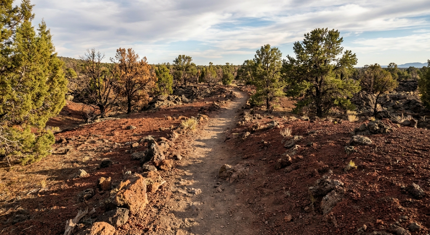
Trail footing
Even on short routes here, the ground is not a casual sidewalk stroll. It is more like a constantly changing puzzle of:
- Loose cinders that slide underfoot like ball bearings
- Jagged lava with sharp edges that punish thin shoes
- Uneven rock shelves where you will step up and down frequently
If you have hiking poles, bring them. If you do not, at least slow down and keep your hands free. This is a place where a simple stumble becomes a real cut.
Cold cave, hot sun
The contrast is part of the fun. You may start in full sun feeling toasty, then step into a cave entrance that feels like someone turned on air conditioning. Pack a light layer even in summer, especially if you tend to run cold once you stop moving.
Watch the sky
July through September often means afternoon thunderheads. Lightning is a serious risk on open lava and ridges, and storms can build fast. If you hear thunder, treat it as your cue to shorten plans and move toward your vehicle or lower, safer terrain.
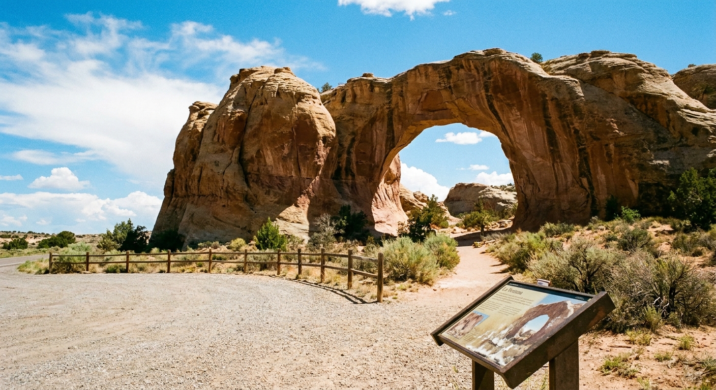
La Ventana Arch
La Ventana is one of those rare natural features that delivers maximum payoff for minimal effort. It is a large sandstone arch in a dramatic cliff band, and you can see it from the road with a short pullout stop.
Where to stop
Look for the La Ventana Natural Arch pullout on NM-117. Use the designated pullout only. Parking is straightforward, and the viewpoint is quick. If you are road-tripping the NM-117 side of the monument, it is an easy add-on between overlooks and short walks.
Best light for photos
Late afternoon tends to bring warmer light on the cliffs. Morning can be quieter, but the arch may be more backlit depending on season. If you are chasing that glowing sandstone look, plan for later in the day.
Accessibility note
This is one of the more accessible “wow” stops because it is roadside viewing from a pullout. By contrast, lava and cave terrain in El Malpais is typically uneven and not mobility-friendly.
Scenic stops
El Malpais is split into two scenic driving moods.
- NM-53: lava flows, big volcanic views, and access toward El Calderon (and the dirt road to Big Tubes).
- NM-117: sandstone cliffs, La Ventana, and classic “pull over and stare” viewpoints.
Just remember: these are two sides of the monument, and you generally connect between them by going back to I-40, not by trying to cross the lava fields.
Easy viewpoints
- Sandstone Bluffs Overlook (NM-117): a classic big view over the cliffs and lava flows, with a quick stop feel.
- La Ventana pullout (NM-117): fast, dramatic, and very first-timer friendly.
- El Calderon area pullouts (NM-53): good places to step out, look across the lava and cinder landscape, and decide how ambitious you want to be.
Use designated pullouts and signed parking areas. The roads here are not the place for a casual shoulder stop.
Fuel, water, and service
Services are limited once you are out of town. Top off fuel in Grants, carry extra water, and do not count on reliable cell service. Download maps before you go and screenshot key directions.
What to pack
You do not need an expedition kit, but you do need to respect the terrain.
- Footwear: hiking shoes or trail runners with thick soles
- Lighting: headlamp plus backup
- Skin protection: sunscreen, hat, and lip balm
- Hands and knees: light gloves and a small first aid kit for scrapes
- Layers: a light jacket for caves and wind
- Weather: rain shell in monsoon season
- Navigation: offline maps and a fully charged phone
Sample itineraries
Half day from Grants
- Option A, NM-117 side: Sandstone Bluffs Overlook plus La Ventana Arch, then back to Grants.
- Option B, NM-53 side: El Calderon area caves or crater views (based on openings and permits), then back to Grants.
Full day from Grants
- Start at the visitor center in Grants for current cave status, permits, and road notes.
- Morning on the NM-53 side: El Calderon area, and Big Tubes only if CR 42 or BIA 42 is dry and your vehicle is appropriate.
- Midday: drive back north to I-40 to reposition to the other side.
- Late afternoon on the NM-117 side: Sandstone Bluffs Overlook and La Ventana Arch for warm light and an easy finish.
- Return to Grants via NM-117 to I-40 (or whichever paved route the visitor center recommends for current conditions).
My personal pacing tip: plan fewer stops than you think you can do. Lava walking is slower and more tiring than dirt trail hiking, and you will enjoy it more if you are not rushing.
Final safety checklist
- Confirm cave access and permits at the visitor center in Grants and note visitor center hours
- Bring two light sources per person for caves
- Wear thick-soled shoes and consider gloves
- Carry more water than you think you need
- In monsoon season, start early and watch for lightning
- Respect seasonal closures, especially for bats
- If you are attempting Big Tubes, confirm CR 42 or BIA 42 is dry and your vehicle can handle it
El Malpais rewards the travelers who slow down: take the short detours, read the landscape, and let the weirdness of New Mexico sink in. Then head back to Grants for a shower, a solid meal, and the kind of sleep you only get after a day of volcanic rock and big sky.