Emerald Bay Rubicon Trail to Vikingsholm
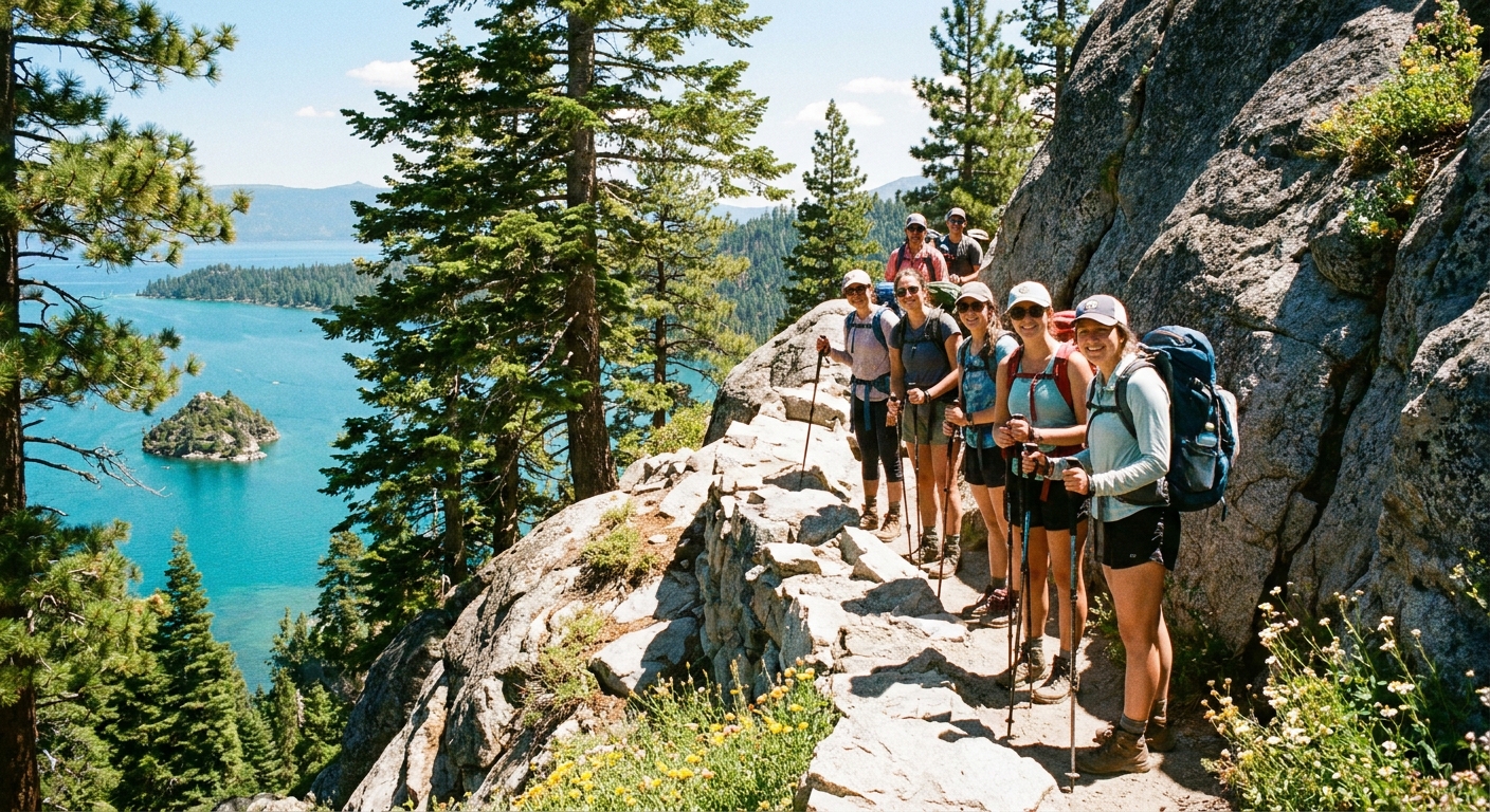
Emerald Bay is the Tahoe postcard that actually holds up in real life. The water glows, the granite is dramatic, and the trail hugs the shoreline like it was designed for people who want big views without committing to an all-day sufferfest.
This walk focuses on the classic segment: from the Emerald Bay overlook area down to Vikingsholm, then along the shoreline for a bit on the Rubicon Trail. The twist is making the logistics painless: when to go out-and-back versus making it a true one-way (without getting stranded), what the kiosk fees mean, and how to avoid the two most common mistakes I see here: rushing the shoreline and torching your calves on the climb out.

Route snapshot
The most popular version starts near the Emerald Bay State Park overlook area on Highway 89, drops to Vikingsholm at the bay’s edge, then climbs back out the same way. That climb is not a surprise if you plan for it. It is a surprise if you treat the downhill like free money.
- Trails: You typically descend on the Vikingsholm Trail (also commonly called the Vikingsholm hike). Near the bottom, you can connect to the Rubicon Trail as it continues along the shoreline.
- Distance: about 1 mile each way (2 miles round trip) from the Highway 89 overlook area to Vikingsholm, but mileage varies depending on your exact start (overlook lot vs nearby pullouts vs Inspiration Point area). Treat this as an estimate and verify if you are planning tightly.
- Elevation: about 400 feet down to Vikingsholm (and yes, you gain it back), with variation depending on start point.
- Best for: big scenery, shoreline walking, history stop at Vikingsholm, optional beach time
- Typical time on trail (hiking only): 1 to 2 hours moving time; plan 1.5 to 3 hours total with stops and crowds
- Key friction points: parking, kiosk fees, spring ice on stairs, and narrow shoreline photo pinch points
Reality check: The hike feels easy going down, then Tahoe reminds you that gravity keeps receipts on the way up.
Getting there and parking
This is the part that quietly decides how your day goes.
- Main starting area: the Emerald Bay overlook area on Highway 89, plus nearby state park lots and legal roadside pullouts (where allowed).
- Parking reality: in summer, weekends, and holidays, these fill early. If you show up late morning, expect circling, waiting, or pivoting.
- Safety note: Highway 89 is busy and fast. Park only in designated areas, watch for traffic when unloading, and do not create new pullouts.
Pro tip: If you have a “must-do” schedule (tour time, paddle rental window, dinner), arrive earlier than you think you need. Parking is the hidden mileage.
Out-and-back vs one-way
Option A: Out-and-back
You park once near Highway 89, walk down to Vikingsholm, then climb back up the same route. This is the default plan and the simplest with kids or anyone who wants “no logistics.”
- Pacing tip: Treat the downhill like a warm-up, not a race. If you bomb the descent, your quads will complain on the return.
- Calf-burn trigger: fast steps down, then trying to “power hike” 400 feet up without breaks.
Option B: True one-way
Summary: A true one-way day here means your pickup is at Highway 89, not at Vikingsholm.
Important geography note: there is no road access at Vikingsholm. That means there is no vehicle shuttle picking you up at the bottom. If you hike down from Highway 89, you should assume you are hiking back up.
If you want a genuine one-way with a road ride, the classic move is to hike the longer shoreline route between D.L. Bliss State Park and Emerald Bay, then climb up to Highway 89 and use a road ride to get back to your starting point. In other words, you finish at the highway, not at the castle.
- Best for: people who want a longer coastal walk, big variety, and a shuttle that actually exists
- What it avoids: having to do the Vikingsholm climb as an out-and-back after you have already lingered at the water
- What it still includes: you will climb out of Emerald Bay to Highway 89. You just do it once.
- Reality check: D.L. Bliss access and parking can be seasonal, controlled, or capacity-limited, and trail segments can be affected by closures or construction. Verify current conditions before you commit.
Option C: Extra credit
If you are specifically here to train, do the out-and-back and add extra shoreline wandering near Vikingsholm (Rubicon Trail in either direction as far as you like). Just know the climb back up is the workout, not the scenic part.
Shuttle planning
Let’s fix the common trap: you cannot plan on a shuttle from Vikingsholm. There is no public road down there, so no bus, no seasonal “park shuttle,” no quick Uber rescue. Your shuttle or ride share only makes sense once you are back up at Highway 89.
Two workable plans
- Plan 1: Shuttle first, hike to your car
Get dropped at your starting trailhead (often D.L. Bliss area for the longer shoreline traverse), hike toward Emerald Bay, then climb up to Highway 89 and end at your car near the overlook area. This is my favorite because your finish line is your trunk, not a timetable. - Plan 2: Hike first, shuttle last
Park at your starting point (again, commonly D.L. Bliss for the longer route), hike toward Emerald Bay, climb up to Highway 89, then catch your ride back along the highway. This is fine, just do not cut it close. Highway traffic keeps its own schedule.
The simple formula
Plan from your latest acceptable return time, then work backward from Highway 89.
- Step 1: Pick your latest “back at the car” time (sunset, dinner reservation, whatever is real).
- Step 2: Subtract road ride time plus a buffer (20 to 30 minutes in peak season for traffic and pickup delays on 89).
- Step 3: That gives you a latest pickup time at Highway 89 (overlook area).
- Step 4: Subtract your hike time to reach Highway 89 plus photo stops and beach time. That gives you your latest start time.
A realistic example
- Goal: back at your car by 4:30 pm
- Road ride + buffer: 20 minutes ride + 30 minutes buffer = 50 minutes
- Latest pickup at Highway 89: 3:40 pm
- Hike time to reach Highway 89 + stops: depends on route. For the short Vikingsholm out-and-back, this section does not apply because you are hiking back to your car. For the longer one-way shoreline day, many groups need 3 to 5 hours plus stops.
My rule: If you want to actually enjoy Emerald Bay, do not start “late afternoon” thinking it is a quick in-and-out. Crowds alone can add 30 minutes without you noticing.
Kiosk fees
Emerald Bay sits within Emerald Bay State Park, and access is managed with day-use parking and fee collection at kiosks in peak periods. Exact prices can shift, and different lots can be managed differently, so confirm posted signage when you arrive.
- What you are paying for: day-use parking and park access amenities (restrooms, maintenance, staffing, and resource protection).
- What it usually looks like: a day-use fee at staffed kiosks during busy times. If you have a California State Parks pass, check whether it is honored at the lot you are using and what it covers.
- When the kiosk matters most: busy summer weekends and holidays, when lines form and lots fill early.
- Carry: a card plus a backup payment method in case connectivity is spotty.
Time-saving tip: If you arrive during a rush, decide in advance who is the “fee runner” and who is the “parking spot spotter.” It sounds silly, but it keeps you from circling while everyone debates the plan.
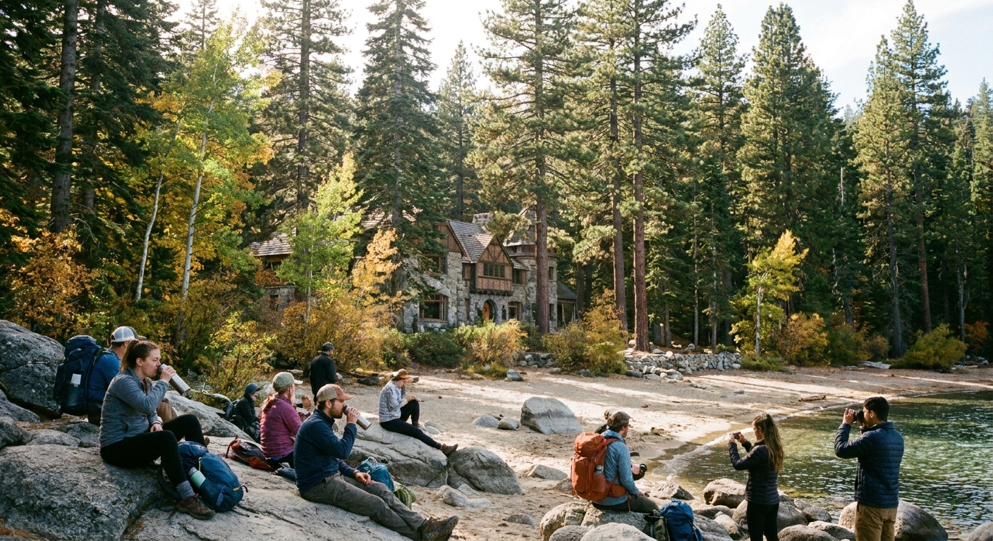
Vikingsholm details
A lot of people hike this specifically for the “castle.” Good instinct. Just know the details are seasonal.
- Tours and hours: Vikingsholm access, tour schedules, and seasonal openings can change. Check the official California State Parks info before you go, especially in shoulder season.
- What to expect: even if you do not tour inside, the shoreline setting and exterior views are worth the walk.
Accessibility and fit
This is short, but it is not nothing.
- Stairs and grade: expect steep sections and stairs. It is not stroller-friendly, and it can be rough if you have knee or balance issues.
- Footwear: wear shoes with real tread. The polished-dust-on-granite combo is sneaky.
- Altitude and sun: Tahoe sun is loud, even when the air feels mild. Bring water for the climb out, not just the walk down.
Spring hazard: ice
In shoulder season, Emerald Bay can be sunny at the overlook and legitimately slick down on the shaded stair sections and compacted tread. Freeze-thaw turns small seeps into thin ice sheets, especially in the morning.
- What gets icy: shaded stairs, switchback corners, and the packed dirt where snowmelt crosses the trail.
- How to move: short steps, keep your weight centered, and use the handrail when available.
- Gear that helps: trail shoes with solid tread; if it is very icy, pack microspikes in spring. Trekking poles help with balance on the way down and knee relief on the way up.
Practical trick: If you see a shiny patch on stairs, assume it is ice even if the air feels warm. Tahoe loves a microclimate.
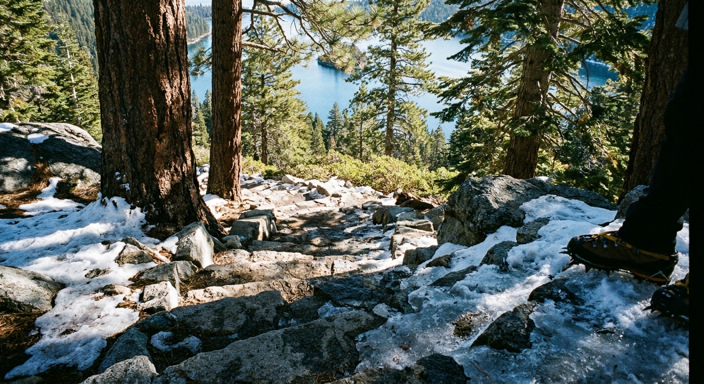
Photo pinch points
The shoreline trail here has a few narrow sections where the lake is on one side and rock wall on the other. These become bottlenecks when someone stops for the perfect shot, or when a group tries to walk four-wide.
Simple etiquette
- Yield at pinch points: If you stop for photos, step fully off the tread into a safe spot so others can pass.
- Downhill does not always have right of way: On stairs and narrow ledges, the most stable rule is “whoever has the safer stance holds, whoever is moving steps through.”
- Announce passes kindly: A quick “on your left” prevents awkward shuffle dances near drop-offs.
- Do not block stairs for group photos: Move to a wider landing or viewpoint.
Local-wisdom vibe: Emerald Bay is photogenic enough that nobody needs to defend their spot. Share the view, and you will still get the shot.
Kayak plus hike
If you want both water time and trail time, Emerald Bay is a great place to stack activities, but only if you plan for parking and fatigue. The shoreline looks close from above, yet transitions take longer than you think once you factor in crowds, changing, and moving gear.
Launching note: launch access varies by season and rules. Many people start from a nearby beach or designated access area rather than “at Vikingsholm,” so confirm where you are actually allowed to put in.
Wind note: Tahoe can get choppy fast, especially later in the day. If you are newer to paddling, calmer mornings often feel friendlier.
Two ways to stack the day
1) Hike first, kayak second
- Why it works: You knock out the footwork while temps are cooler and energy is higher.
- How to pace: Keep the hike snacky and hydrated so you do not start paddling already depleted.
- Bonus: You can scout shoreline conditions and wind before committing to the water.
2) Kayak first, hike second
- Why it works: Morning often brings smoother water and less wind.
- Watch for: shoulder fatigue that makes trekking poles feel suddenly essential on the climb out.
- Tip: Pack a dry layer for after paddling. Even sunny Tahoe mornings can feel chilly once you are out of the water.
Do not double-book your legs: If you are planning a long paddle, keep your hike expectations honest. That climb out of Vikingsholm is short, but it is spicy if you are already cooked.
Calf-burn avoidance
The climb back from Vikingsholm is where most people go from “this is so pretty” to “why are my calves on fire.” The grade plus stair cadence can light you up fast, especially if you are trying to keep up with a faster group. It is about 400 feet of gain from the shoreline to the overlook area, which sounds cute until you do it in sun, in crowds, after lingering at the water.
Technique that helps
- Switch to smaller steps: Short steps reduce calf loading and keep your heart rate steadier.
- Use a metronome pace: Pick a rhythm you can hold for 10 minutes, not 60 seconds.
- Micro-breaks: Stop for 20 to 40 seconds at viewpoints rather than one long sit-down that makes restarting feel brutal.
- Lean slightly forward: Keep your torso stacked over your hips. Over-leaning back forces your calves to do more stabilizing work.
- Poles if you have them: Use poles to share the load with your upper body on steep segments.
If you are cramp-prone
- Hydrate early: Do not wait until you are thirsty at Vikingsholm.
- Add electrolytes: Especially on hot days or if you are stacking kayaking.
- Eat something with carbs: A small snack before the climb out can prevent the shaky-leg feeling.
What to pack
- Footwear: trail shoes with good tread
- Traction (spring): microspikes if conditions are icy
- Layers: a light wind layer for the bay, even on sunny days
- Water: enough for the climb out, not just the walk down
- Snacks: quick carbs plus something salty
- Sun protection: sunglasses and sunscreen, the water reflection is intense
- Optional: trekking poles for knees and calves
Quick timing
- If you want it quiet: start early morning, especially in summer
- If you want the best light: morning for clear water color and less glare, late afternoon for warmer tones on granite
- If you hate crowds: avoid midday on weekends and holidays
- If you are doing the short hike: plan for an estimated 1-mile, roughly 400-foot descent, then the same climb back
- If you want a true one-way: make Highway 89 your pickup point, not Vikingsholm
If you do nothing else, do this: plan your day around parking and your real return logistics, not around the mile count. Emerald Bay rewards slow travel, and it is much easier to go slow when you are not worried about a missed ride, or worse, hunting for a shuttle that cannot physically reach the bay.