Four Corners and Goosenecks: Route from Page or Kayenta

Maya Lin
Maya Lin is a travel journalist and outdoor enthusiast who believes the best trips combine rugged adventures with urban comforts. After spending six years backpacking across four continents, she founded Trail & Town Guide to help fellow travelers navigate both hidden mountain passes and bustling city neighborhoods with confidence.
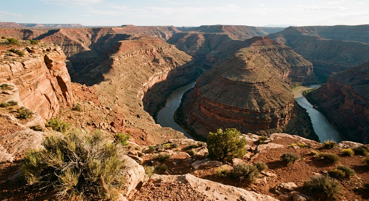
Some Southwest days are all dirt-under-the-nails adventure. Others are iced coffee, a smooth highway, and five-star views from the driver’s seat. This loop is my favorite kind of hybrid: a culture-and-landscape sampler that starts in Page (or Kayenta), touches the famous Four Corners photo-op, then swings up to Goosenecks State Park for one of the most underrated canyon overlooks in the region. If the roads are dry and your comfort level is good with steep cliffside dirt switchbacks, you can finish with Muley Point near golden hour, where Monument Valley’s buttes float on the horizon like a desert mirage.
Reality check first: From Kayenta, this is a genuine half-day. From Page, it is a full day with lots of driving. I’ll give you two versions so you can pick the one that fits your daylight, your gas tank, and your patience.
At a glance
- Best for: Big views with minimal hiking, border-area sightseeing done respectfully, and adding a “classic” stop to a Page or Monument Valley itinerary
- Total time (from Page): ~7.5 to 10+ hours depending on stops, crowds, and whether you add Muley Point (estimate)
- Total time (from Kayenta): ~3.5 to 5.5 hours depending on Muley Point and UT-261 conditions (estimate)
- Drive time only (rough): From Page, plan on roughly 6 to 7 hours behind the windshield. From Kayenta, roughly 2.5 to 3.5 hours, depending on your exact routing and detours.
- Road type: Mostly paved. Muley Point is usually reached via a graded dirt road off UT-261. Conditions vary and can be rough or washboarded after weather or heavy use. If you approach UT-261 from Mexican Hat, you will drive the Moki Dugway, a steep unpaved switchback section.
- Best photo light: Late afternoon into sunset at Muley Point, morning or late afternoon at Goosenecks
Route options
Option A: Page full day
Page → Four Corners → Mexican Hat (quick break) → Goosenecks State Park → Muley Point (optional) → Page
- Depart Page: as early as you can, ideally within 30 minutes of sunrise
- Four Corners stop: 30 to 60 minutes
- Mexican Hat stop: 10 to 30 minutes for fuel, snacks, or a quick leg stretch
- Goosenecks stop: 30 to 60 minutes
- Muley Point stop: 60 to 120 minutes if conditions are good and you want golden hour
If you start late, your day turns into a midday-crowd parade at Four Corners plus harsh overhead light at the overlooks. Starting early is the entire strategy.
Option B: Kayenta half day
Kayenta → Four Corners → Mexican Hat (optional) → Goosenecks State Park → Muley Point (optional) → Kayenta
- Depart Kayenta: morning for cooler temps, or mid-afternoon if you want Muley Point at sunset
- Driving is shorter: you can be pickier about timing and still feel relaxed
Stop 1: Four Corners
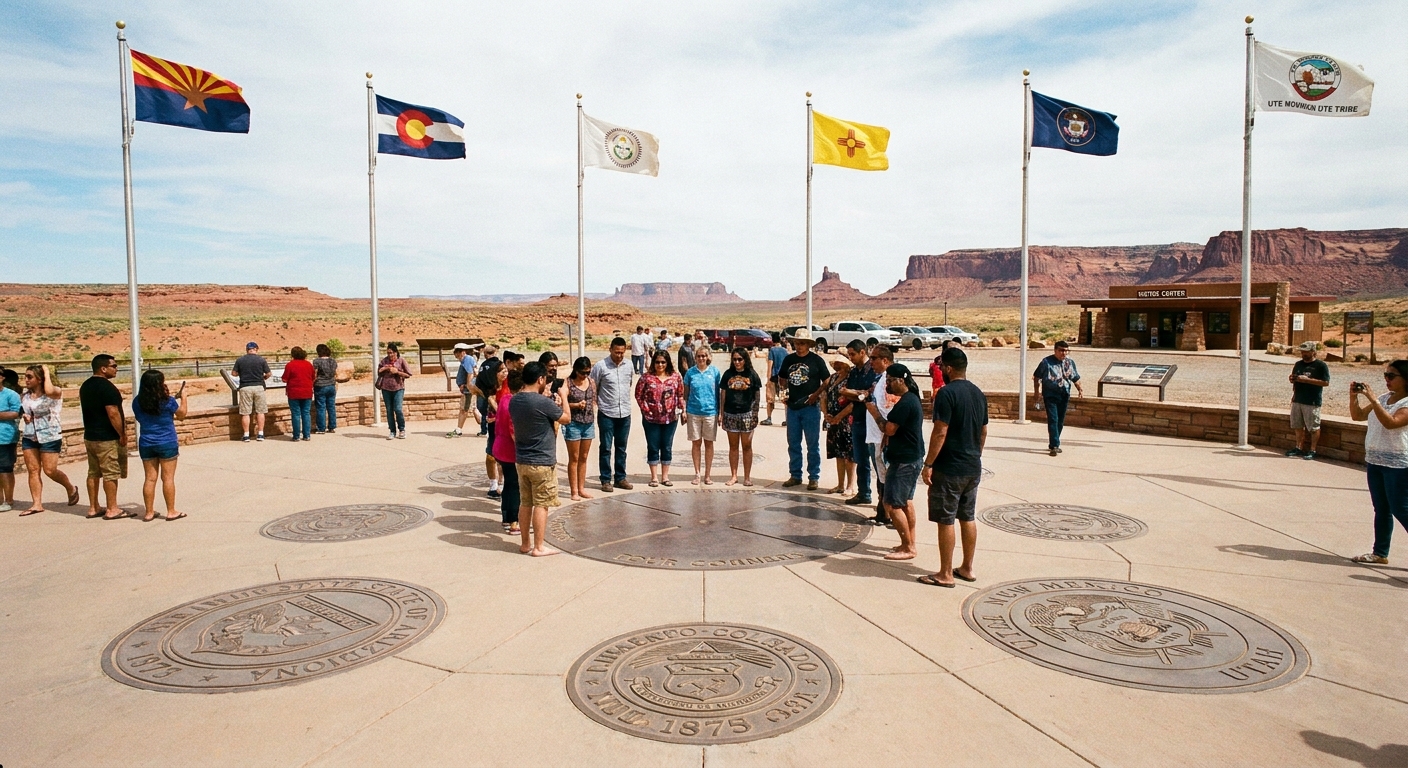
Yes, it’s touristy. Yes, the photo is a little cheesy. And still, if you’ve never stood in four states at once, it’s oddly satisfying. The monument sits within the Navajo Nation, and your entry fee supports on-site operations and local vendors.
Hours
Hours can vary by season and special events. In general, expect daytime hours with a last entry that may be earlier than the posted closing time. Because hours can change, verify the current schedule with official Navajo Nation or Four Corners Monument channels the day before you go.
Fees
Four Corners is a paid entry site (typically per person, not per vehicle). Fees can change, and sometimes cash is the smoothest option in remote areas. Plan on a small admission cost and consider buying from local artisans while you are there.
How long to spend
- Quick stop: 20 to 30 minutes for the photo and a quick lap around the plaza
- Worth-it stop: 45 to 60 minutes if you want to browse vendor stalls and read the displays
When to skip it
If you roll in between 11 am and 2 pm in peak season, you may face longer lines for the center marker and a crowded plaza. If your day is tight and the light is harsh, consider skipping Four Corners and putting that time into the overlooks instead.
Respectful visiting basics
- Stay on designated paths and respect barriers and signage
- Ask before photographing vendors or their work up close
- Pack out all trash, including receipts and snack wrappers
- Be patient: this is a shared space with community members earning a living
Between stops: Mexican Hat
If you want one simple landmark that makes this whole area “click” on a map, it’s Mexican Hat. It sits right in the flow between Four Corners, Goosenecks, and the UT-261 turnoff for Muley Point. It is also a practical pit stop for fuel, a cold drink, and a bathroom before you head to the overlooks.
Stop 2: Goosenecks
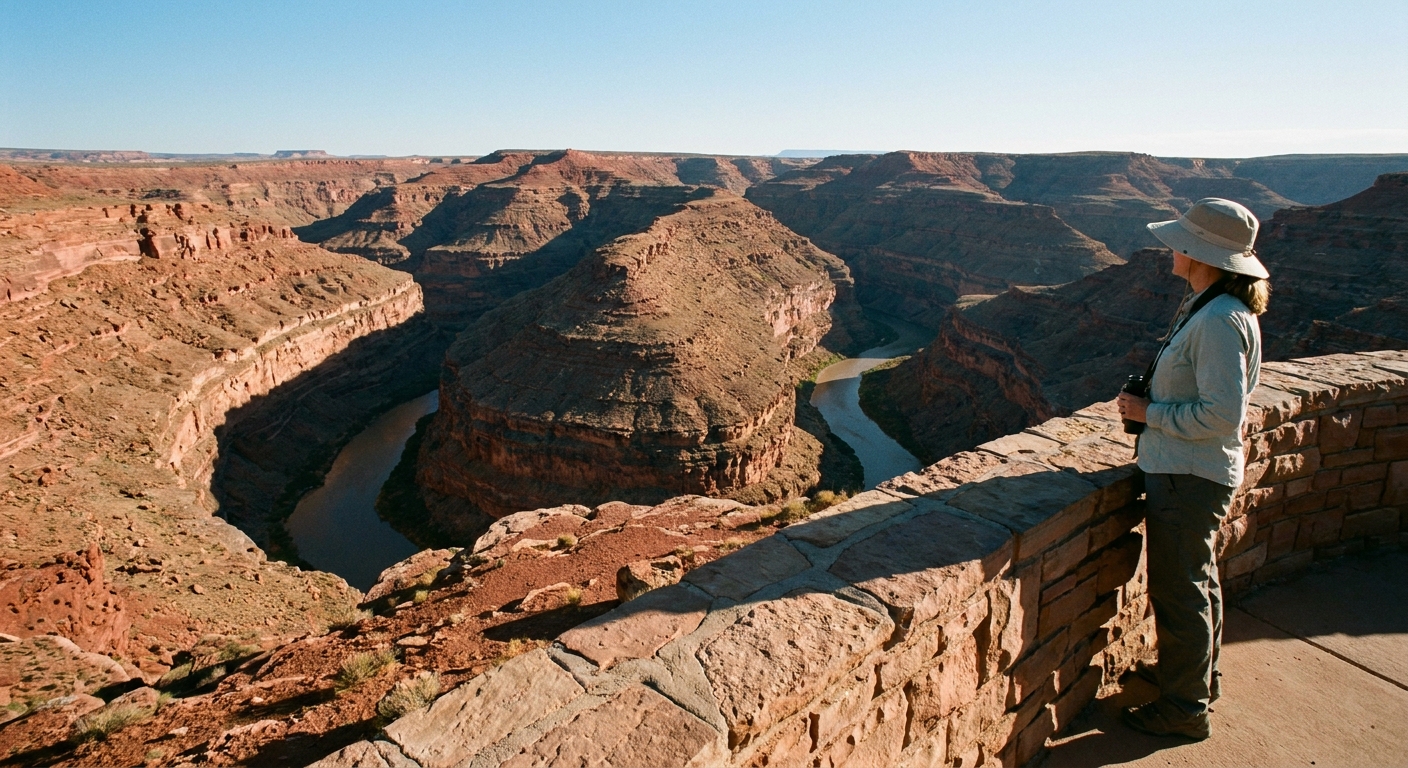
Goosenecks State Park in Utah is small, simple, and spectacular. You drive right up to the rim and look down at the San Juan River carving tight bends through a deep, layered canyon. The scale reads as quiet at first. Then your brain notices the river is a ribbon far below and the walls are massive.
Fees and access
This is a Utah state park, so expect a day-use fee at the entrance. Fee structure can change and may be per vehicle or per person, so verify current rates before you go. Facilities are basic, and the main attraction is the rim viewpoint area.
Best overlooks
- Main rim viewpoint: The classic view with multiple gooseneck bends visible. Great for wide-angle shots.
- Rim walk viewpoints: Short, informal wandering along the rim for slightly different angles. Keep a safe distance from edges. The rock can be crumbly.
Photo timing
Midday sun can flatten the canyon’s texture. Aim for morning (clean light, cooler temps) or late afternoon (more shadow and depth in the rock layers). If you must go midday, use the time for a slower look and save your “hero” photos for later.
Optional: Muley Point
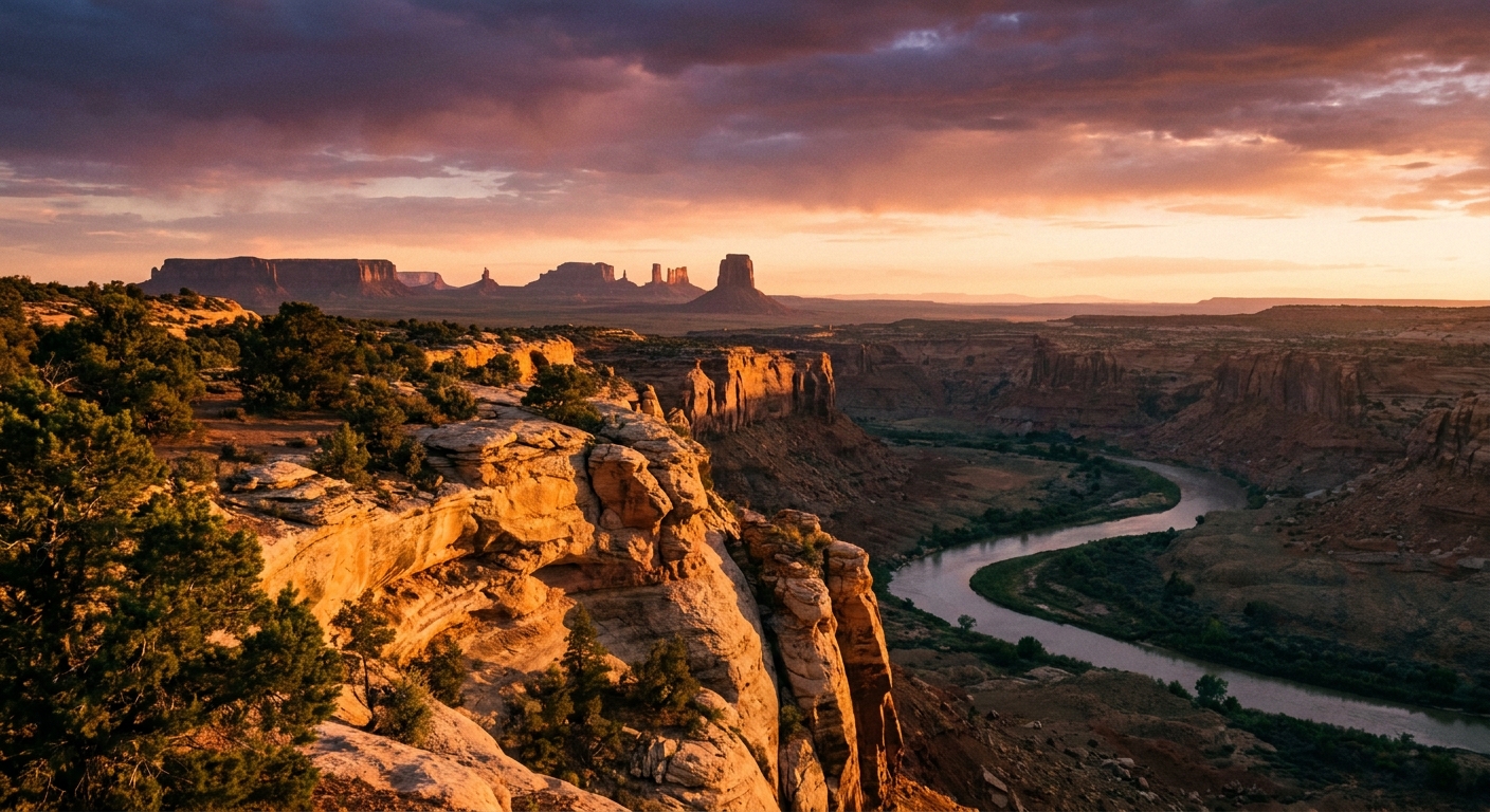
Muley Point is the payoff if you want that classic Southeast Utah feeling: endless space, distant buttes, and the kind of quiet that makes you talk softer without meaning to.
Route clarity that helps: Most visitors reach Muley Point from UT-261 near the top of the grade via the dirt Muley Point Road. If you are coming from Mexican Hat, taking UT-261 to the top means driving the Moki Dugway switchbacks. If you are coming from the north, you can be on UT-261 already and may not need to drive the Dugway at all.
Moki Dugway basics
The Moki Dugway is the famously steep, unpaved switchback section on UT-261 carved into the cliff face. It is scenic and often doable for confident drivers in good conditions, but it can be intimidating if heights or narrow roads are not your thing.
- Unpaved, variable conditions: Often graded, but it can get rough, washboarded, or rutted after storms and heavy traffic.
- Not a great idea for large rigs: Strongly consider skipping it if you are in an RV, towing, or driving an oversized vehicle.
- Weather matters: Avoid during storms or when the road is wet or icy. Mud plus steep grade is a bad combo.
- Take it slow: Use low gear going down, let faster vehicles pass when safe, and do not let anyone rush you.
Muley Point road notes
- Surface varies: The access road is typically dirt and can be dusty, washboarded, or slick when wet.
- After rain, think twice: If you are in a low-clearance car and it has rained recently, this can turn from “quick detour” into “why are we here” fast.
- No services: Bring what you need, including water and a full-size spare if you have one.
Best timing
For the most dramatic light, arrive 45 to 60 minutes before sunset. The best color often happens 10 to 20 minutes after the sun dips, so do not rush off the second it disappears.
When to skip Muley Point
- Stormy weather or recent rain
- High winds, especially if you are traveling with kids or anyone unsteady on their feet
- If you started late from Page: driving in the dark on unfamiliar dirt roads and steep switchbacks is not the vibe
Wayfinding and facilities
- Navigation: Muley Point is sometimes signed in connection with the Valley of the Gods area. Download offline maps ahead of time and do not rely on constant cell service.
- Restrooms: Four Corners has facilities on site. Goosenecks typically has basic restrooms. Muley Point usually has no facilities, so plan accordingly.
Permits
This loop touches and borders lands with different management rules. The simplest way to stay on the right side of things is to treat each area as its own “jurisdiction” with its own entry fees and expectations.
- Four Corners Monument: Entry fee is paid on-site. This is within the Navajo Nation.
- Navajo Nation parks and backcountry areas: Some areas require a Navajo Nation permit or guided access. Requirements vary by location and can change. If you add side trips off the paved highway, verify whether a permit is needed.
- Goosenecks State Park: Utah state park day-use fee at the entrance.
If you are unsure whether your detour crosses into permit-required land, ask at the nearest official booth or visitor contact point, or stick to the clearly signed, established stops listed above.
If you want to avoid Moki Dugway
You can still get a fantastic day out of Four Corners + Goosenecks and call it good. Or, only add Muley Point if you are already approaching on UT-261 from the north and conditions feel comfortable. The views are optional. The stress is not.
Desert safety
This is high-desert travel where “it’s just an overlook” can still mean intense sun, wind, and long gaps between services.
- Water: Bring more than you think. A practical baseline is at least 1 gallon per person per day in hot months, plus extra for pets.
- Fuel: Fill up in Page, Kayenta, or Mexican Hat depending on your direction. Do not count on tiny outposts having what you need.
- Sun and heat: Hat, sunscreen, and light long sleeves go a long way. Plan the most exposed overlooks for earlier or later in the day.
- Edges and wind: The overlooks are real cliffs. Gusts happen. Keep kids close, stay back from the rim, and avoid risky scrambling for “one more angle.”
- Cell service: Expect gaps. Download offline maps ahead of time.
Timing tips
My favorite trick in the Southwest is to reverse the typical schedule. Most people do the famous stop when it is easiest, which is also when it is most crowded.
- If you start in Page: Do Four Corners early, then Goosenecks, then Muley Point late if conditions and daylight allow.
- If you start in Kayenta: Consider Goosenecks first for late-day light, then Four Corners early the next morning if you are staying nearby.
- Skip midday Four Corners if you are short on time or sensitive to crowds. Your overlook photos will be better later anyway.
Quick checklist
- Driver’s license, payment method for entry fees, and a little cash for vendor stalls
- 2 to 3 liters of water per person for a half day, more in summer
- Sun protection: hat, sunglasses, sunscreen
- Snacks that do not melt instantly
- Offline maps downloaded
- Light jacket or wind layer for rim overlooks
Sample timelines
From Page
- Sunrise: Depart Page
- Late morning: Four Corners Monument (keep it to 30 to 45 minutes)
- Midday: Mexican Hat for fuel and a quick break
- Early afternoon: Goosenecks State Park (quick viewpoints, hydrate)
- Late afternoon to sunset: Muley Point (only if UT-261 and the access road are in good shape and you are comfortable with the drive)
- Evening: Return to Page
From Kayenta
- Mid-afternoon: Goosenecks State Park
- Golden hour: Muley Point (optional)
- Next morning option: Four Corners early for smaller crowds
If you have one true half day and you are starting in Page, consider making Goosenecks your must-do and treating Muley Point and Four Corners as optional based on road conditions, lines, and light.
Final notes
This corner of the Southwest is not just scenery. It’s living community land with cultural significance. The best travel mindset here is simple: be curious, be courteous, and leave every place cleaner than you found it. Buy from local artisans if you can, follow posted rules even when they seem inconvenient, and keep your itinerary flexible enough that you never have to rush safety decisions because the clock is winning.