Gatlinburg to Cades Cove: Smoky Mountains Trail and Town Guide
Maya Lin
Maya Lin is a travel journalist and outdoor enthusiast who believes the best trips combine rugged adventures with urban comforts. After spending six years backpacking across four continents, she founded Trail & Town Guide to help fellow travelers navigate both hidden mountain passes and bustling city neighborhoods with confidence.
Some places feel like two trips in one. The Great Smoky Mountains are exactly that: misty ridgelines and creekside trails by day, then a hot shower and a solid meal in town at night. This guide links the most satisfying hikes near Gatlinburg with a smart, low-stress plan for Cades Cove, plus a few Pigeon Forge breaks when you want comfort, fun, and an easy logistics win.
Think of it as your Trail & Town rhythm: lace up early, chase views before the parking lots fill, then lean into mountain-town comforts once the afternoon traffic starts to thicken.
Quick orientation
Gatlinburg is the closest base to the park’s busiest corridor. You can walk to restaurants and coffee, then be at trailheads on Newfound Gap Road fast. It is touristy, yes, but it is also convenient in a way that makes early hiking realistic.
Pigeon Forge is a little farther from most trailheads, but it is excellent for families, rainy-day entertainment, and big-comfort lodging. If Gatlinburg is “boots by the door,” Pigeon Forge is “give me a comfy bed and an easy parking lot.”
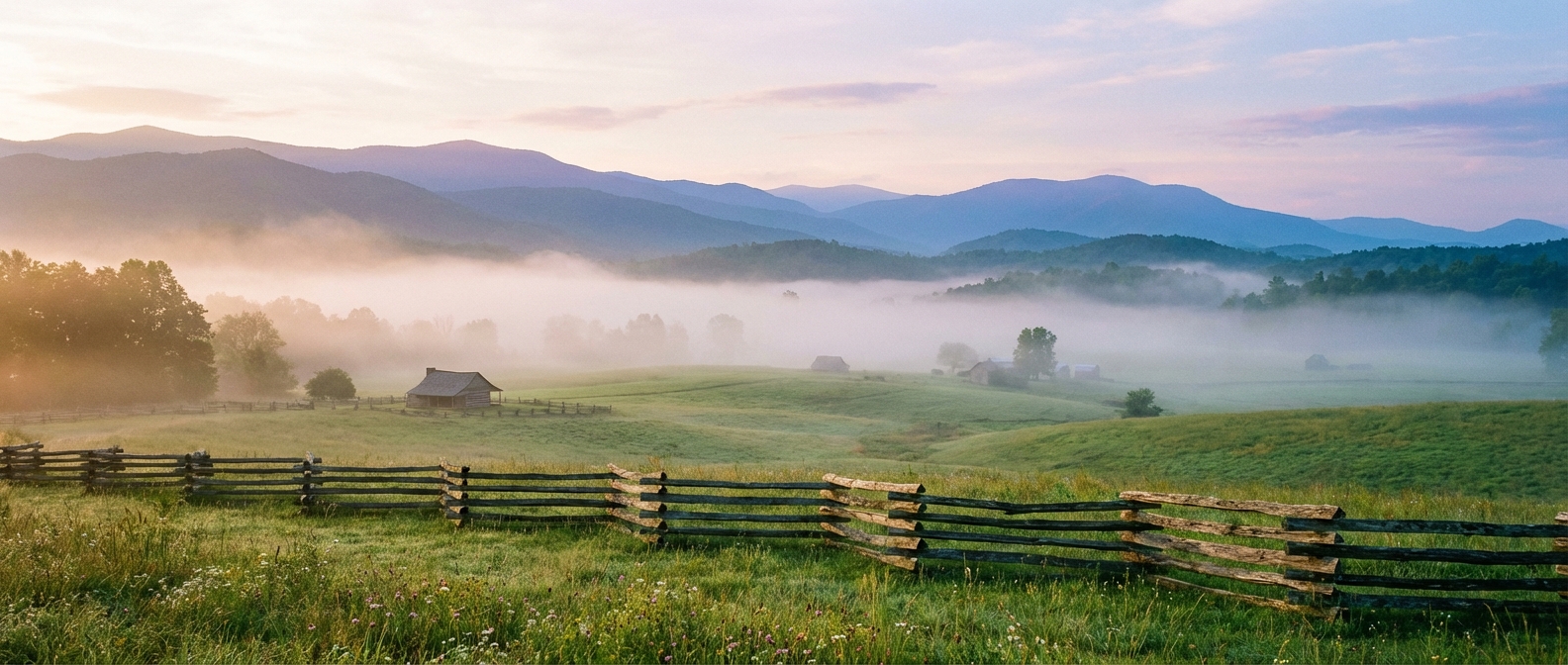
Cades Cove sits on the park’s west side, reached from near Townsend. It is iconic for a reason: a broad valley loop lined with historic buildings, open meadows, and frequent wildlife sightings. It is also one of the most crowded places in the entire park, which is why timing matters more here than anywhere.
Best times to dodge crowds
Daily timing that works
- Arrive early: In peak season, aim to park by 8:00 am for popular trailheads. On weekends in October, try for 7:00 to 7:30 am if you want choice parking.
- Use the midday pivot: From about 11:00 am to 3:00 pm, swap to scenic drives, short nature trails, museums, or a long lunch in town.
- Go late for softer light: Many viewpoints and short walks feel calmer after 5:00 pm in summer.
Season notes
- Mid-October to early November: Peak fall color and peak traffic. Book lodging early, plan sunrise starts, and keep backup hikes in your pocket.
- March to April: Spring break crowds pop up. Wildflowers begin at lower elevations first.
- Summer: Expect full parking at famous spots. Waterfalls and high-elevation hikes are the best “heat strategy.”
- Winter: Quieter, moody, and beautiful, but weather and road conditions can change quickly at elevation.
My crowd rule in the Smokies: pick one “famous” stop per day, then balance it with a less-hyped trail where you can hear the creeks and your own footsteps again.
Trail picks by difficulty
These are classic Smokies hikes with a mix of waterfalls, ridge views, and history. Distances and conditions can vary, so always confirm current trail status and road access before you go.
Easy
-
Laurel Falls Trail: A family-friendly route to one of the park’s most popular waterfalls. It has historically been paved asphalt, but it can be uneven and steeper than it looks in sections, so good shoes still matter.
Quick stats: about 2.6 miles round trip, moderate grade, 2 to 3 hours for most groups.
Parking: Laurel Falls parking area on Little River Road. Arrive early because it fills fast.
-
Gatlinburg Trail: A mellow riverside walk that starts near town. Great for a leg-stretch day or a late-afternoon stroll when you still want “park time” without committing to a climb.
Quick stats: up to 3.8 miles one way (out and back as you like), mostly gentle, 1 to 3 hours depending on turnaround.
Parking: Gatlinburg Trail trailhead near Sugarlands Visitor Center or the Gatlinburg end (availability varies, earlier is easier).
-
Elkmont Nature Trail: A short loop in the Elkmont campground area, separate from the longer Elkmont historic district wanderings. It is a simple forest walk with a little interpretive flavor.
Quick stats: about 0.8 miles loop, easy, 30 to 45 minutes.
Parking: Elkmont area parking near the nature trail access (signage in the campground zone).
-
Sugarlands Valley Nature Trail: A truly easy, low-commitment option near the visitor center, great for mixed mobility and quick “we want to be in the woods” moments.
Quick stats: about 0.5 miles, easy, 20 to 30 minutes.
Parking: Sugarlands Visitor Center area.
Moderate
-
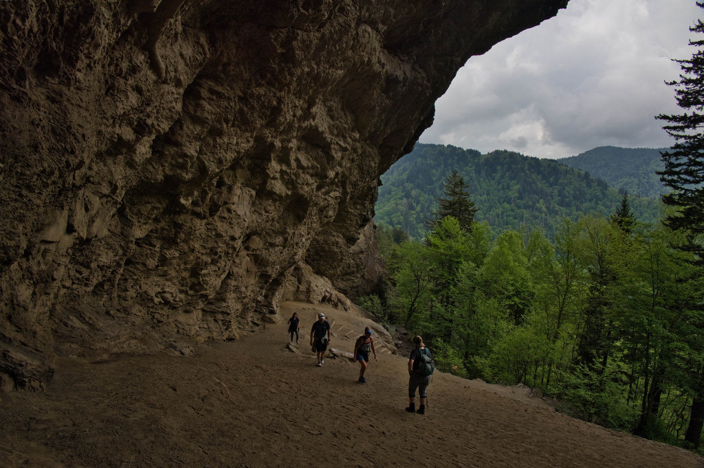
Alum Cave Trail to Alum Cave Bluffs: A Smokies classic with changing scenery, including the arched bluff overhang. Strong payoff without needing a full-day summit push. If you feel great, you can continue toward Mount LeConte.
Quick stats: about 4.4 miles round trip to the Bluffs, roughly 1,100 ft gain, 3 to 5 hours.
Parking: Alum Cave Trailhead on Newfound Gap Road. This lot fills early.
-
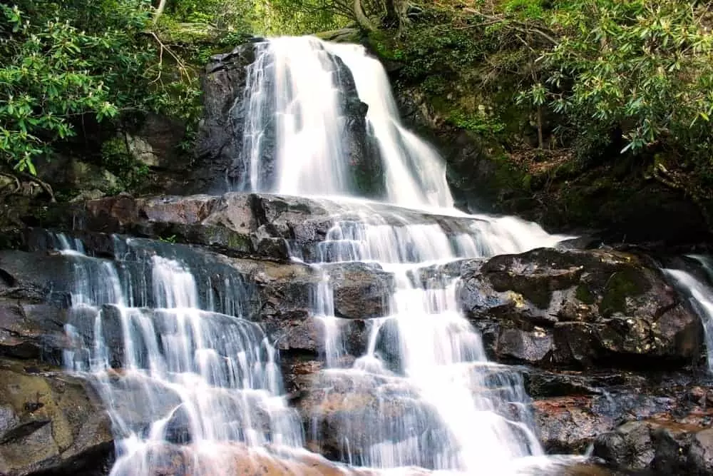
Rainbow Falls: A steady climb with a satisfying waterfall finish. It is popular, but spacing out hikers is easier if you arrive early.
Quick stats: about 5.4 miles round trip, roughly 1,500 ft gain, 4 to 6 hours.
Parking: Rainbow Falls Trailhead (Cherokee Orchard area). Parking can be tight.
-
Chimney Tops Trail: Short, steep, and dramatic. Since the 2016 fire, the trail no longer goes to the old summit scramble. It now ends at an official overlook short of the peaks. You still get big ridge energy, especially in clear weather.
Quick stats: about 3.3 miles round trip, roughly 1,400 ft gain, 2.5 to 4 hours.
Parking: Chimney Tops Trailhead on Newfound Gap Road. Go early and avoid wet conditions if you dislike slick rock.
Hard
-
Charlies Bunion: A longer out-and-back with a rocky viewpoint that can feel genuinely alpine when the weather is crisp. Bring layers even in shoulder seasons.
Quick stats: about 8 miles round trip, roughly 1,600 to 1,900 ft gain, 5 to 8 hours.
Parking: Newfound Gap parking area (plan for limited space).
-
Mount LeConte (via Alum Cave): One of the park’s most iconic big hikes. Expect a long climb, big elevation change, and multiple viewpoints along the way.
Quick stats: about 11 miles round trip, roughly 2,700 ft gain, 7 to 10 hours.
Parking: Alum Cave Trailhead on Newfound Gap Road.
-
Rocky Top (via Thunderhead): A high-effort ridge day that can reward you with wide-open views when conditions cooperate. The most common access is from the Cades Cove side, hiking up toward Spence Field and the Appalachian Trail junctions, then continuing to Rocky Top via the AT.
Quick stats: often 13 to 17 miles round trip depending on route, significant elevation gain, 8 to 12 hours.
Parking: Cades Cove area trailhead parking (Anthony Creek/Bote Mountain vicinity). Start early and bring extra water.
Carry-on-only tip: In the Smokies, “light” still needs to be prepared. Bring a rain layer, a warm layer, extra water, and a headlamp. Weather shifts fast, and sunset comes quicker than your legs expect on the way down.
Scenic drives
Newfound Gap Road
This is the spine connecting Gatlinburg to the park’s high elevations and on toward Cherokee. It is your best “view without the sweat” option and a perfect midday pivot. Stop at overlooks when you see space, and pick one or two named viewpoints so you do not turn it into a parking-lot scavenger hunt.
- Good stops: Newfound Gap, Morton Overlook, and Kuwohi (formerly called Clingmans Dome) when the road is open.
- Best for: quick views, cooler temperatures, easy access to trailheads
- Crowd tip: go early on weekdays or later afternoon for softer light
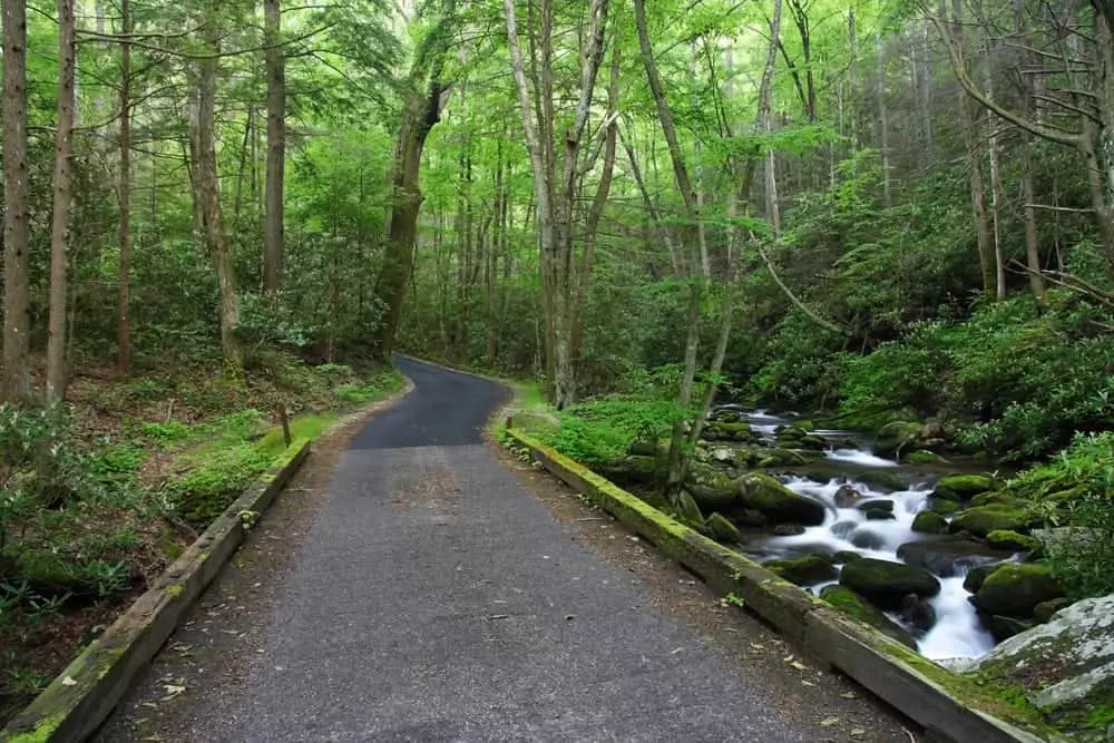
Roaring Fork Motor Nature Trail
A classic loop drive near Gatlinburg that feels like a lush, creek-carved forest tunnel. It pairs beautifully with short stops and quick walks when you want the Smokies atmosphere without a long hike.
Cades Cove Loop Road
The valley loop is slow moving by design, and traffic can make it slower. Go in with a strategy and it becomes a highlight instead of a headache.
- Best for: wildlife spotting, historic cabins and churches, wide valley views
- Crowd tip: arrive early or later in the day, and avoid peak weekend afternoons
Cades Cove without the stress
Cades Cove is an 11-mile, one-way loop. On quiet mornings it can feel like a dreamy, slow roll. In peak traffic it can take a surprisingly long time. Treat it like a sunrise hike and you will like it a lot more.
Simple game plan
- Arrive early: Early morning is best for calmer roads and the highest chance of wildlife activity.
- Pack a picnic: Having your own breakfast or lunch prevents hungry decision-making once you are committed to the loop.
- Choose 1 to 2 stops: Pick a couple of historic buildings or pullouts and let the rest be scenery as you roll.
- Add one short trail: A quick walk breaks up the drive and helps you escape the car-to-car feeling.
Vehicle-free mornings
Cades Cove sometimes offers vehicle-free access windows for biking and walking. The schedule can change by year and season, so check the park’s current Cades Cove page before you plan your day around it.
Wildlife etiquette
Cades Cove is one of the best places in the park to spot deer, turkey, and sometimes black bears. Give animals a wide berth, never approach for a photo, and do not feed anything, ever. If traffic stops for wildlife, be patient and safe. This is not the place for risky passing or roadside crowding.
Gatlinburg breaks
Gatlinburg is a choose-your-own-adventure town. It can be kitschy and crowded, but it can also be exactly what you want after a long climb: a good meal, a hot shower, and an easy evening.
After a big hike
- Go low-key with a riverside walk: The town’s creekside energy is soothing when your legs are cooked.
- Lean into local crafts: The Great Smoky Arts & Crafts Community is a nice counterbalance to the main strip, with working studios and handmade goods.
- Pick one paid view: If you want an attraction-style overlook, choose one and be done. Save the rest of your “views budget” for Newfound Gap Road.
My ritual
I look for a coffee shop where locals actually linger, then I use that quiet window to confirm tomorrow’s road access, trail conditions, and my first parking target. The Smokies reward early commitment, and caffeine helps.
Pigeon Forge breaks
If your group has mixed energy levels, Pigeon Forge is the peace treaty. It is built for easy entertainment and predictable logistics, which can be a gift after a few ambitious trail days.
- When to base here: traveling with kids, you want larger hotels or cabins, or you prefer quick dining options
- When to visit from Gatlinburg: rainy afternoons, rest days, or evenings when you want a change of pace
Pair it with a short morning hike, then use the afternoon for low-effort fun and an early dinner so you can still get to bed at a hiker-friendly hour.
Suggested itineraries
2 days
- Day 1: Park early for Alum Cave Bluffs or Rainbow Falls, then Roaring Fork drive and a relaxed Gatlinburg dinner.
- Day 2: Cades Cove loop early with one short trail stop, then late lunch and a chill afternoon in Pigeon Forge.
3 days
- Day 1: Laurel Falls early, then Newfound Gap Road viewpoints (Newfound Gap and Morton Overlook are easy wins) and a low-key evening.
- Day 2: Big hike day (Charlies Bunion or LeConte), then a comfort-forward meal and an early night.
- Day 3: Cades Cove early, then Arts & Crafts Community browsing in the afternoon.
Practical notes
Parking and fees
Great Smoky Mountains National Park is free to enter, but a paid parking tag is required for many parking situations (in effect since 2023). Rules can shift, so confirm current parking tag details, seasonal road closures, and trail conditions on the official NPS site before you go. Popular trailheads fill fast, especially near Gatlinburg.
Safety and conditions
- Weather: High elevations can be much colder and windier than town. Roads can close for ice, snow, or storms. Check the park’s road status before you commit to a high-elevation plan.
- Bears: Bear spray is not standard for most Smokies day hikes. The basics matter more: keep distance, never feed wildlife, secure food, and do not run. If you see a bear, back away slowly and give it room.
- Ticks and poison ivy: Use repellent, do a tick check after hikes, and learn the quick ID for poison ivy. Staying on trail helps with all of the above.
What to pack
- Rain jacket or poncho
- Warm layer (even in summer at higher elevations)
- Water and snacks
- Headlamp
- Small first-aid kit and blister care
- Trash bag for packing out everything
Leave No Trace
- Stay on trail to protect fragile plants and reduce erosion.
- Do not feed wildlife, and store food securely.
- Keep sound low. These forests have a quiet you can feel when you let them.
One more crowd trick
When the main attractions are packed, do not force it. Pick a less-famous trail, drive five more minutes, and let the Smokies be what they are at their best: green, damp, fragrant forests where the light looks like it was poured through the leaves.
If you want an easy, reliable backup near Gatlinburg, keep Porters Creek in mind. It is quieter than the headline trails and still feels deeply Smokies, especially in spring and after a rain.