Kendall Katwalk from Snoqualmie Pass

Maya Lin
Maya Lin is a travel journalist and outdoor enthusiast who believes the best trips combine rugged adventures with urban comforts. After spending six years backpacking across four continents, she founded Trail & Town Guide to help fellow travelers navigate both hidden mountain passes and bustling city neighborhoods with confidence.
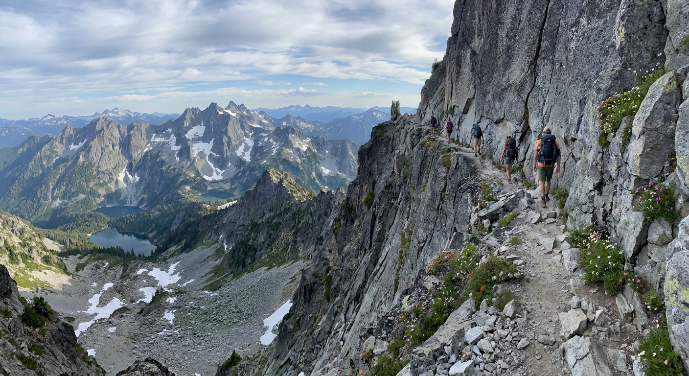
First, a quick but important clarification: this hike is not the Enchantments Snow Lakes above Leavenworth. This is a very different “Snow Lake world” entirely. Kendall Katwalk sits on the Pacific Crest Trail (PCT) north of Snoqualmie Pass, and it earns its reputation with a narrow, blasted ledge that can feel thrilling or terrifying depending on your relationship with exposure.
If you want big, alpine Cascade views without a summit scramble, Kendall Katwalk is one of the best payoffs on I-90. The catch is simple: it is still a mountain trail. Snow can linger well into early summer, and when it does, the “catwalk” becomes a no-fall zone, meaning steep, exposed terrain where a slip can have serious consequences. In this guide I’ll walk you from the pass to the ledge, plus give you a conservative turnaround option for shoulder season.
At a glance
- Trail: PCT north from Snoqualmie Pass to Kendall Katwalk
- Distance: about 11 to 14 miles round trip depending on your start point and turnaround (details below)
- Elevation gain: roughly 2,500 to 3,000 feet depending on start point
- Difficulty: Strenuous because of distance, steady climbing, and exposure at the Katwalk
- Best season: Late summer through early fall for the driest, safest ledge conditions
- Biggest hazard: Exposure on the Katwalk, plus snow lingering on shaded traverses
- Dogs: Possible for steady, experienced trail dogs, but I do not recommend it if snow remains near the ledge or if your dog pulls near drop-offs
Getting there and parking
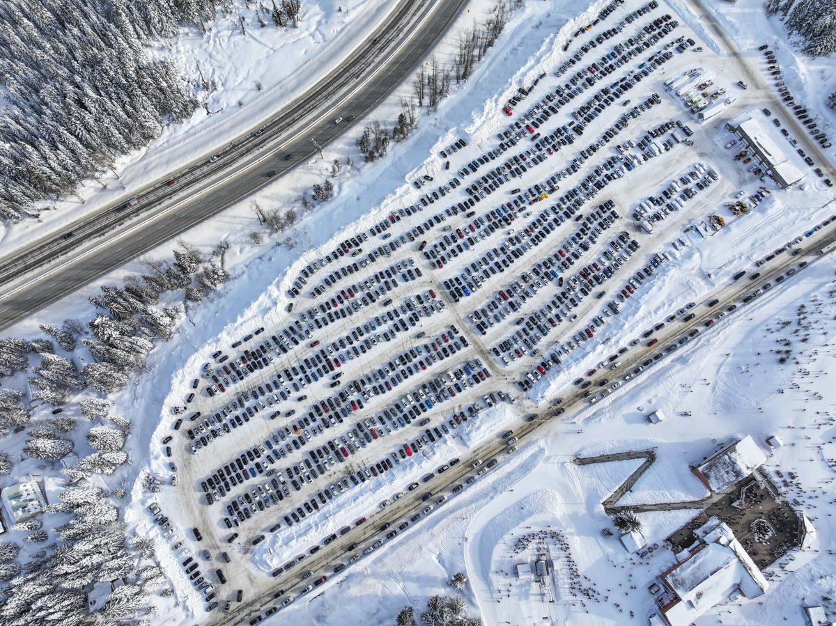
Start area: Snoqualmie Pass on I-90. The most straightforward way to do this hike is to park near Snoqualmie Pass and connect to the PCT heading north. There are multiple lots and connectors in the pass area, and the “right” choice often depends on what is plowed, what is full, and what is signed for day use that morning.
Common start points
- Snoqualmie Pass core lots: Easy access to services, easy to regroup, and typically the simplest place to begin if you want a “start at the pass, hike north” day.
- Gold Creek area lots: Another common option depending on where you like to start and how you prefer to link into the PCT.
My advice: pick a signed, designated lot, then use an offline map to confirm your connector to the PCT northbound. Snoqualmie Pass has a lot going on, and it is easy to waste time wandering between trailheads if you show up without a plan.
Parking tips that actually help
- Arrive early: If you want a relaxed start, aim to park by 8:00 a.m. on weekends.
- Have a backup lot in mind: If your first choice is full, do not waste 30 minutes circling. Park only in designated, clearly legal spots and walk to your connector trail.
- Bring a pass: Pass requirements vary by lot and managing agency around the pass. Some day-use areas are signed for Discover Pass, others for Northwest Forest Pass, and a few have their own rules. Read the sign where you park and match the pass to that sign. I keep a printed backup in the glovebox because cell service is not something I like to gamble on at trailheads.
Route overview
The hike begins in classic Cascade forest, climbs steadily, then opens into a ridge-and-basin landscape where the scale starts to feel alpine. The PCT here is famously well-graded, which is a polite way of saying it still climbs a lot, but it does so in a way that does not beat up your knees quite as brutally as some steeper I-90 classics.
What the trail feels like
- Early miles: Shaded forest, steady switchbacks, and the kind of tread that makes you think, “Oh, this is why thru-hikers love the PCT.”
- Mid section: Longer traverses with periodic views. In early season, these traverses are where you can still hit firm snow in the morning.
- Approach to the Katwalk: The terrain becomes rockier and more open, and you’ll start seeing the steep slope you’ll eventually cross.
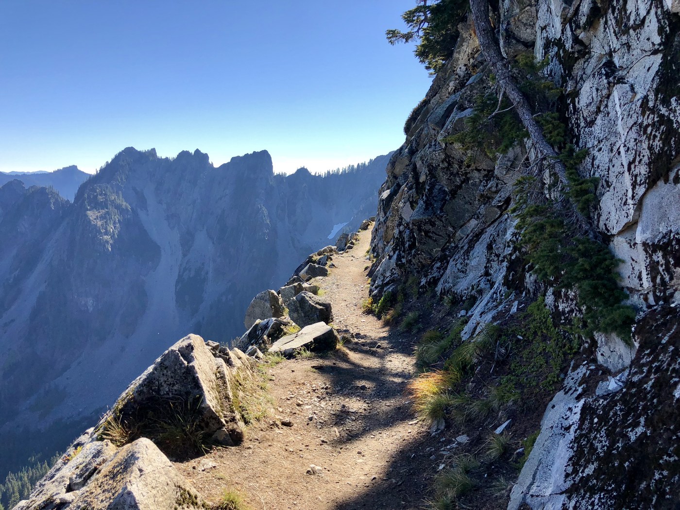
The Kendall Katwalk itself is a narrow segment of trail blasted into a steep mountainside. It is not technical climbing, but it is psychological. If you are comfortable with exposure, it is an unforgettable catwalk with huge views. If you are not, it can feel like the longest about-a-quarter-mile of your life.
Mileage and turnarounds
Exact mileage depends on where you park and which connector you use to reach the PCT northbound. The ranges below are intentionally honest about that. If you want precision, pick your exact lot and measure your route in your mapping app before you go.
Typical totals by start area
- From Snoqualmie Pass core lots: often lands in the 11 to 13 mile round-trip range to the Katwalk area, with roughly 2,500 to 3,000 feet of gain.
- From other nearby lots and connectors: can push closer to 14 miles round trip depending on the approach.
Option 1: Viewpoint turnaround
Plan on roughly 10 to 12 miles round trip, depending on your start point. The idea is to hike up the PCT, enjoy the expanding views, and turn around before committing to the exposed traverse if you see snow, ice, wind that is knocking you around, or you simply do not like what your stomach is telling you.
Easy landmark to use: as you near the open, rocky slopes where the trail begins traversing above steeper terrain, you will typically have clear sightlines to the blasted ledge ahead. If the tread ahead looks narrow and the slope below looks like it would not forgive a stumble, that is your cue to call it. You still get a full-value mountain day without rolling the dice on early-season conditions.
- Best for: shoulder season, uncertain conditions, kids, first exposure test
- Why it works: you get the climb, views, and a confidence read on conditions without committing to the highest-consequence section
Option 2: Katwalk out-and-back
Plan on roughly 11 to 14 miles round trip, with 2,500 to 3,000 feet of gain. If the trail is dry and you are comfortable with exposure, reaching the Katwalk is the signature experience.
- Best for: late summer and early fall, stable weather, confident hikers
- Time estimate: most groups take 6 to 9 hours depending on pace, breaks, and how long you loiter for photos
The Katwalk
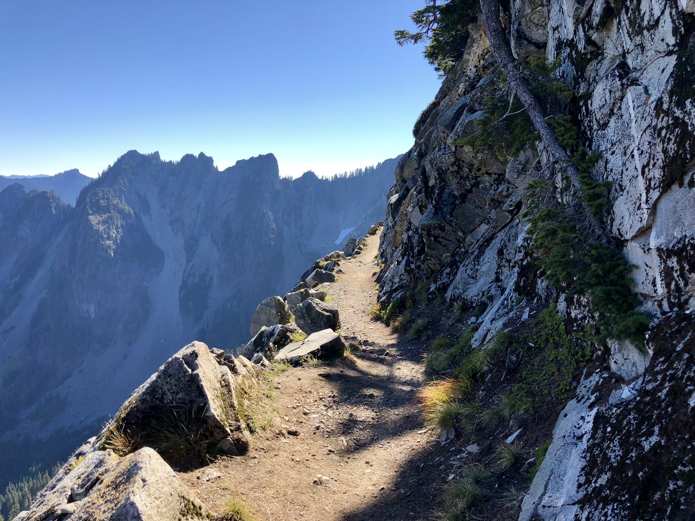
Kendall Katwalk is often described as “a ledge,” and that is accurate. The trail is carved into a steep slope with significant drop-off potential. In dry conditions, the tread is usually wide enough for careful passing, but you should expect narrow spots, loose rock, and uneven footing.
My practical rules
- No distractions: This is not the place for earbuds or staring at your phone while walking.
- One person moves at a time when passing: Pick a wider spot. Communicate. Be patient.
- Wind matters: A breezy forecast can make the ledge feel much more committing, especially for hikers new to exposure.
- Turn around if you feel rushed: The Katwalk rewards calm decision-making. If your group is pressuring you, it is okay to call it.
The Katwalk is a confidence hike, not a conquest hike. If the ledge does not feel like a good idea today, the mountain will still be there next weekend.
Snow and turn back
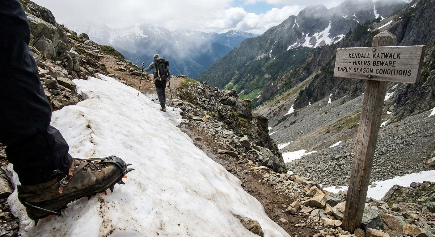
This is the part I wish more people said out loud: snow on or above the Katwalk changes the entire risk profile. A short snow patch on a flat forest trail is annoying. A firm snow patch on an exposed traverse can become a serious fall hazard.
When I turn around
If you encounter snow as you near the open slopes, use these as reasons to turn around:
- You see continuous snow across the trail on steep terrain.
- The snow is hard and slick, especially in the morning.
- You notice runout below you, meaning a slip would send you sliding into rocks or down a long slope.
- You do not have appropriate traction for the conditions and the experience to use it confidently.
Even in a low-snow year, shaded sections can hold on longer than you expect. I’ve had days where the trail was dry for hours, then suddenly I hit one icy traverse that made my turnaround decision very easy.
What to pack
I’m a carry-on only traveler in cities, but in the Cascades I pack like the weather is allowed to have moods. On this trail, that approach pays off.
Essentials
- Water: carry enough for a long day. I plan for at least 2 liters, more on hot weekends.
- Food: real lunch plus snacks you will actually eat even when you are tired.
- Layers: light insulating layer and rain shell. Wind can cut hard in the open sections.
- Navigation: offline map downloaded before you arrive.
- Sun protection: sunglasses and sunscreen. The open slopes reflect light.
- Trekking poles: helpful for the climb and for stability on uneven tread.
If snow is possible
- Traction: consider microspikes if conditions warrant, and know how to walk in them without tripping yourself.
- Earlier start: firmer snow in the morning can be safer than slushy afternoon postholing, but it can also be icier. Assess in the moment.
Water notes
This is not a “water every mile” kind of trail. You may pass small seasonal sources, but do not count on them being flowing late summer. I treat this as a carry-what-you-need hike unless I have recent reports that a specific stream is running. If you do plan to refill, bring a filter.
Leave No Trace
This stretch near Snoqualmie Pass sees a lot of boots, and it shows quickly when people cut corners.
- Stay on the trail: especially near fragile alpine areas. Social trails widen the damage fast.
- Pack out everything: yes, including fruit peels and “biodegradable” scraps.
- Bathroom breaks: step well away from water sources and the trail, and pack out toilet paper.
- Yielding etiquette: uphill hikers typically have the right of way, but on exposed sections use common sense and find the safest spot to let someone pass.
Quick FAQ
Is Kendall Katwalk scary?
If you are sensitive to heights and exposure, it can feel scary. The trail is not technical, but the consequences of a slip are high in spots. In dry summer conditions, many hikers find it manageable by slowing down and staying focused.
Can I do it if I’m not a super strong hiker?
You do not need to be an ultrarunner, but you do need endurance. The most common reason people turn around is not the ledge, it is time and energy. Start early, pace yourself, and consider the pre-ledge turnaround if you are unsure.
When is the best time of year?
For the safest, least stressful experience on the Katwalk, aim for late summer into early fall when snow is typically gone and the tread is dry.
What if the weather turns?
Turn around sooner than you think you need to. Visibility and wind can make the exposed sections feel dramatically harder. If you are hearing thunder, do not debate it. Head down.
What about smoke season?
Late summer can bring wildfire smoke. If the AQI is ugly at the pass, the views will not be worth the effort, and the uphill breathing will feel brutal. I save this hike for clearer days.
My favorite way
If I’m picking a “Town Wander perfect day,” I start early enough to enjoy cool forest miles, hit the open slopes in bright morning light, and then take a long break near the best views with a thermos coffee moment that feels borderline luxurious for a trail day. Then I hike out before afternoon crowds peak and I-90 turns into a parking lot.
Just remember: Kendall Katwalk is spectacular because it is exposed. If snow is still clinging to the ledge, the most experienced decision can be the simplest one: turn around before the catwalk, and come back when the mountains have fully switched to summer.