Mount Lemmon Scenic Corridor: Short Hikes and a Summer Escape From Tucson
When Tucson feels like it is radiating heat from every stucco wall and parking lot, the Mount Lemmon Scenic Corridor is the city’s best magic trick. In about an hour, the Catalina Highway, also known as the Mount Lemmon Scenic Byway, climbs from saguaro-studded desert into pine forest with pockets of aspen, trading triple digits for a jacket-worthy breeze.
This is not a “pack-a-weekend” kind of escape. It is a grab-your-water-bottle, grab-your-coffee, and go kind of day. Below you will find the essentials: fees, closure notes, where to park, the best short hikes, a few classic viewpoints, and what to watch for during monsoon season.

Why it feels like another state
Mount Lemmon is part of the Santa Catalina Mountains, one of southern Arizona’s “Sky Islands.” These isolated mountain ranges rise abruptly from the Sonoran Desert, creating stacked climate zones like a layer cake.
- Start in low desert: saguaro, ocotillo, and creosote near Tucson.
- Mid-elevations: oak and juniper, cooler air, and wider views.
- High country: pine forest, meadows, and in winter, snow near Summerhaven and the ski area.
That elevation gain is your summer payoff. Tucson sits around 2,400 feet and Summerhaven is around 8,000 feet, so the top of the mountain can be 20 to 30°F cooler than the city, especially in summer. Still, sun at altitude is intense, so do not treat “cooler” as “no sunscreen.”
Altitude note: Even easy hikes can feel a little harder up high. If you or your kids are prone to headaches or nausea, go slower than usual, snack early, and hydrate.
Know before you go
Fees and passes
Most day-use recreation along the Mount Lemmon Scenic Corridor is on Coronado National Forest land. Many popular trailheads and picnic areas are in fee sites (often posted as a Standard Amenity Fee area). You will need to display a valid pass or pay at the self-pay station where available.
- Bring: a pen (some self-pay stations are old-school), small bills, and your pass if you have one.
- America the Beautiful pass: Yes, it is accepted at standard federal day-use fee sites along the Mount Lemmon corridor. That said, not every fee is the same. If a site is operated under a concessionaire or has special rules, acceptance can differ. Always check the sign at the specific trailhead or day-use area.
- Where to buy: self-pay stations at trailheads, ranger stations when open, and some local retailers depending on the season.
Tip: If you are planning multiple Catalina Highway outings, a forest pass can be cheaper and less hassle than paying per visit.
Cell service and navigation
Cell reception is inconsistent as you climb. Download maps ahead of time and screenshot your key turns, especially if you plan to explore smaller side roads or less-trafficked trailheads.
Restrooms and water
Facilities vary widely by trailhead. Some have vault toilets, others have none. Treat water as scarce. Even when the air is cool, dehydration sneaks up fast at altitude.
Road and closure notes
The Catalina Highway is generally open year-round, but conditions can change quickly.
Winter snow and ice
After winter storms, the road can be slick and closures are possible. Traction restrictions can be posted at higher elevations (chains and or 4WD depending on conditions). If you are heading up for snow play, check conditions before you leave Tucson.
Monsoon impacts
Arizona’s monsoon season is commonly cited as June 15 through September 30, with the most active stretch often mid-summer. Storms can build fast. Heavy rain can cause rockfall, downed branches, and sudden reductions in visibility. Flooding is more common in the lower canyons, but the entire corridor can be affected.
Wildfire and smoke
Fire restrictions can limit campfires and sometimes access to certain areas. Smoke can also be an issue even when fires are not in the immediate area.
Before you go: check the Coronado National Forest, Santa Catalina Ranger District updates and ADOT 511 for current road conditions and advisories.
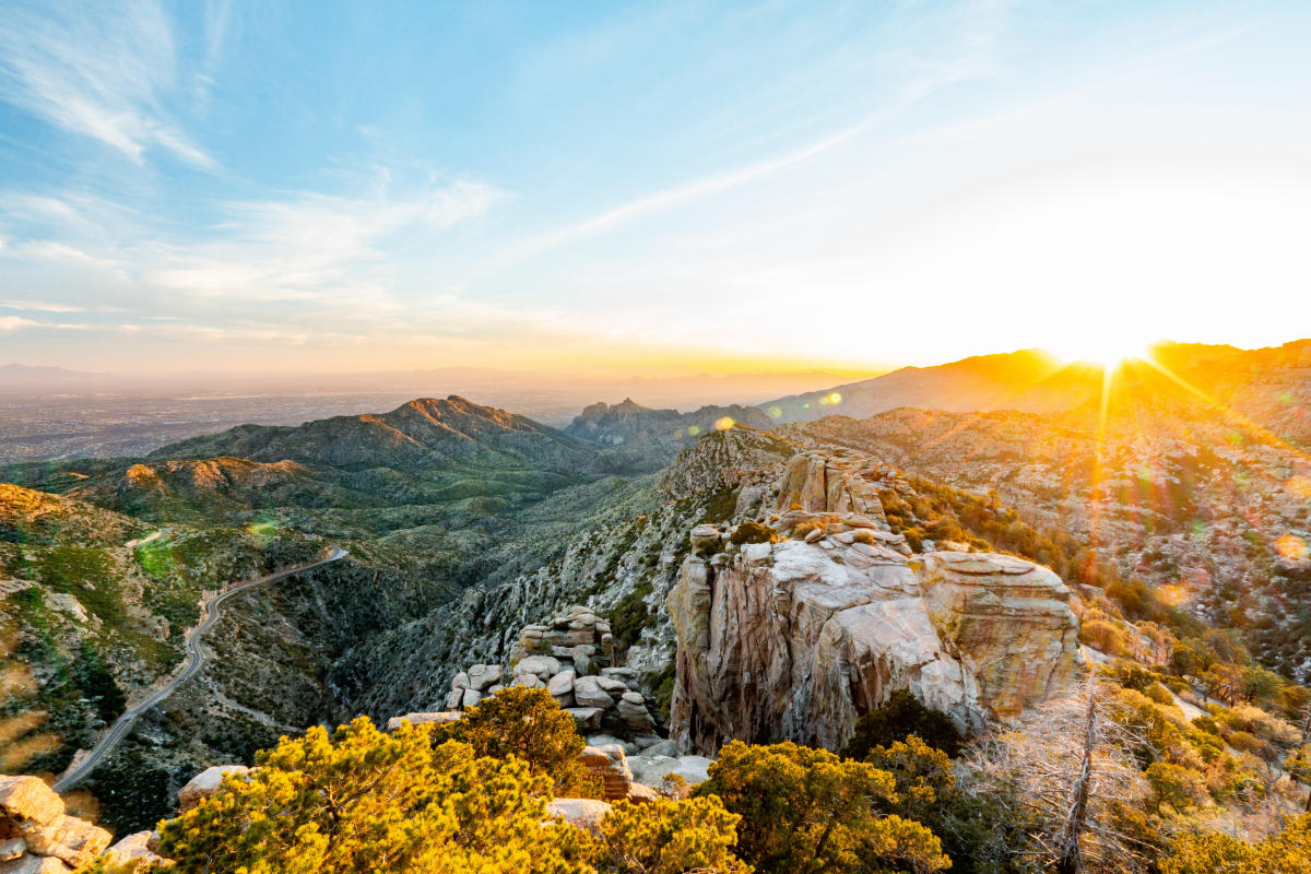
Quick stops worth the pullout
If you want the biggest payoff with the smallest commitment, build in one or two viewpoints. They are also great options if you are traveling with someone who is not hiking today.
- Windy Point Vista: a classic for big views and boulders, plus it is an easy stop right off the road.
- San Pedro Vista: wide-open sky, distant mountain layers, and dramatic light when weather is building.
- Rose Canyon Lake: a mellow walk-around option when the road is open and the area is accessible.
Best short hikes
These are my go-to hikes when I want maximum payoff with minimal logistics. Distances can vary depending on the exact turnaround point, side spurs, and whether you connect trails. Always verify at the trailhead kiosk and on a current map.
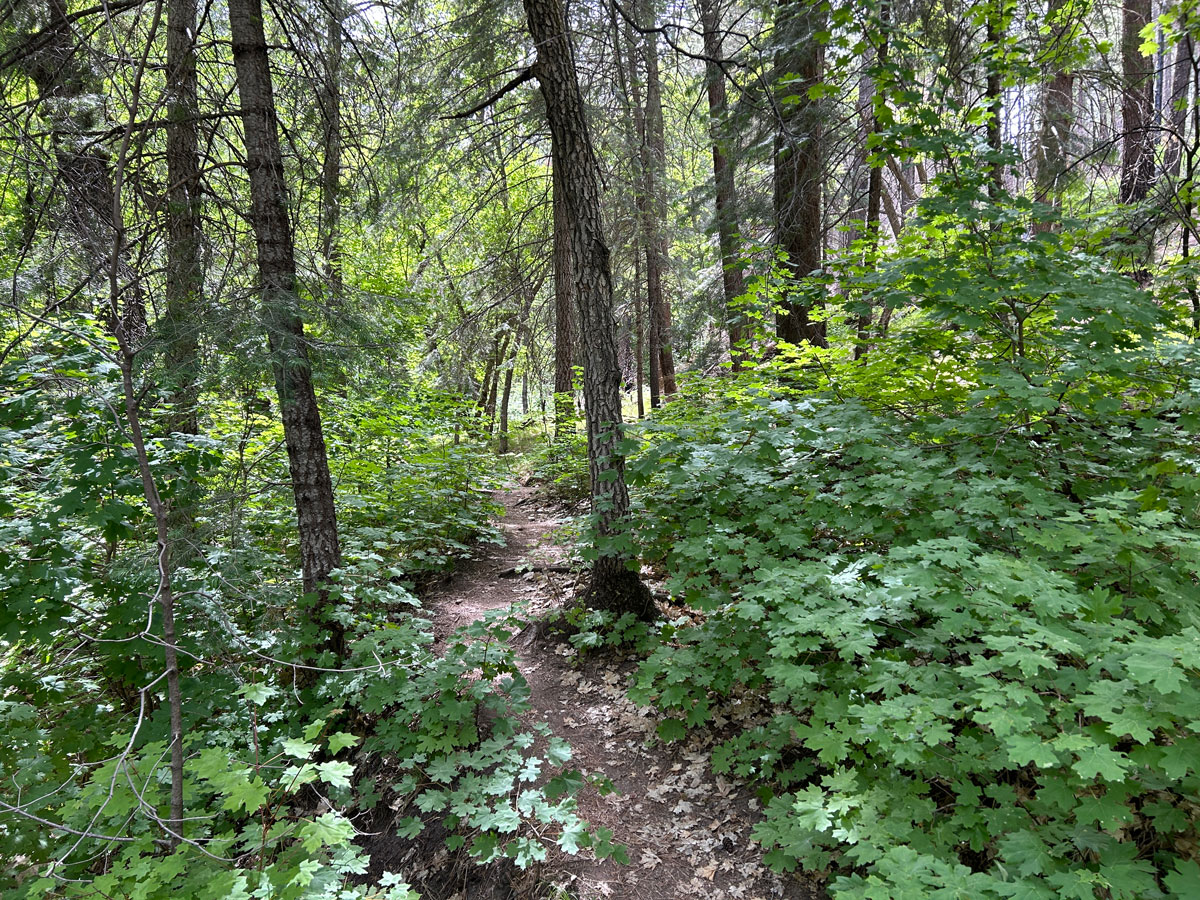
Marshall Gulch Loop
Why go: A classic high-elevation loop with dense pine forest, cool shade, and that “I cannot believe I’m still near Tucson” feeling.
- Typical distance: about 3 to 4 miles, loop
- Effort: easy to moderate
- Vibe: foresty, mellow, and family-friendly with plenty of shade.
- Best for: a summer morning reset or a quick post-brunch leg stretch in the pines.
- Parking: Marshall Gulch Trailhead. This area is popular, so arrive early on weekends, especially when Tucson is hot.
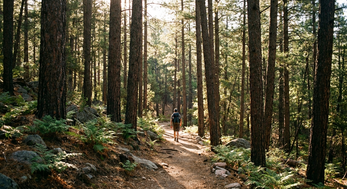
Butterfly Trail (out and back)
Why go: Big canyon views without committing to a full-day trek. Go as far as you like, then turn around when the sun or your schedule says so.
- Typical distance: 2 to 6 miles out and back, depending on your turnaround
- Effort: moderate (it can feel spicier in the sun)
- Vibe: airy switchbacks and expansive views, with a satisfying sense of space.
- Best for: dramatic clouds, especially during monsoon build-up (with safe timing and weather awareness).
- Parking: the Butterfly Trailhead area near the upper elevations. Trailhead parking can be limited.
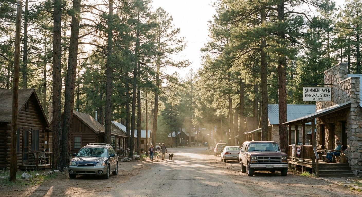
Meadow Trail in Summerhaven
Why go: A low-effort stroll that pairs perfectly with a coffee stop or a casual lunch in Summerhaven.
- Typical distance: about 1 mile round trip (varies with spurs)
- Effort: easy
- Vibe: easy, green, and relaxed.
- Best for: travelers easing into altitude, families, and anyone who wants “forest time” without a workout.
- Parking: Summerhaven street and small lots near the trail access. It can fill on peak weekends.
Short walks near Ski Valley
Why go: The highest elevations you can easily reach by car. Even a short wander here can feel like stepping into a different season.
- Typical distance: choose-your-own, from 0.5 to 2 miles
- Effort: easy to moderate depending on terrain
- Vibe: high-country air, wide views, and quick access to trail segments.
- Best for: temperature relief and quick exploratory walks.
- Parking: around the Ski Valley base area. Usually straightforward, but special events and peak leaf or snow days can change that.
Half-day plans
Option A: Early drive, shady loop, treat after
- 6:30 to 7:30 am: Leave Tucson early to beat crowds and heat.
- Morning: Hike a shaded loop like Marshall Gulch.
- Late morning: Head to Summerhaven for a coffee and a snack. If you want a name to aim for, Cookie Cabin is a local classic. Then drive back before afternoon storms build.
Option B: Midday heat dodge
- Late morning: Drive up when Tucson is roasting.
- Midday: Choose an easy, high-elevation hike or a viewpoint walk at Windy Point or San Pedro Vista.
- Afternoon: Leave early if thunderheads start stacking up.
Option C: Monsoon drama, safely
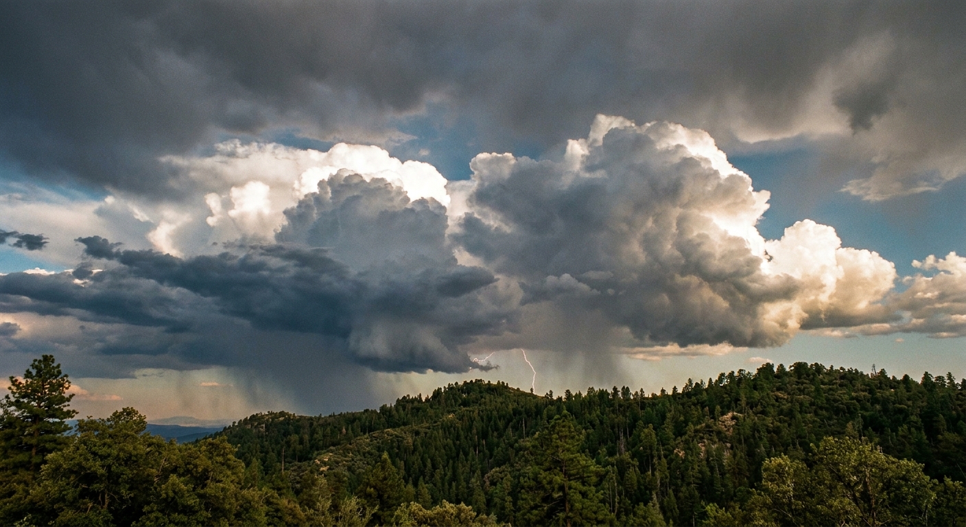
If you love storm watching, Mount Lemmon delivers. The trick is respecting how quickly conditions change.
- Go earlier: aim to hike in the morning.
- Watch the sky: if you hear thunder, you are already within striking distance.
- Pick safer terrain: avoid exposed ridgelines and isolated high points.
Parking etiquette
The corridor’s biggest headache is not the hiking. It is the parking, especially on weekends and holiday breaks.
- Arrive early: before 9 am is your best bet for popular trailheads in summer.
- Park legally: do not block gates, pullouts, or narrow shoulders. Emergency vehicles and road crews need space.
- Display your pass: visible on the dash per the instructions at the site.
- Keep it quiet: sound carries in forest basins. Let the wind and birds do the soundtrack.
- Pack it out: even food scraps. This is how we keep trails clean and wildlife wild.
Monsoon cautions
Monsoon season is gorgeous and dangerous in equal measure. The mountain can feel cool and calm, while a storm cell is building just over the ridge.
Lightning
High elevations increase your exposure. If you hear thunder, turn around. If your hair stands up or you feel static, get lower immediately and spread out from others.
Flash flooding
Even if you are not in a slot canyon, washes and drainage areas can surge quickly. Avoid hiking in or lingering around streambeds when storms are nearby.
Hail and sudden cold
Pack a light rain jacket and an extra layer, even in July. Temperatures can drop fast when storms hit.
Road hazards
Drive slowly in heavy rain. Watch for rockfall, fallen branches, and mud on curves. Give cyclists extra room.
My rule: if I would be disappointed to get stuck on the mountain for a few hours, I do not go up on a day with aggressive afternoon storm forecasts.
What to pack
- Water: more than you think you need, even in cool air.
- Sun protection: hat, sunglasses, sunscreen.
- Light layers: a windbreaker or rain jacket and a warm layer for higher elevations.
- Traction-ready shoes: trails can be dusty, rocky, or muddy after storms.
- Snacks: especially if you plan to linger at viewpoints.
- Offline map: download before you lose signal.
- Small cash: for fee envelopes or quick stops depending on the season.
Pack light but smart. Think functional layers, no duplicates, nothing heavy you will resent on switchbacks.
Leave no trace
Mount Lemmon gets loved hard in summer. A few small choices make a big difference.
- Stay on trail: shortcuts create erosion quickly in steep terrain.
- Respect wildlife: do not feed animals, and store food securely. Yes, that includes keeping snacks out of reach in the car when you stop.
- Keep dogs leashed: for wildlife, other hikers, and your dog’s safety in stormy conditions.
- Choose reusables: refillable bottle, reusable snack bag, and a small trash bag.
Quick FAQ
How long does it take to drive up from Tucson?
Depending on where you start in Tucson and your destination on the mountain, plan on roughly 45 to 90 minutes. Also, the Catalina Highway is notoriously winding. If you have passengers who get carsick (especially kids), pack water, snacks, and whatever normally helps, and consider a front seat strategy.
Is Mount Lemmon good for kids or beginner hikers?
Yes. Many trail options are short, shaded, and at cooler temperatures. Just remember altitude can make effort feel harder, so keep snacks and water flowing and do not be afraid to go slow.
Can I avoid crowds?
Go early, go midweek, or pick less-famous trailheads. Summer weekends can feel like the entire city had the same idea.
Do I need a high-clearance vehicle?
For the main Catalina Highway and common trailheads, a standard car is typically fine. For rough side roads, conditions vary and can change after storms.
The bottom line
If you are in Tucson and craving a reset that feels legitimately far away without actually being far away, the Mount Lemmon Scenic Corridor is your move. You get a mountain drive, cooler air, and short hikes that still deliver real forest energy. Start early, check conditions, pay attention to weather, and let the Sky Island do what it does best: make summer feel survivable again.