Mount Si to the Haystack

Maya Lin
Maya Lin is a travel journalist and outdoor enthusiast who believes the best trips combine rugged adventures with urban comforts. After spending six years backpacking across four continents, she founded Trail & Town Guide to help fellow travelers navigate both hidden mountain passes and bustling city neighborhoods with confidence.
Mount Si is one of those hikes I recommend with equal enthusiasm to two very different friends: the one who wants a classic Pacific Northwest grind through mossy forest, and the one who wants a big payoff view without committing to a remote alpine objective. The “Haystack” is the dramatic rock fin you see near the top, and the most important part of planning this outing is deciding where you will turn around: at the official Mount Si viewpoint, or on the more serious (and optional) Haystack scramble.
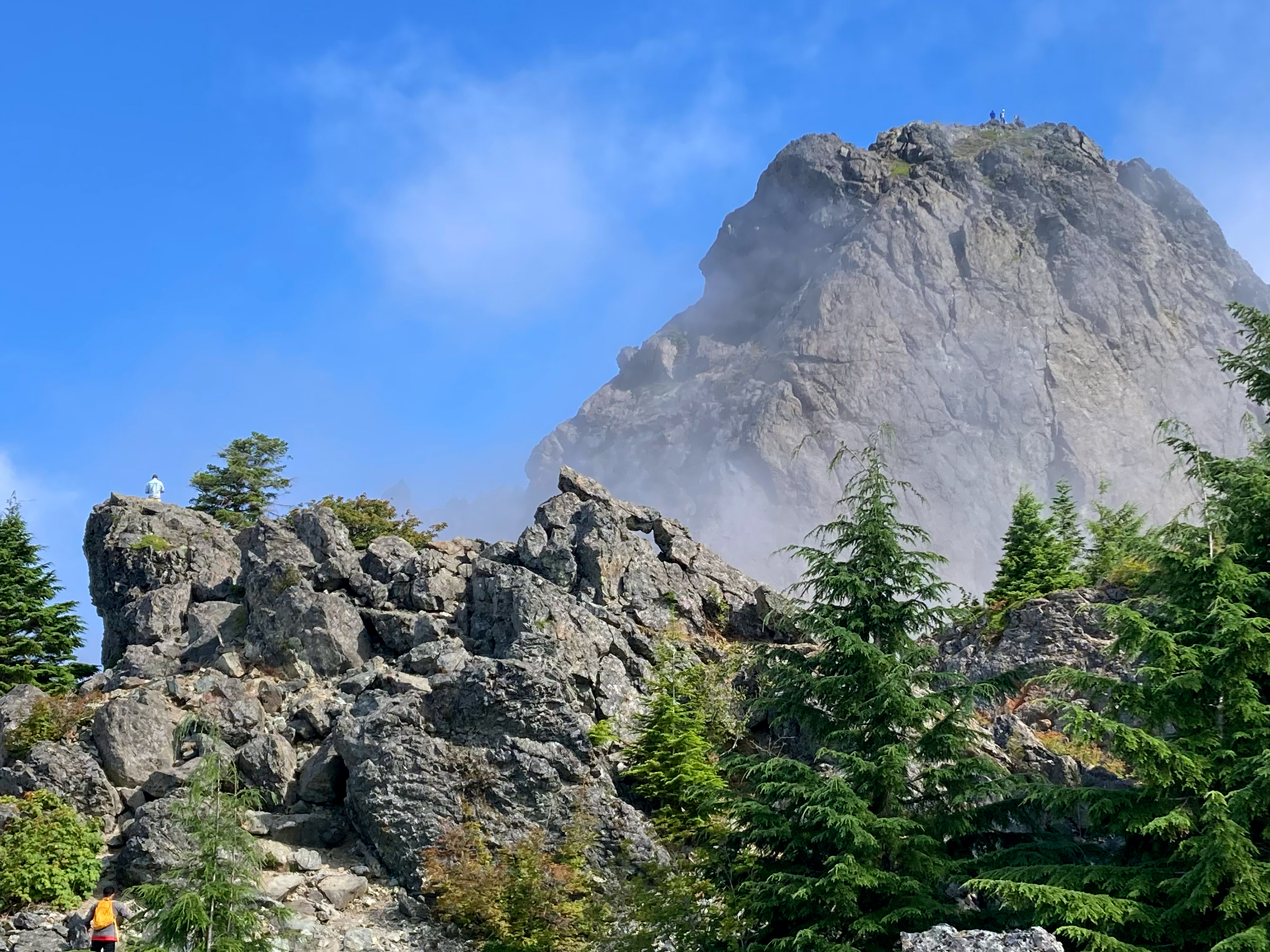
At a glance
- Trail: Mount Si Trail (Mount Si Natural Resources Conservation Area, near North Bend, Washington)
- Round-trip distance: about 8 miles to the official viewpoint (out and back, but your GPS may vary)
- Elevation gain: about 3,150 feet (varies by device and exact turnaround point)
- Time: many hikers take 4.5 to 7 hours, and it can swing widely with fitness, breaks, conditions, and crowds
- High point without scrambling: the signed, rocky Mount Si viewpoint
- Optional add-on: the Haystack scramble (shorter in mileage than you expect, bigger in consequence than it looks)
Quick clarity: Little Si and Teneriffe Falls are different trailheads with different routes. I am leaving those hikes off this page so you can focus on the Mount Si to Haystack plan.
Getting there and parking
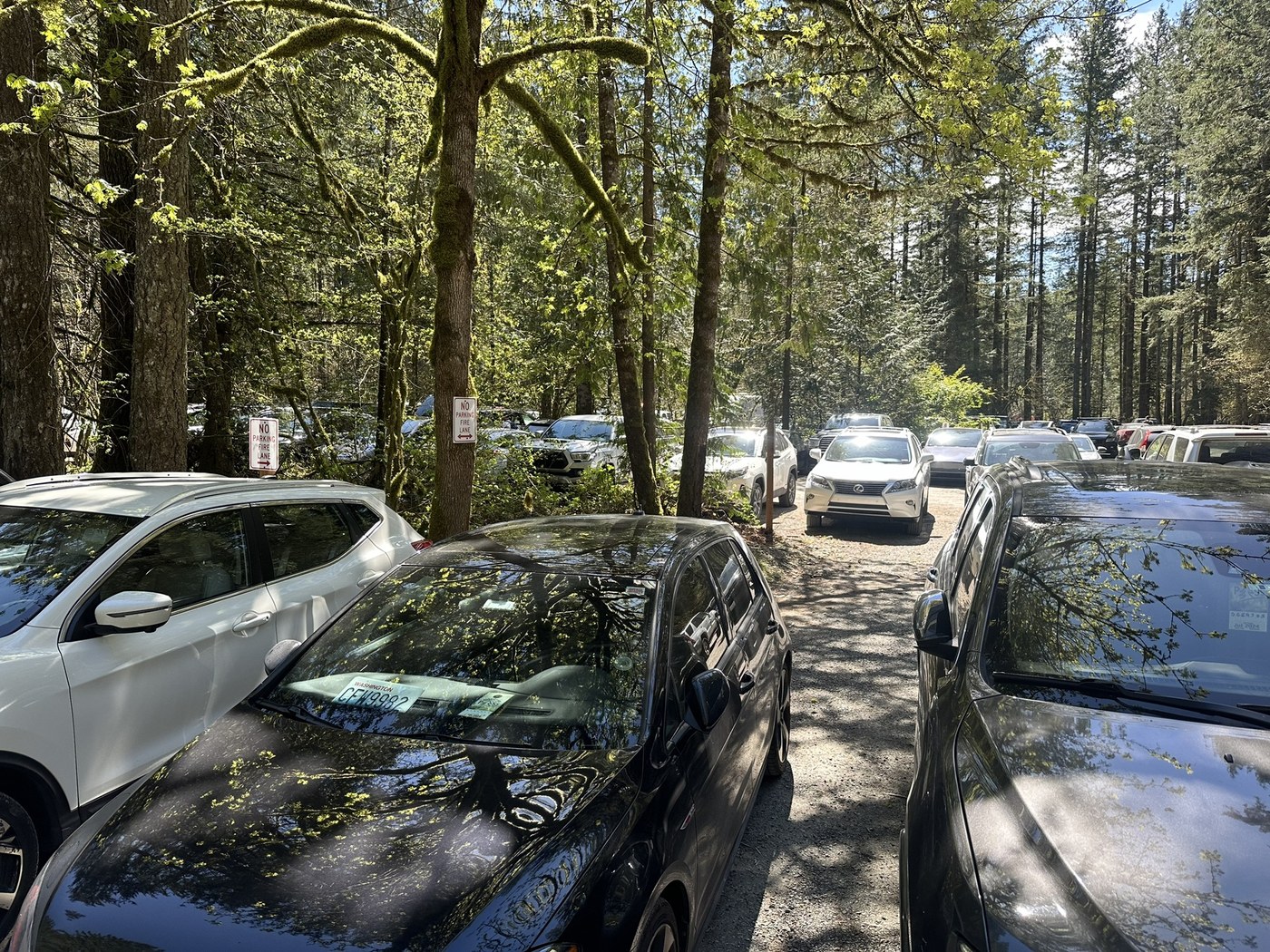
The Mount Si trailhead sits just outside North Bend and is popular year-round. On sunny weekends, it can feel like half of Seattle had the same idea.
Parking basics
- Where: Mount Si Trailhead parking lot (Mount Si NRCA, near North Bend)
- When to arrive: for weekends and summer evenings, I aim for before 9 a.m. if I want a stress-free spot
- Overflow: if the main lot fills, you may see informal overflow parking nearby. Be picky: park legally, do not block gates, and do not assume a shoulder is “fine” if signage says otherwise
Passes and fees: Mount Si is managed as a Washington DNR Natural Resources Conservation Area, and it is typically a Discover Pass area. Policies can change, so confirm the current requirement before you go.
Trail basics
- Restrooms: there are restrooms at the trailhead. Do not count on facilities higher up.
- Water: plan to carry what you need. Do not assume you will find reliable, treatable water on this route.
- Cell service: it can be spotty. Download your map before you leave town.
To the official viewpoint
The Mount Si trail is straightforward navigation-wise: a well-maintained, heavily used path that climbs steadily through forest with a few classic Pacific Northwest switchbacks. The challenge is not route-finding. It is the relentless elevation gain.
What it feels like
- Lower section: packed dirt and roots, typically damp, often muddy in shoulder seasons
- Middle section: sustained climbing, switchbacks, and the feeling that the grade never quite lets up
- Upper section: rockier footing as you approach the viewpoint. Expect polished rock when wet and occasional bottlenecks where hikers pass
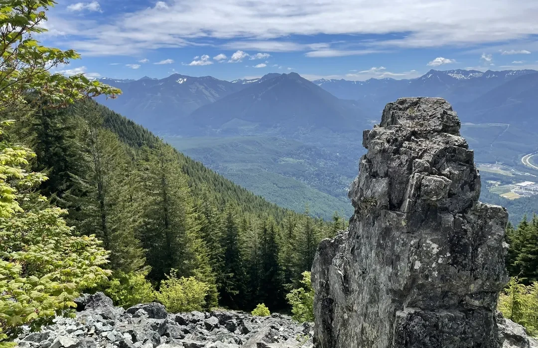
You will know you are near the end when the forest thins and the trail starts to step up over larger rocks. The official viewpoint is a well-known stopping point with expansive views on a clear day.
Haystack choice
Here is my honest take: the official Mount Si viewpoint is a complete hike. If you stop there, you still get the workout, the sense of arrival, and the classic view. The Haystack scramble is optional, and it is where the tone shifts from “popular hiking trail” to “hands-on rock problem with real exposure.”
What the Haystack is
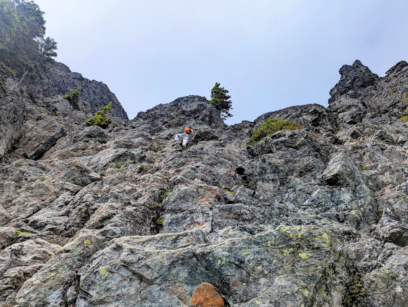
The Haystack is the iconic rock fin near the top of Mount Si. To get closer (and especially to climb higher on it), you leave the comfort of the maintained trail and move onto steep, uneven rock where a slip can have serious consequences.
Where the scramble begins
From the viewpoint area, you will see obvious boot paths continuing upward toward the Haystack. This is the transition: you are no longer on the same maintained hiking tread, and the terrain becomes steeper, rockier, and more “choose your own line.” If you find yourself needing your hands for balance, feeling exposed, or wondering where the trail went, treat that as your cue that you are in scramble territory. Turning around here is a solid decision, not a failed one.
Who should stop at the viewpoint
- Anyone hiking with kids who are not experienced with exposed scrambling
- Anyone uncomfortable with heights, exposure, or using hands for balance
- Anyone in trail runners or worn-out footwear with questionable traction
- Anyone hiking in rain, snow, or ice, or when the rock is wet and slick
- Anyone arriving late in the day when you are likely to descend in fading light
- Anyone feeling cooked at the viewpoint. The descent is long, and tired legs are when ankle rolls happen
When the Haystack makes sense
- You have scrambling experience and can stay calm with exposure
- Conditions are dry and you have solid traction
- You are comfortable with route choice and turning around if it does not feel right
- You understand it is not a “summit on a trail” situation. It is a risk decision
My rule: if you are asking yourself, “Is this sketchy?” treat that as useful information, not a challenge. There is zero shame in calling the viewpoint your finish line.
Turnarounds
If you want a great day out without committing to exposed scrambling, you have a few sensible turnaround points. I like to decide these before I start climbing, because summit fever is real on Mount Si.
- Turnaround 1: before the final rocky steps if the upper trail is crowded, slick, or you feel unstable
- Turnaround 2: the official viewpoint (the best “full experience” stop for most hikers)
- Turnaround 3: a conservative approach toward the Haystack where you can get a closer look and photos, then back off before the scramble feels committing
If you are hiking in shoulder season, this is also where snow patches and thin ice can linger. Microspikes can be helpful in the right conditions, but they are not a magic fix for exposed scrambling.
What to pack
Mount Si is close to town, but it is still a steep mountain hike that can swing from warm at the trailhead to windy and cold at the top. “Carry-on-only energy” here means: bring fewer things, but make them the right things.
- Traction-forward footwear: grippy trail shoes or boots
- Layers: a light insulating layer plus a rain shell
- Water: enough for a sustained climb. Many people bring 1.5 to 2+ liters
- Food: something you will actually eat when you are tired
- Navigation: downloaded offline map, even on a popular trail
- Headlamp: especially outside long summer daylight
- Trekking poles: optional on the way up, amazing on the way down
Conditions and safety
- Rain: roots and rock get slick fast. Expect slower travel time.
- Winter and early spring: snow and ice can linger near the top. The “easy” trail can become a slip hazard.
- Crowds: yield politely, be patient at bottlenecks, and avoid knocking rocks loose above other hikers.
- Rockfall and congestion near the rocks: once people spread out toward the Haystack, there is more loose rock potential. Give space, do not climb directly above other hikers, and be extra conservative if it is busy.
- Helmets: you will see plenty of people without one, but if you choose to go onto steeper rock and you own a helmet, it is not an unreasonable choice.
- Dogs: plenty hike with dogs, but consider paw traction and crowd stress. I would not bring a dog onto exposed scrambling terrain.
Mount Si is popular for a reason. That popularity can create a false sense of security. Stay within your comfort zone, and treat the Haystack as optional, because it is.
Leave No Trace note: with crowds, small choices add up. Stay on durable surfaces near the top, do not shortcut switchbacks, pack out your trash (and yes, tissues), and keep the viewpoint area from turning into a widened sprawl.
North Bend after
This is where my Trail and Town brain is happiest. After a steep descent, North Bend is close enough to make a hot drink and a real meal feel like part of the itinerary, not an afterthought.
- Coffee: pick a local spot in North Bend for something warm before you get back on the highway
- Food: aim for carbs and salt. You earned both
- Recovery: give yourself 10 minutes in the parking lot for a slow stretch. Your knees will thank you
FAQ
Is the Haystack the true summit?
Most people treat the official viewpoint as their endpoint, and that is a completely legitimate finish line. The Haystack is a prominent feature near the top, but the true high point is not reached by the maintained trail and involves additional off-trail travel and scrambling decisions. If your goal is “a great Mount Si day,” the viewpoint delivers. If your goal is “the highest point,” do more homework than a casual trail guide can responsibly cover.
Do I need climbing gear for the Haystack?
Most hikers who go beyond the viewpoint do so without technical climbing gear, but that does not mean it is low-risk. If you are not already confident in exposed scrambling, the right move is to stop at the viewpoint.
Are Little Si and Teneriffe Falls on the same route?
No. Little Si and Teneriffe Falls start from different trailheads and follow different routes. This page focuses only on Mount Si to the Haystack area.