North Rim Grand Canyon: Short Day Hikes When the Road Is Open
Maya Lin
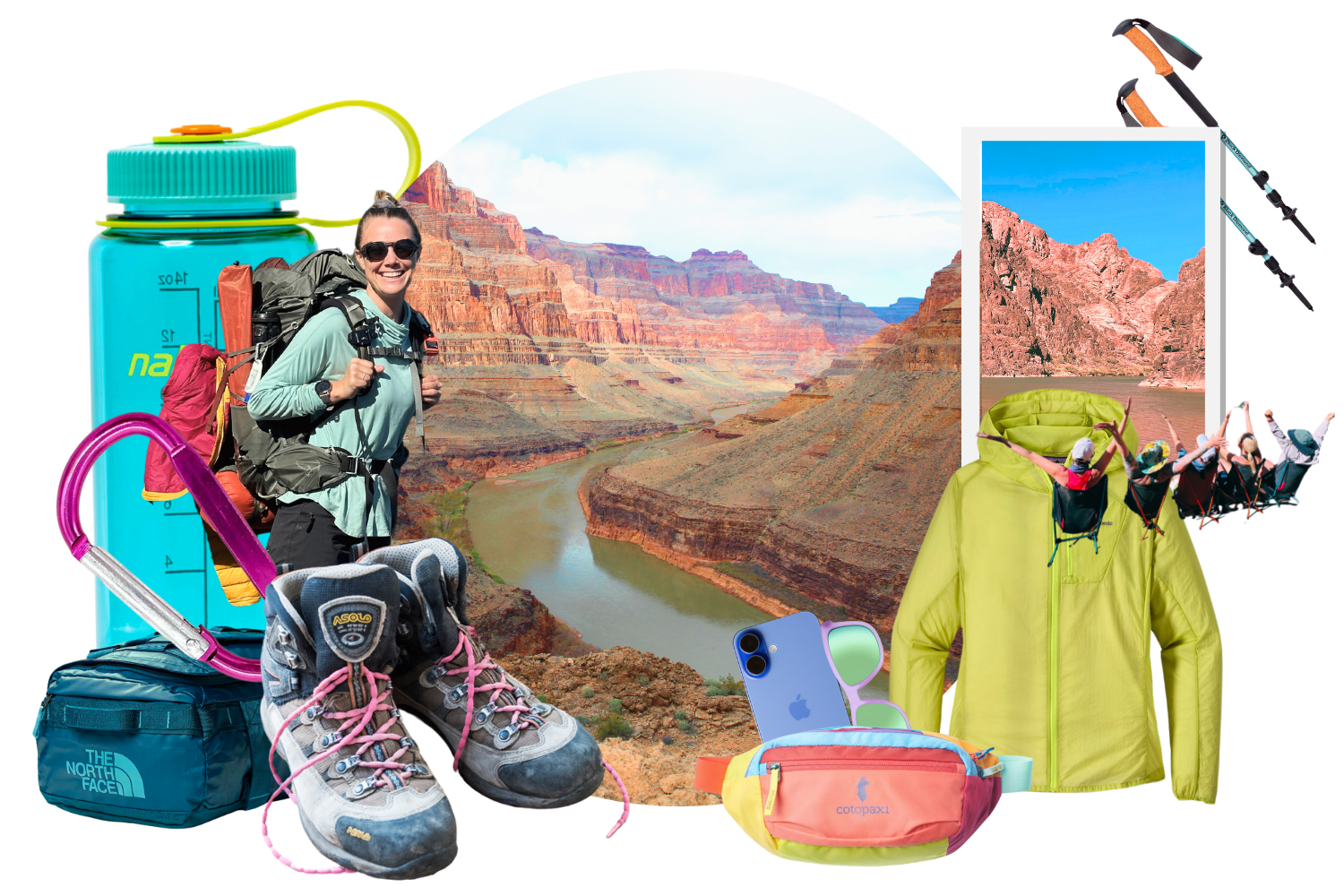
Maya Lin is a travel journalist and outdoor enthusiast who believes the best trips combine rugged adventures with urban comforts. After spending six years backpacking across four continents, she founded Trail & Town Guide to help fellow travelers navigate both hidden mountain passes and bustling city neighborhoods with confidence.
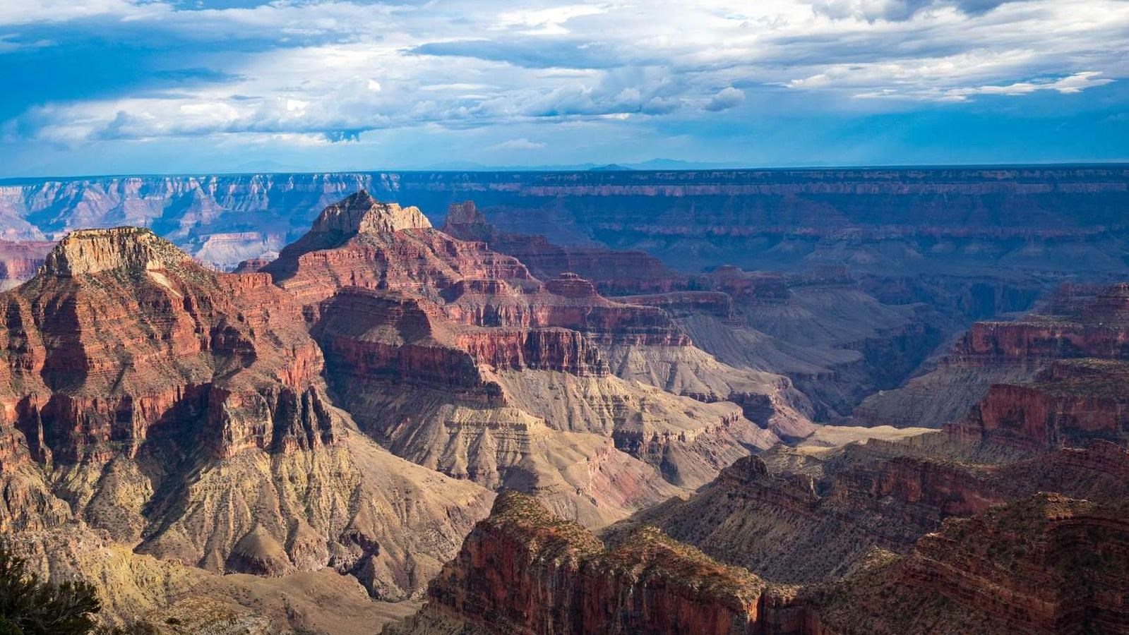
The North Rim feels like the Grand Canyon’s quieter, pine-scented alter ego. When the road opens for the season, you get cooler air, fewer crowds, and views that feel somehow more intimate, even though the canyon is still doing its endless, jaw-dropping thing.
This guide focuses on short day hikes that stay under roughly 6 miles round trip, with elevation reality checks (because “short” can still mean “spicy”), plus the practical stuff that makes or breaks a North Rim day: where to stay, where to fuel up, and what the seasonal closures actually mean for your plans.
Before you pick a trail
Road open dates and the winter closure reality
North Rim access is seasonal. AZ-67 (the main park road) is usually open May 15 to October 15, but the exact dates can shift with snow and weather. After closure, you cannot drive to the North Rim facilities. Services shut down, and the area becomes a snowbound, backcountry-style zone only reachable by long approaches. Plan your North Rim day hikes for the open season, and always confirm current status before you go.
- Always verify road status and trail conditions on the National Park Service Grand Canyon North Rim page before departure.
- Shoulder season tip: early and late season can bring icy trail patches and cold winds on exposed viewpoints, even on an otherwise sunny day.
- Services note: even when the road is open, some services (lodging, dining, visitor services) can run seasonally and may be limited early or late in the season.
“Short” hikes and elevation: what to expect
On the rim, many of the best viewpoints are reached by short trails with modest ups and downs. The moment you start dropping into the canyon, the math changes. Descents feel easy until the return climb stacks up in the sun and thin air.
- Rim-level viewpoints: the North Rim sits around 8,000 feet (often a bit higher depending on the viewpoint). Expect breathy legs if you came from sea level.
- Into the canyon: even a 3 to 6 mile outing can include sustained uphill on the return.
- Heat note: the North Rim is often cooler than the South Rim, but inner canyon temps can still be dramatically hotter.
Quick logistics that save the day
- Fuel: do not assume you can top off “in the park.” Fuel availability is limited and seasonal. Many visitors fill up at Jacob Lake before heading to the rim.
- Water: carry your own. Water is not reliably available on most trails, and even developed water spigots can be shut off seasonally. Check the NPS water updates before you go.
- Navigation: download maps offline. Cell service can be spotty.
- Getting around: expect to drive yourself to most trailheads and viewpoints. The North Rim does not have the same shuttle setup as the South Rim.
- Time buffer: sunset comes faster than you think when you are lingering at viewpoints.
The best short North Rim day hikes (under ~6 miles)
Distances and elevation vary slightly by mapping app and exact turnaround point. Consider these practical ranges, not courtroom testimony.
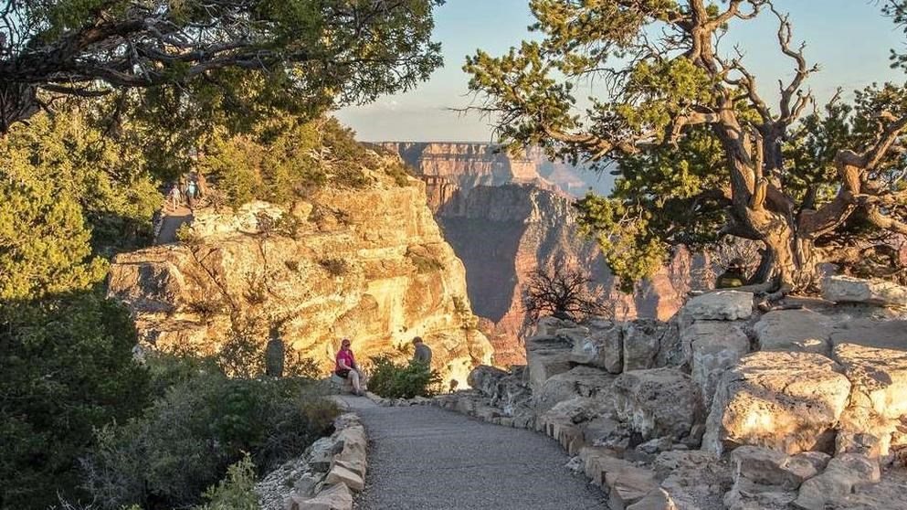
Bright Angel Point
Why go: the classic North Rim viewpoint walk, big payoff for minimal mileage. You get a dramatic promontory with wide open canyon layers and that “I cannot believe this is real” feeling within minutes.
- Distance: about 0.5 miles round trip (paved main walk to the viewpoint)
- Elevation: modest, with some paved and some uneven sections
- Good for: first-timers, sunrise, families with older kids
- Reality check: there are drop-offs and rails are not everywhere. Stay alert, especially with wind.
Transept Trail
Why go: a mellow forest walk that still sneaks in canyon glimpses over Transept Canyon. If you want a quieter, less exposed option (or a midday leg-stretcher between viewpoints), this is a great pick.
- Distance: roughly 3 miles round trip depending on turnaround
- Elevation: gentle grades with rolling ups and downs
- Good for: shade lovers, birders, anyone acclimating to altitude
- Reality check: the “wow” factor is subtler than the point-to-point overlooks, but it is calming in the best way.
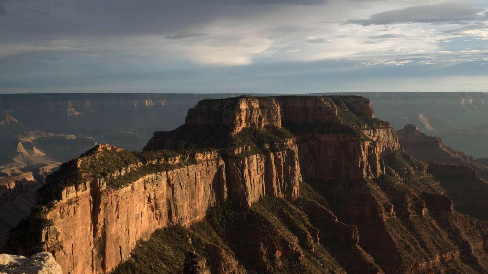
Cape Royal
Why go: one of the biggest viewpoint payoffs on the North Rim with a very short walk from the parking area. If you only do one “drive and stroll” stop, this is a strong contender.
- Distance: about 0.6 miles round trip (to the main viewpoint)
- Elevation: minimal
- Good for: sunset, photographers, anyone short on time
- Reality check: the access road to Cape Royal is seasonal and can close earlier than you expect during storms or maintenance. Check day-of conditions.
Cliff Springs (Cape Royal area)
Why go: a short trail with a different vibe: limestone, forest, and a spring area that feels surprisingly intimate compared to the huge overlooks. This is a nice contrast hike when you have already taken in a few big rim views.
- Distance: about 1 mile round trip (out-and-back to the spring area)
- Elevation: moderate for the distance, with some uneven footing
- Good for: a quieter walk, shade, and variety
- Reality check: springs can be sensitive environments. Stay on trail, do not contaminate water, and keep snacks secured.
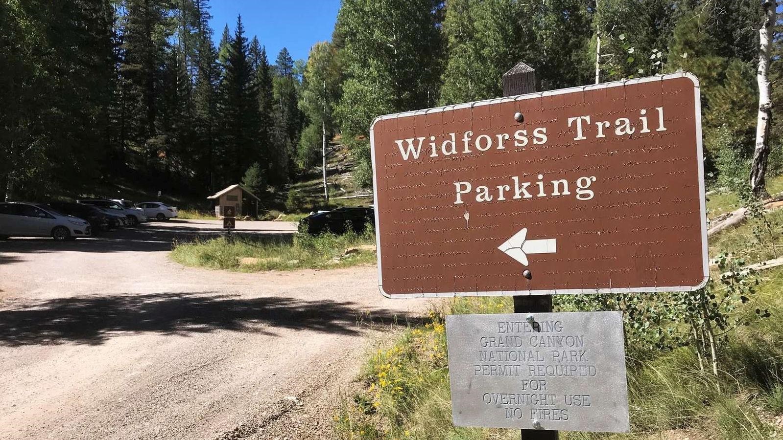
Widforss Trail (to a sensible turnaround)
Why go: one of my favorite “choose your own adventure” North Rim walks. The full trail is longer, but you can hike out to a viewpoint and turn around well under 6 miles while still getting a remote, airy canyon feel.
- Distance: choose 2 to 6 miles round trip by turning around at a viewpoint that feels satisfying
- Elevation: mostly gentle, with a few rolling climbs
- Good for: people who want space, a longer forest walk, and fewer crowds
- Reality check: carry water and a layer. This trail can feel cooler and breezier than you expect in the trees and near open points.
North Kaibab Trail (quick taste, not a sufferfest)
Why go: this is the iconic corridor into the canyon from the North Rim. You do not have to go far to feel the scale shift beneath your feet.
- Distance: choose a turnaround and keep it honest
- Easy option: to Coconino Overlook (about 1.5 miles round trip)
- Moderate option: to Supai Tunnel (about 4 miles round trip)
- Elevation: the return is uphill. Always.
- Good for: experienced hikers who want to step below the rim without committing to a huge day
- Reality check: pick a strict turnaround time. The canyon will happily lure you deeper, and it can be much hotter just a little lower.
If you are debating “one more switchback,” turn around while you still feel strong. Your future self climbing back to the rim will be grateful.
Elevation and effort
Use this to match your day to your legs, not your optimism.
- Easiest payoff: Bright Angel Point, Cape Royal
- Easy to moderate strolls: Transept Trail, Widforss (short turnaround)
- Moderate with uneven footing: Cliff Springs
- Most effort for the miles: North Kaibab (any descent means a climb back)
Where to stay
On the North Rim
If your goal is sunrise on the rim, short hikes before breakfast, and zero stress about long drives, staying on the North Rim is the dream. You can roll into Bright Angel Point with coffee in hand and be back before the day-trippers arrive.
- Pros: unbeatable convenience, golden hour access, cooler nights
- Cons: limited availability, seasonal operations, fewer dining and shopping options
Near the North Rim (realistic gateway bases)
If you cannot snag rim lodging, these nearby areas are common bases during North Rim season. You still get an early start without turning your day into a highway endurance event.
- Jacob Lake: close-ish, practical, and a popular “fuel up first” stop.
- Fredonia: more services, still within a reasonable drive.
- Kanab (UT): more lodging and food options, often a good choice if North Rim availability is thin.
Tusayan (South Rim base) and visiting the North Rim
Tusayan is the hotel hub just outside the South Rim entrance, and it is excellent for South Rim access. But as a base for North Rim day hikes, it is a long haul. Expect a multi-hour drive each way, and you will spend more time on pavement than on trail.
- Pros: lots of lodging choices, more year-round services, easy South Rim access
- Cons: very long day to reach the North Rim, sunrise and sunset become tough, fatigue adds up
My honest take: if your heart is set on North Rim hiking, prioritize the North Rim or a nearby gateway base during the open season. Use Tusayan for a separate South Rim-focused trip.
Split your trip
If you want both rims without sprinting through either, consider a split stay. Do a couple of South Rim hikes, relocate, then enjoy a slower North Rim day with sunset at Cape Royal and a short morning walk to Bright Angel Point.
Pack like you mean it
- Water: at least 1 to 2 liters for short rim walks, more if you drop below the rim
- Layers: wind shell plus a warm layer. Rim weather changes fast.
- Traction: early and late season can mean ice in shady spots
- Sun protection: hat, sunglasses, sunscreen. High elevation sun is sneaky.
- Snacks: salty and quick. Think trail mix, jerky, bars.
- Headlamp: yes, even for “short” hikes. Viewpoints plus sunset is a classic time trap.
Easy North Rim day plan
If you want a simple, low-stress day built around short hikes, here is a flow that works well during the open season.
- Morning: Bright Angel Point for cool air and softer light.
- Late morning: Transept Trail for a shaded walk and a calmer pace.
- Afternoon: rest, lunch, and a short nap or coffee break. The North Rim is made for slow travel.
- Golden hour: drive to Cape Royal for sunset, then add a short out-and-back on Widforss if you want extra steps.
If you want to dip below the rim, swap Transept for a controlled North Kaibab out-and-back (Coconino Overlook or Supai Tunnel), and keep your turnaround conservative.
Safety and stewardship
- Stay back from edges: crumbly rock and sudden gusts are a real combination.
- Lightning note: July through September can bring fast-building thunderstorms. If you hear thunder, get away from exposed viewpoints and ridgelines.
- Respect wildlife: do not feed animals. Secure food, especially around viewpoints and picnic areas.
- Leave No Trace: pack out everything, including fruit peels and tissues.
- Know your limits: altitude plus heat plus sun can sneak up fast, even on “short” days.
- Pets and permits: day hiking does not require a permit, but overnight backcountry trips do. Pets are allowed on some rim trails if leashed, but are generally not allowed below the rim on corridor trails like North Kaibab. Confirm current pet rules on the NPS site before you go.
Quick FAQ
Is the North Rim less crowded than the South Rim?
Generally yes, especially on weekdays and outside peak summer weekends. Iconic viewpoints can still get busy, but the overall vibe is calmer.
Can I do these hikes if I only have half a day?
Yes. Bright Angel Point and Cape Royal give huge views for minimal time, and you can add one short forest trail if you have extra hours.
What if the road is closed?
If AZ-67 is closed for the season, you cannot drive to the North Rim facilities. In that case, pivot to the South Rim or plan a future North Rim trip during the open window.