Olympic National Park: Rainforest, Ridge, and Coast
Maya Lin
Maya Lin is a travel journalist and outdoor enthusiast who believes the best trips combine rugged adventures with urban comforts. After spending six years backpacking across four continents, she founded Trail & Town Guide to help fellow travelers navigate both hidden mountain passes and bustling city neighborhoods with confidence.
Olympic National Park is the rare place where you can walk under dripping, mossy giants in the morning, climb into alpine views by lunch, and end the day watching surf explode against sea stacks. The catch is that Olympic is big, the roads are slow, and the “three ecosystems” you came for are spread out like a choose-your-own-adventure book with a lot of driving between chapters.
This guide is built for day hikers who want the iconic Olympic experiences without turning their trip into a logistics headache. I will walk you through the best trails in the Hoh Rainforest, Hurricane Ridge, and the Pacific coast, then help you pick a base town (Port Angeles or Forks) that fits your vibe, budget, and appetite for good coffee.
Before you go: how Olympic works
Why it feels complicated
- No road cuts through the middle. You travel around the park’s edges on Highway 101, then branch into valleys and beaches on spurs.
- Drive times are real. A “short” 40-mile hop can take well over an hour on two-lane roads, plus stops for elk, fog, and pullouts you cannot skip.
- Weather changes fast. The coast can be windy and clear while the rainforest is raining and Hurricane Ridge is socked in.
Fees, passes, and basics
- Entrance fee: Olympic charges a standard National Park entrance fee (check the current price on the NPS site). An America the Beautiful pass can be a great deal if you are visiting multiple parks. The pass covers entry, not special reservations or backcountry permits.
- Permits and reservations: Most day hikes do not require permits. Overnight backcountry trips do. Lodging and campgrounds can require reservations in peak season, and popular spots book out early.
- Cell service: Spotty to nonexistent once you leave town. Download offline maps and save your lodging confirmation screenshots.
- Road notes: The Hoh Rainforest is accessed by Upper Hoh Road, which dead-ends at the visitor area. Hurricane Ridge is accessed via Hurricane Ridge Road from Port Angeles.
- Tide planning: For beach walks that involve rounding headlands or rocky points, check a tide table. Aim for low tide and do not push it.
Check NPS alerts before you drive. Hurricane Ridge road access, hours, and services can change seasonally (snow) and from year to year (construction and reduced facilities). Summer traffic can also mean long lines at the Hoh entrance and crowded parking at Hurricane Ridge. Use the Olympic NPS “Alerts” page the morning you go.
When to go (quick seasonal reality)
- Rainforest: Open year-round, best light and fewer crowds in shoulder season. Expect wet trails anytime.
- Hurricane Ridge: Best for classic hiking in summer and early fall. In winter and spring, snow travel, chains requirements, and closures are common.
- Coast: Dramatic all year. Summer is calmer and busier; winter is stormy and spectacular, but conditions can be more hazardous.
Quick orientation: where you are coming from
- From Seattle: Port Angeles is usually the smoothest first base (ferry or Tacoma Narrows route), then shift west to Forks if you want rainforest and beaches without long day trips.
- From Portland: You might enter from the south or southwest. Consider a first night near the coast (Kalaloch area) or west side, then loop north to Port Angeles if Hurricane Ridge is on your list.
Olympic rewards slow travel. If you can give it two or three nights, you will spend less time gripping the steering wheel and more time actually hiking.
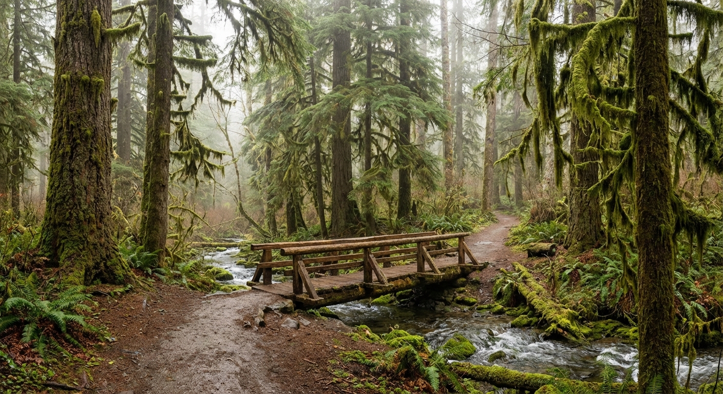
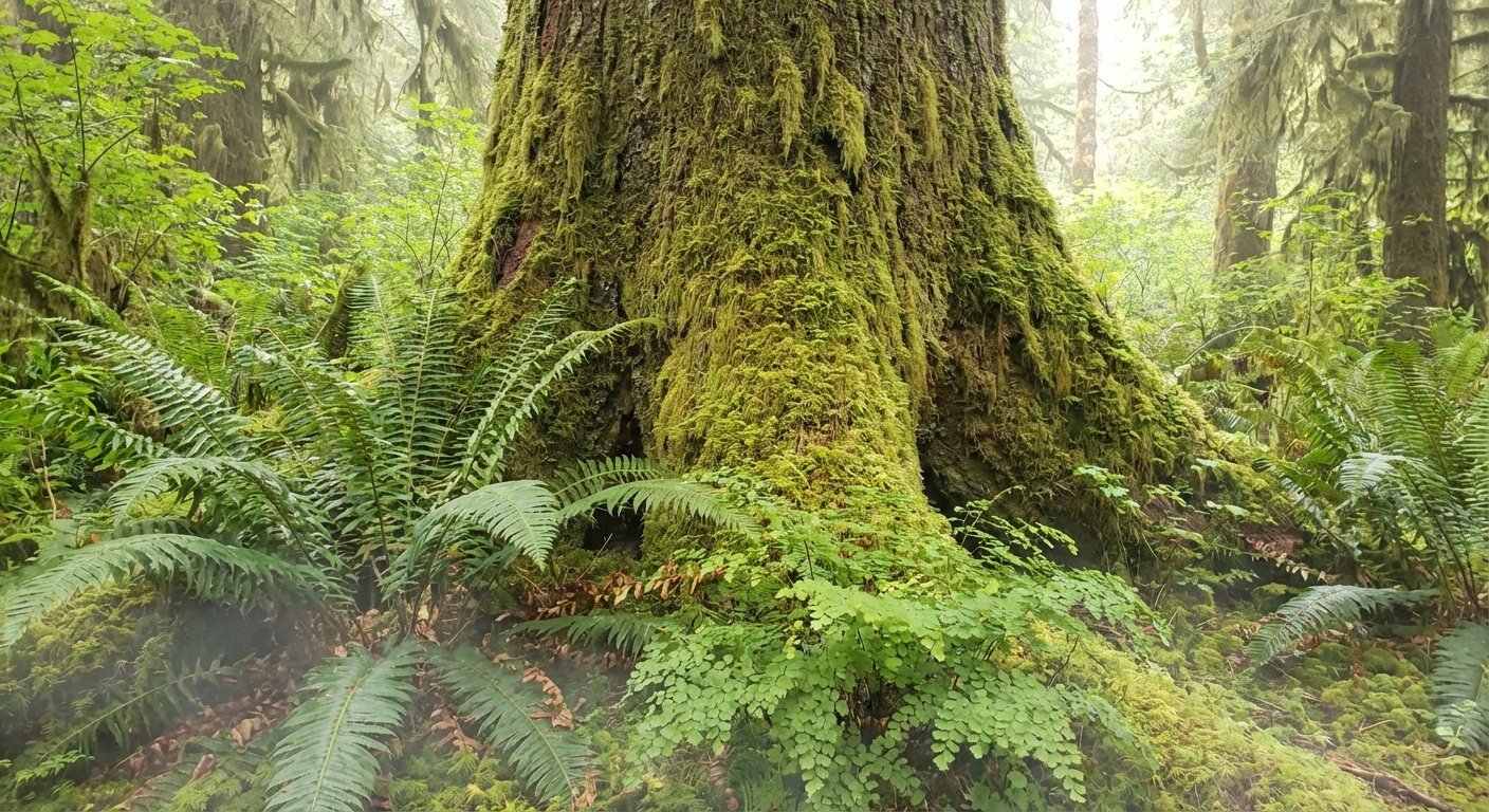
Zone 1: Hoh Rainforest
The Hoh is Olympic’s green cathedral: Sitka spruce draped in moss, ferns at every angle, and that rainforest hush where even your footsteps sound louder. It is also one of the most popular corners of the park, so timing matters.
Trail picks in the Hoh
-
Hall of Mosses Trail (easy loop)
- Distance: ~0.8 mile loop
- Elevation: mostly flat
- Time: 30 to 60 minutes
- Start: Hoh Rain Forest Visitor Center area
- Notes: Short, iconic, and often busy. Surfaces are generally well-maintained and commonly considered one of the more accessible walks in this zone, but conditions vary by season and maintenance.
-
Spruce Nature Trail (easy loop)
- Distance: ~1.2 miles
- Elevation: mostly flat
- Time: 45 to 90 minutes
- Start: Hoh Rain Forest Visitor Center area
- Notes: Often quieter than Hall of Mosses and has river views. Great in light rain when the forest looks extra saturated.
-
Hoh River Trail to Five Mile Island (moderate out-and-back)
- Distance: ~10 miles round trip
- Elevation: ~200 to 500 feet (gentle, rolling)
- Time: 4 to 6 hours
- Start: Hoh River Trailhead (near the visitor area)
- Notes: My go-to for a “real hike” without an all-day commitment. Deep rainforest vibes and big valley scale.
Hoh pro tips
- Arrive early. Parking can fill, especially on summer weekends. In peak season, you may also hit a wait at the entrance station.
- Pack for wet. Even on “dry” days, the Hoh is humid and drippy. A rain shell and a dry bag for electronics are worth it.
- Food storage: Do not leave food visible in your car at trailheads. Use proper food storage and keep a clean vehicle to avoid wildlife problems.
- Look for wildlife, respectfully. Roosevelt elk sometimes show up in meadows and along the road. Give them space and keep voices low.
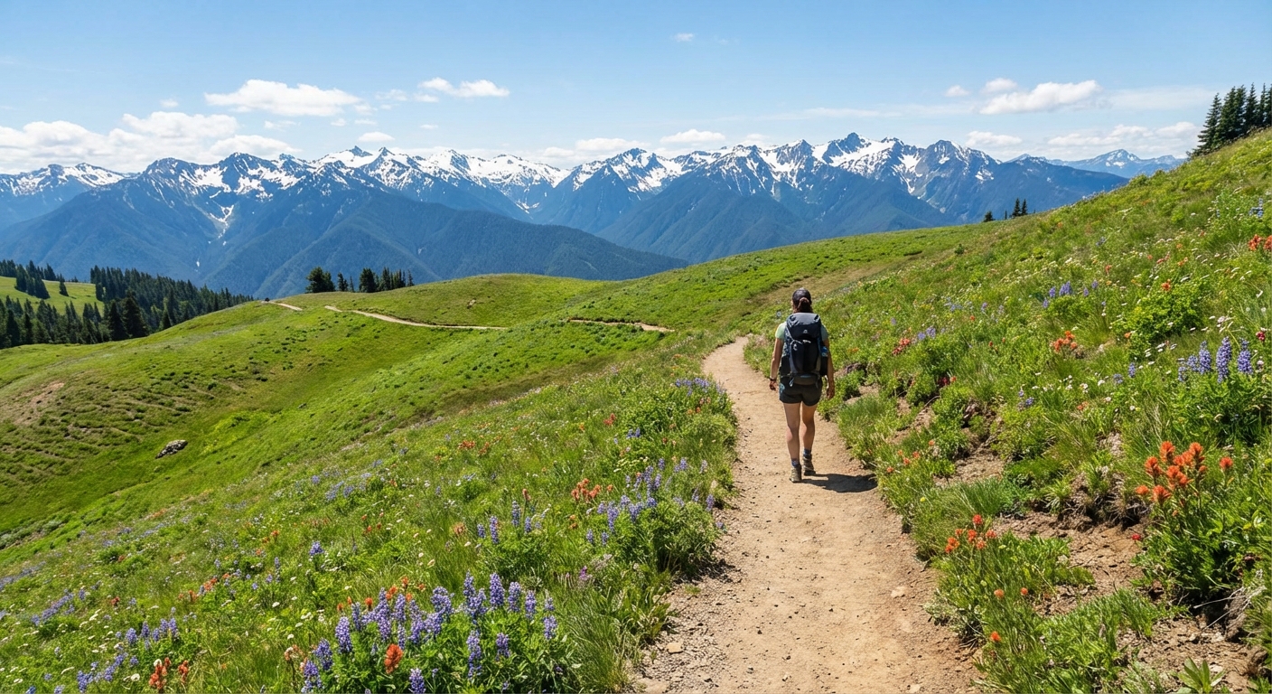
Zone 2: Hurricane Ridge
Hurricane Ridge is the fastest way to go from coffee shop to alpine air. The views on a clear day are unreal: layered ridgelines, sharp peaks, and the kind of light that makes you stop mid-sentence. Because access is straightforward from Port Angeles when the road is open, this area is perfect for a half-day hike that still feels like a big mountain experience.
Trail picks at Hurricane Ridge
-
Hurricane Hill (moderate out-and-back)
- Distance: ~3.2 miles round trip
- Elevation: ~700 feet
- Time: 1.5 to 3 hours
- Start: Hurricane Ridge Visitor Area trailhead
- Notes: A classic with big payoff for moderate effort. Often considered a good option for a wide range of hikers, but wind and weather can make it feel tougher.
-
Klahhane Ridge (moderate to strenuous out-and-back)
- Distance: commonly 6 to 8 miles round trip (depending on turnaround point)
- Elevation: ~1,500 to 2,500 feet
- Time: 4 to 7 hours
- Start: Switchback Trail area near Hurricane Ridge
- Notes: More rugged and less “family stroll” than Hurricane Hill, with dramatic views that feel higher and wilder.
-
Cirque Rim (easy loop)
- Distance: ~1.0 mile loop
- Elevation: small rolling gain
- Time: 30 to 60 minutes
- Start: Hurricane Ridge Visitor Area
- Notes: A short option if weather is shifting or you want a quick alpine hit before driving elsewhere.
Hurricane Ridge pro tips
- Check conditions the morning of. Fog and low clouds can erase views. Also check the NPS alert page for road status, hours, and current services.
- Winter and shoulder season: Snow and ice can linger. Traction devices, warm layers, and flexibility are key.
- Carry water and snacks. Services can be limited up top, and what is open can change.
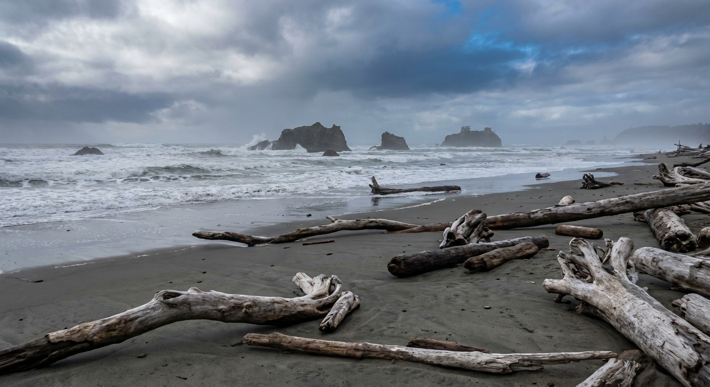
Zone 3: Pacific coast
Olympic’s coast is not a lay-on-a-towel situation. It is moody, wild, and wonderfully untamed, with driftwood piles, sea stacks rising out of the surf, and that salty air that makes you feel like you can finally breathe all the way in.
Best coastal walks
-
Rialto Beach to Hole-in-the-Wall (moderate out-and-back, tide-dependent)
- Distance: ~3.3 miles round trip
- Elevation: mostly flat, but uneven footing
- Time: 2 to 3.5 hours (more if tide pooling)
- Start: Rialto Beach parking area
- Tide note: You may need a low tide window to comfortably pass rocky points and explore safely near Hole-in-the-Wall. Conditions vary day to day, so plan conservatively.
-
Second Beach (easy to moderate out-and-back)
- Distance: ~1.4 miles round trip
- Elevation: some stairs and a forest descent
- Time: 1 to 2 hours (plus sunset lingering)
- Start: Second Beach trailhead near La Push
- Notes: A short forest approach drops you onto a gorgeous stretch with sea stacks. One of the best sunset spots if you are staying near La Push or Forks.
-
Ruby Beach (easy)
- Distance: flexible, choose your turnaround
- Elevation: short downhill to the beach, then flat
- Time: 30 to 90 minutes
- Start: Ruby Beach parking area
- Notes: Short access with big scenery. Great as a quick coastal stop between drives.
Coast safety (friendly, but serious)
- Respect sneaker waves. Keep a wide buffer from the waterline and never turn your back on the ocean.
- Do not climb on driftwood logs. Logs can roll or shift fast, especially near the surf. They are heavier than they look.
- Know your tide window. If your route requires rounding headlands or passing rocky points, plan around low tide and turn back early.
- Dress like you will get misted. Wind plus salt spray is real. A light rain jacket earns its spot.
Tide resources
Use NOAA Tides and Currents and select the nearest station for your beach plan (La Push is a common reference point). Screenshot the tide chart before you lose service.
Driving: linking zones
If you are trying to see all three ecosystems, the smartest move is to plan your days around one major zone plus a smaller add-on, rather than trying to stack everything into a single mega-day. Olympic is not built for speed.
Typical drive times
- Port Angeles to Hurricane Ridge: about 30 to 45 minutes one way (when the road is open).
- Port Angeles to Rialto Beach (La Push area): roughly 1.5 to 2 hours.
- Forks to Rialto Beach: roughly 20 to 30 minutes.
- Forks to Hoh Rainforest: roughly 45 minutes to 1 hour.
- Port Angeles to Hoh Rainforest: roughly 2 to 2.5 hours.
Reality check: These are typical in good conditions. Add time for summer congestion (Hoh lines can be significant), roadwork, wildlife, coffee stops, and the inevitable photo pullouts.
Three sample itineraries
Option A: Two nights, split bases (my favorite)
- Day 1: Arrive Port Angeles, sunset at Ediz Hook, dinner in town. Driving: low.
- Day 2: Hurricane Ridge hike in the morning, then drive to Forks in the afternoon for an easy beach sunset. Driving: about 3 to 4.5 hours total (plus any ridge delays).
- Day 3: Hoh Rainforest early, then one coastal walk before heading out. Driving: about 2 to 4 hours depending on exits and beach choice, plus potential Hoh wait time.
Option B: Two nights, one base in Port Angeles (mountain-forward)
- Day 1: Port Angeles town evening. Driving: low.
- Day 2: Hurricane Ridge main hike plus a shorter waterfall or lake stop near the north side. Driving: about 1.5 to 3 hours total.
- Day 3: Long day trip to Hoh or the beaches. Start very early and keep expectations flexible. Driving: about 4 to 6 hours total, plus potential waits.
Option C: Two nights, one base in Forks (rainforest and coast)
- Day 1: Forks check-in, sunset at Second Beach. Driving: about 1 to 2 hours total depending on where you are coming from.
- Day 2: Hoh Rainforest early and longer Hoh River Trail hike. Driving: about 1.5 to 2.5 hours total, plus any entrance line.
- Day 3: Rialto to Hole-in-the-Wall at low tide, then drive onward. Driving: about 1 to 2 hours before your onward route.
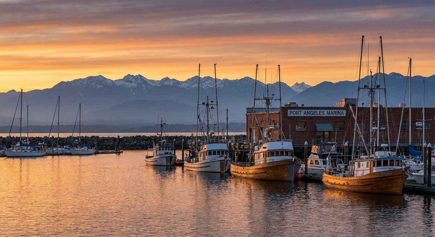
Base town: Port Angeles
Port Angeles is the park’s most practical “have a real bed and a great breakfast” base for the north side. It is the easiest launch point for Hurricane Ridge and a solid place to stock up before heading west.
Best for
- Hurricane Ridge day hikes and flexible weather pivots
- Travelers who want more dining choices and walkable conveniences
- Ferry connections and a smoother arrival day (especially from the Seattle area)
Where to stay
- In town hotels: Great if you want to walk to dinner and start early without extra driving.
- Cabins and vacation rentals: Look on the east and west edges of town for quieter mornings.
- Budget tip: Book ahead for summer. Port Angeles can fill when the ridge is clear and the forecast looks good.
Food and coffee
I keep Port Angeles simple: find a coffee shop you genuinely like, then plan one nice meal and one no-fuss meal per day. Think sandwiches for the trail, something warm and comforting after wind at Hurricane Ridge.
Supplies
- Grocery stores and pharmacies for last-minute layers, snacks, blister care, and fuel for a cooler
- Outdoor gear options exist but are limited compared to big mountain towns, so arrive with essentials if you can
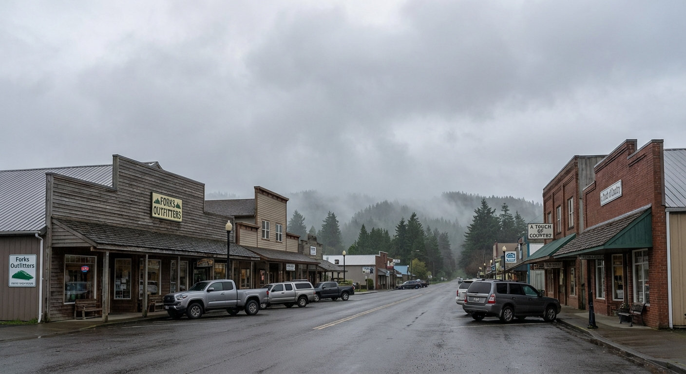
Base town: Forks
Forks is the practical base for the west side of Olympic. It is close to the Hoh Rainforest and several of the most famous beaches. The town is small and functional, which is exactly what you want when your priority is dawn trailheads and sunset shorelines.
Best for
- Hoh Rainforest and coastal hikes with minimal driving
- Travelers who want to stay closer to the action and spend less time looping back to Port Angeles
- Low-key evenings and early starts
Where to stay
- Motels and simple inns: Solid value for hikers who only need a clean place to crash.
- Cabins and forest stays: Great for families or groups. Confirm driving time to the beaches, since “near Forks” can mean very different things.
- Alternative: If you want to be closer to beach sunsets, consider staying nearer to the La Push area when available.
Food and coffee
Forks dining is more limited than Port Angeles, so plan like you are heading into the backcountry: identify one or two reliable spots, then keep snacks and easy meals on hand. Your future self will thank you when you return salty, tired, and happy from Rialto.
Supplies
- Basic groceries and trail food, but fewer specialty options
- Fill up on gas before heading to the coast spurs and rainforest roads
Other base options (quick)
- Sequim: Drier weather, good for travelers who want a calmer town feel and easy access to the north side. You will still drive for the rainforest and most beaches.
- Kalaloch: On-the-coast lodging that makes sunsets effortless. Great if the beach is your main event and you want fewer late-night drives.
What to pack for day hikes
Olympic is a “four seasons in one weekend” kind of park. My carry-on-only philosophy still holds here: I pack layers that mix and match, so one kit can handle wet forest, windy ridges, and chilly beaches without bringing my whole closet.
- Rain shell (non-negotiable)
- Warm mid-layer for Hurricane Ridge
- Trail shoes with grip (beach rocks and wet roots are slick)
- Small daypack with water, snacks, and a basic first-aid kit
- Offline maps downloaded ahead of time
- Tide table screenshot if you are doing Rialto or any headland-dependent beach walk
Trail etiquette that matters here
- Stay on trail in the rainforest. The plants are slow-growing and the soil is fragile.
- Pack out everything, including food scraps. Coastal areas in particular can turn into windblown trash magnets.
- Give wildlife space. If an elk changes its behavior because of you, you are too close.
- Respect tide pools. Look, do not touch, and step on bare rock when you need to move around.
Quick planning cheat sheet
If you have one day
Pick one ecosystem and do it well. From Port Angeles, choose Hurricane Ridge (if open). From Forks, choose the Hoh or Rialto. Trying to hit all three in one day is possible, but it will feel like a windshield tour.
If you have two to three days
Split your time between Port Angeles (mountains) and Forks (rainforest and coast). You will hike more and drive less, which is the whole point of coming to Olympic.
If you have four days or more
Add a second coastal beach, take your time on a longer Hoh River Trail segment, and give yourself a buffer day to chase the best weather window at Hurricane Ridge.