Sentinel Dome and Taft Point Hikes (Yosemite)

Maya Lin
Maya Lin is a travel journalist and outdoor enthusiast who believes the best trips combine rugged adventures with urban comforts. After spending six years backpacking across four continents, she founded Trail & Town Guide to help fellow travelers navigate both hidden mountain passes and bustling city neighborhoods with confidence.
If you want huge Yosemite views without signing up for an all-day sufferfest, the Sentinel Dome and Taft Point trailhead on Glacier Point Road is my favorite kind of compromise: a short hike with an outsized payoff. One minute you are stepping out of your car in sun-warmed pine forest, and not long after you are standing on open granite with Half Dome framed like a postcard.
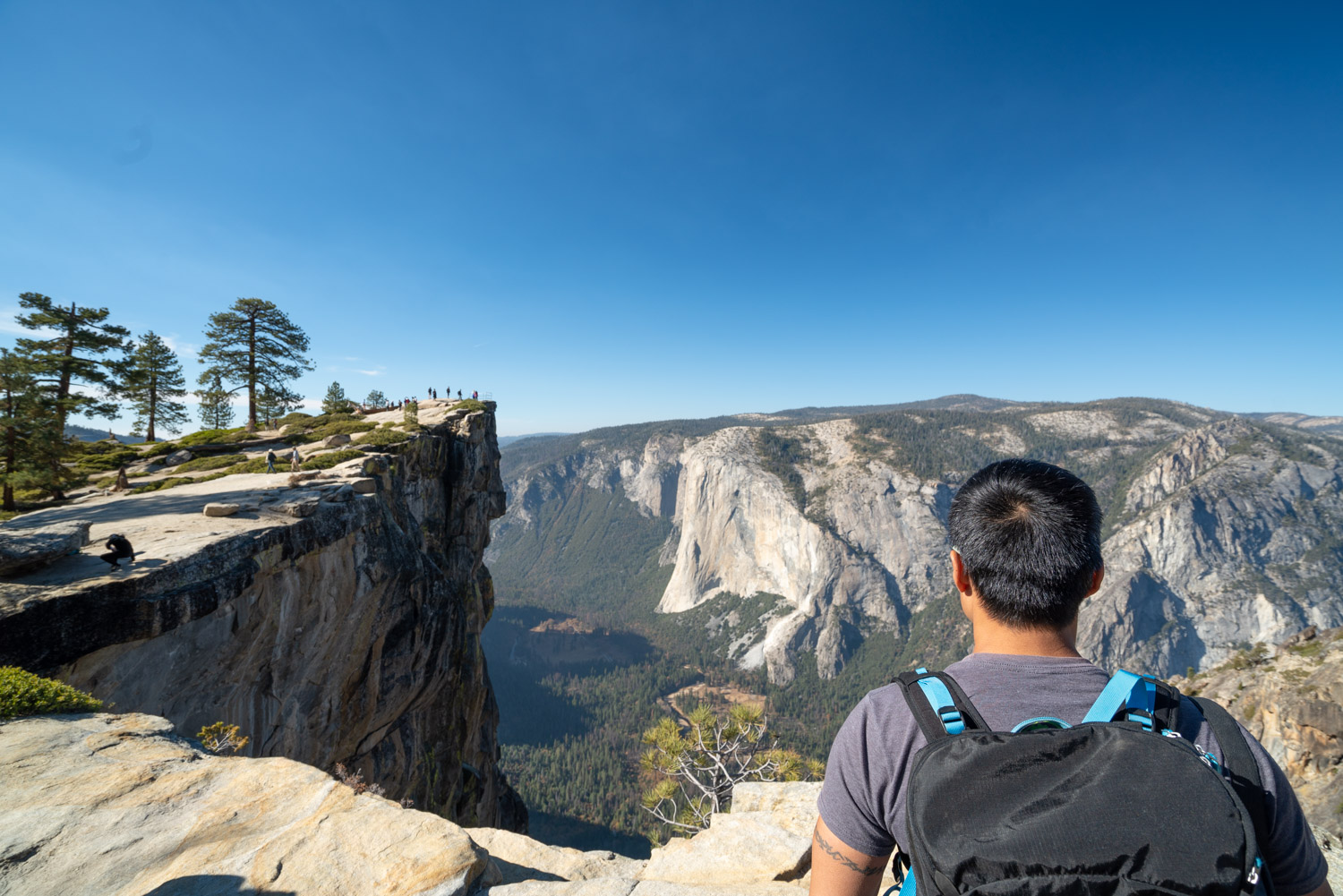
This guide covers the two classic out-and-back hikes that start from the same signed trailhead: Sentinel Dome and Taft Point. It also calls out what that infamous Taft Point “railing” really is (hint: it is not a safe, fenced viewpoint) and the key seasonal detail that trips people up: Glacier Point Road is not a year-round drive.
Quick clarity: these are not the longer Pohono Trail rim walk that connects viewpoints from Glacier Point, and they are not the Panorama Trail down to Yosemite Valley. These are short, standalone hikes from the Sentinel Dome and Taft Point trailhead on Glacier Point Road that bring you right back to your car.
Expectations in one sentence: both hikes start as mellow forest walks, then finish with big, open granite viewpoints (Taft Point especially goes from “easy stroll” to “whoa” very quickly at the rim).
Trailhead basics
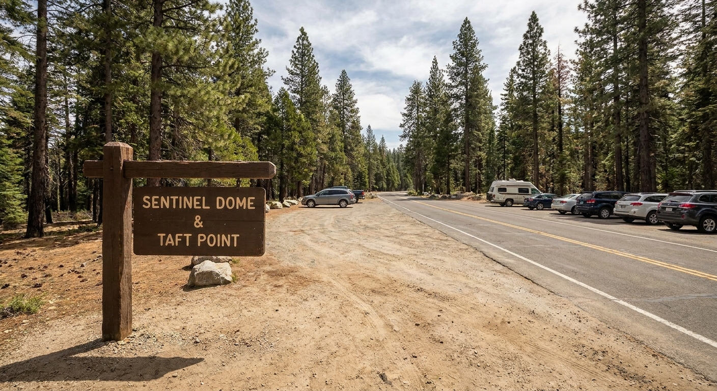
The trailhead is signed for Sentinel Dome and Taft Point and has a dedicated parking area right off Glacier Point Road. Because it is one of the best effort-to-view ratios in the park, it can fill quickly on weekends and summer afternoons.
- Location: Sentinel Dome and Taft Point trailhead on Glacier Point Road (Yosemite National Park).
- Facilities: expect basic trailhead parking. Do not count on water at the trailhead, and plan to use restrooms at larger developed stops along Glacier Point Road before you arrive.
- Cell service: spotty. Screenshot your map before you go.
Family-friendliness (with a big caveat): the walking portion of both trails is generally well-traveled and approachable for many ages, but the summit and rim areas are where things get real. Sentinel Dome is open and windy. Taft Point has deep fissures and a serious drop.
My timing tip: If you want the best experience with the least stress, go early morning or later in the day. Midday light is harsher, the parking is worse, and Taft Point can feel like a line at the edge.
Glacier Point Road season
Glacier Point Road is a seasonal mountain road, and access is the number one reason people show up ready to hike and end up pivoting to something else.
- Typical opening window: late spring through fall.
- Typical closure window: winter into spring due to snow. The road generally closes after significant storms and stays closed until snow removal is complete.
- Shoulder-season reality: even when it is “supposed” to be open, early or late storms can cause short-notice closures.
- Also happens: closures can be due to construction or repairs, and sometimes closures are partial (open to one point, closed beyond).
- Reality check: exact opening and closing dates vary every year with snowfall, storm timing, and road work. Check the National Park Service road conditions before you commit.
If Glacier Point Road is closed beyond the point you need, you cannot drive to this trailhead. There are winter ski and snow travel approaches for experienced travelers, but that is a completely different trip than the quick warm-season hikes described here.
One more admin thing: Yosemite entry rules can change (including reservation systems in some seasons or years). Before you build your whole day around this, double-check current park entry requirements and road access.
Hike 1: Sentinel Dome
Distance, gain, difficulty
Sentinel Dome (out and back): roughly 2.0 to 2.4 miles round trip, with about 400 to 600 feet of elevation gain depending on where you park and how much you wander on the granite at the top. Most people finish in 1 to 2 hours depending on stops and how long you linger at the summit.
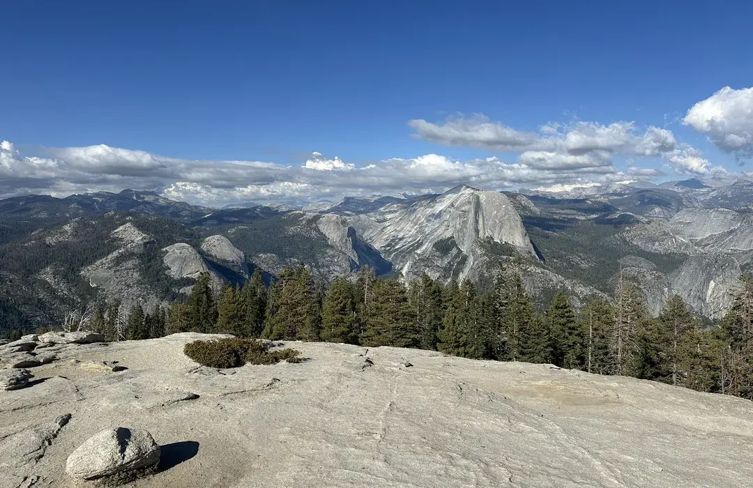
The climb is steady but short, and the reward is a 360-degree panorama from a smooth granite summit. If you have been dreaming of a big Half Dome view without hiking out of the Valley, this is your move.
What it feels like
The trail starts in forest, then gradually opens up. Near the top you will likely be walking on granite, where the route can feel less like a dirt trail and more like following worn footpaths across rock. In clear weather, the summit is obvious once you crest the dome.
- Exposure: moderate at the top, with open edges. You can enjoy the view without going near the brink, but keep kids close.
- Terrain: mostly dirt trail with the usual Sierra mix of roots and small rocks, then open granite near the summit. Not stroller-friendly.
- Best for: sunrise or late afternoon light, photography, and anyone who wants a short hike with a true summit feeling.
The essentials
- Water, even for a short hike. The sun and elevation add up.
- Sun protection. The summit is open and reflective.
- A light layer. Wind at the top can surprise you, even on warm days.
- Grippy shoes. Granite is friendly until it is dusty or slick.
Weather note: you are high on the road and fully exposed on the granite. If you hear thunder or see building storm clouds, get off the dome and away from the rim. Open rock is not the place to negotiate lightning.
Altitude note: This trailhead sits high on Glacier Point Road. If you just came from near sea level, do not be surprised if you feel a little more winded than the mileage suggests.
Hike 2: Taft Point
Distance, gain, difficulty
Taft Point (out and back): roughly 2.0 to 2.4 miles round trip, with about 200 to 400 feet of elevation change depending on small trail variations and where you wander at the rim. Plan 1 to 2 hours.
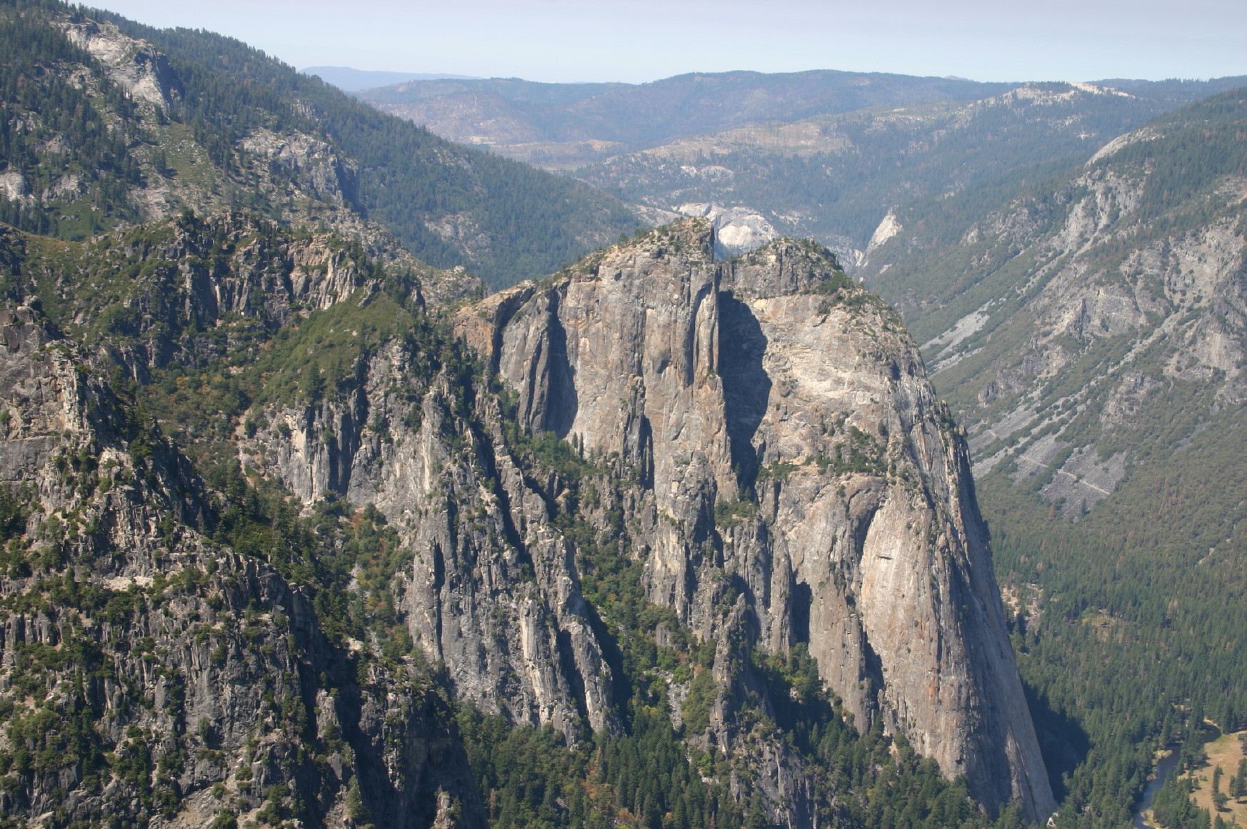
This trail is mostly mellow through forest until it suddenly is not. Taft Point sits on the rim above Yosemite Valley and delivers the kind of vertical drama that makes even confident hikers swallow once before stepping closer.
Fissures and the “railing”
Let’s translate the internet lore into real-world expectations.
- The fissures: Near Taft Point you will see dramatic cracks in the granite, often called fissures. They are deep and abrupt, and they can be a hazard if you are distracted or walking in low light.
- The “railing”: There is a spot where people sometimes pose near the edge holding a small metal bar or pipe for photos. It is not a protective guardrail and it does not make the viewpoint safe. It is simply metal next to a very real drop.
- Exposure level: high at the rim. You can have a fantastic experience here without stepping onto tiny ledges or leaning out near the bar area.
If heights make you uneasy, treat Taft Point like a choose-your-own-adventure viewpoint. You can stay well back from the edge and still see El Capitan and the Valley walls. If you are traveling with kids, keep them close and stay away from the fissures and rim.
When it is best
Taft Point shines in late afternoon through sunset, when the Valley walls start glowing and the crowds thin a little.
Crowd tip: Weekday mornings are the calmest. Sunset is gorgeous, but it is also when Taft Point is most likely to feel crowded right where you do not want crowd pressure.
Sunset safety: If you time it for golden hour, bring a headlamp for each person and plan to be extra conservative near the rim as the light fades. Fissures plus dusk is not the time to test your balance.
Doing both
Yes, and it is one of the best half-day plans off Glacier Point Road. Because Sentinel Dome and Taft Point share a trailhead and the mileage is short, you can comfortably hike both with time left for a scenic drive stop.
- Both hikes separately: roughly 2.0 to 2.4 miles each, so about 4.0 to 4.8 miles total if you return to the trailhead between them.
- Time estimate: 3 to 4 hours with photos, snack breaks, and viewpoint lingering.
My preferred order: Start with Sentinel Dome for the sweeping context shot of the whole landscape, then finish at Taft Point for the dramatic rim views. If you are chasing sunset, flip it and end on Sentinel Dome for wide open sky and an easier sense of space.
Navigation notes
This is not a complicated area, but it helps to know what to look for.
- Trail signs: The trailhead and junctions are signed for Sentinel Dome and Taft Point. If you arrive at an obvious split, follow the posted signs for the destination you want.
- What can confuse people: Parts of the terrain near the viewpoints are granite with multiple footprints and social paths. When in doubt, follow the most worn route that stays on durable surfaces and heads toward the obvious dome summit (Sentinel) or rim opening (Taft).
My low-tech approach: screenshot a map before you lose service, then hike sign-to-sign instead of trying to overthink it.
This is not Pohono or Panorama
Yosemite has a way of reusing names and viewpoints that sound similar, so here is the clean separation that will save you time and wrong turns.
- Sentinel Dome and Taft Point hikes: short out-and-back hikes from the Sentinel Dome and Taft Point trailhead on Glacier Point Road, ending at a dome summit or rim overlook.
- Pohono Trail: a longer rim route associated with Glacier Point area viewpoints. It is a different commitment and is not what most people mean when they talk about doing Sentinel Dome and Taft Point as a quick stop.
- Panorama Trail: a longer route that heads down toward Yosemite Valley. It is not a quick loop back to your car at this trailhead.
If your goal is a short hike with huge payoff, stay focused on the two trail signs that match the trailhead name: Sentinel Dome and Taft Point.
Parking and etiquette
These hikes are popular for a reason, and a little planning goes a long way.
- Arrive early or late: Parking is easier and the experience feels calmer.
- Step aside on narrow sections: especially near viewpoints where people cluster.
- Keep the edge clear: At Taft Point, avoid crowding people near drop-offs. Give space, wait your turn for photos, and do not pressure anyone to move closer than they want to.
- Leave no trace: Stay on durable surfaces near the rim, pack out trash, and do not shortcut switchbacks or create new social trails.
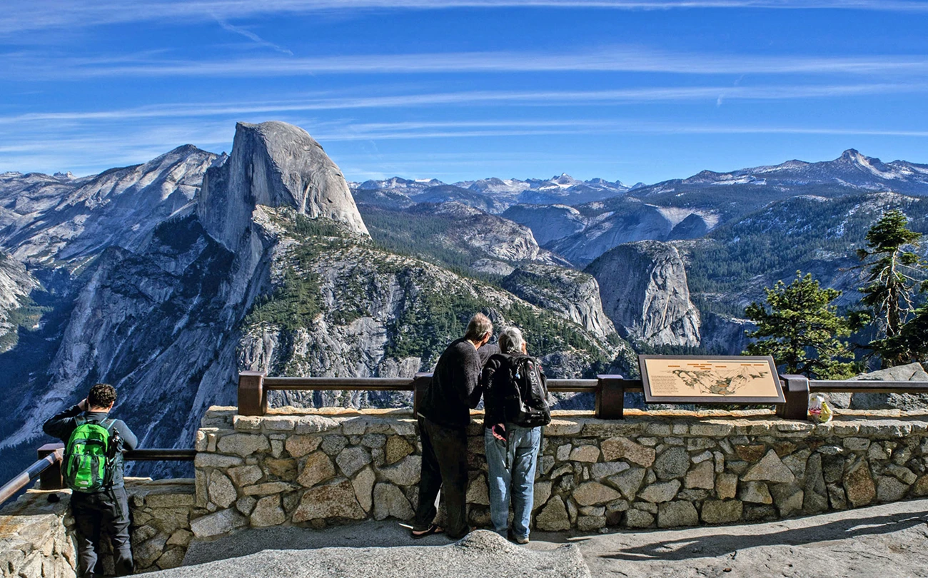
My personal rule here is simple: the views are already epic. No photo is worth making the rim feel unsafe for you or anyone else.
Pets
Yosemite has specific pet rules, and they can be stricter than people expect. In many parts of the park, dogs are limited to paved areas like roads, parking lots, and some developed paths.
Before you bring a dog, confirm current regulations for Sentinel Dome and Taft Point on the National Park Service site.
- If pets are allowed: keep dogs on a leash (maximum 6 feet) and pack out waste.
- My practical take: even where permitted, Taft Point’s fissures and rim exposure are not a great match for curious dogs or crowded conditions.
FAQ
Which is better, Sentinel Dome or Taft Point?
If you want a 360-degree panorama and a true summit feel, choose Sentinel Dome. If you want sheer vertical drama and a jaw-dropping rim overlook, choose Taft Point. If you have time, doing both is the sweet spot.
Is Taft Point dangerous?
Taft Point has real exposure at the rim and deep fissures in the granite. You can keep it very safe by staying well back from the edge and not treating the small metal bar area like a protected viewpoint.
Do I need hiking boots?
No, but you do want shoes with decent tread. Granite can be dusty or slick depending on conditions.
Can I do these hikes in winter?
When Glacier Point Road is closed (snow, storms, or projects), you may not be able to drive to this trailhead. Winter travel in this area becomes a different kind of outing that requires experience, proper snow travel planning, and conservative decision-making.