Valles Caldera: Valle Grande Overlooks and Easy Walks

Maya Lin
Maya Lin is a travel journalist and outdoor enthusiast who believes the best trips combine rugged adventures with urban comforts. After spending six years backpacking across four continents, she founded Trail & Town Guide to help fellow travelers navigate both hidden mountain passes and bustling city neighborhoods with confidence.
Valles Caldera National Preserve feels like New Mexico decided to take a deep breath. One minute you are on piney mountain roads, and the next you are looking out over an enormous, bright-green bowl of meadow ringed by volcanic ridgelines. The best part is that you do not need a backpacking permit or a full day to enjoy it. For the quick stops in this half-day guide, you typically can just show up, check what is open, and go. A quick drive, a few overlooks, and one or two gentle walks can make a perfect half-day reset, especially if you are balancing trail time with coffee shops and museums in Los Alamos, Santa Fe, or Taos.
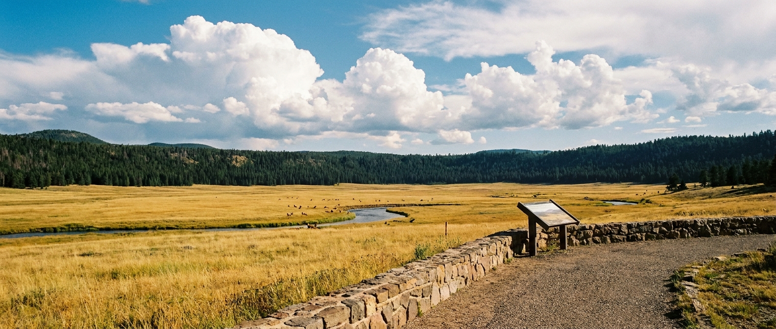
This guide focuses on the easiest, most reliable stops: Valle Grande viewpoints, mellow meadow walks like La Jara and History Grove, and the practical details people always ask about, including gates, elk etiquette, and winter access. Preserve access rules and road openings can change with snow, mud, wildlife management, or resource protection. Treat the visitor contact station and the official VCNP alerts page as your final authority for what is open today. But below you will also find baseline, real-world numbers so you can plan without doing homework in the parking lot.
Entry basics
Valles Caldera has a “preserve” vibe, not a typical national park entrance plaza. Most visitors arrive via NM-4 between Los Alamos and Jemez Springs.
Where to start
- Main approach: arrive via NM-4 and follow signs for the preserve entrance and Visitor Contact Station.
- Best first move: park at the Visitor Contact Station first and confirm road status, gate hours, trail conditions, wildlife guidance, and closures. VCNP can restrict access even on blue-sky days.
Getting there
- GPS-friendly landmark: search for “Valles Caldera Visitor Contact Station” in your map app. This is the simplest, most reliable pin for first-time visitors.
- Navigation tip: cell service can be spotty. Download offline maps before you leave town.
Fees and passes
Current reality: there is no entrance fee to visit Valles Caldera National Preserve as of 2026. Policies can change, so confirm on the official VCNP website before you go.
You may still run into reservations, permits, or limited-access rules for specific activities, seasons, or areas. If you are planning something beyond a simple drive and a short walk, check the official VCNP site for current requirements.
Hours and gates
Baseline hours: plan on 9 AM to 5 PM as a typical, easy-to-remember planning window.
Real-world caveat: VCNP hours can shift seasonally, and gates can close for snow, spring mud, habitat protection, or management operations. Also, “open” does not always mean “you can drive everywhere.” Interior roads can be seasonal, some are gravel, and some may be closed to protect habitat or because the caldera turns into the kind of mud that laughs at your tires. Always verify same-day access details at the Visitor Contact Station or on official VCNP updates.
If your plan is centered on Valle Grande views and short walks, you can still have a great visit even when deeper roads are limited.
Valle Grande viewpoints
The Valle Grande is the iconic scene: a huge open meadow that looks like it belongs in the Rockies, except you are in northern New Mexico at high elevation (roughly 8,000 to 8,700 feet around the Valle Grande area). The simplest way to experience it is by using pullouts and viewpoints along NM-4 and nearby preserve access points.
Easy viewpoint stops
- Valle Grande pullouts on NM-4: use the signed roadside turnouts near the preserve entrance for big, immediate meadow views.
- Redondo Peak views: on clear days, scan the rim and high points across the caldera for the “volcanic bowl” effect.
Best strategy
- Drive slowly and expect to stop more than once. Light and clouds change the look of the meadow every few minutes.
- Morning and late afternoon often deliver the best sky, but afternoon comes with a thunderstorm caveat.
- Bring binoculars or a zoom lens. Wildlife is often far out in the grass.
What you will see
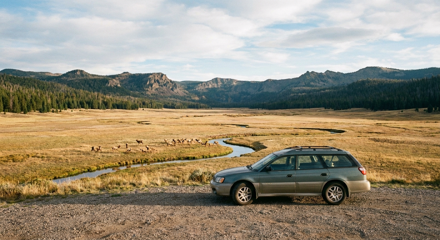
On clear days you will get layered views: meadow foreground, dark conifer rim, and rounded volcanic features that make the caldera feel like a gentle amphitheater. In summer, grasses run neon-green after monsoon rain. In fall, the meadow turns gold and the aspens near the edges flicker yellow.
Easy walks
If you want to get out of the car without committing to a big hike, these short options are the sweet spot. They are ideal for families, travelers acclimating to altitude, and anyone trying to squeeze in a walk between a café stop in town and a scenic drive.
Note on numbers: routes can be rerouted and trailheads can shift with management decisions. Distances and times below are solid planning baselines, but confirm current conditions if you are visiting in shoulder season or after storms.
La Jara Trail
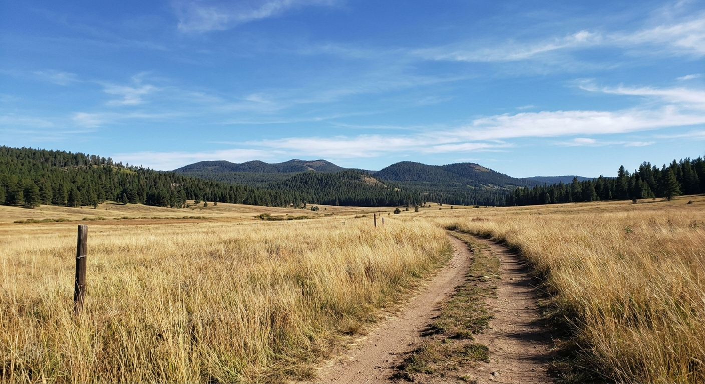
Why go: La Jara is one of the most approachable ways to step into the caldera landscape. Expect open meadow walking with big sky, subtle elevation changes, and a strong chance of seeing elk or birds at a distance.
- Trail type: loop
- Distance: about 1.5 miles
- Typical time: 45 to 75 minutes, longer if you are scanning for wildlife
- Best for: first-time visitors, photographers, anyone who wants a calm, uncluttered walk
- What to bring: sun protection, water, a light layer (shade is limited)
- Footing: generally easy, but it can be muddy after rain
- Access note: trailhead access can be seasonal or affected by gate hours, snow, or mud
History Grove Trail
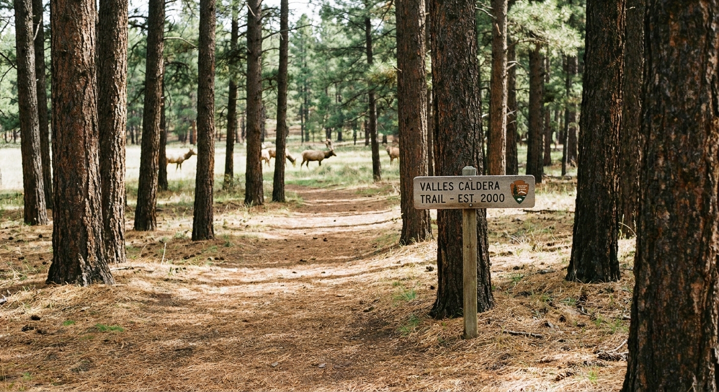
Why go: History Grove offers a different mood: more trees, more shade, and a closer look at the preserve’s cultural and land-use story. It is a great add-on if the meadow is windy or if storms are building and you want a shorter, safer outing.
- Trail type: out-and-back
- Distance: roughly 0.5 to 0.7 miles round-trip
- Typical time: 20 to 40 minutes
- Best for: hot afternoons, kids who need variety, travelers who like a little context with their scenery
- What to notice: tree species changes with elevation and moisture, plus the way the forest edge meets the open grassland
- Access note: confirm trailhead parking and any temporary closures at the Visitor Contact Station
Lightning note: if thunder is audible, leave open meadows and exposed areas immediately and head for your vehicle or a safer location.
Accessibility
- Viewpoints: many of the best Valle Grande views are roadside pullouts, so you can get the wow-factor with minimal walking.
- Trail feel: La Jara is mostly open and exposed; History Grove has more shade and a more sheltered feel.
- Surface reality: both walks can get muddy after rain. If you need firm, predictable footing, ask at the Visitor Contact Station what is in the best condition that day.
Facilities
Valles Caldera is beautiful, but it is not a services-heavy destination. Plan like you are going somewhere quiet.
- Restrooms: restrooms are typically available at the Visitor Contact Station. Do not assume they exist at every trailhead or pullout.
- Water: bring your own. Do not count on potable water being available everywhere.
- Food: pack snacks. Dining options are outside the preserve.
- Picnic: pullouts and day-use areas can work well, but follow posted rules and leave no trace.
- Dogs: rules can vary by area and season. If dogs are allowed, expect leash requirements and limited water and shade. Verify before arriving.
Wildlife distance
Seeing elk in Valles Caldera can feel like stumbling into a nature documentary. It is also where visitors most often make mistakes, usually by getting too close “just for one photo.” Please do not. Elk are powerful, fast, and unpredictable, especially during the fall rut and when calves are present.
Keep your distance
- Follow posted VCNP rules and ranger guidance. If the preserve posts specific distances, use those.
- Good baseline: stay at least 25 yards from most wildlife and 100 yards from bears and other predators, unless VCNP posts different rules for a specific area.
- Use binoculars or a zoom lens instead of walking closer.
- If an animal changes behavior because of you (staring, stepping toward you, bunching up, moving away), you are too close.
Watch like a good guest
The best wildlife moment is the one where you are still, quiet, and not changing the scene. Pull over safely, turn off the engine if you are in a turnout, and watch. You will see more natural behavior that way, and you will leave the caldera feeling like you did it right.
Winter access
Valles Caldera sits high enough that winter is not a light dusting. It is a real season with snowpack, wind, and rapid changes in road safety. This is where planning matters most.
What closed means
- Road closures are common. Interior roads and some trailheads can be inaccessible for long stretches.
- Gates can change quickly after storms or during thaw and refreeze cycles.
- Sun does not guarantee traction. Shaded areas hold snow and ice and refreeze overnight.
How to plan
Before you drive from Los Alamos, Santa Fe, or Taos, check official VCNP updates for current access and call if you are unsure. In winter, have a backup plan that still feels like a treat, like a soak in the Jemez area or a museum morning in Los Alamos.
Timing
This is one of my favorite “rugged plus comfortable” New Mexico add-ons because you can get your meadow fix and still be back in town for a real meal and excellent coffee.
From Los Alamos
- Drive time (approximate): roughly 45 to 60 minutes to the main entrance area via NM-4, depending on your starting point, construction, and stops.
- Half-day flow: contact station check-in, 2 to 3 viewpoints, one short trail, then a relaxed drive back.
From Taos
- Drive time (approximate): typically around 2 to 2.5 hours each way depending on route (for example, via Santa Fe or via US-84 and connections), weather, and traffic.
- Make it worth it: if you are coming from Taos, pair Valles Caldera with another Jemez Mountains corridor stop so the drive feels like a loop day instead of an out-and-back.
Altitude and storms
The preserve is high enough that you will feel it if you are coming from lower desert towns or if you flew in recently.
- Go easy for the first hour. Short walks can feel more tiring than expected.
- Hydrate and snack. High elevation plus sun can sneak up on you.
- Watch the sky after lunch. In summer, afternoon thunderstorms are common. If clouds build fast or you hear thunder, pivot to short, close-to-the-car stops and avoid open meadows and exposed ridgelines.
If you want the calmest half-day, start earlier, do your meadow walk before the sky gets dramatic, and save your town comforts for the afternoon.
What to pack
You do not need a full daypack setup, but a few basics will make the caldera feel effortless.
- Layers: even in summer, wind and sudden temperature drops happen.
- Sun protection: hat, sunglasses, sunscreen. The meadow is bright and exposed.
- Water: more than you think at altitude.
- Binoculars: the single best upgrade for elk viewing without breaking rules.
- Traction in shoulder season: if conditions are wet or icy, choose footwear with grip.
Half-day plans
Option A: Easy scenic
- Arrive at the Visitor Contact Station and confirm what is open today (roads, gates, trails).
- Stop at 2 to 4 viewpoints along NM-4 for wide views and wildlife scanning.
- Walk La Jara (about 1.5 miles, loop) if trailhead access is open and conditions are dry enough for comfortable footing.
- Finish with History Grove (roughly 0.5 to 0.7 miles round-trip, out-and-back) for a shady, shorter stroll if time and weather allow.
Option B: Storm-aware
- Contact station check.
- Viewpoints only, staying close to NM-4 and established pullouts.
- History Grove as a quick walk if thunder is not present.
Either way, you will leave with the sense that you just visited a different state for a few hours. That is the magic of Valles Caldera.