Highway 140: Merced River Canyon Drive to Yosemite Valley

Maya Lin
Maya Lin is a travel journalist and outdoor enthusiast who believes the best trips combine rugged adventures with urban comforts. After spending six years backpacking across four continents, she founded Trail & Town Guide to help fellow travelers navigate both hidden mountain passes and bustling city neighborhoods with confidence.
If you are coming into Yosemite via El Portal, Highway 140 is not just “the way in.” It is a full-on canyon experience, with the Merced River flashing beside you, boulders and granite walls rising up close, and enough little pullouts to turn a 45-minute drive into an entire afternoon if you are not careful. I have done this approach when I wanted the most scenic entrance with the least white-knuckle driving, for me, and it is my go-to when I am balancing a trail-heavy Yosemite day with a softer landing back in town. That said, all Yosemite approaches can feel demanding in weather, darkness, or heavy traffic, so I treat every route as a conditions-dependent decision.
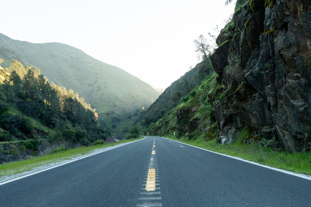
Below is what the drive actually feels like from Mariposa through El Portal to Yosemite Valley, where to stop safely, how to reach the river without bushwhacking, what to know about the rockfall-prone narrow sections between El Portal and the Arch Rock Entrance, and how to budget time realistically, especially in spring.
Quick overview
The vibe: A river-canyon road that stays relatively low and follows the Merced. It is scenic nearly the whole way once you drop toward the river, with frequent bends but generally a more relaxed feel than the steeper, higher-elevation approaches.
- Route: Mariposa to El Portal on CA-140, then into Yosemite via the Arch Rock Entrance, continuing along the Merced River into Yosemite Valley.
- Road feel: Two-lane, curvy, with narrow shoulders in places. The best views come fast and you need patience for slower traffic.
- Pullouts: Intermittent, not continuous. You will see clusters of solid, well-used pullouts, then long stretches where stopping is not safe or allowed.
- Best seasons for scenery: Spring for river power and waterfalls, fall for warm colors and fewer crowds, winter for moody canyon light (with occasional storm impacts).
If you are the kind of traveler who loves a micro-adventure baked into the transit time, this is your entrance road.
Time budget
Mapping apps assume you will drive straight through. In reality, the Merced River Canyon begs for stops, plus you have to factor in entrance lines and Yosemite Valley traffic.
Typical drive times (no long stops)
- Mariposa to El Portal: about 45 to 60 minutes
- El Portal to Arch Rock Entrance: about 10 to 15 minutes
- Entrance to Yosemite Valley floor: about 25 to 45 minutes in light traffic
Important reality check: In peak summer midday, holiday weekends, or when parking is a mess, Yosemite Valley traffic and parking searches can add 30 to 90+ minutes. Road work, rockfall controls, and fire-related closures can also change CA-140 travel times on short notice, even if the app looks optimistic. If you have a hike start time, tour, or dinner plan, build that cushion in.
Realistic scenic-day budgets
- Fast but not frantic: Add 20 to 40 minutes for two quick pullouts and a photo stop.
- River dip and snack: Add 60 to 90 minutes for a short riverside break.
- Spring runoff slow roll: Add 30 to 60 minutes for extra cautious driving, more gawking, and heavier entrance congestion.
My personal rule: if I have a timed reservation, hike start, or meeting anyone in the Valley, I leave myself at least an extra hour beyond what the app says. It buys you calm, and calm is the entire point of taking the canyon route.
Mariposa to the river
Leaving Mariposa, you start in classic Sierra foothill terrain: golden grass in summer, oak-studded slopes, and that particular California light that makes everything look like a Western. As you descend toward the Merced, the air often cools a notch and the landscape tightens into canyon walls.
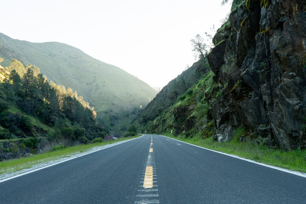
There are a few informal turnouts along this stretch, but the big payoff begins once the river becomes your constant companion. From that point on, your best stops are the ones that are clearly designed as pullouts, with enough room to get fully off the roadway.
Pullouts and view stops
Pullouts can change with maintenance, rockfall cleanup, and seasonal parking patterns. I still think in categories first, because the number-one goal is to stop safely.
Also, a quick expectation-setter: pullouts come and go, and I am not listing every turnout. Instead, I am giving you a few reliable, nameable anchors plus the simple rules I use to choose a safe stop in the moment.
Anchors you can recognize
- Briceburg area: A classic river-canyon stretch where the road-trip feeling finally clicks into place. If you see signage for Briceburg or the historic bridge area, you are in one of the most consistently scenic parts of the canyon.
- Merced River canyon day-use pullouts: Between Briceburg and El Portal, you will notice a repeating pattern of established roadside pullouts and short paths down toward the water. Think of this as a corridor of day-use access points rather than one single, clearly bounded “recreation area.”
- El Portal area: Your last practical pause before the entrance station, with river views nearby and a clear shift from “canyon road trip” to “national park day.”
- Arch Rock Entrance area: Not a lingering spot, but a useful mental marker. Once you are here, shoulders tighten and stopping opportunities drop off fast.
Even with these anchors, I never force a stop. If a pullout is crowded or the approach is on a blind curve, I keep going. The canyon is generous.
1) Scenic pullouts with big river views
Look for signed or well-established paved pullouts where you can step out, stretch, and take in the canyon without playing frogger with traffic. The river is frequently right there, and in spring it can be loud enough to drown out passing cars.
- What to do: quick photos, binocular scan for birds, five-minute reset between stops
- What to watch: fast traffic on blind curves. Only stop where you can pull fully clear and exit the car safely.
2) Short riverside access points
Some pullouts lead to obvious social paths down to the river. These are great for a feet-in-the-water break, but they are not beaches in the soft, lounge-chair sense. Think rounded stones, cold water, and swift current.
- Best for: picnic on rocks, a quick wade in late summer, a calmer moment if Yosemite Valley feels crowded
- Not ideal for: letting kids roam without close supervision, or any plan that involves floating downstream
3) The photo-magnet stops
You will notice clusters of cars at a handful of spots, especially in spring when the river is high. If a turnout is full, keep going. The canyon delivers another view around the next bend, and it is never worth parking half-on, half-off the asphalt.
River access safety
The Merced looks inviting, especially when Yosemite temperatures spike and Valley parking lots feel like ovens. But this river is not a tame city greenway. Even when it is lower, it moves with purpose, and conditions can be hazardous year-round.
What to know before you step in
- Spring runoff is powerful. Cold, fast, and deceptively deep. A shallow-looking channel can knock you over easily.
- Footing is unstable. Rounded river rocks roll, especially near the waterline.
- Keep it knee-deep or less. For most people, that means a quick rinse close to shore, not wading out.
- Late summer is not automatically “safe.” Cold pockets, sudden depth changes, and slippery rocks still catch people off guard.
- Keep kids and dogs close. This is not a “wander and splash” river when flows are high.
My canyon-stop checklist
- Park fully in a designated pullout, never on a narrow shoulder.
- Obey “No Parking” signs, even if other cars are ignoring them.
- Wear shoes you can get wet, not flip-flops that slide on granite.
- Pack out every crumb. Ravens and squirrels learn fast.
- If you see poison oak, treat it like a fence. Give it space.
- Do not climb on loose slopes or below rocky cliffs. Rockfall is part of this canyon’s reality.
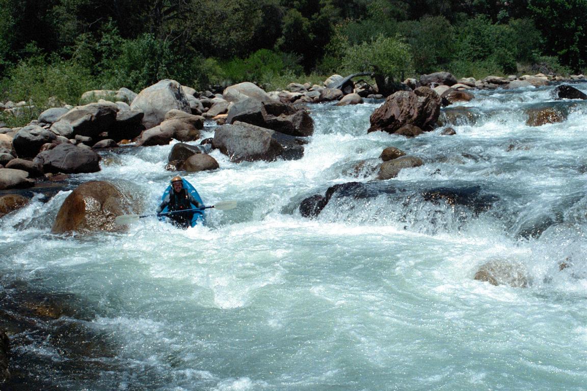
If you are traveling with anyone who is not a confident mover on slippery rocks, keep it simple: sit on a stable boulder, snack, take in the sound of the water, and call it a win.
Narrow stretches and rockfall
As you approach the park, the road pinches in and the canyon walls feel closer. The most noticeable rockfall-prone, shoulder-less stretches are typically between El Portal and the Arch Rock Entrance. This is a living canyon. Rocks fall. Crews stabilize slopes. Traffic patterns can change quickly.
Before you drive, it is worth checking official updates for current conditions. Yosemite’s National Park Service road conditions info and Caltrans updates for CA-140 are the two places I trust when storms, fires, or construction are in play.
How it affects your drive
- Possible one-way traffic control: At times, you may see temporary signals, cones, or flaggers.
- Reduced shoulders: In some stretches, there is nowhere safe to stop even if the view is gorgeous.
- Rock debris: Small stones on the roadway are not unusual. Drive attentively, especially after storms.
How I drive this stretch
- Stay off the brakes on corners unless needed, and keep a longer following distance.
- Skip last-second pullouts. If you missed one, keep going.
- Expect slowdowns close to the entrance, especially during peak arrival times.
The important thing is not to be scared, it is to be patient. This zone tends to reward calm drivers.
Parking etiquette
The canyon makes you want to stop constantly, and I get it. But this is where a little restraint keeps everyone safer.
- Do not stop in travel lanes and do not “hover” half in, half out of a turnout.
- Never block gates, driveways, or service access, even for a 30-second photo.
- Do not create new informal parking on soft shoulders. It widens the road edge over time and makes the next driver think it is normal.
- Respect private property near small communities and homes along the corridor.
- If a pullout is full, keep going. There will be another.
Gas, food, and coffee
Highway 140 is friendly in the sense that you are not heading into a fuel desert, but once you pass Mariposa and commit to the canyon, choices narrow. I like to treat Mariposa as my last big chance for options, then use El Portal for quick basics if needed.
Mariposa
- Gas: Fill here if you are at half a tank or less, especially if you plan to drive around the Valley afterward.
- Food: This is where you can grab a real meal or build a picnic with more variety.
- Coffee: If I have a morning entrance planned, I get coffee in town first so I am not scrambling later.
El Portal
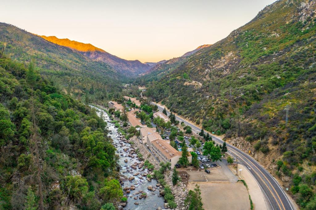
El Portal is your practical pit stop zone. Think convenience, not a culinary destination. It is useful for last-minute snacks, drinks, and any “oops, we forgot” items before you enter the park and prices climb.
Inside Yosemite Valley
Yes, you can eat in the Valley, but at popular times you are trading daylight for lines. If you can, bring lunch with you and save Valley food stops for a treat, not a necessity.
Spring conditions
If you get to choose when to do this drive, spring is the drama season. Snowmelt swells the Merced, the canyon feels alive, and even a simple pullout stop turns into a front-row seat for moving water.
What changes in spring
- The river is higher and faster. Great for photos, not great for casual river play.
- Wet corners after storms: Shaded stretches can stay damp and slick.
- More stopping: People pull over constantly, so expect unpredictable slowdowns.
My favorite spring move is the simplest: I plan an extra 30 minutes just to pull over twice, listen to the river, and let the road trip feel like part of Yosemite, not just the lead-in.
Driving tips
- Start earlier than you think. Morning light in the canyon is gorgeous, and you beat the entrance surge.
- Use pullouts to let locals pass. It is polite, and it reduces tailgating stress.
- Keep your camera plan simple. If it is not a safe stop, it is not a stop.
- Expect spotty cell service. Download maps, playlists, and any confirmations before you drop deep into the canyon.
- Pack a micro picnic kit. Even carry-on-only travelers can manage a reusable bottle, a couple snacks, and a trash bag.
Mini itineraries
Option A: Straight to the Valley
- Gas and coffee in Mariposa
- One quick scenic pullout in the canyon
- Arrive in Yosemite Valley without feeling rushed
Option B: Canyon morning, Valley afternoon
- Early start from Mariposa or El Portal
- Two pullouts plus a 20-minute riverside break
- Enter Yosemite mid-morning and spend the rest of the day on Valley icons
Option C: End-of-day decompression
- After a big hike in Yosemite, take your time leaving
- Stop once in the canyon for sunset light and a snack
- Return to El Portal or Mariposa with the feeling that you got two experiences in one day
This is my favorite way to use Highway 140. The canyon helps your nervous system settle after a peak-season Yosemite parking lot.
Before you go
Yosemite entry requirements can change year to year, including timed-entry or reservation systems in some seasons. Before you commit to the drive, confirm the current policy for your dates and arrival time so your beautiful canyon approach does not end at a surprise line.
FAQ
Is Highway 140 the most scenic way into Yosemite?
It is definitely one of the most scenic. The constant Merced River views make it feel immersive before you even pass the entrance station.
Can you swim in the Merced River along Highway 140?
You will see people wading and sitting along the shore at a few access points, but “swimming” depends on season and conditions. In spring, the water is cold and fast and I treat it as look-and-listen territory, not play territory. Even in late summer, I keep any water time close to shore and knee-deep or less.
Where should I stop for last-minute supplies before Yosemite Valley?
Mariposa is your best bet for a fuller stock-up. El Portal is useful for quick essentials right before the entrance.
How much extra time should I add for stops?
If you want to enjoy the canyon at all, add at least 30 to 60 minutes. In summer midday or on spring weekends, add more for entrance lines, Valley traffic, and parking. Also remember that road work, controls for rockfall, or fire-related closures can change the timeline fast.