Hite Cove Trail Near El Portal

Maya Lin
Maya Lin is a travel journalist and outdoor enthusiast who believes the best trips combine rugged adventures with urban comforts. After spending six years backpacking across four continents, she founded Trail & Town Guide to help fellow travelers navigate both hidden mountain passes and bustling city neighborhoods with confidence.
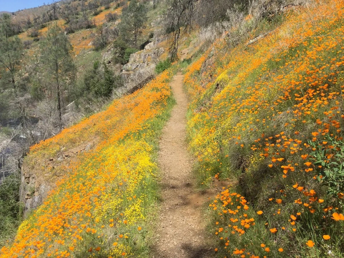
If you are staying in El Portal and want a spring hike that feels like a Yosemite “bonus level” without fighting for Valley parking at dawn, Hite Cove is my go-to. It is close, it gets scenic fast, and when the wildflowers are on, the canyon walls look like somebody spilled paint along the trail. The catch is that it can get hot, brushy, and a little too choose-your-own-adventure if you do not decide on a turnaround ahead of time.
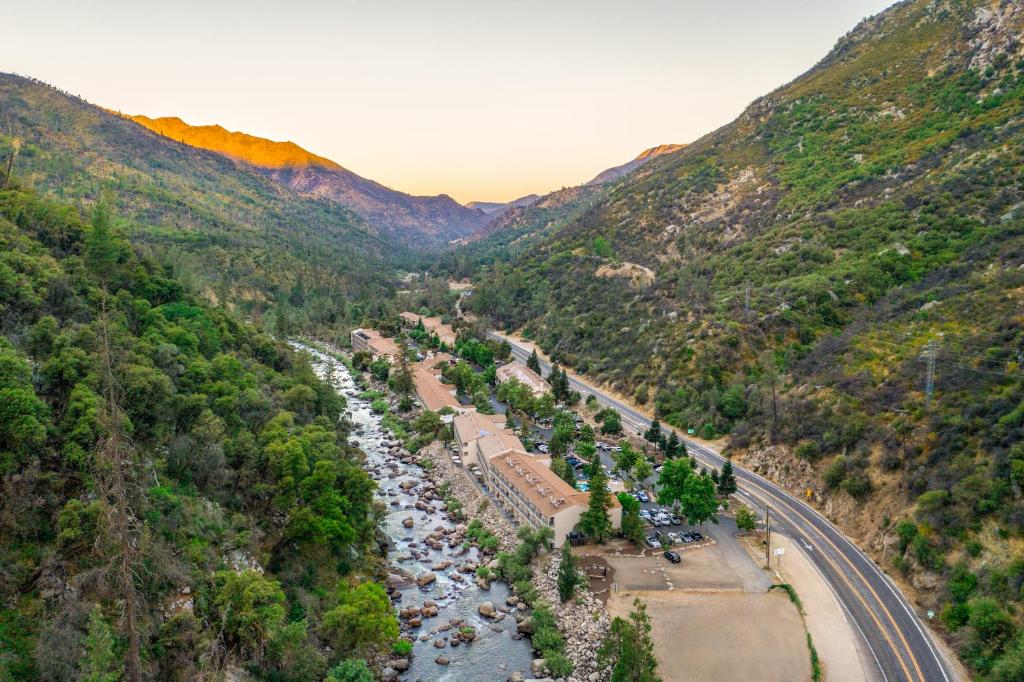
On the ground, this is a river-canyon foothill trail with sunny slopes that light up in spring and a lot of exposure once the day warms up.
This is exactly the kind of half-day outing I love when I am balancing dirt time with a shower, a good dinner, and a real coffee afterward.
Quick facts for planning
- Trail: Hite Cove Trail, a Merced River canyon hike accessed from Highway 140 near El Portal and Briceburg
- Type: Out-and-back
- Best season: Spring for wildflowers
- Difficulty notes: Rolling trail with some ups and downs; heat and sun exposure often make it feel harder than the mileage
- Key challenges: Heat, limited shade, brushy sections where ticks and poison oak thrive
- Why it works from El Portal: Short drive, big spring payoff, and easy to set a firm turnaround time
Where the trail starts (Highway 140)
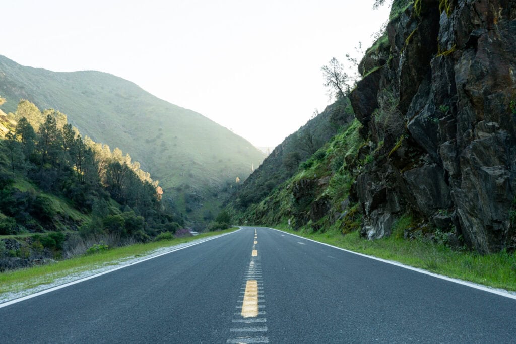
The Hite Cove Trail begins off Highway 140, the main road running through El Portal toward Yosemite Valley. The trailhead area is not a big, obvious visitor complex. Think roadside access with limited pullouts, and plan to arrive early on peak spring weekends.
Two practical notes that matter here:
- Parking is limited and scattered: If the main pullout is full, do not force it. Keep driving until you find a legal, safe spot fully off the roadway, and never block gates or narrow the shoulder. Also, do not park on private driveways or turnouts that look like they serve nearby homes. If you cannot park cleanly, call it and come back earlier.
- Expect small changes year to year: Winter storms, road work, and rockfall cleanup can affect where it is comfortable to park. I always confirm the current trailhead pin on a reputable map before I go, and I download the area offline because canyon coverage can be spotty.
For maps, I usually check one of the big trail apps (AllTrails, Gaia GPS, or CalTopo) and cross-check the trailhead location before I leave town.
When to go for wildflowers
Hite Cove is famous for spring blooms, but the timing shifts year to year depending on rain, late cold snaps, and heat waves.
Typical bloom window
- March: Early season. In good rain years you can see the first pops of color, but it is hit or miss.
- April: Usually the sweet spot. This is when the trail can feel like a wildflower gallery, especially on sunlit slopes.
- May: Late season. Blooms can linger, but heat ramps up fast and the hike feels more exposed.
My timing rule from El Portal
If I only have one spring morning to spare, I aim for April and I start early. You get better light in the canyon, cooler temps, and a lower chance of turning your hike into a sweaty survival shuffle.
A clear turnaround plan
The biggest mistake I see on Hite Cove is people starting casually, enjoying the first miles, and then realizing they are committed deeper than their water, daylight, or tolerance for heat allows. The tread is usually straightforward to follow, but the trail is long enough that it quietly lures you into going farther than you planned.
A safe, satisfying out-and-back
For most hikers basing in El Portal and looking for a spring wildflower hike, I recommend a 3 to 4 mile out-and-back (about 1.5 to 2 miles each way). On many spring mornings, that is a solid 2 to 3 hour outing once you add photo stops and a real break.
Difficulty-wise, expect a moderate feel: it is not one relentless climb, but it is also not flat. For that shorter out-and-back, I plan for roughly 400 to 700 feet of total elevation gain thanks to the rollers. Your exact number will vary based on where you turn around and what your app counts, but this range is a realistic planning anchor for effort.
That shorter plan usually gives you:
- Plenty of wildflowers in season
- Great canyon and river views without having to chase an “official” destination
- A predictable timeline for a half-day plan
Turn around when either of these happens:
- You have been hiking for 60 to 75 minutes one way at a comfortable pace
- You hit your half-water point (when you have used about half of what you carried)
This is not a trail where you want to be thirsty and still “just a little farther” from your car. Spring sun here can be sneaky intense.
Heat comes fast here
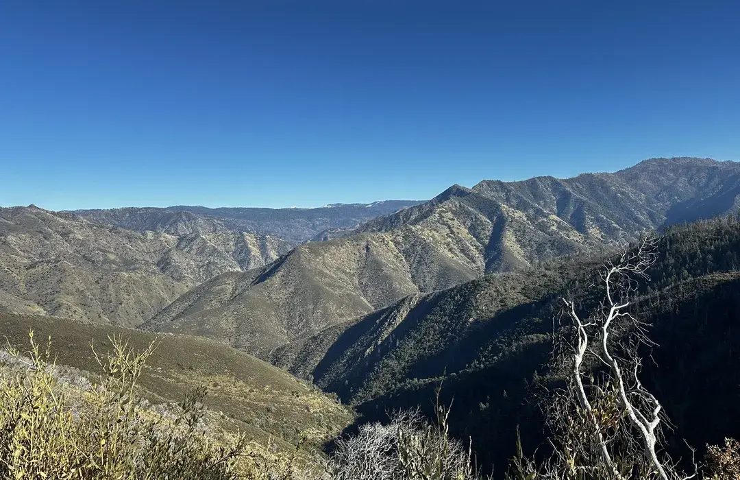
This area can warm up quickly, and parts of the route offer limited shade. If you are coming from higher elevations or from a cool coastal forecast, the canyon heat can surprise you.
What I do
- Start early: Morning is safer and more comfortable.
- Carry more water than you think: Especially if you are doing more than a short out-and-back.
- Sun protection: Hat, sunglasses, and sunscreen. Exposed hillside hiking adds up fast.
- Plan a firm cutoff: Turnaround time beats optimism every time.
If the day is already hot in El Portal, assume it will feel hotter once you are out on sun-baked trail.
About water on the trail
I do not plan on any potable water on this hike. The Merced River is down in the canyon, access is often awkward, and even if you carry a filter, you should not rely on it as your primary plan. For a half-day out-and-back, I treat this as a carry-what-you-need hike.
Ticks and poison oak
Hite Cove is the kind of foothill trail where nature is not shy about brushing your ankles. In spring, that is part of the charm, but it also means you should plan for ticks and poison oak.
Ticks
- Wear long socks or gaiters if you have them.
- Do a tick check at your turnaround and again when you are back at the car.
- Try to avoid brushing through tall grass at trail edges.
Poison oak
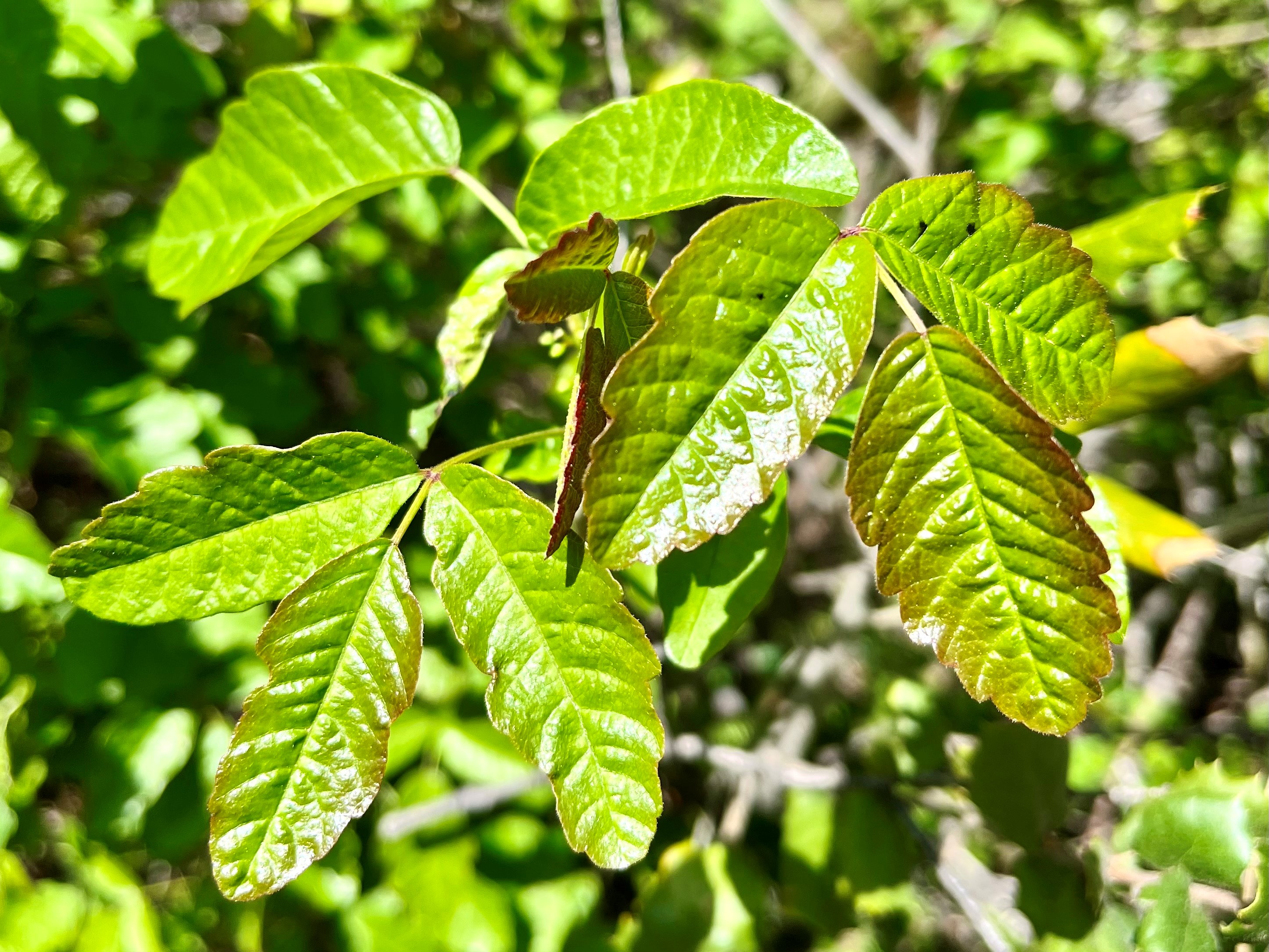
Poison oak is common in the Yosemite foothills. Learn the look before you go, and assume it can appear as low shrubs, climbing vines, or leaf clusters right at shin level.
- Stay on the main tread and avoid shortcutting around brush.
- If the trail narrows, slow down and pass carefully.
- Consider carrying soap or wipes for hands and forearms if you are sensitive.
Closures and conditions
The Yosemite region has seen frequent fire activity in recent years, and even when a trail is technically open, conditions can change. Expect the possibility of temporary closures, detours, or hazard warnings due to:
- Recent wildfire impacts
- Burned trees and falling debris risk
- Trail work and erosion after storms
Also, keep in mind that post-fire hazards can linger for years. Snags fall, slopes shed rock, and tread can wash out long after the headlines are gone.
What to check before you go
Because the Highway 140 corridor can involve different land managers depending on the exact spot you are accessing, I check a couple of sources instead of guessing who is in charge.
- Yosemite National Park conditions: Especially if you are pairing this with Valley plans the same day, or if a road issue spills into park travel.
- Relevant land manager alerts for the exact trailhead area: Look for official notices from the agency responsible for that stretch of the Merced River corridor (Forest Service, BLM, county, or park postings depending on location).
- Caltrans and county road updates: Highway 140 can be affected by rockfall, construction, or emergency restrictions.
- Recent trip reports: Useful for blowdowns, brush levels, or trail work, but I treat these as context, not gospel.
If you see wording like “hazard trees,” “unstable slopes,” or “no services,” take it seriously. A conservative turnaround is your friend on any trail with recent disturbance.
What to pack
This is a short hike that can feel long if you are underprepared. My minimal kit looks like this:
- Water: Enough for heat plus a buffer
- Salty snack: The canyon sun makes you sweat more than you think
- Sun protection: Hat and sunscreen
- Tick plan: Tweezers or a tick tool, plus a post-hike check
- Long layers: Light long sleeves or pants help with brush and sun
- Offline map: Downloaded in advance
And yes, I still try to keep it all small enough that I do not feel like I am hauling my life around. Comfort matters, but so does actually enjoying the walk.
Make it a half-day
This is how I like to structure it when I am based in El Portal:
- Early morning: Drive to the Highway 140 trailhead area and hike to your pre-decided turnaround
- Late morning: Back at the car before the canyon heat peaks
- Afternoon: Lunch, a shower, and something easy in town
- Evening: Either head into Yosemite Valley for sunset views, or keep it mellow and rest up for a bigger hike tomorrow
It is one of those rare Yosemite-area wins where you can get a real nature hit and still feel human afterward.
FAQ
Is Hite Cove Trail good for kids?
It can be, especially as a shorter out-and-back, but the heat, exposure, and brush make it better for kids who are comfortable hiking and who can follow a turnaround plan. For families, morning is the safest choice.
Do I need a Yosemite entrance reservation for this hike?
Hite Cove is accessed from Highway 140 near El Portal, outside the classic Yosemite Valley trail system, but travel rules can change seasonally. If you plan to combine this with a Valley visit the same day, check current Yosemite entry requirements before you go.
Can I count on seeing wildflowers?
No wildflower hike is guaranteed, but April is typically your best bet. In dry years blooms may be sparse or short-lived. In wet years, the show can be spectacular.
What is the biggest safety issue here?
Heat and dehydration are the big ones, followed by poison oak exposure and ticks in brushy sections. A firm turnaround time and enough water solve most problems before they start.