Icicle Ridge Trail Above Leavenworth

Maya Lin
Maya Lin is a travel journalist and outdoor enthusiast who believes the best trips combine rugged adventures with urban comforts. After spending six years backpacking across four continents, she founded Trail & Town Guide to help fellow travelers navigate both hidden mountain passes and bustling city neighborhoods with confidence.
I love Leavenworth for its split personality: you can start your morning sweating up a legit ridge climb and still be back in town in time for a cold drink and a good coffee. Icicle Ridge is that kind of hike. It is steep right out of the gate, wildly scenic once you gain the spine of the ridge, and flexible enough to make it a tough half-day or an all-day grind depending on where you turn around.
This guide covers the Icicle Ridge climb from Icicle Ridge Trail (USFS Trail #1570) just outside Leavenworth, including the steep opening climb, a realistic turnaround overlook, how brutal the summer heat can feel on this sun-baked slope, and what the views look like as the Wenatchee River valley opens beneath you. One planning note up front: this route is commonly hiked as a day trip, but rules can change. If you are linking trails, chasing spurs, or pushing deeper toward wilderness boundaries, confirm current regulations with the managing agencies before you go.
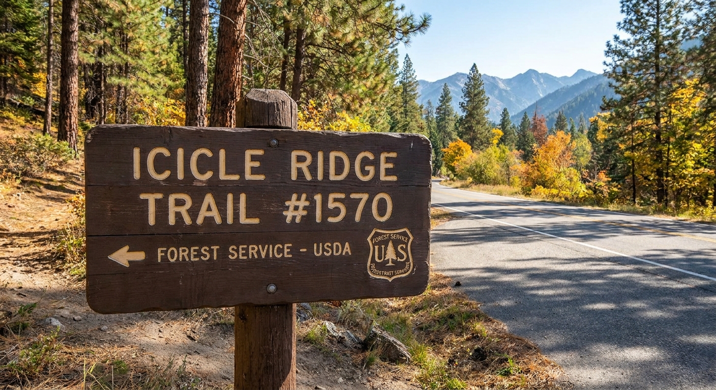
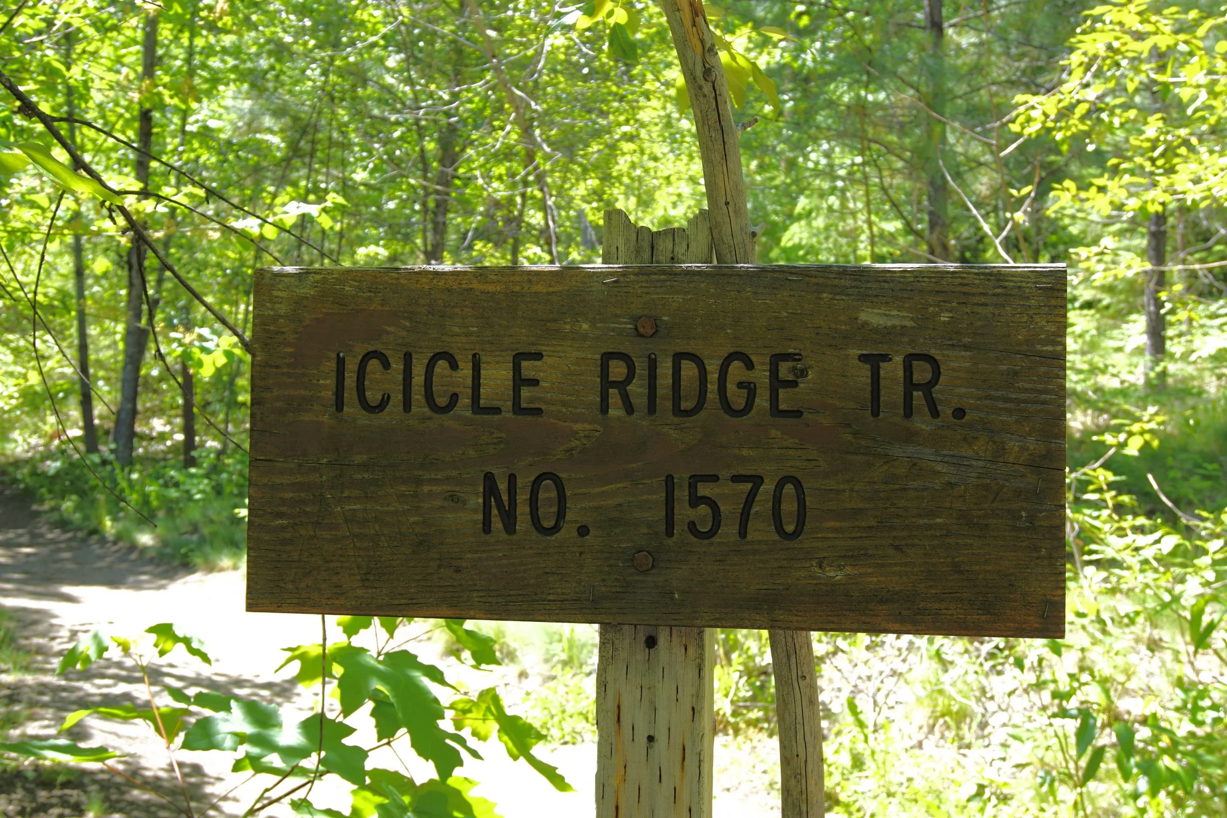
Trailhead reality check: people use “Icicle Ridge Trailhead” as a catch-all, and that is where confusion starts. Along Icicle Road, you may see multiple signed pullouts or small lots that access pieces of the broader trail system. I do not treat any one pullout as the only start. The practical way to find the right start for Trail #1570 is to follow on-site USFS signage for “Icicle Ridge Trail #1570” and confirm you are on #1570 in your map app. If your mapping app shows more than one “Icicle Ridge Trailhead,” trust the trail number on the physical sign over the label. If you want a stable anchor that will not change with app pins, use this: you are looking for a posted Icicle Ridge Trail #1570 signboard along Icicle Road a short drive southwest of downtown Leavenworth, not the Ski Hill trail network.
Who this hike is for: if you like steep workouts and big views for the effort, this is your hike. If you are newer to hiking, it still works, but an early start and a firm turnaround plan matter a lot here.
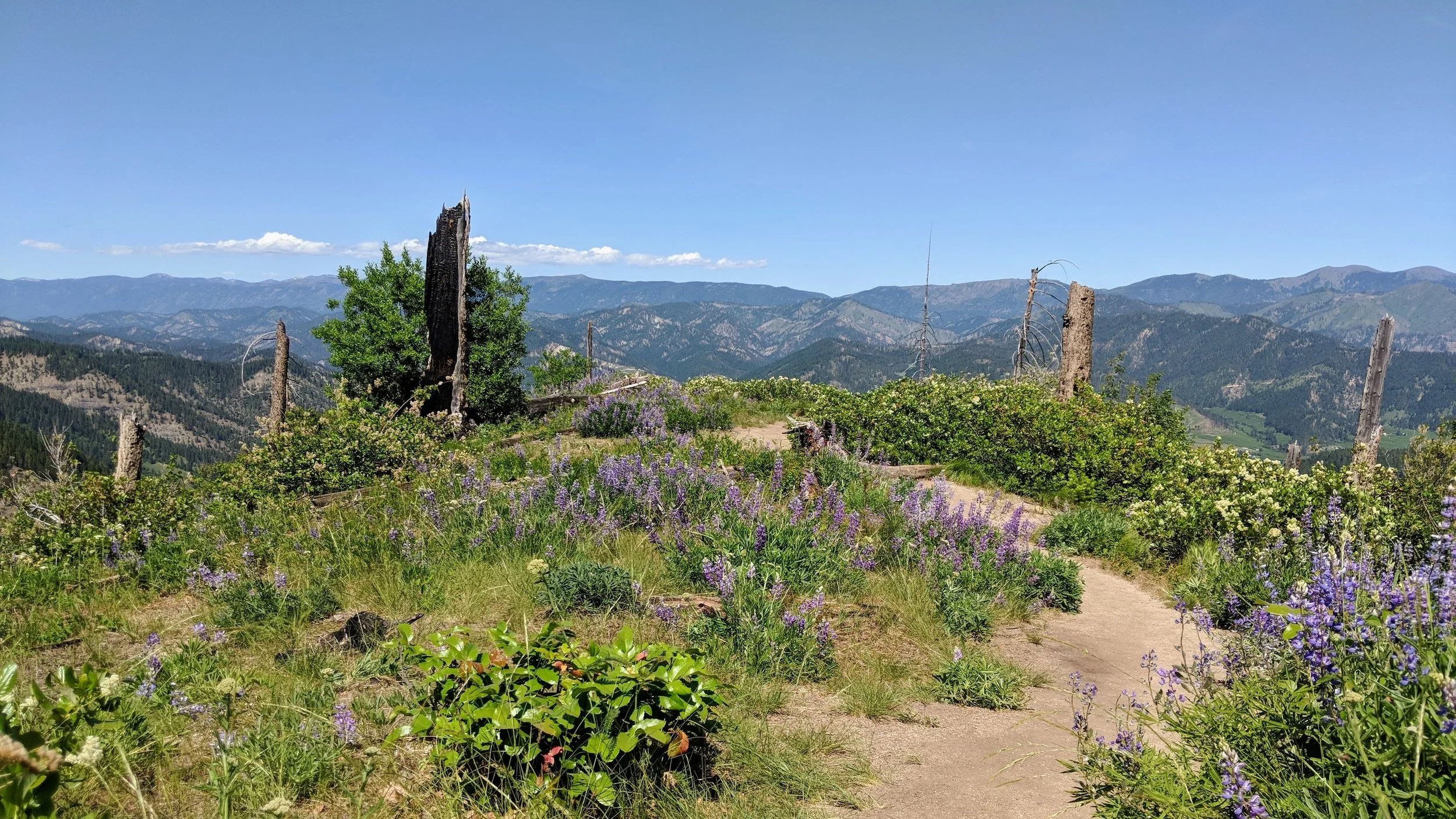
At a glance
- Starting point: Any signed USFS access for Icicle Ridge Trail #1570 along Icicle Road, southwest of Leavenworth
- Type: Out-and-back ridge climb
- Best season: Spring through fall (shoulder season is the comfort play)
- Sun and heat: High exposure, especially late morning through afternoon
- Water: Plan to carry what you need (do not count on reliable water on trail)
- Dogs: Common, but heat and dry tread are the main issues
Typical “sweet spot” turnaround: the first broad, open ridge viewpoint where Leavenworth and the Wenatchee River valley snap into full view. Distance and gain vary depending on exactly where you stop and which access point you started from, so I treat this as an approximate half-day hike and use my watch or map app to decide the final turnaround.
Trailhead and parking
The start for Icicle Ridge Trail #1570 is not at the Leavenworth Ski Hill. It begins from signed US Forest Service trail access points along Icicle Road, a short drive southwest of town.
From US-2 in Leavenworth, turn onto Icicle Road and head toward Icicle Creek. You are looking for posted signage that explicitly says Icicle Ridge Trail #1570. Because this corridor has multiple recreation sites and access points, I rely on the trail number on the signboard plus a quick map check rather than a single “park here” description.
If you feel turned around: do not guess. Pull into the next safe turnout, re-check your map, and backtrack until you find posted trailhead information for Trail #1570. If your mapping app labels more than one “Icicle Ridge Trailhead,” trust the physical #1570 sign on the ground over the label.
Because this is a popular, close-to-town hike, the parking vibe is classic Leavenworth: it fills early on summer weekends, and the trail gets busy fast. If you want cooler temps on the climb and an easier parking situation, treat this as an early-morning start.
Parking tip: do not block gates or shoulder-park in a way that narrows Icicle Road. If the lot is full, make a different plan or come back earlier. Towing and ticketing are a real possibility in busy corridors like this.
Passes and fees: fee and pass requirements can vary by specific pullout or lot along Icicle Road. Some USFS trailheads require a Northwest Forest Pass, and some accept an America the Beautiful pass, but do not assume. The only trustworthy answer is what is posted on the fee sign at the exact lot you use on the day you hike.
Route overview
Here is the simplest mental map: you leave a signed #1570 access, climb immediately through dry forest and open hillside, and eventually pop onto the ridge where the view opens wide. Early on, the trail can feel like a staircase made of dirt and sun. Once you gain the ridge, the Wenatchee River valley starts showing off.
The main decision point: once you reach the more open ridgeline and the valley views get consistent, you choose between (1) turning around at the first major ridge viewpoint for the best effort-to-payoff ratio, or (2) continuing along the ridge for a longer, hotter, more committing day. Either way, the return is the same trail back down.
Junctions exist, and the area has enough connector trails that it can get fuzzy if you are hiking on autopilot. If your plan is “up to the first major ridge viewpoint and back,” it is straightforward. If your plan is “let’s connect a few trails and see what happens,” that is when an offline map stops being optional.
Trail surface in a sentence: expect dry, often dusty tread with some loose footing, limited shade, and a descent that can feel slippery when the dirt turns into ball bearings under your shoes.
The climb
Icicle Ridge wastes no time. The first mile or two are the kind of uphill that makes you do an honest gear check: are your shoes rubbing, are you carrying enough water, did you start too late in the day, and do you really want to keep your sweatshirt on?
The tread is typically dry in summer and can be dusty, with long stretches that feel fully exposed to sun. The slope here is often sun-baked, and even when town is comfortable, this hillside can feel like it is running its own weather system.
Pacing that works
- Start earlier than you think you need to. Cooler air makes the first climb feel half as hard. On hot days, I try to be hiking down before lunchtime.
- Set micro-goals. The next bend, the next patch of shade, the next rocky outcrop.
- Do not commit out of stubbornness. If you are already overheating early, the ridge keeps going and it keeps asking for more.
Best turnaround
Here is the honest truth: the best cost-to-view ratio on Icicle Ridge often happens before the hike becomes an all-day project. Once you reach the ridge and start getting consistent valley views, you have already earned the highlight reel.
A realistic turnaround for most hikers: the first major ridge viewpoint where you can clearly see Leavenworth below and the Wenatchee River valley stretching out. You will know it because it is the first spot where people naturally stop, spread out a bit, and point at the valley.
My personal decision rule: when I hit that first major ridge viewpoint, I stop on purpose. I eat something. I check time, water, and how cooked I feel. If it is already hot and my water is dropping fast, that is my cue to turn it into a perfect half-day and head down.
Why not keep going? Past the early ridgeline payoff, the trail can turn into a longer, hotter grind with fewer big-payoff moments per mile. If you have all day and want a full-value workout, go for it. If you want a ridge hike that still leaves you human for town later, that first major ridge viewpoint is the move.
Distance and gain
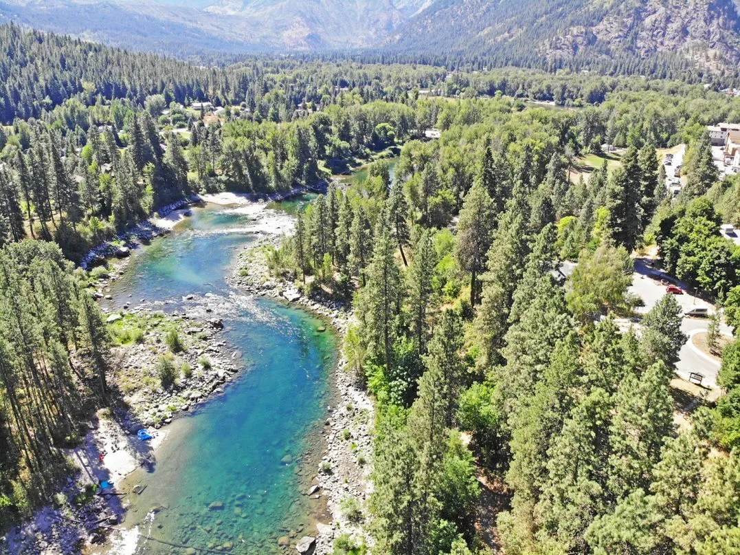
Exact mileage varies because your turnaround point is the whole personality of this hike, and because people start from different #1570 access points along Icicle Road. Your recorded numbers also depend on your GPS track, small stops and starts, and exactly where you call your turnaround. The character stays consistent: steep early gain, then rolling ridge travel that can extend your day quickly.
- Half-day outing: turning around at the first major ridge viewpoint is often reported in the 4 to 6 mile round trip range with roughly 1,500 to 2,200 feet of gain. Treat these as wide trip-report ranges, not guaranteed stats. If you want numbers you can actually plan on, drop a pin on your intended turnaround point in your map app and use its distance and elevation estimate for the exact access point you plan to park at.
- Longer ridge day: if you keep following Trail #1570 beyond the first major ridge viewpoint, a simple, actionable way to frame it is a time-based, water-based, or elevation-based turnaround. For example, “turn around at 4 hours total hiking time,” “turn around when I hit half my water,” or “turn around when I hit X feet on my watch.” Depending on where you call it, it is easy to turn this into an 8+ mile round trip with 2,800+ feet of gain. Connector trails and side paths are part of why these numbers balloon, so keep an eye on your track and do not let curiosity quietly add an extra ridge.
If you are choosing between “great views and still happy at dinner” versus “I want to empty the tank,” decide at the trailhead. Icicle Ridge is one of those hikes where stubbornness adds miles faster than you expect.
Heat and sun
This slope can cook. Leavenworth sits in a drier, sunnier pocket east of the Cascade crest, and Icicle Ridge often feels more like an exposed foothills climb than a shady alpine stroll. Even if it is pleasant in town, it can be intense once you are on the open hillside.
My heat strategy
- Carry more water than you think you need. For me, that usually means starting with at least 2 liters for a shorter out-and-back, and more if it is hot or I am sharing with a dog.
- Start early. I want to be heading down as the heat ramps up.
- Wear sun protection that breathes. A hat with coverage and a light layer beats frying your shoulders.
- Bring salty snacks. This is a sweat-loss hike.
If the forecast is genuinely hot, there is no shame in turning around at the first major ridge viewpoint. You still get the full Icicle Ridge experience: effort, exposure, and that sweeping valley perspective.
Views
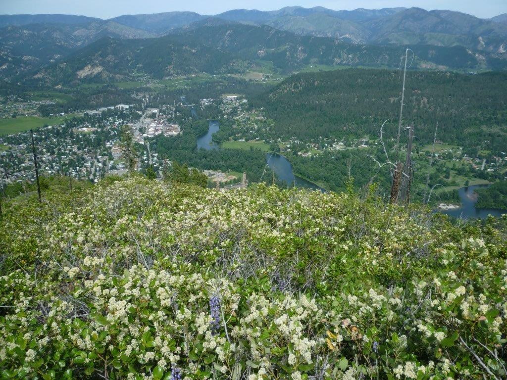
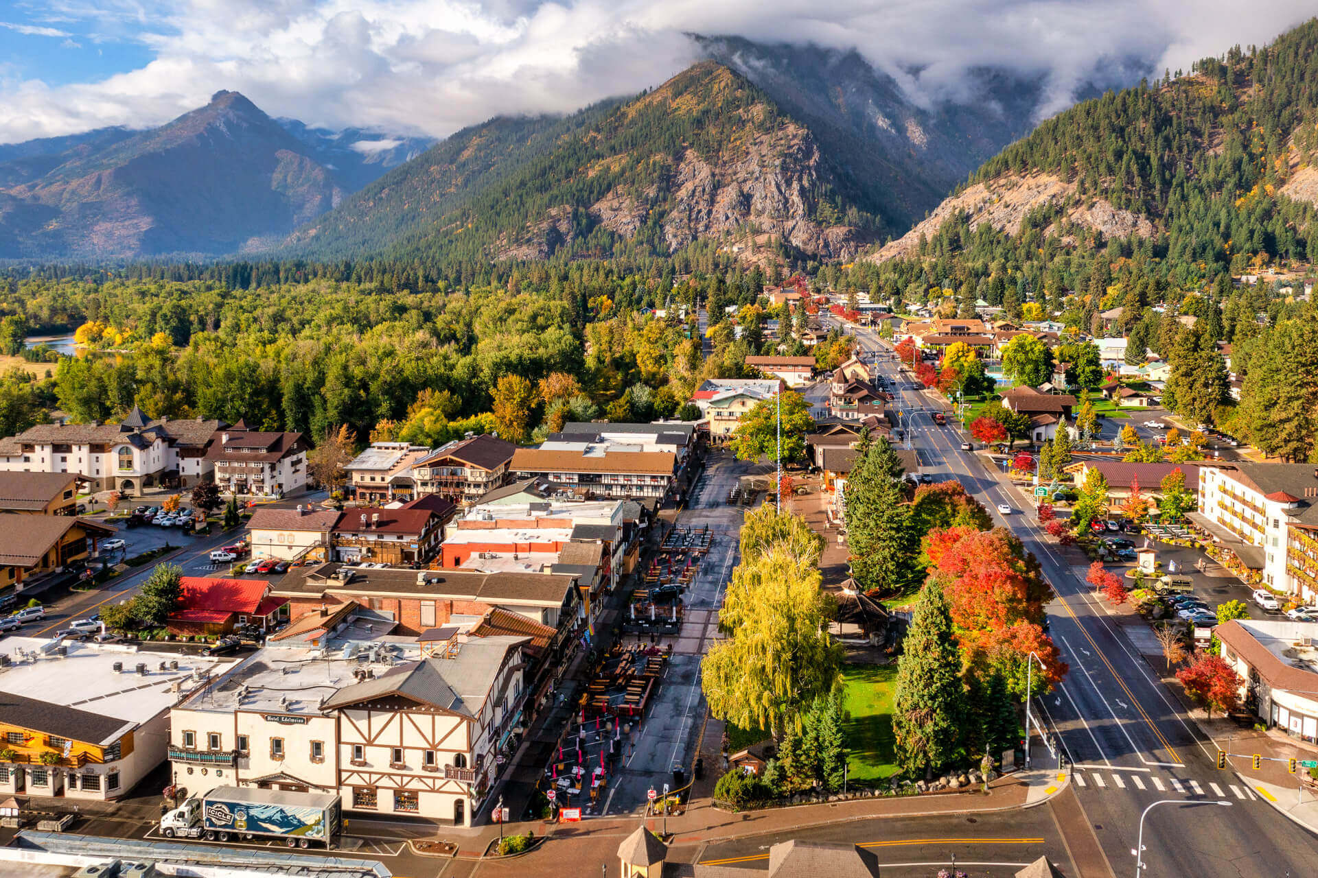
Once you are on the ridge, the landscape opens in a way that feels very “Cascades meets dry side.” You get a broad look at Leavenworth tucked in the valley, the Wenatchee River threading through, and the surrounding hills stacking into the distance.
It is the kind of view that makes you understand the region better. West of the crest, you hike through deep green. Here, you feel the dryness and light, and you can literally see how the valley funnels people, roads, and river routes through the mountains.
Permits and rules
Icicle Ridge gets mentioned in the same breath as “Enchantments” because you are in the same Leavenworth and Icicle Creek neighborhood. The key thing to keep straight is that day hiking on Trail #1570 is generally treated like a normal day hike, while overnight camping and travel into permit-managed zones are what typically trigger extra requirements.
The crisp distinction: day hiking on #1570 is usually just day hiking, but overnight plans, off-route wandering, and boundary-crossing are where you need to slow down and verify. If you plan to camp, connect routes, or push toward wilderness and Enchantments-adjacent areas, confirm current zone boundaries, camp rules, and any permit requirements on official maps before you go. This is one of those places where “close by” does not always mean “same rules.”
Navigation tips
This is not a remote wilderness navigation challenge, but it is also not a one-sign-and-you-are-done situation. The area has multiple trails and connectors, and it is easy to drift onto a side path if you are hiking on autopilot.
- Follow signs for Icicle Ridge Trail #1570. At any signed junction, confirm #1570 on the post and in your offline map before you continue.
- Quick on-trail orientation: the climb starts immediately. When the tread stops feeling like a pure uphill treadmill and starts rolling along a more open ridgeline, you are entering the main view zone. That is also where a lot of people choose to turn around.
- Use an offline map. Cell coverage can be inconsistent, and this is the kind of place where a quick junction mistake can turn your “short” day into a much longer one.
- On the ridge, be intentional about your turnaround. Pick your viewpoint, actually stop, and decide. It is easy to keep drifting forward because the ridge keeps teasing you.
What to pack
I am a carry-on-only traveler, and I pack for day hikes the same way: bring what solves problems, not what looks impressive. Icicle Ridge is all about sun, sweat, and the fact that the downhill is dusty enough to keep you honest.
- Water: carry what you need, because you should not count on filling up on-route
- Electrolytes or salty snacks: future-you will thank you on the descent
- Sun protection: hat, sunglasses, sunscreen
- Shoes with grip: dusty tread can be surprisingly slick on the way down
- Light layers: mornings can be cool even when afternoons scorch
- Offline map: download the area and keep it accessible if you hit junctions
- My always-pack items: a small blister kit and a salty “emergency” snack I do not touch until I need it
Season notes
- Spring: you might run into lingering snow or muddy patches in shaded spots. Early season is also when the climb can feel deceptively easy until it warms up fast.
- Summer: heat, smoke, and wind are the big variables. Check for wildfire closures and air quality before you drive over.
- Fall: cooler temps make the uphill feel friendlier. If you are hiking during hunting seasons in central Washington, bright colors are a smart precaution.
- Winter: traction can be necessary depending on conditions, and access can change with snow. This guide is written with snow-free hiking in mind.
Safety and etiquette
- Heat illness is the main risk. Headache, chills, nausea, and confusion are not “push through it” signals. They are turn-around-now signals.
- Dusty descents can be slippery. Give yourself time and do not rush the downhill.
- Wind happens. On the ridge, gusts can make breaks feel chilly even on a hot day. Keep a light layer handy.
- Wildfire conditions can change fast. Respect closure signs, and if smoke is heavy, save this one for another day.
- Leave No Trace: pack out all trash, including food scraps.
- Dogs: bring extra water, consider paw protection in hot conditions, and pack out waste. Leash expectations vary by area and season, so follow posted rules.
After the hike
One reason I keep coming back to Icicle Ridge is how cleanly it pairs with a town afternoon. If you turn around at the first major ridge viewpoint, you can be back with plenty of time to shower, stretch, and wander.
- Post-hike decompression: find shade and actually drink water, not just coffee
- Slow travel move: take a short walk along the Wenatchee River to cool down and loosen up your legs
- Reward yourself: a relaxed dinner in town tastes better when you have earned it
Quick FAQ
Is Icicle Ridge hard?
Yes, especially at the start. The opening climb is steep and can feel punishing in heat. The difficulty comes less from technical terrain and more from sustained uphill plus sun exposure.
What is the best turnaround point?
For most people, it is the first major ridge viewpoint where Leavenworth and the Wenatchee River valley are clearly visible. A very common trip-report planning range for that turnaround is 4 to 6 miles round trip and roughly 1,500 to 2,200 feet of gain, depending on your exact access point, your exact stopping spot, and what your tracker records. If you want tighter numbers, the best move is to pin your intended turnaround in your map app and use its distance and elevation estimate from the pullout you plan to park at.
Is there water on the trail?
Do not plan on it. Treat this as a carry-all-your-water hike, especially in summer.
Do I need a permit?
You generally do not need a permit for a standard day hike on Icicle Ridge Trail #1570. Parking passes and fees can vary by the specific lot you use along Icicle Road, so check the posted sign at the pullout where you park. If you plan to camp overnight or connect into other areas with different regulations, verify current boundaries, parking rules, and permit requirements before you go.