Lake Stuart Day Hike (Past the Colchuck Junction)

Maya Lin
Maya Lin is a travel journalist and outdoor enthusiast who believes the best trips combine rugged adventures with urban comforts. After spending six years backpacking across four continents, she founded Trail & Town Guide to help fellow travelers navigate both hidden mountain passes and bustling city neighborhoods with confidence.
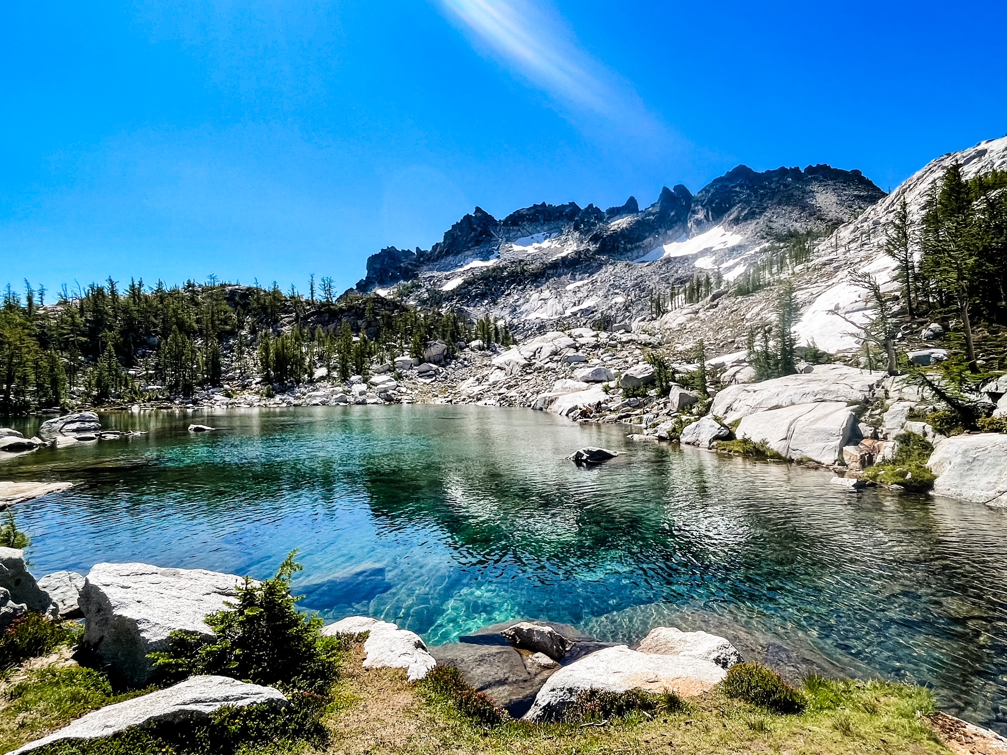
Lake Stuart is one of those Washington hikes that feels like a secret even though it is hiding in plain sight. You start on the same popular approach used for Colchuck Lake, but at the junction you take the right-hand fork and the crowd thins fast. A few miles later you are standing at a long, rocky shoreline with the north side of Mount Stuart looking absolutely unreal above the water.
If you want an Enchantments-area day hike with big payoff, fewer people than Colchuck (most days), and a straightforward trail to follow, Lake Stuart is my go-to recommendation.
Quick stats
- Trailhead: Stuart Lake Trailhead (often called Stuart Lake or Colchuck Lake Trailhead) near Leavenworth
- Route: Out and back to Lake Stuart, right-hand fork at the Colchuck junction
- Distance: about 9 to 10 miles round trip
- Elevation gain: roughly 1,600 to 2,000 feet
- Time: ~4.5 to 7 hours for most hikers, depending on pace and breaks
- Difficulty: Moderate to moderately strenuous (rocky footing in sections)
Numbers vary by map, GPS track, and where your device decides the trailhead begins, so I think in ranges for this one.
Getting there and parking
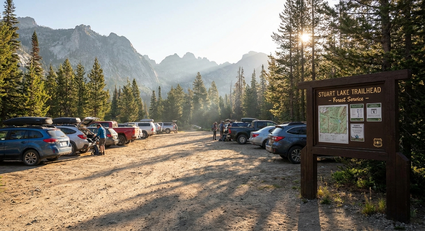
The Stuart Lake Trailhead is up the Icicle Creek Road corridor outside Leavenworth. It is the same starting point for Colchuck Lake, which means the parking situation is the biggest wildcard in your day.
- Road notes: Most hikers reach the trailhead in a standard passenger car in typical summer conditions, but forest road conditions can change (potholes, washboarding, occasional rough patches). Check current conditions before you go, especially early season.
- Arrive early: On weekends and peak season, early is everything. If you roll in mid-morning on a summer Saturday, you are gambling.
- Overflow etiquette: If the lot is full and you find legal roadside overflow, park fully out of the travel lane and do not block gates or driveways. If there is any doubt about whether a spot is allowed, keep driving.
- Passes: This is a USFS trailhead that typically requires a Northwest Forest Pass or a qualifying federal lands pass that covers standard amenity fees (for example, America the Beautiful annual or senior passes). Because accepted passes and fee setups can change, verify the current requirement on the Okanogan-Wenatchee National Forest page for the Stuart and Colchuck Lake trailhead before you go.
- Trailhead basics: Facilities and signage can change over time, so I treat this trailhead like a “pack it in, pack it out” start. Bring your own trash plan and do not count on services.
The hike, step by step
Trailhead to the junction
The first part of the trail is classic Cascades forest hiking: dirt tread with roots, rocks, and steady climbing that never quite lets you forget you are gaining elevation. You will pass a few creek-adjacent spots and small drainages depending on the season, and you will likely see plenty of hikers headed for Colchuck, especially early in the day.
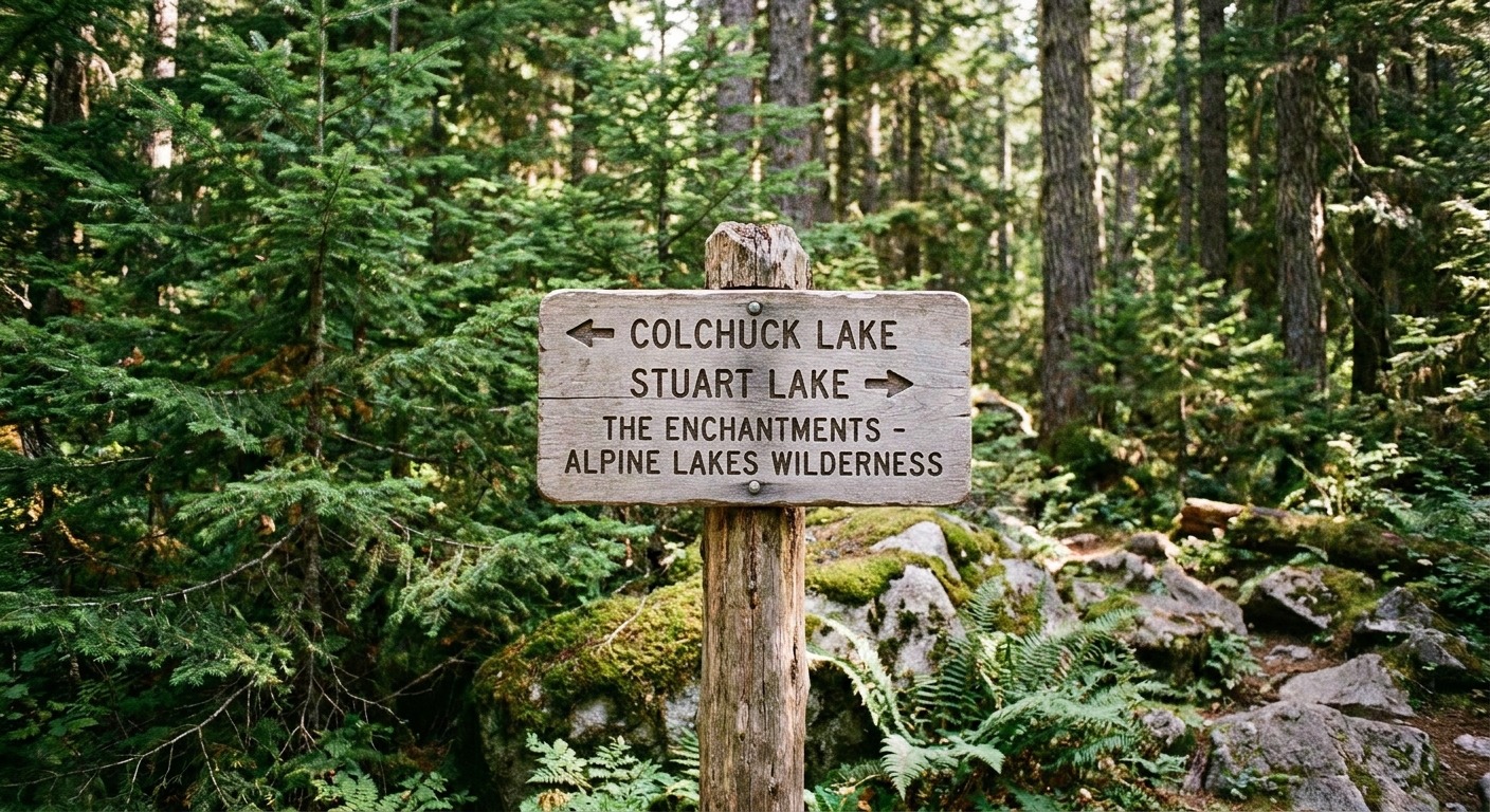
Landmarks to watch for: You will cross creek drainages and pass obvious worn “pull-off” spots where people take quick breaks. The big navigational moment is not subtle, though. You are looking for a signed fork where one direction points to Colchuck Lake and the other points to Stuart Lake.
Mileage reality check: Most hikers hit the signed Colchuck and Stuart split at roughly 2.5 to 3.5 miles from the trailhead, depending on the map and GPS track. If your device says 2.7 and your friend’s watch says 3.3, welcome to the club.
The junction: take the right fork
You will reach a signed junction where the trail splits for Colchuck Lake and Stuart Lake. Take the right-hand fork for Stuart Lake. The left fork heads toward Colchuck Lake and, beyond it, the upper Enchantments routes.
A small mental trick I use: at the junction, I stop for a snack, check water, and do a quick foot assessment. Once you turn right, it feels quieter and more remote, and it is easy to keep cruising until you realize you should have adjusted something back at the split.
Past the junction
Past the split, the character shifts a bit. You are still in forest, but the tread often feels rougher and the hiker traffic typically drops off.
- Footing: Expect rocky sections and roots. Trail runners are common here, but if you are prone to ankle rolls, hiking shoes or boots can be a calmer choice.
- Grade: Mostly steady, with a few punchier bits. Nothing technical, just persistent.
- Navigation: Straightforward in summer conditions. In early season snow, the trail can disappear and even the junction can be easy to miss if you are not paying attention.
From the junction, it is usually another 1.5 to 2 miles before you start getting those first real openings and hints of granite ahead. The first time Mount Stuart shows itself, it is a full stop moment.
What the lake is like
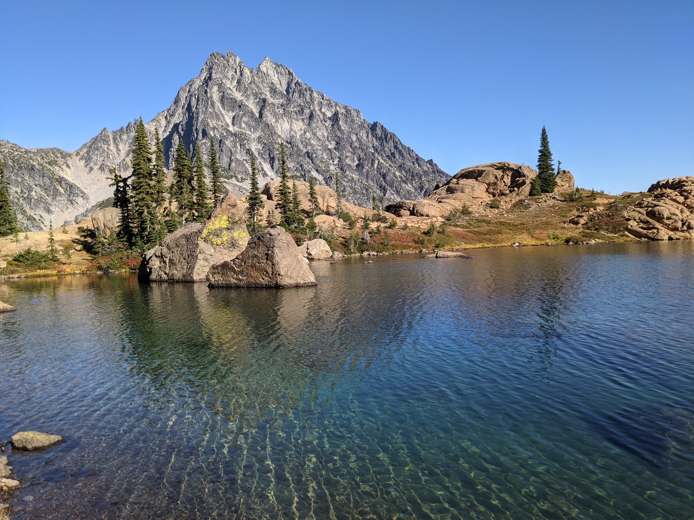
Lake Stuart has a rugged shoreline with rocks, logs, and pockets of flatter spots that make for great snack breaks. It is not a manicured beach-lake. Think alpine bowl vibes, with Mount Stuart dominating the scene.
If you want the most dramatic views, wander a bit along the shore. Just keep your steps careful. The rocks can be slick, and it is not a place where you want to test your balance near the water after a long hike.
Swimming
Let me be honest: many people do not actually swim in Lake Stuart, even if they bring the dream of a post-hike dip. (This is based on what I usually see at the shore, not a scientific survey.)
- Water temperature: Cold, even in summer. This is alpine water, and it can feel like an instant ice bath.
- Shore access: More rock-hopping than wading in. You can get in, but it is not a gentle sandy entry.
- Best expectation: A quick dip for the brave, or a feet-in soak for everyone else.
My personal sweet spot is taking shoes off, letting my feet go numb for a minute, then drying off in the sun while I eat something salty. It scratches the “lake swim” itch without turning into an accidental cold-water endurance event.
Bugs
If you hike Lake Stuart in peak summer, bugs can be the make-or-break factor for how long you want to linger at the shore.
- Worst window: Often late July through September in many years, with plenty of variation depending on snowpack and heat.
- Where they hit: Forested stretches and any calm, shaded areas. At the lake, breezes can help, but still plan for mosquitoes.
- What works: A small bottle of repellent, long sleeves if you run sweet, and keeping breaks slightly breezier or sunnier if the bugs are thick.
- Pro move: Pack a headnet if you hate bugs more than you hate carrying one extra item. It is a tiny weight penalty for a massive mood upgrade.
Water, food, and pacing
This is a classic “you are out long enough to notice mistakes” day hike, so I treat it like a mini endurance day.
- Water: Carry enough for the full hike, especially on hot days. There are often flowing sources along the corridor depending on season, but do not count on them late summer.
- Filtering: If you plan to top off from creeks or the lake outlet, use a real filter or purification method. Treat all backcountry water as potentially contaminated.
- Snacks: I like a mix of quick sugar and real food. Think trail mix plus something you will actually want to eat when you are tired.
- Pacing: Save something for the return. The climb out is gradual, but your legs will feel it.
Turnaround options
Lake Stuart is a perfect destination in its own right. If your goal is a satisfying day hike with a big alpine payoff, turn around at the lake and call it a win.
Best turnaround point
- Turnaround at the first good lakeshore spot where you can comfortably sit, eat, and enjoy the view. For many people, that is 15 to 30 minutes of exploring along the shoreline max.
Time-based turnaround
If you want a simple rule that protects your afternoon, use this:
- Turn around no later than halfway through your available daylight or driving plan. In practice, for most people aiming to be back at the car by dinner, that means turning around from the lake after a 30 to 60 minute break, or earlier if the bugs are intense.
The walk back can feel long, and the last thing you want is to rush down rocky trail when you are tired.
What to pack
- 10 essentials, including a headlamp
- 2 to 3 liters of water (more on hot days)
- Filter or purification method if you plan to top off
- Layers: lightweight insulating layer and rain shell
- Bug protection: repellent, and optionally a headnet
- Sun protection: sunglasses, sunscreen, hat
- Grippy footwear, plus trekking poles if you like extra stability on the descent
Season and safety
The easiest time to do Lake Stuart as a straightforward hike is during the usual snow-free window, often July through October. Year to year, that can shift a lot.
- Shoulder season: In spring and early summer, snow can linger, obscure the trail, and make route-finding more serious. If you are not comfortable navigating in snow, this is not the trail to “wing it” on.
- Traction: When there is firm morning snow or lingering icy patches, microspikes can be the difference between “fun adventure” and “why did I do this.”
- Avalanche risk: In winter and early spring, conditions can move from hiking to snow travel quickly. Use conservative judgment and check current avalanche information if you are traveling in snowy terrain.
- Cell service: Expect it to be spotty to nonexistent. Plan like you will not be able to call for help.
- Smoke and closures: Late summer in Washington can mean wildfire smoke, fire bans, or sudden area closures. Check current conditions, air quality, and forest notices before you commit.
Dogs
Dogs are common on this trail. Keep them under control, be considerate around other hikers, and follow current leash rules for the area. The rocky shoreline can be hard on paws, and the lake is cold, so bring water and a plan that does not depend on your dog self-regulating.
Leave No Trace
This corridor sees heavy use because it shares the approach with Colchuck. A few small habits make a big difference:
- Stay on trail even when it is tempting to shortcut muddy spots.
- Keep shoreline breaks durable on rock and established areas.
- Pack out everything, including food scraps.
- Give wildlife space, especially around water and near the lake outlet areas.
FAQ
Is Lake Stuart less crowded than Colchuck Lake?
Usually, yes. The first few miles can feel busy, then the Stuart fork tends to thin out noticeably. On peak summer weekends, though, “less crowded” can still mean plenty of company.
Do I need special permits for a day hike?
For a standard day hike, you typically just need the appropriate trailhead parking pass. Most of the time that means a Northwest Forest Pass or a qualifying federal recreation pass, but rules can change, so confirm current requirements on the Okanogan-Wenatchee National Forest site before you go.
Can kids do this hike?
Strong hiking kids can, but it is a long day with rocky footing. If you are on the fence, consider a shorter objective or plan for a conservative turnaround time.
When is the best time of year?
For most hikers, mid-summer through fall is the simplest. Early season can mean snow patches and trickier navigation. Mid to late summer brings the highest chance of bugs, but also the most reliable trail conditions.