Mailbox Peak: Old Trail vs New Trail

Maya Lin
Maya Lin is a travel journalist and outdoor enthusiast who believes the best trips combine rugged adventures with urban comforts. After spending six years backpacking across four continents, she founded Trail & Town Guide to help fellow travelers navigate both hidden mountain passes and bustling city neighborhoods with confidence.
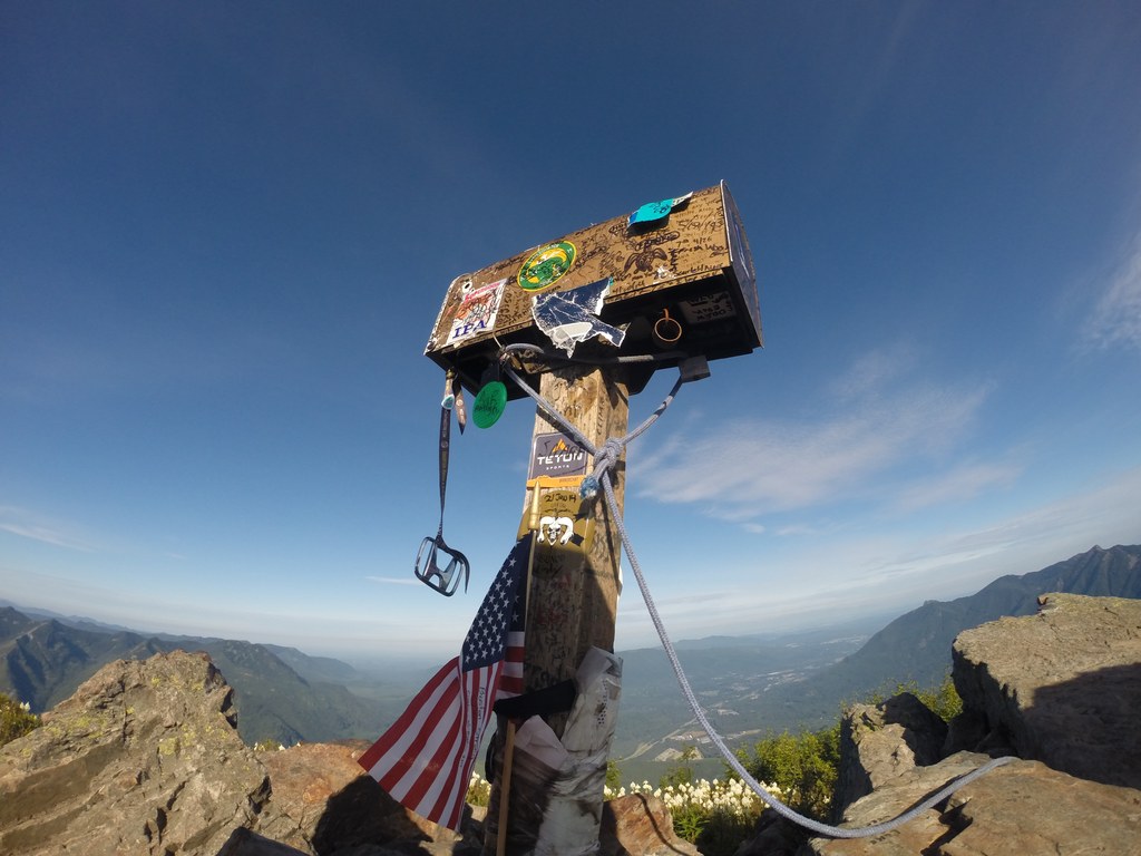
Mailbox Peak is one of those Washington hikes that shows up in conversation the same way spicy ramen does. Someone always says, “It’s not that bad,” and someone else stares into the middle distance like they just remembered the climb.
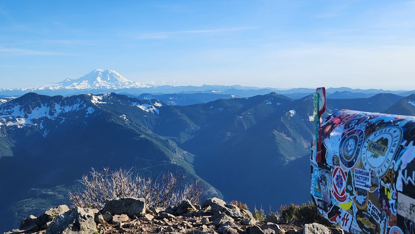
The good news is you have a choice. Mailbox Peak has two main routes from the same general area near North Bend: the Old Trail (short, notoriously steep) and the New Trail (longer, more consistent, and generally kinder on knees and morale). They both lead to the summit mailbox, the sweeping Cascades views, and the oddly satisfying moment of signing a register that is often tucked inside alongside notes from other hikers who are also quietly rethinking their life choices.
Quick comparison
Stats can vary a bit by GPS track, snow conditions, and exactly where you start. Different apps can also include short connector bits differently. These ranges are solid for planning your day.
| Route | Round-trip distance | Elevation gain | Typical grade feel | Best for |
|---|---|---|---|---|
| Old Trail | About 5.5 to 6 miles | About 4,000 feet | Very steep, sustained, leg burner | Conditioning hike, “I want the challenge” days |
| New Trail | About 9 to 10 miles | About 4,000 feet | Steady climb, more switchbacks, fewer shock-steep pitches | First-timers, safer pacing, more enjoyable ascent |
Translation: the elevation gain is basically the same. The difference is how quickly that gain happens, and how much the trail design works with you instead of against you.
Old Trail
The Old Trail is famous for a reason. It goes up. Immediately. And then it keeps going up. It is the kind of trail where you stop “just to drink water” every eight minutes and pretend you are admiring moss.
Distance and grade
- Distance: roughly 5.5 to 6 miles round trip.
- Elevation gain: roughly 4,000 feet.
- Grade: extremely steep for long stretches, with fewer switchbacks and more straight-up climbing.
If you are used to steep climbs or you love a cardio test, the Old Trail scratches that itch. If you are newer to steep Pacific Northwest footpaths, it can feel like someone set your stairmaster to “spite.”
Footing
Expect roots, slick dirt in wet months, and a lot of direct uphill. On the descent, the Old Trail can be rough on knees and quads, and it is easier to slip when the ground is damp or dusty.
New Trail
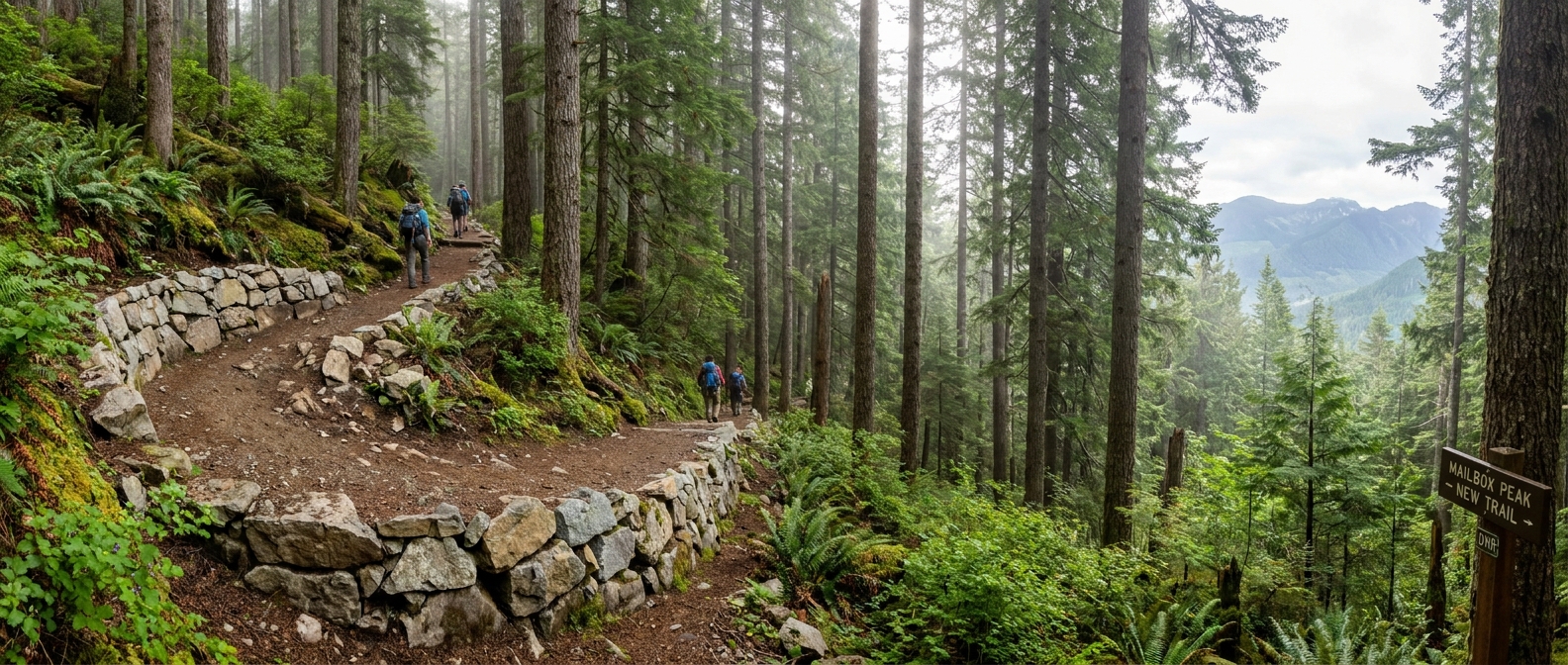
The New Trail was built to be sustainable and to spread the climb out. It still climbs hard, because Mailbox is Mailbox, but it gives you a rhythm that is much easier to maintain. I think of it as the difference between sprinting stairs and hiking a steep hill with switchbacks.
Distance and grade
- Distance: roughly 9 to 10 miles round trip.
- Elevation gain: roughly 4,000 feet.
- Grade: more moderate overall, with consistent switchbacks and fewer “wall” sections.
One honest note: the New Trail is less steep, but it is longer. If you struggle more with long, steady climbs than short suffering, the extra miles can feel mentally harder even if your legs are happier.
Trail feel
The New Trail is still mostly forested for much of the climb, but the tread is generally more predictable and the switchbacks reduce erosion and slipping. You will still work for the summit, but you are less likely to feel like every step is a negotiation.
Parking and trailheads
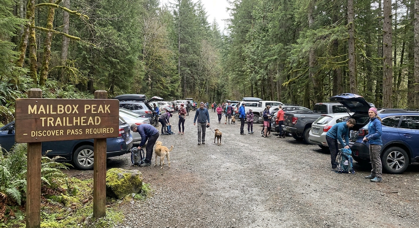
Both routes are accessed from the same general Mailbox Peak area near North Bend, and both can be busy. Trailhead logistics can change over time, so treat any single map pin as a starting point and confirm current details before you drive.
- Discover Pass: a Washington State Discover Pass is required to park at the trailhead.
- Arrive early: if you want a straightforward parking experience, aim for early morning.
- Have a backup plan: if lots are full, do not create new parking spots where you block traffic or emergency access.
- Expect crowds: mid-morning on a sunny weekend can feel like a group project.
If you care about exact mileage, verify the route listing you are using (and the specific trailhead name) before you go. Apps and trip reports do not always start and stop in the same place.
Also worth a quick check: whether restrooms are available, and whether seasonal snow, downed trees, or maintenance work has changed access.
Which route to choose
If this is your first time hiking Mailbox Peak, I recommend the New Trail for most people.
- Better pacing: the steadier grade helps you keep an even effort, which usually means a more pleasant day overall.
- Safer descent: fewer ultra-steep pitches means less sliding and less knee misery on the way down.
- More first-timer friendly: you still earn the summit, but you are less likely to burn out early and turn it into a survival march.
The Old Trail is a great second visit if you want the challenge or you are training for steeper objectives. But for a first impression, the New Trail is the version that is more likely to make you say, “That was hard, but I’d do it again,” instead of, “I need to lie down for a week.”
Time and what to bring
Everyone moves differently, but these ballpark ranges help with planning:
- Old Trail: often around 4 to 7 hours round trip.
- New Trail: often around 5 to 9 hours round trip.
A quick, practical packing list for either route:
- Plenty of water and snacks (this is not the hike to under-pack calories).
- Layers for the summit, even on warm days.
- A headlamp if there is any chance you will finish late.
- Traction in shoulder seasons (microspikes can turn a sketchy day into a reasonable one).
In winter and early spring, treat this like a real mountain outing. Conditions can change fast and the upper mountain can hold snow and ice longer than you expect. Check recent trip reports and consult the NWAC forecast when snow is in the picture.
My recommendation
First trip recommendation: hike Mailbox Peak via the New Trail. It delivers the same summit payoff with a more sustainable climb, a more controlled descent, and a better chance you will actually enjoy your time in the woods instead of bargaining with your calves.
A very good reason to turn around: if you are encountering ice or firm snow without traction, especially on steep sections or near the upper mountain, call it. Mailbox is close to Seattle, but it is still a serious hike where slips can get serious fast. If you did not bring microspikes and conditions feel sketchy underfoot, the summit will still be there another day.
I love a tough hike, but I love a safe hike more. Mailbox Peak rewards patience and good judgment at least as much as it rewards strong legs.