Twin Falls Hike near North Bend

Maya Lin
Maya Lin is a travel journalist and outdoor enthusiast who believes the best trips combine rugged adventures with urban comforts. After spending six years backpacking across four continents, she founded Trail & Town Guide to help fellow travelers navigate both hidden mountain passes and bustling city neighborhoods with confidence.
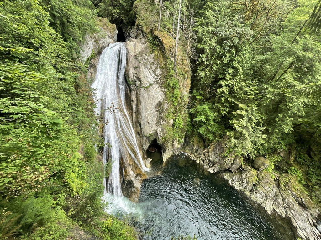
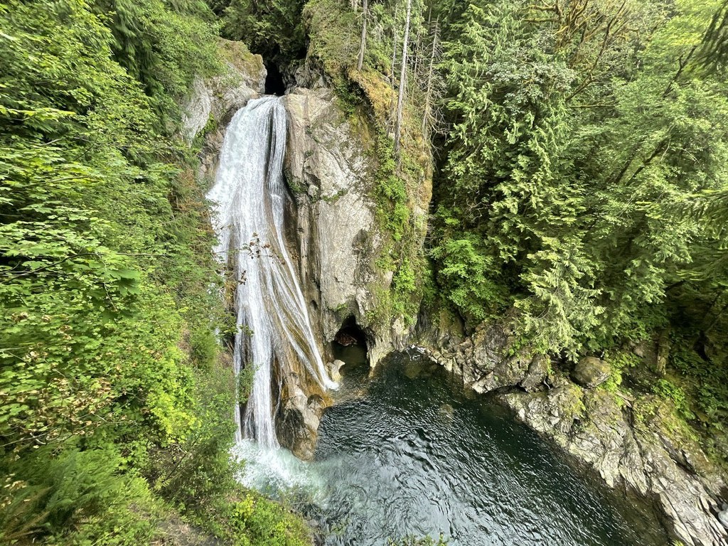
There are a lot of “Twin Falls” in the world, but the one you want for this hike is the Washington waterfall near I-90 outside North Bend, in the Snoqualmie River valley near Olallie State Park. It is the kind of quick-hit adventure I love on a Seattle-area day: a real waterfall payoff, mossy forest air that smells like wet cedar, and you are back in town fast enough for a good coffee and a late lunch.
If you are here for the famous cascade plunging into a rocky gorge, you are in the right place. If you meant Twin Falls, Idaho, that is a completely different trip.
Quick facts
- Location: I-90 corridor near North Bend, Washington, in the Snoqualmie River valley near Olallie State Park
- Waterfall: Twin Falls (the main payoff is the lower falls viewpoint)
- Typical hike style: Forested out-and-back with a steady climb back out of the gorge
- Parking: Small lots that fill fast on weekends
- Pass/fee: Day-use parking rules here can vary by lot and managing agency. Some nearby parking is state-managed and may require a Discover Pass where posted. Always confirm the specific trailhead signage before you leave your car.
- Key hazards: Slick rocks, wet roots, and cliff-edge viewpoints with little margin
Getting there
This is an easy one to navigate from Seattle, but I still treat it like a real outing. Aim your map app at Twin Falls Trailhead near North Bend and double-check you are headed for the I-90 Snoqualmie River valley, not anything in Idaho.
- Navigation tip: Cell service can be spotty in the trees and along the river. I download the map before I lose signal.
- Road reality: Weekend mornings can back up near exits and lots. If you can swing a weekday morning, it feels like a different place.
Which trailhead to use
There are a couple of ways people “do Twin Falls” here, and the confusion usually comes down to where you park. In plain terms, you want the access that is signed for the Twin Falls Trail and the gorge viewpoints. This stretch of the I-90 corridor is managed as a mix of lands and access points, so I let trailhead signage, not assumptions, be the boss.
Option A: Twin Falls Trailhead (most direct)
This is the most straightforward choice if your main goal is standing at the railing and watching the water hammer into the gorge. It is the classic start for the lower falls viewpoint.
- Best for: First-timers, families, anyone who wants the waterfall payoff quickly
- Tradeoffs: Parking fills early, especially on sunny weekend mornings
Option B: Park farther away (adds distance)
On busy days, you may have to park legally wherever you find space, then walk back to the signed Twin Falls access. In practice, that can mean a longer approach and a little extra attention to posted signs so you reconnect with the correct trailhead rather than wandering onto a different path in the corridor.
- Best for: People who want more forest time and do not mind extra walking
- Tradeoffs: Adds time, and it is easier to miss turnoffs if you are not watching for posted Twin Falls signs
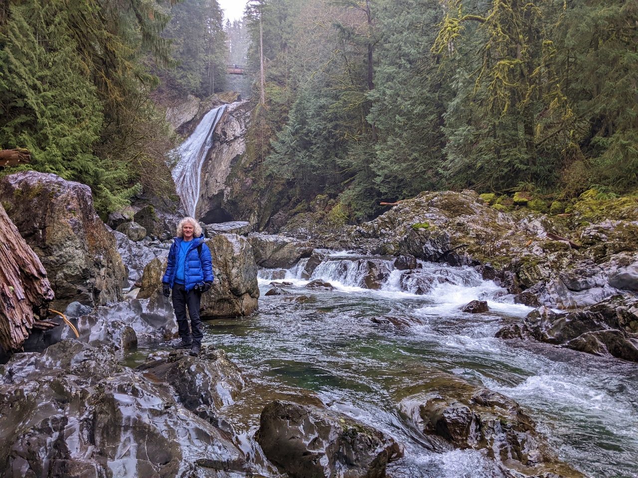
My rule of thumb: If your GPS says “Twin Falls Trailhead” and you see clear official signage for Twin Falls, you are likely lined up well. Once you are on the trail, follow posted signs for Twin Falls and stick to the main, well-traveled path toward the gorge viewpoints.
Mileage and timing
Mileage varies depending on the exact parking area, minor reroutes, and which viewpoint spur you take. I use these as planning ranges, not hard promises. Before you go, check the latest official trailhead info and a recent, reputable trip report for current routing and distance.
Main viewpoint
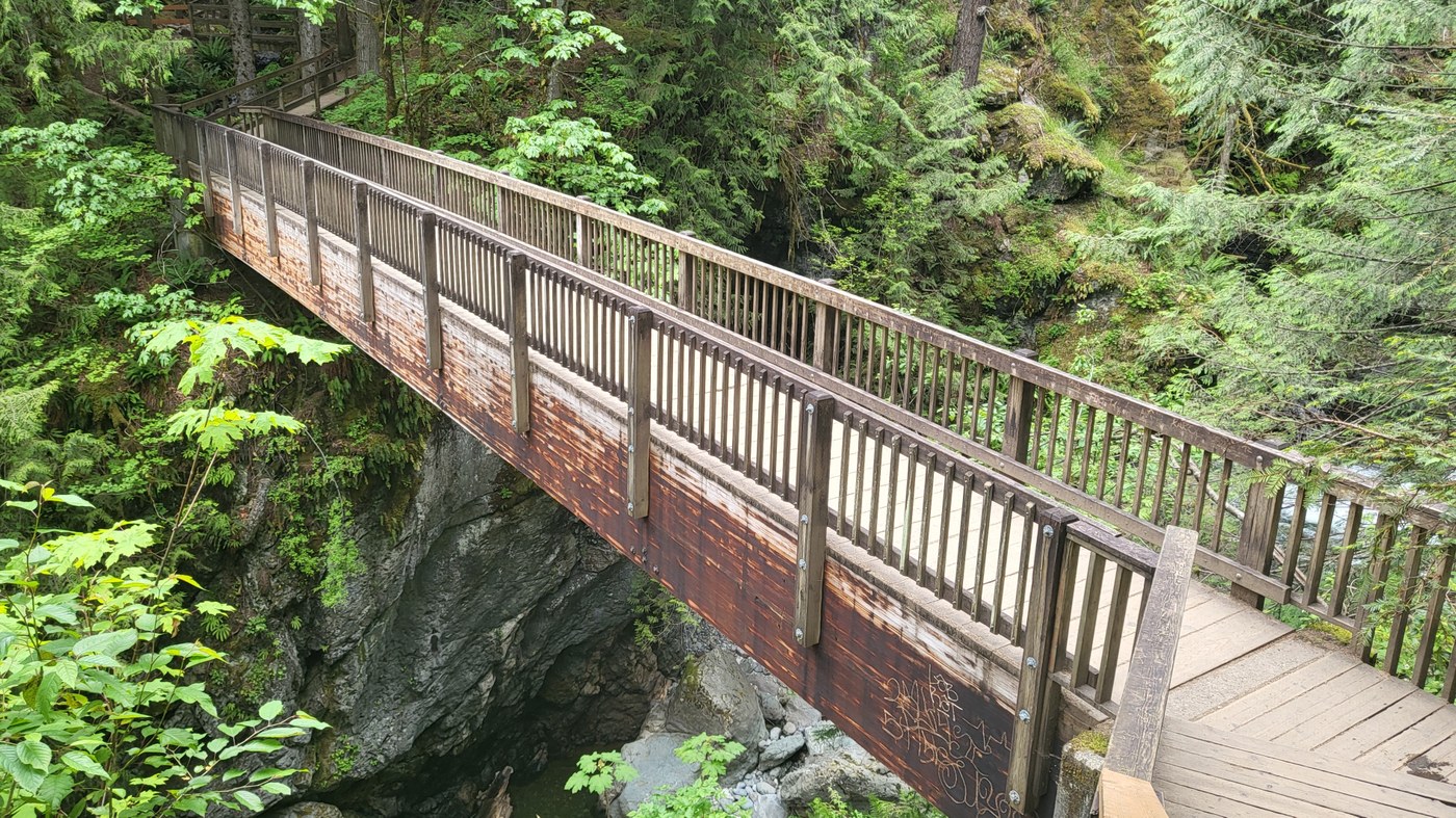
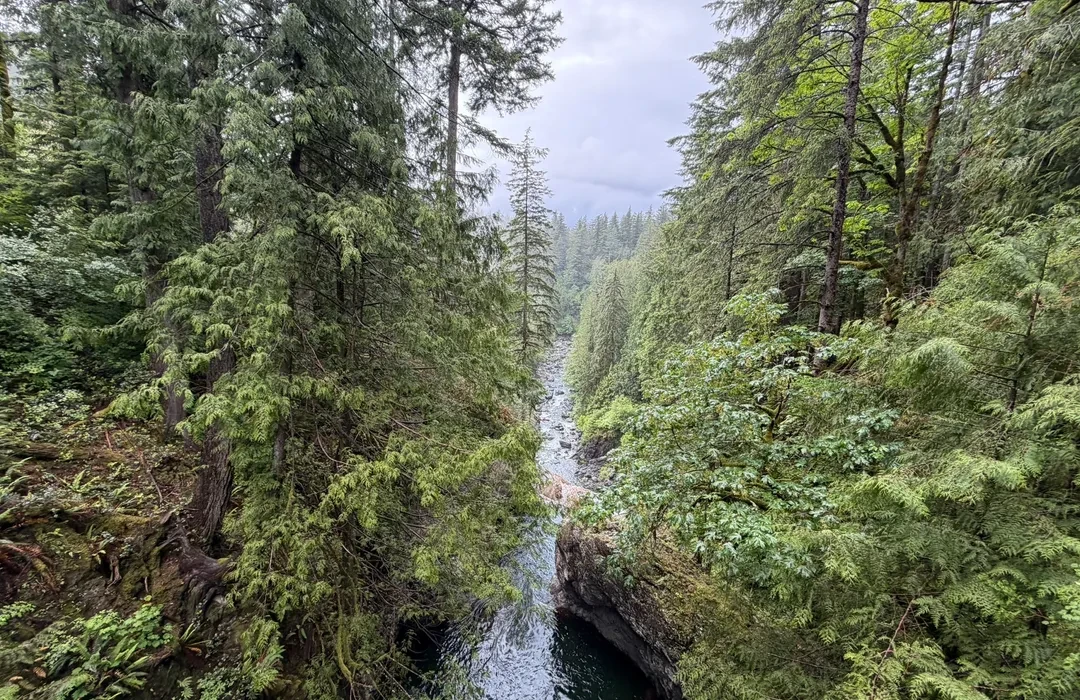
Plan on roughly 2.5 to 3.5 miles round trip from the most common Twin Falls Trail access, with a moderate climb on the way back out from the gorge. This is the classic experience: you drop through lush second-growth forest, cross bridges, then arrive at the viewpoint where the falls feel loud enough to vibrate your ribs.
Beyond the main viewpoint (optional)
Plan on roughly 3.5 to 5.0 miles round trip if you keep walking on the main trail beyond the headline overlook, only if it is open. This section is sometimes impacted by maintenance, high water, storm damage, or other closures, so I treat anything beyond the main viewpoint as bonus walking, not a guaranteed add-on.
Timing tip: Even though the mileage is friendly, add time for slick mud, photo stops, and occasional slowdowns at bridges or narrow sections. On quiet days you may walk straight through. On busy days it can feel like a little parade.
Pass and parking
This area sits in a patchwork of managed lands and access points, and parking requirements depend on the specific lot. In the I-90 corridor, some state-managed day-use parking may require a Discover Pass where it is posted. Other nearby lots may use different rules. I do not assume anything. I read the sign where I park, then I follow it.
- Do this first: Before you lock up, check the parking signs for pass requirements and any lot-specific rules.
- Arrive early: Lots here are not huge, and this is one of the closest big-waterfall hikes to Seattle.
- Have your stuff ready: Pass displayed if required, shoes on, daypack packed. It keeps things moving in a crowded lot.
If you do not already have the required pass for the lot you choose, the safest plan is to arrange it ahead of time rather than counting on an on-site purchase option.
Facilities and dogs
Facilities and rules can vary by which access point you use, so I treat the trailhead like a place to confirm, not guess. If you are hiking with a dog, expect standard trail etiquette: keep your dog under control, pack out waste, and follow any posted leash rules at the trailhead.
My practical approach: assume there may not be trash service, pack out everything, and do not count on running water. If there is a toilet at the lot you choose, consider it a bonus, not a guarantee.
Safety at the viewpoints
The best views of Twin Falls come with a catch: waterfall spray plus slick rock plus steep drop-offs. Treat this like a short hike with real consequences if you get careless.
- Stay behind railings and established barriers. If you see social trails toward the edge, skip them.
- Expect slippery footing. Wet roots and polished rock can feel like ice, especially in rain or shoulder season.
- Watch kids closely. This is not the place for free-roaming at the viewpoint.
- Wear traction-friendly shoes. Trail runners with decent tread or light hikers are ideal. Fashion sneakers get sketchy fast.
- Keep your phone away from the edge. The classic move is leaning out for a photo. The better move is stepping back and zooming in.
Cold-weather note: In winter, mist can freeze on boards, rocks, and bridge approaches. If it looks glossy, slow down.
If you want the best light without the biggest crowds, try a weekday morning. You get that Pacific Northwest hush, the kind where you hear the river before you see it, and the viewpoint is less of a traffic jam.
What to pack
This is a short hike, but it is a wet one. My go-to kit stays minimal and practical.
- Water: At least one bottle per person
- Rain shell: Even on “dry” days, the mist at the falls can soak you
- Warm layer: The gorge can feel cooler than the parking lot
- Snacks: Quick calories for the climb back up
- Small first aid basics: Blister coverage is enough for most people here
- Microspikes (seasonal): Only if conditions are icy and you are comfortable using them
Leave no trace note: Pack out everything, including fruit peels. Stay on the main trail and skip the tempting little side scrambles down toward the river. The corridor erodes fast, and it stays beautiful when we tread lightly.
Best time to go
Twin Falls runs year-round, and that is part of the appeal.
- Late fall through spring: Big water, dramatic roar, and lush greens. Expect mud and slick footing.
- Summer: Easier footing and longer days, but lower flow and heavier crowds.
- After rain: Stunning flow, but be extra conservative around viewpoints.
- Winter: Beautiful and quiet, but watch for icy bridges, frozen mist, and occasional blowdown after storms.
If you are trying to balance rugged with comfort, this is a great shoulder-season choice: hike in the morning, then head back toward North Bend or Snoqualmie for a warm meal and a cafe stop.
Accessibility
This trail is best treated as a standard forest hike, not an accessible path. Expect dirt tread, roots, uneven surfaces, and grades that are not stroller-friendly, especially near the gorge and viewpoints. If you need a smooth, wheelchair-friendly route, this is likely not the right fit.
FAQ
Is Twin Falls in Washington the same as Twin Falls, Idaho?
No. This hike is to Twin Falls near North Bend in Washington along the I-90 corridor. Twin Falls, Idaho is a city in southern Idaho and not related to this trail.
Is the hike hard?
Most hikers find it moderate. The route is not long, but the climb back up from the river is enough to make you breathe a little, especially if the trail is muddy.
Can I do just the main viewpoint and turn around?
Yes, and many people do. The main viewpoint is the headline moment. Anything beyond that is optional bonus walking if you want more trail time.
Do I need a Discover Pass?
It depends on the lot. In this corridor, some state-managed day-use parking requires a Discover Pass where it is posted, and other lots may use different rules. Because requirements can vary by specific parking area, always check the signage at the trailhead where you park and confirm current rules before you go.
Are dogs allowed?
Often, yes, but rules can vary by managing agency and specific access point. Check the trailhead signage for leash requirements and any seasonal restrictions, and plan to keep your dog under control around bridges, crowds, and viewpoints.
Can I continue past the main viewpoint?
Sometimes. Conditions past the main viewpoint can be affected by maintenance, storms, or high water, and closures do happen. Check current conditions before you count on a longer walk, and turn around if you hit a closure sign or sketchy conditions.
Are the viewpoints safe?
The established viewpoints are designed for visitors, but conditions are often wet and slippery. Stay on the main trail, respect railings, and avoid scrambling on rocks near the edge.