Best Hikes in Saguaro National Park
Saguaro National Park is the rare place where you can hike through a living museum of the Sonoran Desert and still be back in Tucson for a shower and a perfect cortado. The park is split into two districts on either side of the city: Saguaro West (Tucson Mountain District) and Saguaro East (Rincon Mountain District). West is famous for dense saguaro forests and glowing sunsets. East climbs higher, stays a touch cooler, and offers bigger-day options if you want to earn your dinner.
This guide rounds up the best hikes in both districts with trail stats, what they feel like on the ground, and the practical details that make desert hiking actually fun.

Before you pick a trail
Fees and passes
Saguaro National Park charges an entrance fee. If you are visiting more than one national park this year, an America the Beautiful pass can be the easiest way to simplify the math. Check the official NPS Saguaro page for current fees, pass details, and updates before you go since these can change.
Pet rules you need to know
This is a big one: pets (including dogs) are not allowed on park trails, with limited exceptions for paved areas like roads, picnic areas, and select paved paths. If you are traveling with a dog, plan on scenic drives and short paved strolls only, and always confirm current rules on the NPS site.
Go early, hike smart
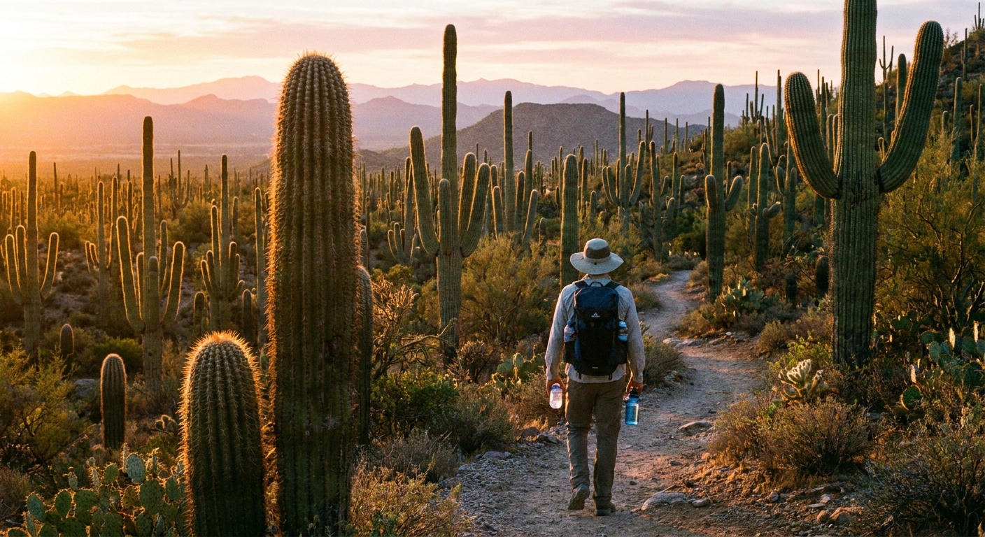
Heat is the main challenge here, not altitude or technical terrain. Most visitors are happiest in October through April. In late spring and summer, plan sunrise starts and shorter routes. Trails can feel surprisingly exposed, and shade is usually scarce in the low desert.
Water, sun, and desert math
- Carry more water than you think. A common warm-weather rule of thumb is up to 1 liter per hour, but it varies by temperature, effort, and the person doing the hiking. Many routes have no reliable water at all, so bring what you need from the start.
- Sun protection is non-negotiable: wide-brim hat, sunscreen, sunglasses, and lightweight long sleeves.
- Footwear: sturdy trail runners are fine for most routes, but watch for loose rock, cholla spines, and the occasional sandy wash.
- Navigation: signed junctions are common, but bring an offline map. Washes and braided paths can be confusing.
Parking and trailheads
Parking can be limited at popular trailheads, especially on winter weekends and during peak visitor season. If a trailhead uses a smaller lot or a roadside pull-off, arrive early and have a backup hike in mind.
Which side fits your day
- West (Tucson Mountain District): classic saguaro density, easier-to-moderate loops, great golden hour.
- East (Rincon Mountain District): more elevation options, longer hikes, and a “wilder” feel close to the city.
Best hikes in Saguaro West
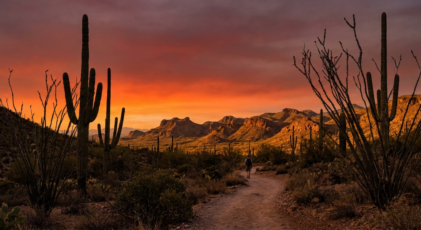
Think of Saguaro West as the park’s greatest-hits album: big cactus scenery almost immediately, excellent loop options, and a front-row seat to desert sunsets.
Valley View Overlook Trail
Why it is worth it: This is the quick-win sunset hike. You get a short trail, a classic viewpoint, and a strong chance of that desert glow that makes you forget your email inbox exists.
- Type: Out-and-back
- Distance: about 0.8 miles round trip (verify posted distance on-site)
- Difficulty: Easy
- Best time: Late afternoon for sunset, or early morning for soft light
Maya note: If you only have an hour, do this and then drive Bajada Loop for additional viewpoints. It pairs beautifully with an unhurried dinner in Tucson afterward.
Desert Discovery Trail
Why it is worth it: A short, interpretive loop that is ideal for families, first-timers, or anyone easing into desert hiking. It is also a good “temperature check” if you are unsure how the heat will feel.
- Type: Loop
- Distance: about 0.5 miles (verify posted distance on-site)
- Difficulty: Easy, mostly level
Accessibility note: It is designed to be visitor-friendly and educational, but accessibility can vary by surface and grade. If you need a fully accessible route, confirm current details at the visitor center.
What you will see: interpretive spots, close-up saguaros, and a concentrated crash course in Sonoran Desert plants.
King Canyon to Wasson Peak
Why it is worth it: Wasson Peak is widely cited as the highest point in the Tucson Mountains. This route gives you a satisfying climb with a summit view that feels much bigger than the mileage suggests.
- Type: Out-and-back or loop options
- Distance: commonly 6 to 8 miles round trip depending on route (confirm your exact option on a current map)
- Difficulty: Moderate to strenuous due to elevation gain and sun exposure
- Best time: Early morning, especially outside winter
Route options to know: Many hikers go up King Canyon and return the same way. A popular alternative is to connect with other trails to create a longer loop (often involving the Hugh Norris area). Exact mileage and elevation gain vary a lot based on the version you choose, so map it before you commit.
Trail feel: steady climbing, rocky sections, and long stretches without shade. The payoff is a wide-open panorama of Tucson, surrounding ranges, and the saguaro-studded valleys.
Parking note: The King Canyon trailhead area can fill fast and may rely on limited roadside parking. Go early, especially on weekends.
Sendero Esperanza Trail
Why it is worth it: If King Canyon feels busy, Sendero Esperanza is a strong alternative that often feels more spacious. It is a great choice for hikers who want mileage and solitude without committing to an all-day mountain epic.
- Type: Out-and-back or longer combos
- Distance: commonly 4 to 8+ miles round trip depending on turnaround or connectors (map your plan)
- Difficulty: Moderate
Maya note: This is a straightforward trail in the sense that you do not need special gear. You do need water, a hat, and the humility to turn around early if the heat starts creeping up.
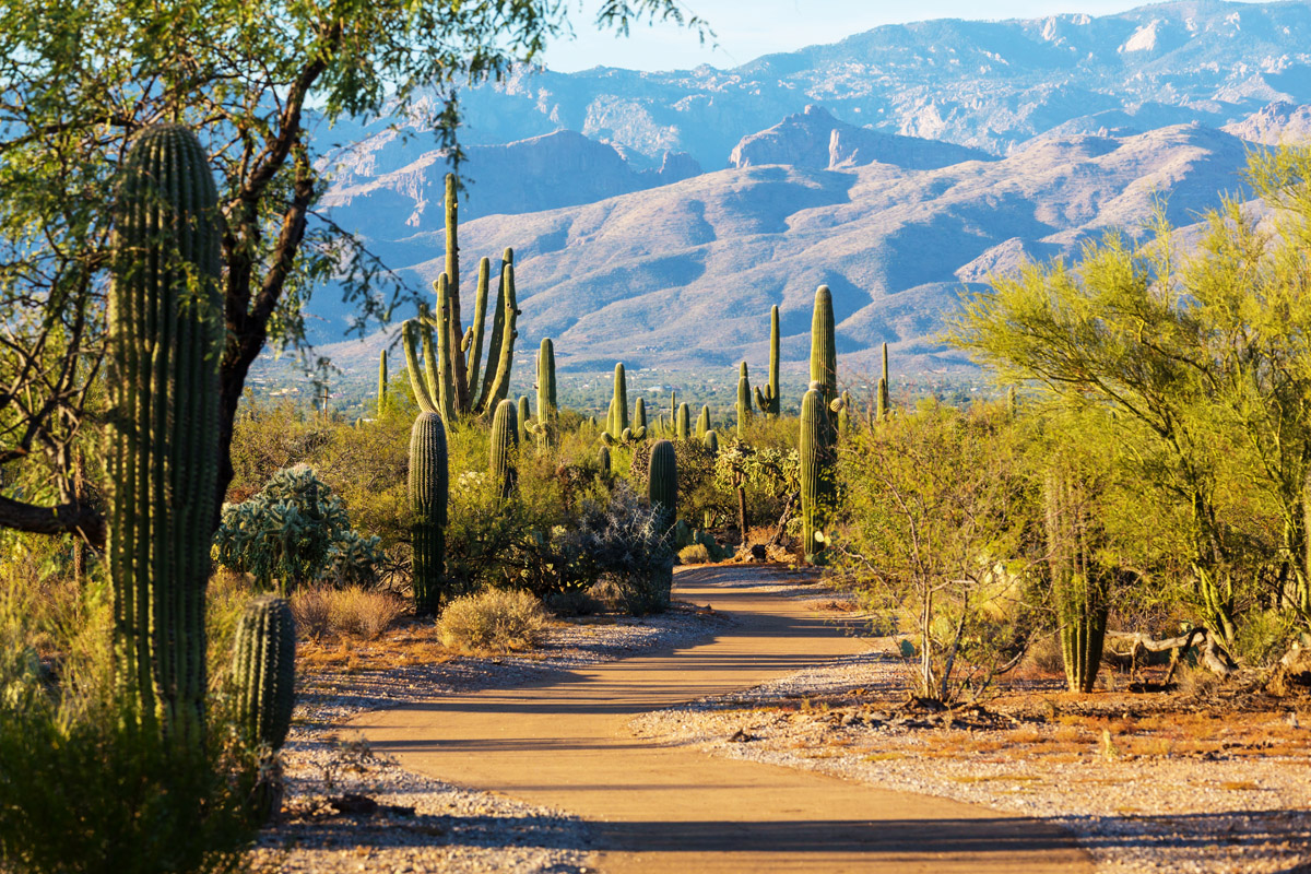
Best hikes in Saguaro East
Saguaro East leans a little more rugged and a little more expansive. You still get iconic cacti, but the hikes can feel more like you are traveling through the desert rather than sampling it.
Freeman Homestead Trail
Why it is worth it: This is a simple, scenic loop with history baked in. It is great for an easy morning walk, especially if you want something satisfying without the effort of a longer hike.
- Type: Loop
- Distance: about 1 mile
- Difficulty: Easy
What makes it special: interpretive elements and a sense of place that ties the desert landscape to human stories.
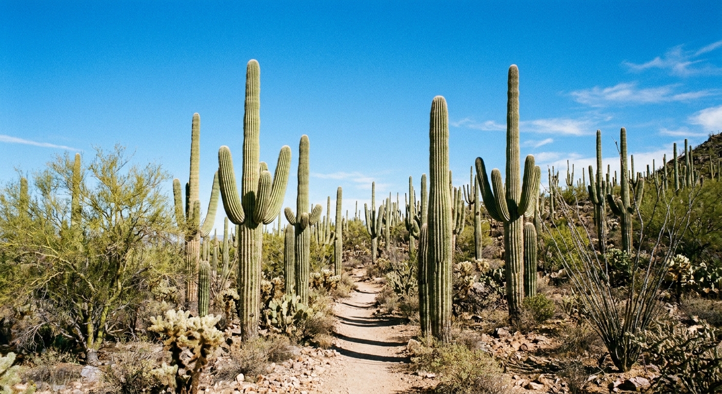
Cactus Forest Trail
Why it is worth it: If you came for “that Saguaro National Park look,” this is it. Big saguaros, layered desert plants, and a trail that lets you dial in your own distance.
- Type: Out-and-back
- Distance: up to about 8 miles round trip if you go long, shorter options are easy (confirm turnaround mileage on a current map)
- Difficulty: Easy to moderate depending on how far you go
- Best time: Sunrise for cool temps and fewer people
Maya note: This is one of my favorite “city break plus nature” mornings. Hike early, then head into Tucson for breakfast and coffee while you are still feeling heroic.
Tanque Verde Ridge Trail
Why it is worth it: This is where Saguaro East shows its teeth. The ridge hike is steep, exposed, and incredibly rewarding, with a big, airy view that feels more alpine than you expect from a cactus park.
- Type: Out-and-back
- Distance: roughly 5 to 6+ miles round trip to lower ridge viewpoints, longer if you continue (map your turnaround)
- Difficulty: Strenuous
- Best time: Cool-season mornings only
Honest warning: This is not the trail to “see how it goes” at noon. If the forecast is hot, pick Cactus Forest instead and save this for winter.
Garwood Dam and Wildhorse Tank
Why it is worth it: A compact hike that mixes desert scenery with a destination. It is a satisfying choice if you want more than a stroll but less than a ridge climb.
- Type: Usually an out-and-back, with possible loop-ish variations depending on connectors
- Distance: around 3 to 4 miles round trip (confirm your exact route)
- Difficulty: Moderate
What you will see: rocky desert terrain, saguaros, and the dam and tank area.
Seasonal note: Any water you see here is typically seasonal and not guaranteed. Do not count on it for filtering or refilling.
Pick a hike by time
1 to 2 hours
- Valley View Overlook (West) for sunset
- Desert Discovery (West) for an easy intro
- Freeman Homestead (East) for an easy loop with history
Half a day
- Cactus Forest Trail (East), choose your turnaround point
- Garwood Dam and Wildhorse Tank (East) for a moderate destination hike
Full-day challenge
- King Canyon to Wasson Peak (West) for a signature summit
- Tanque Verde Ridge (East) for strong hikers in cool weather
Desert safety basics
- Start earlier than you think. In warm months, “morning hike” means first light.
- Bring electrolytes. Water alone can feel insufficient when you are sweating.
- Know your turnaround time. If you want to be back to the car by 10 am, you need to turn around well before that.
- Monsoon awareness matters. In summer, storms can bring lightning and sudden runoff in washes. Avoid hiking in active storms and do not linger in low drainages if weather is building.
- Watch for wildlife. Give snakes space, never reach into rock crevices, and keep an eye out around dawn and dusk.
- Stay on trail. This protects fragile desert soils and helps you avoid surprise encounters with spiny plants.
Simple packing list
- 2 to 3 liters of water for moderate hikes, more for long or hot outings
- Electrolyte mix or salty snacks
- Sun hoodie or lightweight long-sleeve shirt
- Wide-brim hat and sunglasses
- Sunscreen and lip balm
- Closed-toe shoes and a small first-aid kit (tweezers help with spines)
- Offline map on your phone plus a backup battery
After the hike
This is the Town Wander sweet spot: dusty boots in the morning, city comforts by afternoon. Plan your hike so you finish before the heat spikes, then head into Tucson for a long lunch, a museum stop, or a slow coffee break. The desert is better when you do not rush it, and Tucson is an easy place to linger.
My favorite Saguaro day is a sunrise hike in the East, a mid-morning coffee in town, then a golden-hour loop drive and short walk in the West. Two districts, one day, zero need to choose.
Quick trail comparison
| Trail | District | Distance | Difficulty | Best for |
|---|---|---|---|---|
| Valley View Overlook | West | ~0.8 mi RT | Easy | Sunset, quick views |
| Desert Discovery | West | ~0.5 mi loop | Easy | Families, first-timers |
| King Canyon to Wasson Peak | West | ~6 to 8 mi RT | Moderate to strenuous | Summit views |
| Sendero Esperanza | West | ~4 to 8+ mi RT | Moderate | Quieter miles |
| Freeman Homestead | East | ~1 mi loop | Easy | History, easy walk |
| Cactus Forest | East | Up to ~8 mi RT | Easy to moderate | Classic saguaro scenery |
| Tanque Verde Ridge | East | ~5 to 6+ mi RT | Strenuous | Training hike, ridgeline views |
| Garwood Dam and Wildhorse Tank | East | ~3 to 4 mi RT | Moderate | Destination hike |
Final tip
If you are deciding between trails that all sound good, decide based on light and temperature. Sunrise and the last two hours before sunset are when Saguaro National Park looks the most cinematic and feels the most forgiving. Pick a trail that gets you out there during those windows, and you will understand why people fall hard for this cactus-filled corner of Arizona.