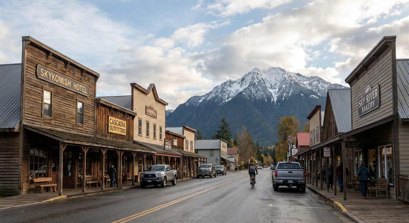
Blanca Lake Hike: Road, Climb, and the Lake

Maya Lin
Maya Lin is a travel journalist and outdoor enthusiast who believes the best trips combine rugged adventures with urban comforts. After spending six years backpacking across four continents, she founded Trail & Town Guide to help fellow travelers navigate both hidden mountain passes and bustling city neighborhoods with confidence.
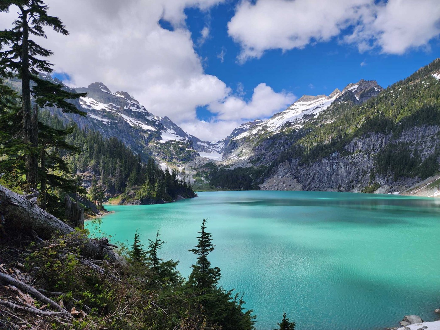
Blanca Lake is the kind of hike that makes you question your life choices somewhere in the middle, and then rewards you with a lake so intensely turquoise it looks edited. If you love big payoff days and do not mind earning it, this is one of the most memorable alpine lake hikes off Highway 2.
What makes Blanca different from a lot of popular Washington lake hikes is the combo: a rough forest-road approach to the trailhead followed by a steep climb that does not really do gentle. Plan for a leg day, a slower pace than your usual, and a long break at the water because you will want to stare at it for a while.
Blanca Lake at a glance
- Location: Near Skykomish, Washington, off Highway 2 in the Henry M. Jackson Wilderness (Mount Baker-Snoqualmie National Forest)
- Typical route: Out-and-back to Blanca Lake
- Distance: Commonly hiked as about 7 to 8 miles round trip from the main trailhead
- Elevation gain: Roughly 3,300 feet from the main trailhead, depending on the exact parking and road conditions
- Difficulty: Hard, mostly because the elevation comes fast
- Best season: Summer into early fall, when the road is snow-free and the trail is not a slushy mess
These numbers can vary from app to app, and they can change in real life if you have to park lower because the access road is rough or blocked. If you end up road-walking, expect to add extra mileage and time on top of the standard stats. I treat Blanca as a high-effort day no matter what the exact mileage says.
Getting there
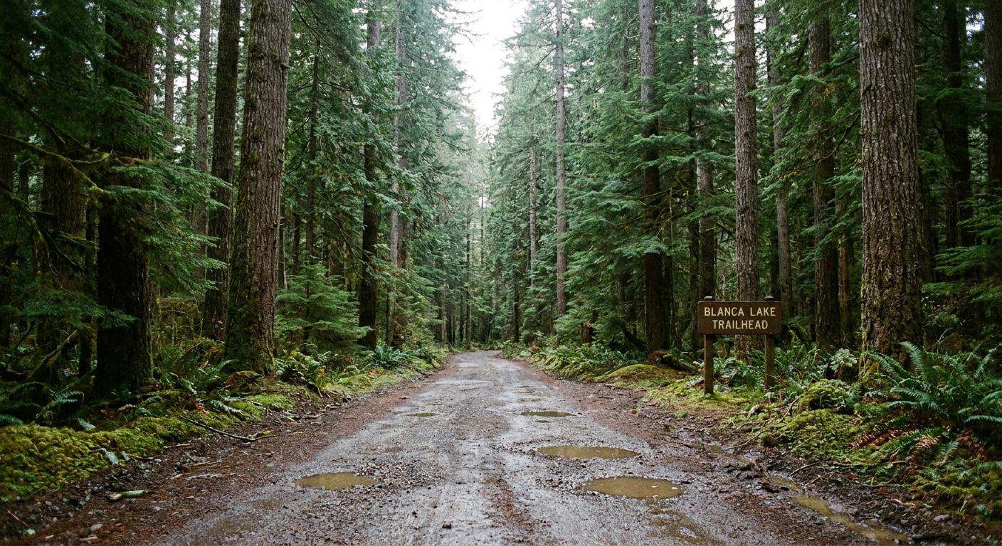
Blanca Lake starts with a small test of patience before you ever lace up your boots: the access road. You turn off Highway 2 and follow a forest road up to the trailhead. Road conditions can be rough and may include potholes, washboarding, and ruts. If you are in a low-clearance car, go slow and be ready to reassess if the road is looking worse than you expected.
Road names and numbers can be confusing here because people refer to the approach a few different ways (and signage can change). Before you go, confirm the current route on an official source or a very recent trip report. Also, download your map for offline use before you lose service because it is easy to second-guess a junction once you are on gravel spurs.
Road tips
- Budget extra time: The drive from Highway 2 to the trailhead often takes longer than it looks on a map.
- Bring a full-size spare if you have one: Potholes plus sharp rocks can be a bad combo.
- Do not force it: If you are scraping or spinning out, it is smarter to park lower and walk the road than to risk getting stuck.
- Arrive early on weekends: Parking is limited, and Blanca has a reputation that draws a crowd.
If you end up parking lower down the road, you will add mileage and a bit more elevation. It is not the end of the world, but it makes an already demanding day feel longer.
Permits and rules
Do not skip the boring-but-important stuff. Requirements can change year to year, and they can vary by where you actually park. Treat this section as a reminder to confirm current rules on the Mount Baker-Snoqualmie National Forest site or a current listing for the trailhead before you drive out.
- Parking pass: This trailhead is on national forest land. Check the current signage at the parking area and the USFS trailhead listing to see whether a Northwest Forest Pass (or another pass) is required where you end up parking.
- Wilderness permit: Some trailheads in Washington wilderness areas use a self-issue registration box for day use. If there is a register at the Blanca Lake trailhead, fill it out. If there is not one, do not assume a separate permit is required.
- Dogs: Rules can change, so check current regulations before you bring a dog. If dogs are allowed, keep yours under control and leash your dog, especially around other hikers and the lakeshore, and follow any posted leash rules.
The hike
The Blanca Lake trail wastes very little time. You start in forest, you start climbing, and then you keep climbing. There are sections that feel like a staircase made of roots and dirt, and the middle portion is where most people realize this is not a casual lake stroll.
If you want a simple mental metric: a big chunk of that 3,300-ish feet comes quickly. It is the kind of trail where you look at your watch, feel like you have been working for an hour, and realize you have barely put a dent in the elevation yet.
Trail feel
- Lower forest climb: Steady grade right away with a classic Cascade forest vibe. It is pretty, but you are mostly focused on breathing.
- Middle grind: The toughest stretch. It can feel nonstop, with fewer natural breaks. Trekking poles help a lot here, especially on the way down.
- Upper approach: Near the lake, the trail starts teasing you with more light through the trees and occasional openings. Your pace may slow, but morale improves because you know the payoff is close.
My biggest advice is to pick a sustainable pace early. Blanca punishes the classic mistake of starting too fast. I like a slow-and-steady rhythm with short standing breaks rather than long sit-down stops that make it harder to restart.
Turnaround plan
Not every day needs to be an all-the-way day. If you hit the middle section and your legs are toast, your water is running low, or weather is turning, turning around is still a win. You will get a tough workout, a forest immersion reset, and you will leave the lake as motivation for a return when conditions and energy line up.
A simple rule I use on tough Cascade hikes: if you are already dreading the descent before you are halfway up, that is a sign to reassess. Blanca’s downhill can be hard on knees and ankles, especially if roots and dirt are slick.
Seasonal conditions
Blanca is a summer favorite for a reason. In shoulder season, the same trail that feels like a hard workout in August can turn into a traction-and-timing problem.
- Snow can linger: Early season often means steep snow patches, slick mud, or slushy sections in the shade.
- Roots and mud get slick: After rain, the descent can feel like a slow-motion slide if you are not careful.
- Traction decisions matter: If there is any chance of lingering snow, do not assume it is fine without traction. Make the call based on current conditions and your comfort level.
- Shorter days: In fall, it gets dark fast under the trees. Bring a headlamp even if you do not plan to need it.
The reward
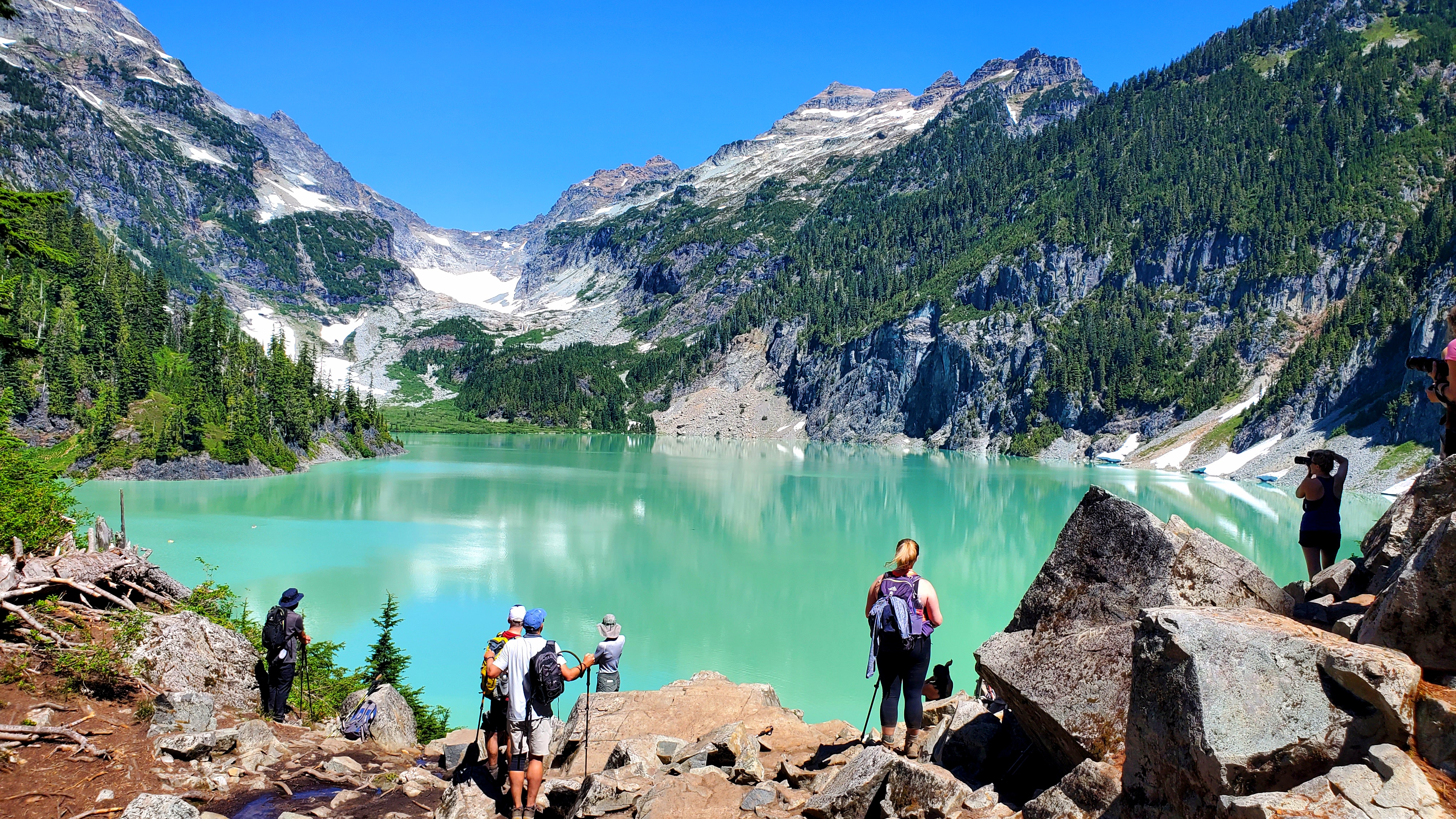
Blanca Lake’s color is the headline. On a clear day, the water reads as milky turquoise, framed by steep slopes and pale rock above.
That unreal color is commonly attributed to fine suspended rock particles, often called glacial flour, that scatter light in a way that makes the water glow. Whatever you call it, it is one of those lakes that makes you stop talking mid-sentence.
When you arrive, you will likely find a mix of day hikers and people taking long lunch breaks. There are spots to sit on rocks near the shore, plus pockets of shoreline where you can filter water or dip your feet.
Swimming
“Realistic” depends on what you mean by swimming.
- Quick dip: Yes, if you are heat-tolerant and not bothered by cold shock.
- Leisurely swim: Usually not. Even in summer, the water stays very cold.
- Wading and feet-soak: Absolutely. This is the most common and, honestly, the most pleasant option.
If you do dip in, do it with intention: ease in slowly, keep it brief, and warm up right after. I always pack a dry base layer and a small towel for hikes like this because the post-dip chill can hit fast once you stop moving.
Facilities
- Toilets: Many hikers report a pit toilet at or near the main trailhead, but I still do not plan your day around it. Facilities can be closed, seasonal, or in rough shape. Bring what you need and pack out used toilet paper.
- Water: If you filter from the lake or streams, treat the water. Shore access can be rocky and it can feel busy at popular times, so be patient and do your filtering without blocking the best sitting spots.
- Cell service: Expect it to be spotty. Download your map for offline use and do not rely on being able to look things up once you are on the road.
What to pack
Blanca is hard enough that “I’ll just wing it” can turn into a long day. This is one trail where a little preparation pays off.
My essentials
- Trekking poles: Your knees will thank you on the descent.
- Plenty of water: Bring more than you think, or bring a filter and know where you will use it.
- High-calorie snacks: Think food you will actually eat when you are tired.
- Layers: It can be hot on the climb and cool at the lake.
- Traction in shoulder season: If there is any chance of lingering snow, do not assume it is fine without traction.
- Bug protection: Some summer days are relentless.
Also: do not forget a little extra time in your plan. Blanca is one of those hikes where your moving pace may be normal, but your breaks get longer because the view is so good and the climb is such a calorie burn.
Timing and etiquette
When to start
If you can, start early. You will get cooler temps for the climb, better parking odds, and a calmer lake experience before the midday rush.
Weather check
Mountain weather can shift quickly near the Highway 2 corridor. Bring a light shell even if the forecast looks dreamy in town. If smoke season is active, consider air quality because this trail is sustained cardio.
Leave No Trace
- Pack out everything: Including food scraps.
- Stay on trail: The grade makes the area vulnerable to erosion.
- Give others space at the shoreline: People spread out to snack, filter water, and rest. A little courtesy goes far.
Blanca Lake FAQ
How hard is Blanca Lake?
Hard. The distance is manageable for many hikers, but the elevation gain is concentrated. If you do well on sustained climbs, you will be fine. If you hate steep grades, this one will feel long.
How long does the hike take?
Most day hikers should plan a solid half day to full day, depending on fitness, trail conditions, and how long you linger at the lake. Blanca is not the hike I schedule tightly.
Is the road to the trailhead always passable?
Not always. Conditions can change with weather, maintenance, and washouts. If the road looks beyond your vehicle’s comfort zone, park lower and walk, or choose a different hike that day.
Can I turn around before the lake and still have a good hike?
Yes. The road approach plus the early climb make for a solid workout, and turning around is a smart call if you are running out of daylight, water, or energy.
My take
Some hikes are about a perfect trail experience. Blanca is more like a trade: you exchange sweat for color. And when you finally see that turquoise water through the trees, it feels like the Cascades are letting you in on a secret.
If you want to stack a rugged day with an urban comfort afterward, this is one of my favorite Highway 2 pairings: hike Blanca early, then reward yourself with a slow meal and a really good coffee in Skykomish or Index on the way back. You will have earned both.