Capitol Reef Scenic Drive on Route 24
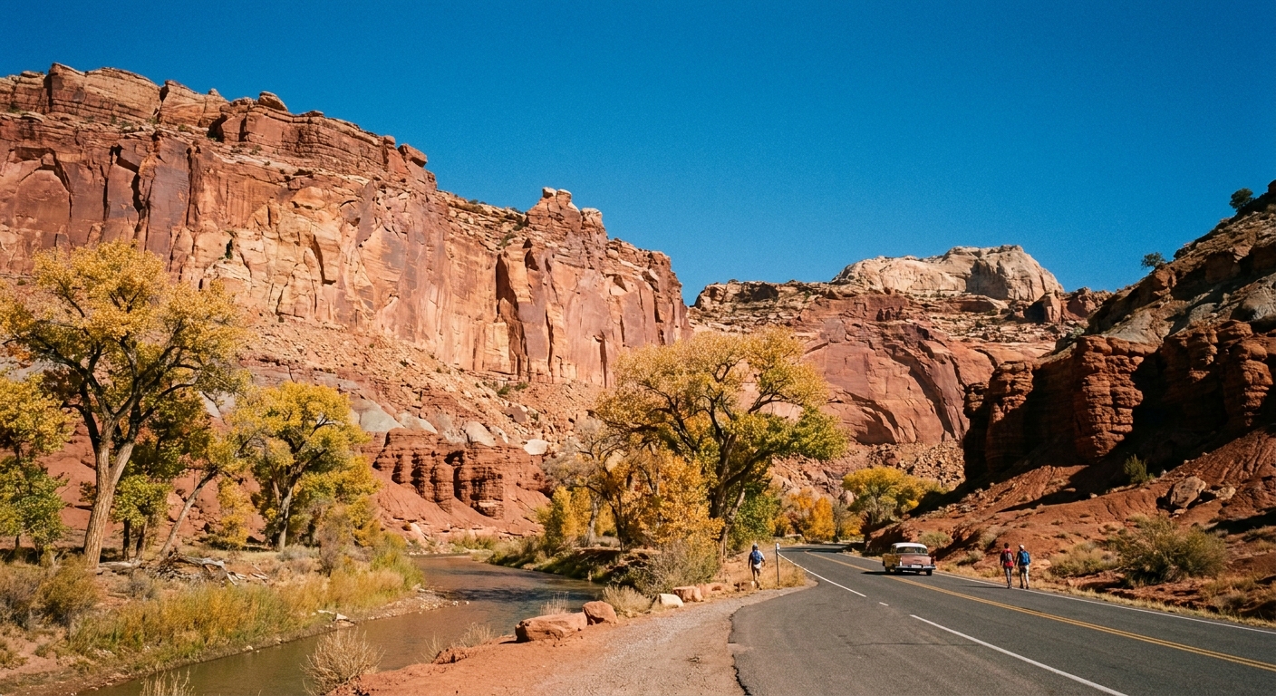
Capitol Reef is the rare national park where you can do a genuinely satisfying day without committing to a big trail. Route 24 slices right through the heart of the park, and the scenery is not a teaser, it is the main event. Think: sheer Wingate cliffs, orchards tucked into a desert “reef,” and a river that somehow keeps cottonwoods alive in a place this red.
This chapter is built for drive-planning intent: the best stops along Route 24, how to see the petroglyphs respectfully, and the short, low-commitment walks that slot into a scenic drive without turning your day into a full-on hiking checklist. If you already have a long-hike plan from a “best day hikes” list , use this as the complementary piece that helps you stitch viewpoints, panels, and picnics into a smooth loop.

Before you start: what Route 24 means
Route 24 is a Utah state highway that passes through Capitol Reef National Park near Fruita. You can treat it as a linear scenic drive with frequent pullouts and quick stops, then choose whether to add the short spur that leads into the historic Fruita area and Capitol Reef’s central amenities.
Quick logistics
- Road conditions: Route 24 is paved and typically accessible year-round, though winter storms can bring temporary slick conditions.
- Fees: Driving Utah State Route 24 through the park does not require an entrance fee. You only pay a fee if you turn off Route 24 onto park fee areas, like the park’s Scenic Drive past the Fruita campground (and other managed access points). If you are doing multiple parks, an America the Beautiful pass often pencils out quickly.
- Cell service: Spotty to limited. Download offline maps and save your itinerary notes before you enter the park.
- Restrooms: Concentrated around Fruita and the visitor center area. Plan accordingly if you are mostly hopping pullouts.
How to pace the day
For most travelers, the sweet spot is 3 to 5 hours for a Route 24 centered drive with petroglyphs and a couple of short walks, plus an extra 60 to 90 minutes if you add Fruita pie, the Gifford House area, or a longer sit-down picnic.
Route 24 drive plan: west to east
There are great views in both directions, but going west to east tends to feel like the landscape is revealing itself in chapters. Use this as a modular itinerary: stop for what interests you, skip what does not, and keep your day unhurried.
1) West side pullouts: first wow views
As you approach the park, the rock starts to stand up. Look for safe, signed pullouts that give you room to step away from traffic and take in the scale. Early morning light makes the cliffs look almost brushed with copper.
- Best for: quick photos, stretching legs, orienting yourself.
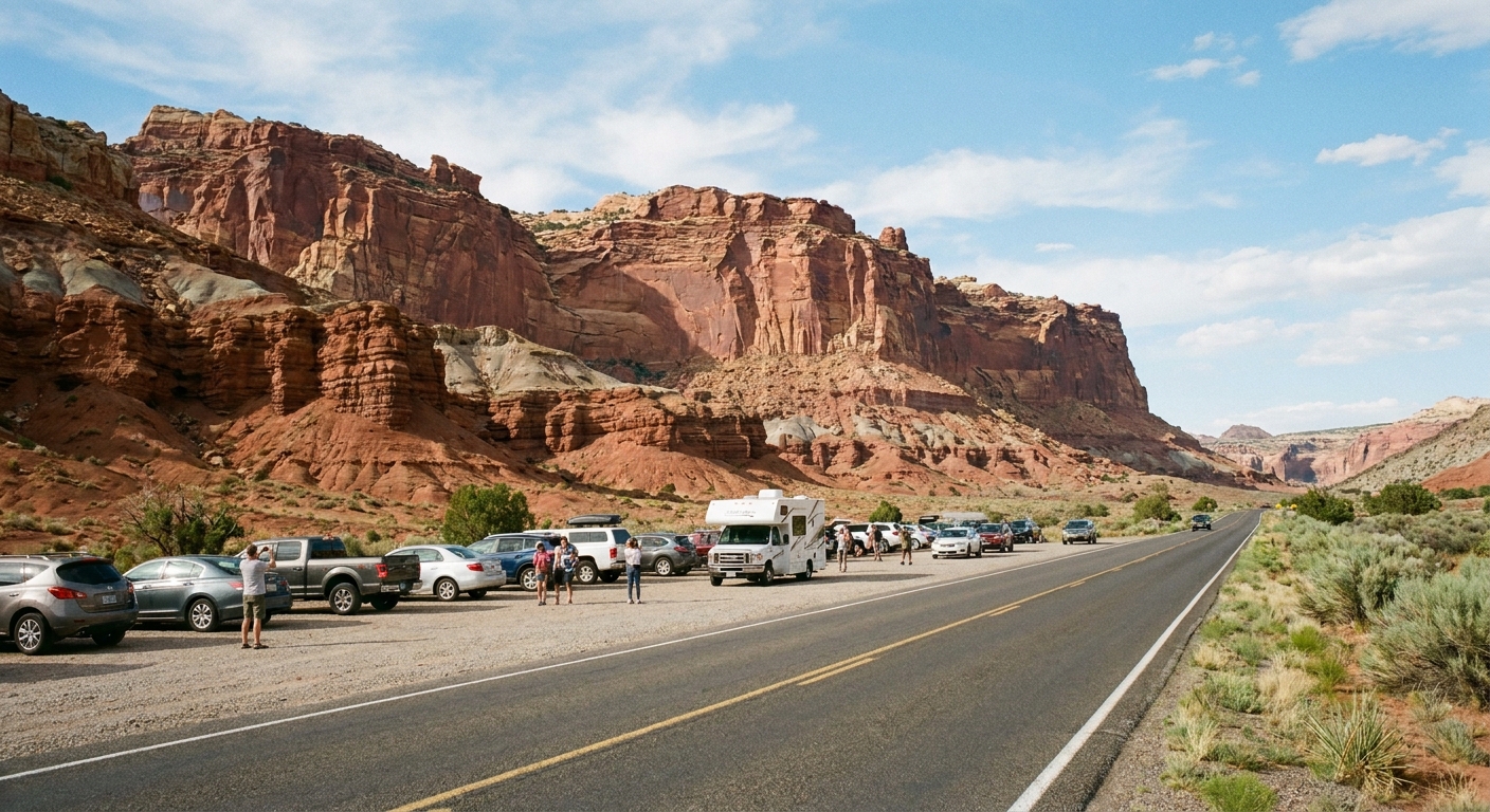
- Good named stops: Panorama Point and Goosenecks Overlook are classic “big reward, small effort” stops near the main corridor. They work especially well early or late when the light is softer.
- Pairs well with: a 5 to 10 minute wander near your car on slickrock or packed dirt, staying within sight of the road.
2) Petroglyph panels
The petroglyph panels along Route 24 are one of the most rewarding “minimal effort, maximum meaning” stops in the park. They are also a reminder that this landscape has been home, not empty space, for a very long time.
How to do this stop well
- Use the boardwalk: The viewing area is accessed by a flat wooden boardwalk that keeps feet off fragile soils and helps make the stop friendly for strollers and many mobility needs.
- Take your time: Your eyes adjust after a minute. Look for bighorn sheep, human figures, and geometric shapes.
- Bring binoculars or a zoom lens: You will see more and you will be less tempted to step off-trail.
- Stay on designated paths: Desert soils can be fragile, and rock art sites are culturally sensitive.
- Never touch the rock art: Oils from hands and tiny abrasions add up over time.
Micro-walk pairing: This is already a short walk from the pullout. Add an extra 10 minutes to stroll slowly, scan the cliff face, and let your eyes do the work.

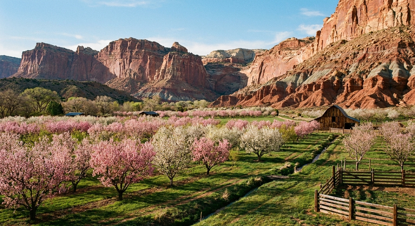
3) Fruita detour: orchards and picnic time
Even if you are not doing a long hike, dipping into Fruita changes the whole tone of the day. The cliffs feel closer, the cottonwoods feel greener, and the park suddenly has a “small desert farm town” personality.
Picnic timing
If you can, picnic in Fruita around late morning or early afternoon. You will have built up just enough appetite from pullouts and short walks, and the shade here can feel like a miracle in warmer months.
- What to pack: refillable water bottle, salty snack, fruit, and something that will not melt instantly.
- Coffee tip: If you are the type who plans trips around caffeine, grab your coffee in Torrey before you enter. Inside the park, options are limited.
Micro-walks in Fruita
- Orchard wandering: A gentle stroll that feels like a palate cleanser between overlooks.
- Historic area stroll: Short, flat, and great for families or anyone saving energy for later.
4) Visitor Center
If you only stop once for information, make it here. Rangers can flag current conditions like flash flood risk, closures, or the best time of day for a specific viewpoint. This is also the most reliable place to reset: water, restrooms, and a quick look at maps if you want to add a short walk beyond your original plan.
- Best for: up-to-date conditions, junior ranger materials if you are traveling with kids, and checking seasonal notes.
- Pairs well with: a short interpretive walk nearby if you want to move after sitting in the car.
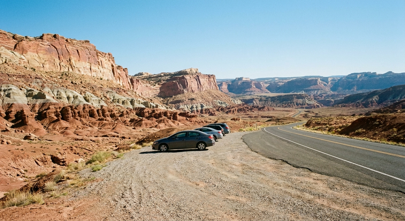
5) East side pullouts: open horizons
As you continue along Route 24, the park’s mood shifts. You still get dramatic rock, but the views start to open, and you can often find a pullout where it is just you, the wind, and the kind of silence that makes you talk quieter without meaning to.
Named stop for golden hour
If you want an easy, classic sunset plan without committing to a long hike, aim for Sunset Point. Pair it with Goosenecks Overlook if you want a quick one-two viewpoint combo.
Micro-walk pairing: the ten-minute rule
At a safe pullout, set a timer for ten minutes and walk slowly away from the road noise, then back. No route-finding, no ambition. It is amazing how much more you notice when you give a landscape ten uninterrupted minutes.
Short walk pairings
This is the “add-on menu” for a Route 24 day. These are intentionally short so you can keep the drive as the backbone and still feel like you got out into the park.
Petroglyphs plus a slow scan
Instead of treating the petroglyph stop as a quick photo, treat it like a mini museum visit. Spend 15 to 25 minutes looking, comparing shapes, and watching how the light changes what you can see.
Panorama Point and Goosenecks Overlook
These two are perfect for travelers who want dramatic views without a big time investment. They are also great “energy level checkpoints.” If you feel good after these, add more stops. If you are tired, you still got the headline views.
Orchards and historic Fruita stroll
If you are already planning a bigger hike on another day, this is the perfect “recovery walk.” Flat, shaded in places, and rich in human history.
Overlook-style short walks
Capitol Reef has several viewpoints and short trails near the main corridor that deliver a lot quickly. Ask at the visitor center which short routes are in best shape and which are best for sunset, wind, or heat that day.
My rule of thumb: if a stop requires you to re-pack your whole daypack, it stops being a scenic drive and becomes a hike day. Keep it light, keep it simple, and you will enjoy the drive more.
Best time of day
Morning: best colors
Morning light tends to show off the texture in the cliffs, and the air is cooler for those short walk pairings. If you are traveling in summer, this is when the drive feels most comfortable.
Midday: picnic and shade
Midday is when the park can feel hottest and brightest. This is when Fruita shade and a real lunch break matter. Plan your most “sit and savor” stop here rather than bouncing between pullouts.
Late day: glow, then exit plan
The rock can glow late in the day, especially when the sun drops low. Just remember you are on a highway corridor. Plan your turnaround and driving time so you are not rushing in the dark, especially if you have a long drive back to Torrey or beyond.
Responsible viewing
Rock art respect
- Do not touch petroglyphs or lean gear against the panel walls.
- Stay on established paths and viewing areas, including the boardwalk.
- Keep voices low. Many visitors experience these sites as cultural spaces, not just photo ops.
Roadside safety
- Only stop at signed pullouts or clearly safe shoulders.
- Watch for cyclists and fast traffic when opening doors.
- Hold onto hats and loose items. Wind gusts can be sudden.
Leave No Trace basics
- Pack out all trash, including fruit peels and tissues.
- Do not step on cryptobiotic soil crusts. They are living and slow to recover.
- Stay hydrated and do not underestimate sun exposure, even on “just a short walk.”
Sample half-day itinerary
Use this if you want a plug-and-play plan that does not overlap with a full “best hikes” day.
- Panorama Point for a first big view and a quick stretch.
- Goosenecks Overlook for an easy canyon overlook.
- Petroglyph boardwalk stop, 20 to 30 minutes with binoculars or a zoom lens.
- Visitor Center for current conditions and a quick map check.
- Fruita detour for a picnic and a short orchard stroll.
- Sunset Point if timing works, then head back before dark driving feels stressful.
What to pack
- Water: more than you think, even if you “won’t really hike.”
- Sun protection: hat, sunglasses, and sunscreen.
- Binoculars: best upgrade for petroglyph viewing.
- Light layers: mornings and evenings can be cooler than expected.
- Picnic kit: a small bag, napkins, and a trash bag for pack-out.
- Offline maps: downloaded before you enter the park corridor.
FAQ
Is Route 24 the same as the Scenic Drive road?
No. Route 24 is the highway through the park. The park’s Scenic Drive is a separate road that branches into the Fruita area and beyond. This guide focuses on Route 24 as the backbone, with Fruita as the most useful detour.
Do you need to pay to drive Route 24?
No. You can drive Utah State Route 24 through Capitol Reef without paying an entrance fee. The fee applies when you enter park fee areas, such as the Scenic Drive beyond Fruita campground.
How long do you need for the petroglyph stop?
You can do it in 10 minutes, but it is more rewarding in 20 to 30 minutes, especially if you bring binoculars and take time to scan. The flat boardwalk makes it an easy stop to fit into a drive day.
Can you do this itinerary with kids or limited mobility?
Yes. Most stops are pullout-based with short, relatively flat walking. The petroglyph viewing area’s flat boardwalk is especially helpful. Choose fewer stops, prioritize shade and restrooms, and avoid midday heat when possible.