Lower Calf Creek Falls
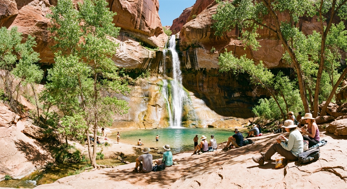
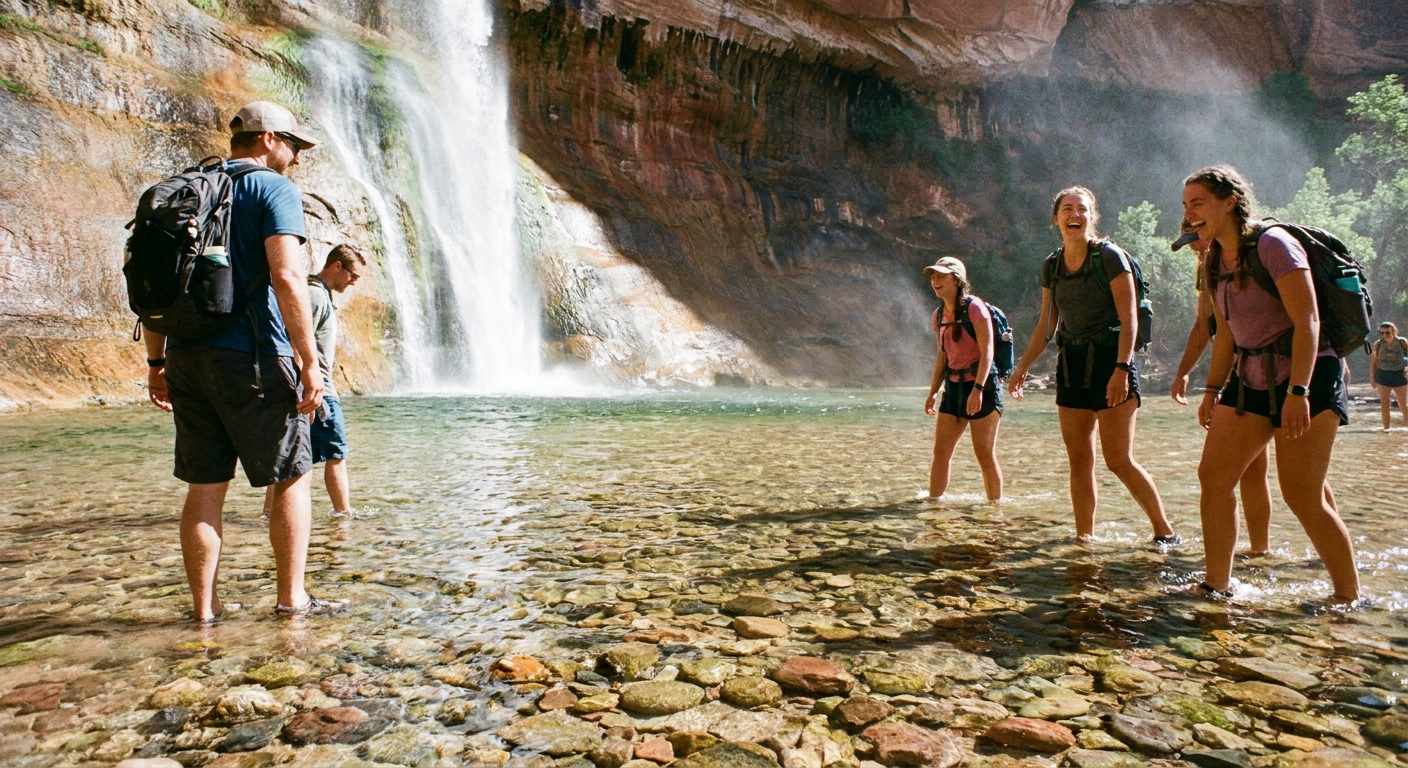
Lower Calf Creek Falls is the rare southern Utah classic that delivers on every promise: a clear creek you actually want to wade in, a ribbon of cottonwoods in a sea of slickrock, and a 126-foot waterfall that feels almost unfairly lush for the desert. It is also a hike where timing matters more than mileage. The trail is mostly exposed, the canyon can feel like an oven in summer, and one small gear decision (hello, sand strategy) can make the difference between a refreshing creek day and a gritty, foot-scorching shuffle back to the trailhead.
This is the day-hike briefing I wish someone handed me the first time: when to start for shade, what the trail is really like underfoot, what to pack, how the interpretive markers work, and how to make it fit smoothly into an Escalante and Boulder driving day.

Trail snapshot
- Hike: Lower Calf Creek Falls Trail (out and back)
- Distance: about 6 miles round trip
- Typical time: 2.5 to 4 hours depending on heat, photo stops, and swim time
- Difficulty: moderate, mainly due to heat, exposure, and deep sand rather than steepness
- Trailhead: Calf Creek Recreation Area on UT-12 between Boulder and Escalante
- Fees: day-use fee is commonly required at the recreation area (carry a card and some cash just in case)
Expect a well-established path with long stretches of deep, loose sand, plus some slickrock and short rocky bits where you will be glad for decent traction. The destination is a shaded amphitheater with room to sit, snack, and soak your feet. Swimming is often possible, but conditions vary seasonally.
Best time of day
This hike is famous, but the canyon still rewards early birds and late starters. Most of the route is sun-exposed with minimal shade until you are near the falls.
My timing rule of thumb
- Hot months (late May to September): Start early. Aim to be walking by 7:00 to 8:30 am to keep the outbound leg cooler and arrive at the falls before the harshest midday heat. If you are not a morning person, consider a late-afternoon start, but only if you have ample daylight and are confident about your return timing.
- Shoulder seasons (March to May, late September to November): Mid-morning starts are comfortable. 9:00 to 11:00 am usually feels great, and the canyon light at the falls can be beautiful.
- Winter (December to February): Go when the sun is up. Mornings can be icy, especially on shaded rock. Bring extra layers and watch footing.
Why it feels hotter than you expect
Even though the trail follows a creek, much of it runs across open benches and sandy flats that reflect heat upward. The air can be still, and once the sun is high, it is a full-body bake. Plan your water and your pace like you would for a longer hike.
If you can only remember one thing: the falls area is the reward, but the trail is the test. Make the test easier by starting before the sun gets confident.
Trail footing
Let us talk about the real reason this hike feels longer than the map suggests: sand.
What the sand is like
- Deep and loose: Much of the route is a sandy track that shifts under your feet, especially in dry periods.
- Energy drain: The grade is friendly, but the sand quietly taxes calves, ankles, and patience.
- Heat amplifier: In summer, the sand can feel like it is radiating heat from below.
How to make it easier
- Start earlier than you think you need to so you can take breaks without baking.
- Wear gaiters if you hate sand in your shoes (not required, but satisfying).
- Keep your stride shorter and settle into a steady pace. Fighting the sand usually backfires.
Water shoes
Good news first: the main trail to Lower Calf Creek Falls does not require a creek crossing. You stay on the west side of Calf Creek the whole way to the falls.
So why do people talk about water shoes here? Because the destination is basically an invitation to get wet. The plunge pool and creek edge are where water shoes earn their keep.
When water shoes are worth it
- You plan to swim or wade at the falls
- You want to scramble on slick rocks near the water without stressing about traction
- You are hiking with kids who will inevitably end up in the creek
What to bring
Best choice for most people: lightweight sandals with a secure heel strap or low-profile water shoes. Avoid flimsy flip-flops. The rocks near the water can be slick.
What to pack
This is not a technical hike, but it is a “small mistakes feel big” hike. Heat, sun, glare, and sand add up fast.
Essentials
- Water: At least 2 liters per person in cooler weather. In summer, many hikers are happier with 3 liters.
- Sun protection: Wide-brim hat, sunglasses, and sunscreen. A light sun shirt is worth its weight.
- Snacks: Salty snacks plus something real to eat at the falls. The return trip is warmer and less charming.
- Footwear plan: hiking shoes or trail runners with decent traction. Consider gaiters if you hate sand. Pack water shoes only if you plan to get in the water.
- Small first aid: blister care is the big one here. Sandy grit is sneaky.
Nice-to-haves
- Trekking poles: helpful in deep sand and for stability near the creek.
- Swim layer and small quick-dry towel: the pool can be a mood reset on hot days.
- Bug repellent: usually minimal, but after wetter periods you might be glad you packed it.
- Phone camera or small camera: the falls photograph beautifully in shade, especially with a longer exposure if you have the setup.
Leave at home
- Heavy coolers and big chairs: you will regret hauling them. Bring a small sit pad instead.
- Speakers: the soundtrack here is water on rock and canyon quiet. Let it be that.
Markers and history
If you like your hikes with a side of story, this trail quietly delivers. Near the trailhead you can usually pick up an interpretive brochure that matches the numbered trail markers along the route.
The stops point out features you would otherwise walk right past, including Fremont culture sites like pictographs and granaries tucked into the canyon walls. Keep your eyes up, not just on the sand.
Please look, photograph, and admire, but do not touch rock art or masonry. Even gentle contact can cause long-term damage.
Dogs
Dogs are generally allowed on leash, and many people bring them, but this is one of those hikes where the cute plan can turn serious fast.
- Hot sand hazard: In summer the sand can burn paws quickly, and there is little shade for long stretches. If it is too hot for your hand on the sand, it is too hot for their feet.
- Water is not a free pass: The creek is there, but you still have several miles of exposed sandy trail.
- Bring extra water for your dog and consider paw protection. When in doubt, choose a cooler day or leave the dog at home.
Etiquette and safety
Heat and hydration
If the forecast is extreme, consider an early start or pick a higher-elevation hike for the day. Know the signs of heat illness, and do not be shy about turning around. The falls are not going anywhere.
Flash flood awareness
This is not a slot canyon hike, but you are in a drainage. If thunderstorms are in the forecast, especially upstream, be conservative. In monsoon season (typically mid-summer), check radar and avoid hiking if storms look active.
Protect the oasis
- Stay on the main trail to reduce erosion through cryptobiotic soil.
- Pack out all trash, including food scraps.
- Keep a respectful distance from wildlife and other hikers at the falls. The amphitheater is small and sound carries.
Getting there
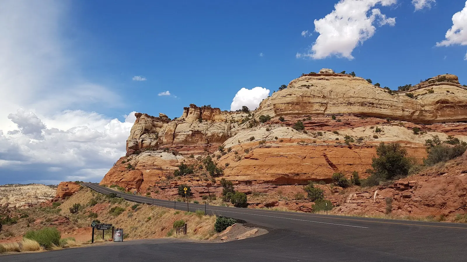
The trailhead is at Calf Creek Recreation Area right on scenic UT-12, roughly between Boulder and Escalante. If you are stringing this hike into a road day, the key is planning your fuel, food, and cell service expectations.
Parking and start strategy
- Arrive early on weekends and in spring and fall. This is a marquee stop on UT-12.
- Use the restroom at the trailhead before you start. Facilities are limited once you are on trail.
- Cell service: spotty to nonexistent. Download maps offline before you arrive.
Nearby services
Boulder (west of the trailhead) is small but has a few memorable stops and a calm, end-of-the-road vibe. Escalante (east of the trailhead) is your practical base for more hiking days, with more lodging and casual food options.
- Fuel: top off when you can in either town. Do not assume you will find late-night options.
- Groceries and snacks: buy picnic supplies in town before arriving at the trailhead.
- Coffee: start in Boulder or Escalante and bring it along. UT-12 mornings are made for a thermos.
Fit it in your day
Lower Calf Creek Falls is the perfect anchor for a day that mixes windshield time with one big, satisfying hike. Here are a few realistic ways to structure it.
Option A: Morning hike
- Early breakfast in Boulder
- Arrive at Calf Creek early and hike in the cooler hours
- Lunch and recovery back at the trailhead or in Escalante
- Afternoon: scenic stops on UT-12, short walks, or a mellow drive to your lodging
This is my favorite if you want the hike to feel like the main event and still have energy to enjoy your evening.
Option B: Swim-first day
- Mid-morning start if temperatures are moderate
- Long hang at the falls with a swim and lunch
- Late afternoon in Escalante for a shower, dinner, and an early night
If you are doing back-to-back big days in Grand Staircase-Escalante, this one can double as your “active recovery” day, especially if you treat the falls as your reward spa.
Option C: Late-day light
In cooler months, a later start can be lovely. In summer, only do this if you are confident about daylight and comfortable hiking in heat. Bring a headlamp regardless.
Quick checklist
- Check the weather, especially heat and thunderstorms
- Start early in warm months
- Carry more water than you think you need
- Expect deep sand and plan footwear accordingly
- Bring water shoes only if you plan to swim or wade at the falls
- If hiking with a dog, take paw heat seriously
- Grab the interpretive brochure and watch for the numbered markers
- Download offline maps and do not count on cell service
If you plan it right, Lower Calf Creek Falls is the kind of day that makes southern Utah feel like a choose-your-own-adventure book: desert, water, shade, and a big, cinematic payoff. Rugged enough to feel earned, comfortable enough to enjoy with a good picnic and a clean change of socks waiting in the car.