Mount Baker Highway: Artist Point, Heather Meadows, and Snow Closures
If you have ever pointed your car toward Mount Baker on a bluebird morning, you already know the feeling: the highway climbs fast, the views get unreal, and then, just when you think you are minutes from Artist Point, the road can end at a locked gate and a wall of snow.
This is normal. The last stretch of the Mount Baker Highway (WA-542) is one of the most weather-sensitive roads in Washington, and Artist Point sits high enough that winter sticks around long after the lowlands have moved on to spring hikes and patio season.
Below is a clear, practical way to plan your day around Heather Meadows and Artist Point, including what the gates usually do, when avalanche risk is highest, where to get the best photos, and how to build a great itinerary even if the upper highway is closed.

Heather Meadows vs Artist Point
People say “Artist Point” like it is the whole destination, but the Mount Baker Highway has two distinct high-country hubs that behave differently across the seasons.
Heather Meadows
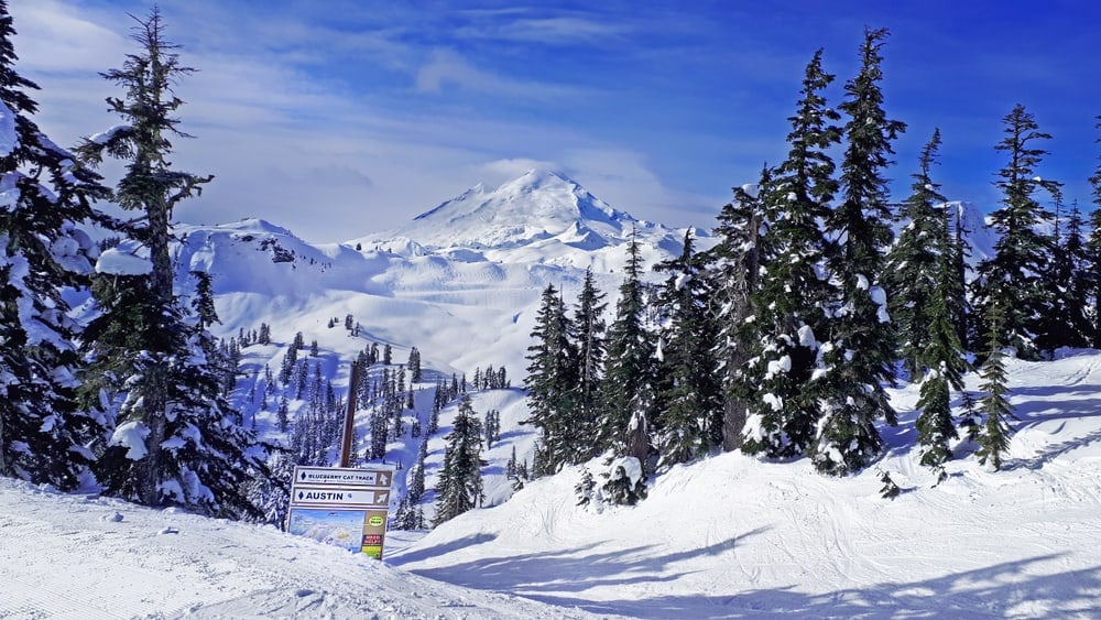
Heather Meadows is where you will find the Mount Baker Ski Area base area, the main parking lots, toilets in season, and the dependable winter access point. If snow blocks the final stretch, Heather Meadows is usually your highest drivable point.
Even in shoulder season, Heather Meadows can deliver the goods: sweeping views, quick snow-free strolls in late summer, and a front-row seat to alpenglow on Table Mountain and Mount Herman.
Artist Point
Artist Point is the end of the highway above Heather Meadows. It is famous for the postcard view of Mount Shuksan and the chance to step onto ridgelines quickly. It is also the place most likely to be inaccessible by car for months at a time due to snow, avalanche danger, and plowing realities.
Gate dates and what “closed” means
There are a few different “closures” people talk about on WA-542. Knowing which one applies saves you from gambling on a long drive.
Typical seasonal pattern
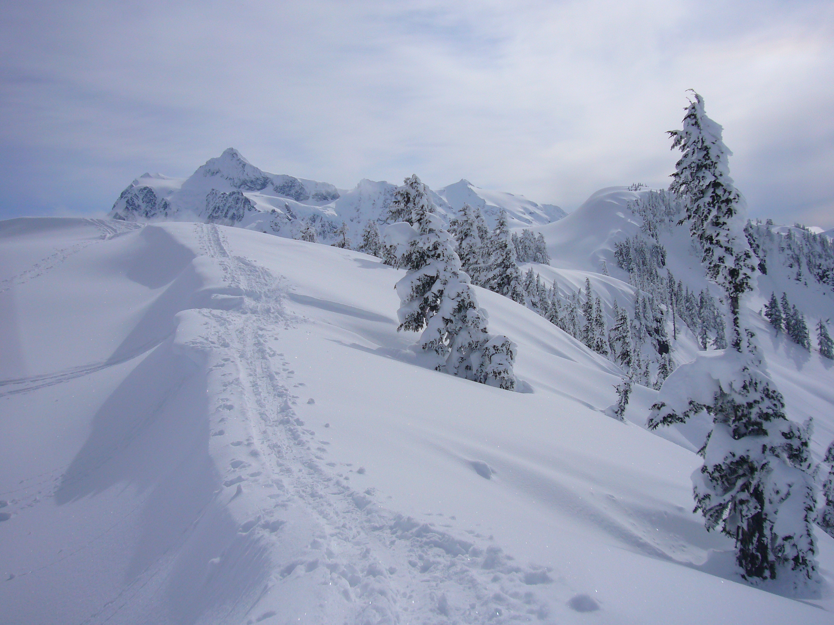
- Winter through late spring: The upper highway beyond Heather Meadows is commonly closed to vehicles. The road is not just snowy, it is often under active avalanche hazard.
- Late spring into early summer: Plowing operations and avalanche safety assessment determine when crews can open the final stretch. Openings vary widely year to year.
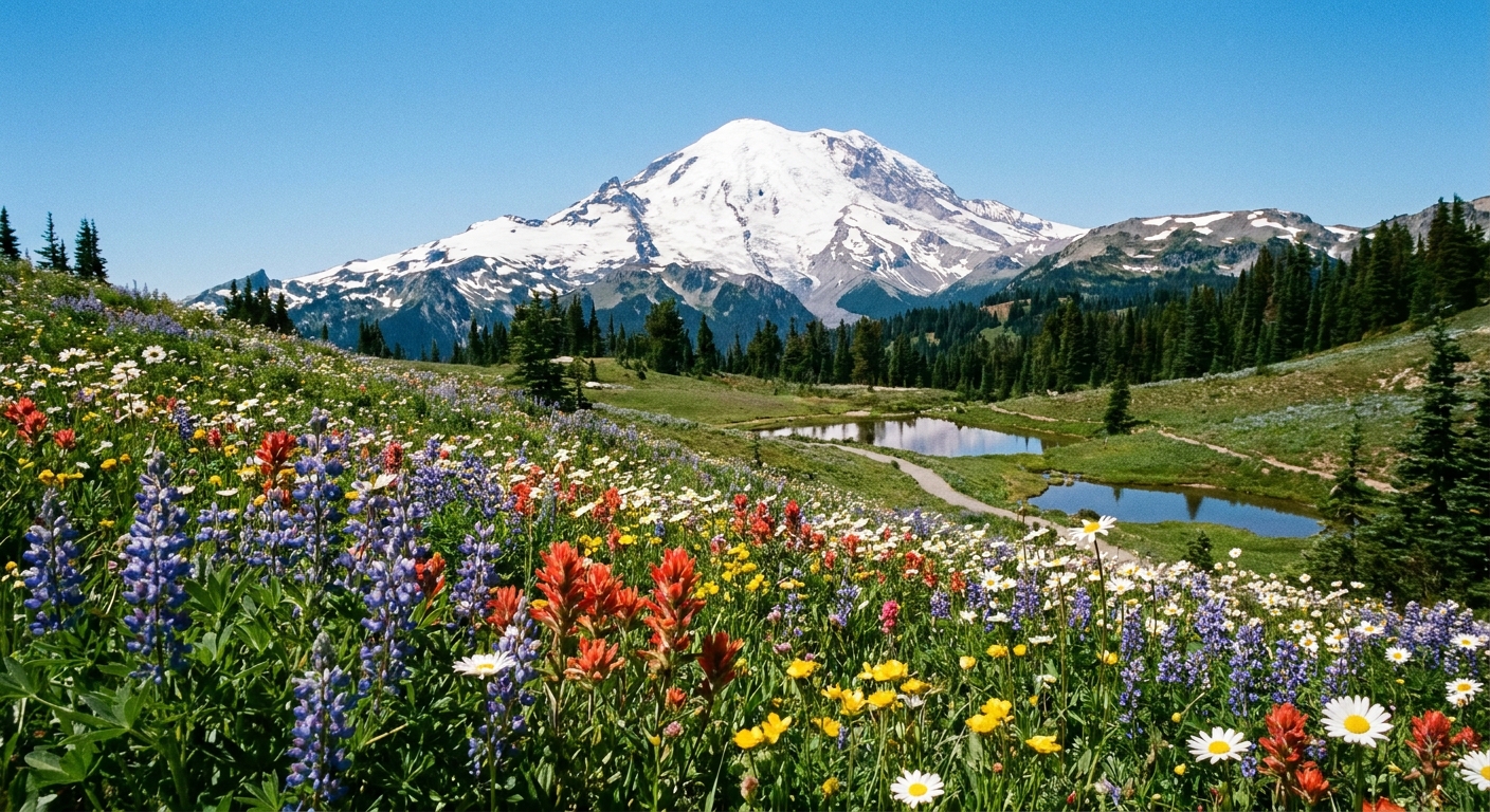
- Mid-summer through early fall: This is the most reliable time to drive to Artist Point. Trails are typically at their friendliest, with wildflowers giving way to crisp ridge views.
- Late fall: Early storms can close Artist Point again fast, sometimes with little notice.
Important reality check: There is no single annual opening day you can count on. One year might open early, another might hold well into summer. Snowpack, storm cycles, and crew capacity all matter.
Where to verify conditions
- Washington State Department of Transportation (WSDOT): Look up WA-542 status, alerts, and any posted restrictions.
- Mount Baker Ski Area updates: Helpful context for snowpack, parking, and day-to-day conditions at Heather Meadows.
- Northwest Avalanche Center (NWAC): For avalanche forecasts during winter and spring, including travel advice for the Mount Baker area.
If you only do one thing before leaving home, do this: check the road status and read the avalanche forecast if you plan to step onto snow.
Avalanche risk basics
I am not going to pretend a web article can replace avalanche education, but you can still make smart, conservative choices with a few key principles.
Why the upper highway is sensitive
The slopes above and adjacent to the road between Heather Meadows and Artist Point can produce avalanches in winter and spring. That is one reason vehicle access is often restricted. Even if the weather looks calm in the parking lot, conditions can be very different on wind-loaded slopes above you.
Highest-concern season
In the Mount Baker zone, the most complex mix for non-experts is often mid-winter through spring, when storms, wind transport, warming cycles, and rain-on-snow events can rapidly change stability.
Simple decision rules
- If you do not have avalanche training and gear, avoid steep snow slopes. Stick to mellow terrain near parking areas or plowed corridors.
- Treat cornices like cliffs. In spring and early summer, overhanging snow can extend far beyond the visible edge of a ridge.
- Do not “just follow tracks.” They may lead onto loaded slopes or toward terrain traps.
- Turn around early if you see red flags: recent avalanches, cracking snow, whoomphing sounds, heavy snowfall, strong winds, or rapid warming.
If your goal is simply views and photos, you can have an incredible day at Heather Meadows without committing to any steep snow travel.
Short walks, big views
These are the options I recommend when you want maximum scenery with minimal commitment, or when you are traveling with mixed fitness levels.
At Heather Meadows
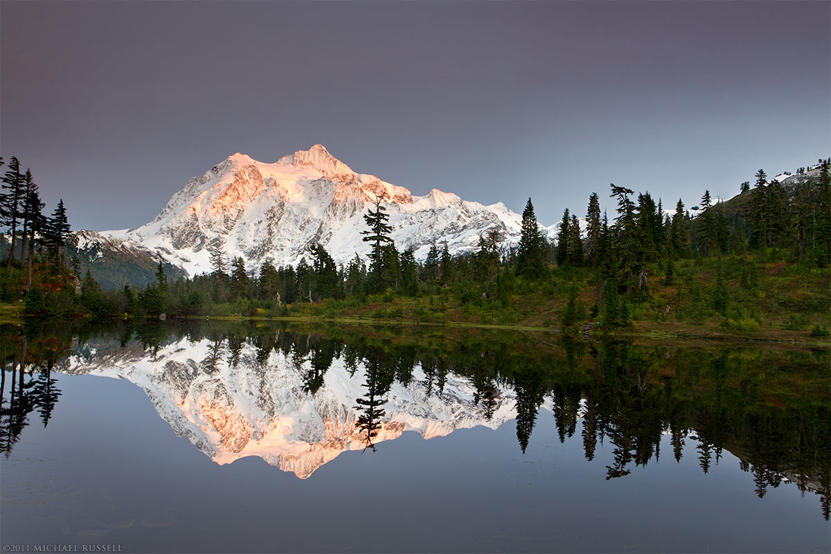
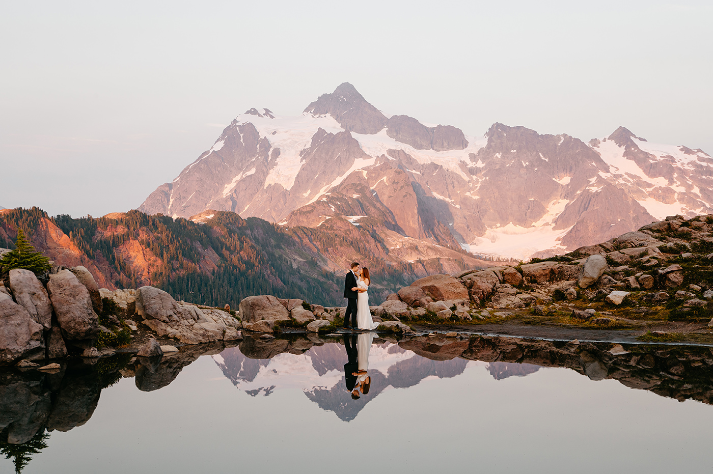
- Picture Lake (very short, iconic): Roughly 0.5 mile round trip with minimal elevation gain (about 0 to 50 feet depending on snow and where you start). A quick stroll to one of the most photographed reflections in Washington. On calm days, Mount Shuksan mirrors in the water.
- Heather Meadows viewpoints (pick your distance): Easy wandering on short paths and ski area edges in summer. Expect minimal elevation gain and make it as short as you want, from a 10-minute leg stretch to a mellow 1 to 2 mile meander.
Accessibility varies by season. In early summer, snow can linger around trailheads even when roads are clear.
Ridge options from Artist Point
When Artist Point is open and the high country is mostly snow-free, it becomes a choose-your-own-adventure trailhead. If snow remains, treat these as mountaineering-style outings, not casual hikes.
Table Mountain
Table Mountain is a popular objective from the Artist Point area, offering wide-open views and strong sunset potential.
- Typical summer hiking stats: roughly 3 to 4 miles round trip and about 1,000 to 1,200 feet of elevation gain, depending on your exact route and turnaround point.
- Best for: late summer and early fall when the path is mostly snow-free and cornices are gone.
Huntoon Point
These routes can feel “right there” from the parking lot, but ridgeline exposure, lingering snow, and cornices can raise the stakes early or late in the season.
- Typical summer hiking stats: roughly 2 to 3 miles round trip with about 600 to 900 feet of gain (varies with side trips and where you stop).
- Note: If you are traveling with kids, dogs, or anyone uneasy with exposure, pick a conservative turnaround point and stick to it.
Ptarmigan Ridge
Ptarmigan Ridge is spectacular and also committing. Treat it as a long, weather-dependent objective where turning around early is part of the plan, not a failure.
- Typical day-hike stats to a good viewpoint: often 8 to 12 miles round trip with about 1,500 to 2,500 feet of gain, depending on conditions and how far you go.
- Reality: Wind, whiteouts, and lingering snow can turn a “trail day” into an “all-business” day.
My rule: If you came for a beautiful day and not an epic, choose the shorter ridge options or a Heather Meadows sampler and save the big ridges for a stable forecast and an early start.
Quick note on numbers: Mileage and elevation can vary based on snow, route choices, and where you park. Treat these as planning estimates and confirm with a current map before you go.
Photo stops and timing
The Mount Baker Highway is basically a moving viewpoint. The trick is knowing where to pause and when the light is kind.
Best light
- Sunrise: Crisp air, fewer crowds, and clean contrast on Shuksan.
- Golden hour: Warmer tones on ridges and wildflowers in late summer.
- Blue hour: Great for calm, moody lake reflections and post-sunset color shifts.
Go-to photo locations
- Picture Lake: Reflection shots, especially in calm conditions.
- Artist Point parking area and nearby viewpoints: Wide-angle views of Shuksan and the surrounding peaks.
- Heather Meadows vista areas: Often underrated, especially when clouds are doing dramatic things.
Practical tip: Bring a small microfiber cloth. Between mist, drizzle, and dusty pullouts, your phone lens will need it.
If the road is closed
If your whole day depends on parking at Artist Point, a closure can feel like a blown trip. Instead, build a two-tier itinerary that still feels like a win.
Plan A: Artist Point
- Drive to Artist Point.
- Do a short ridge walk for views.
- Loop back to Picture Lake for calmer compositions.
- Finish with a late-day stop at a viewpoint near Heather Meadows.
Plan B: Heather Meadows sampler
- Park at Heather Meadows.
- Walk to Picture Lake if accessible.
- Explore mellow paths and viewpoints close to the base area.
- If you want more movement, do an out-and-back walk on safe, low-angle terrain only, avoiding steep open slopes in snowy months.
Plan C: Low-elevation pivot
If visibility is poor, winds are strong, or avalanche danger is elevated, do not force it. Pivot to a lower-elevation forest walk, a cafe stop in Glacier or Bellingham, and save the alpine for a clearer, safer day. Baker will still be there, and your photos will be better when you can actually see the peaks.
Logistics
Recreation passes
In the summer months when the area is accessible for hiking and sightseeing, you will typically need a Northwest Forest Pass (or an America the Beautiful interagency pass) to park at many trailheads and day-use areas along the upper Mount Baker Highway, including the Heather Meadows area and Artist Point when open. Signage can change and specific lots vary, so bring the pass and verify current requirements on the Mount Baker-Snoqualmie National Forest site before you go.
Parking and timing
Summer weekends can get crowded fast, especially at Artist Point. Arrive early if you want easy parking and quieter trails. In winter, parking fills for snow play and ski days.
What to pack
- Layers: a warm midlayer and a shell, even in summer
- Water and snacks, plus one extra snack you forget you need
- Sun protection: sunglasses and sunscreen (snow glare is intense)
- Traction if snow is possible: microspikes can turn a sketchy stroll into a comfortable one
- Offline maps and a charged battery pack
Leave No Trace
Heather Meadows and the Artist Point area are stunning because the landscape is delicate. Stay on established trails when they are visible, give wildflowers space, and pack out everything. In snow season, disperse use thoughtfully and avoid trampling exposed vegetation where the snow is thin.
Choose the right day
If you want one quick decision framework, here it is:
- Want the best odds of driving to Artist Point: Aim for mid to late summer, and still check conditions.
- Okay with a flexible plan: Go in early summer or fall, but build a Heather Meadows backup.
- Going in winter or spring: Treat it as a snow trip centered on Heather Meadows, read NWAC, and keep terrain choices conservative unless you are trained and equipped.
Mount Baker is one of those places that rewards patience. When you match your plan to the season, even the “closed gate” days can become the ones you remember most.