Mount Charleston Near Las Vegas: Cooler Summer Hikes
Las Vegas in summer is a commitment. The kind where your water bottle gets warm in the car and the sidewalk feels like it’s giving you feedback. Mount Charleston is the reset button.
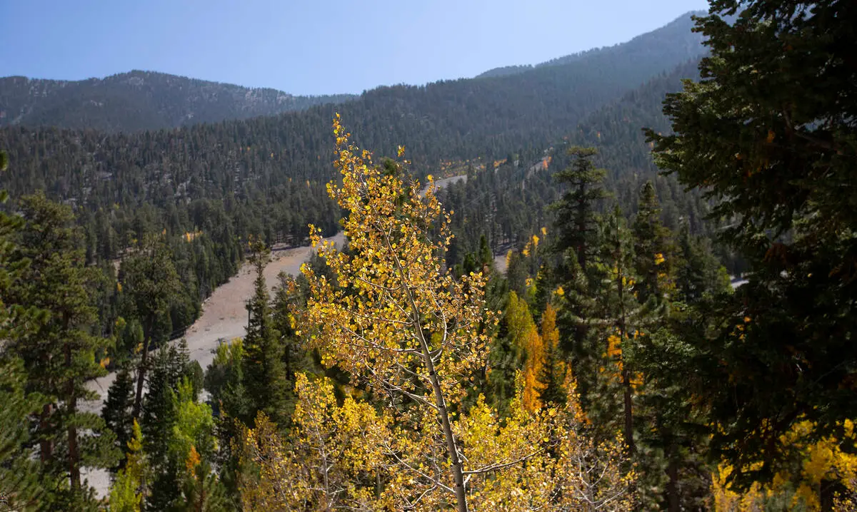
Less than an hour from the Strip, the Spring Mountains climb from Mojave scrub into ponderosa pine and high-elevation limestone ridgelines. The payoff is simple: cooler temps, actual shade, and hikes that feel like a different state.

Before you go: closures and alerts
A quick but important heads up: parts of the Mount Charleston trail system were heavily damaged by major flooding tied to Hurricane Hilary (August 2023). Some routes have had long-term closures and ongoing reconstruction since then, and conditions can change quickly.
- Check current status for your exact trailhead and route the day before you go (and again the morning of).
- If a trail is posted closed, treat it like closed. Not “one foot around the sign” closed.
- Use official sources: U.S. Forest Service (Humboldt-Toiyabe National Forest) Spring Mountains alerts, NDOT for road conditions (NV-156 and NV-157), and the National Weather Service forecast for Mount Charleston.
Later in this guide, I call out a few trails that have been impacted, plus easy swaps that tend to be more reliably accessible.
Why it feels cooler
Mount Charleston is a nickname for the high country around Charleston Peak in the Spring Mountains, managed by the U.S. Forest Service (Humboldt-Toiyabe National Forest). Elevation does the heavy lifting here.
- Las Vegas sits around ~2,000 to 2,500 feet (it varies by neighborhood), while many Mount Charleston trailheads start closer to ~6,500 to 9,000 feet depending on the route.
- As a rule of thumb, temperatures often drop about ~3 to 4°F per 1,000 feet gained. That can translate to roughly 15 to 25°F cooler at trail level, sometimes more, sometimes less.
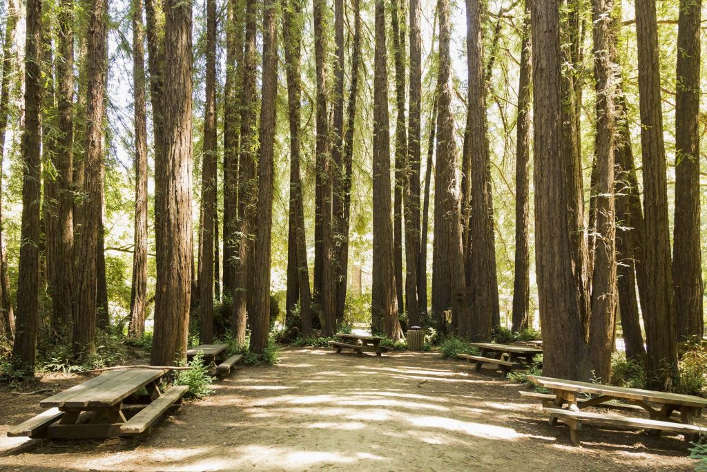
- Shade matters. Pine and fir forests plus north-facing canyons make midday hiking more realistic than on the desert floor.
This isn’t the Red Rock experience, just higher. It’s cooler, more forested, and way more weather-variable, with its own seasons, hazards, and trail etiquette.
Two ways up
Mount Charleston access is basically a choose-your-own-adventure with two main roads. Knowing which one you’re taking helps with planning, expectations, and last-minute pivots.
- Kyle Canyon Road (NV-157): The classic route for many popular trailheads and day-use areas. Great for canyon hikes and quick shade escapes, but also where storm impacts have been very visible in recent years.
- Lee Canyon Road (NV-156): A different side of the mountain with higher-elevation options and reliably forested vibes. It’s a strong pick for summer shade and cooler starts.
If one side has closures or weather issues, the other side can sometimes save your day.
Pick your hike by elevation
When you plan Mount Charleston, think in tiers. The higher you go, the cooler it gets, but the more likely you’ll run into late-season snow patches, wind exposure, or lingering closures after storms.
Tier 1: Shaded forest walks
These are the hikes I recommend if you want trees, steady grades, and a high chance of finishing before lunch without feeling cooked. Even here, check the current Forest Service status before you commit.
- Bristlecone Trail (Lee Canyon): Mostly forested with frequent shade and that quiet, cool-forest feeling you drove up for.
Quick stats: usually ~3 miles round trip, modest elevation gain (varies by starting point and exact loop/out-and-back choice).
Status: check Humboldt-Toiyabe NF/Spring Mountains updates before you go. - Fletcher Canyon: A canyon hike that often feels cooler than its mileage suggests thanks to the walls and vegetation. Watch for storm runoff signs in monsoon season.
Quick stats: commonly ~4 miles round trip, moderate elevation gain.
Status: verify trailhead access and any storm-related restrictions. - Cathedral Rock Trail: Shorter, scenic, and great if you want views without committing to a long day. Expect more sun exposure near the rock features.
Quick stats: often ~2 to 3 miles round trip, moderate gain for the distance.
Status: confirm current access and any temporary closures.
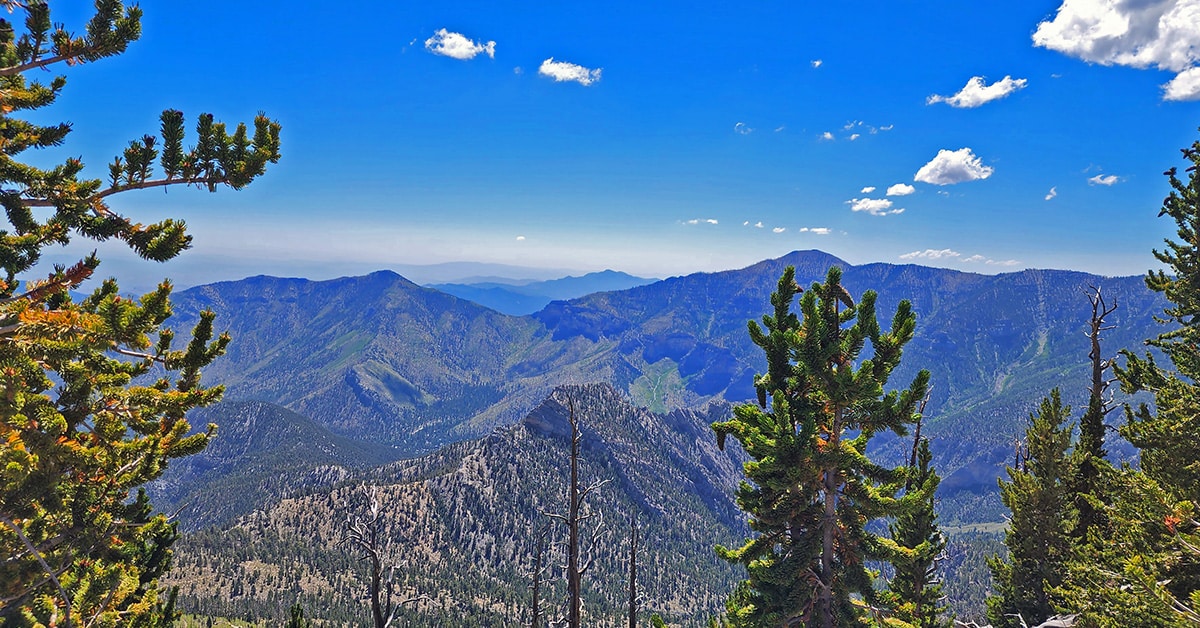
Tier 2: Big views without a full summit
If you want a more classic “mountain day” but don’t need to tag the highest point in southern Nevada, aim for ridges and viewpoints. Translation: bring mountain legs (steady climbing endurance), not just good vibes.
- North Loop Trail (to viewpoints): This route can be a choose-your-own adventure. Go far enough for sweeping views, then turn around before the full loop if you aren’t prepared for a long day.
Quick stats: viewpoints can be ~6 to 10+ miles round trip depending on turnaround, with significant elevation gain.
Status: check for post-storm conditions and trail work. - Griffith Peak (via South Loop): A demanding hike with rewarding ridge scenery. Start early for cooler temps and calmer winds.
Quick stats: commonly ~10 to 11 miles round trip, big elevation gain (around a few thousand feet).
Status: verify trail conditions, lingering snow, and any closures.
Tier 3: High alpine goals
These are the “bring your mountain legs” options where weather and seasonal snow matter more.
- Charleston Peak: The headline summit. Routes are long and serious for day hikers. Snow can linger on upper sections into late spring and sometimes into early summer depending on the year.
Quick stats: typically ~16 to 18+ miles round trip depending on route, with major elevation gain.
Status: confirm route access, snow, and any restoration work before you go.
Trailhead reality check: parking fills fast on weekends. For popular trailheads, arriving early is less about being intense and more about avoiding a long walk on asphalt before you even start hiking.
Trail notes: what might be closed
A few well-known Mount Charleston favorites have been impacted by flooding and storm damage in recent years, especially after Hurricane Hilary in August 2023. Two names you’ll see all over old blog posts are worth calling out:
- Mary Jane Falls (Trail Canyon area): This trail has seen major damage and long-term closures. Check current U.S. Forest Service status before you plan around it.
- Trail Canyon: The broader area has also been affected, with access and conditions changing as repairs continue. Verify before you go.
If you were aiming for that shaded-canyon feel and find closures, Lee Canyon options like Bristlecone Trail (and other open forest routes nearby) can be excellent substitutes depending on what’s currently accessible.
What summer means up here
Mount Charleston doesn’t follow the Las Vegas calendar. In the same year you can be dealing with 110°F heat in the valley and a cold wind plus snow patches up high.
Snow can linger
- After snowy winters, north-facing upper sections can hold snow well into late spring and sometimes beyond.
- Early-season melt creates mud, slick limestone, and runoff in shaded gullies.
- If you see snow on steep slopes and you don’t have traction, treat it as a turnaround signal, not a dare.
Access can change
The quickest way to avoid disappointment is to check current conditions the day before you go. Look up updates from Humboldt-Toiyabe National Forest for the Spring Mountains area, plus NDOT for NV-156 and NV-157. Summer storms, maintenance, and fire activity can temporarily close roads or trailheads.
Smoke happens
Even if Mount Charleston isn’t on fire, regional fires can affect air quality. If you have asthma or just hate hiking in a campfire haze, keep a flexible plan and be ready to pivot to a lower-effort forest walk or an indoor Vegas day.
Summer hazards
Mount Charleston is cooler than Las Vegas, but it’s still the desert Southwest. Two things catch visitors off guard: fast weather changes and how quickly “pleasant” turns into “exposed.”
Fire restrictions
In dry months, fire danger climbs. Follow posted rules about campfires, stoves, smoking, and parking. Hot exhaust on dry grass is a classic way to ruin everyone’s weekend.
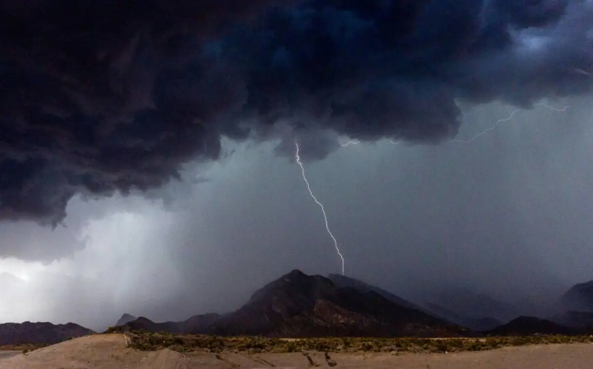
Flash floods and monsoon storms
Late summer often brings monsoon-style storms. Even when your sky’s blue, rain miles away can push water through narrow canyons.
- Avoid lingering in narrow washes if storms are in the forecast.
- If you hear sudden roaring water, see rising muddy flow, or notice debris moving, move to higher ground immediately.
Lightning on ridges
High points and open ridgelines aren’t the place to “wait it out.” Plan summit and ridge hikes with an early start so you’re heading down before afternoon storms build.
Altitude and dehydration
It’s cooler, so you may not notice how much water you’re losing. Add altitude, and headaches can show up fast.
- Bring more water than you think you need.
- Add electrolytes if you sweat heavily.
- Take your first mile slowly and let your breathing settle.
My no-drama packing list
Carry-on-only is my travel love language, but mountain days demand a few specific extras. Here’s what I actually bring when I’m trying to keep it simple and safe.
- Water: enough for your route plus a buffer. Don’t count on finding reliable water on trail.
- Electrolytes: tabs or powder
- Sun protection: hat, sunglasses, sunscreen. Shade isn’t constant.
- Light layers: a breathable long sleeve and a thin wind layer. Ridge winds can feel chilly even in July.
- Grippy shoes: limestone and loose gravel can be slick
- Offline map: cell service is inconsistent
- Headlamp: for early starts or slow returns
- Small first-aid kit: blisters happen
Dogs: generally allowed on many trails, but rules can vary by area and season. Keep them leashed, bring extra water for them, and assume there will be long dry stretches.
Pair it with a Vegas trip
If you’re visiting Las Vegas, the best way to do Mount Charleston is to treat it like a climate escape, not an all-day slog that leaves you too tired to enjoy the city.
Option A: Sunrise hike, Vegas afternoon
- Early morning: drive up while it’s still cool in the valley
- Morning: hike a Tier 1 or shorter Tier 2 route
- Late morning: picnic lunch at a shaded day-use area
- Afternoon: back in Vegas for a pool, a museum, or a long lunch somewhere air-conditioned
Option B: Late afternoon walk, dinner in the city
On very hot days, I like this schedule because you get cooler mountain air without the pressure of a big mileage goal.
- Mid-afternoon: drive up as the day starts to soften
- Late afternoon: short shaded hike
- Evening: return for dinner and a show
Coffee, minimal effort
My rule: get coffee in Vegas before you leave so you aren’t hunting for caffeine when you should be watching the road. Pick a neighborhood shop near your hotel, then head for the mountains with your cup and your playlist.
Don’t repeat the desert: If you already did Red Rock or Valley of Fire, Mount Charleston is your “different Nevada” day. Think forest air, limestone cliffs, and mountain weather, then come back to Vegas for the neon and the good food.
Quick logistics
- Drive time: typically under an hour from central Las Vegas, depending on trailhead and traffic
- Start time: earlier is better for parking, cooler hiking, and avoiding storms
- Permits and fees: vary by area and day-use site. Check current rules for the trailhead you choose.
- Where to check updates: U.S. Forest Service (Humboldt-Toiyabe NF) Spring Mountains alerts, NDOT road conditions, and the NWS Mount Charleston forecast
- Leave no trace: pack out trash, stay on trail, and respect wildlife and vegetation
If you only remember one thing: Mount Charleston is cooler, not consequence-free. Bring more water than you think, start earlier than you want, and turn around sooner than your ego prefers.
Choose your day
If you want maximum shade: pick a canyon or forest route and keep it to a half-day.
If you want views: go for a ridge hike with an early start and a weather check.
If you want a summit: commit to Charleston Peak only when conditions and daylight line up, and treat it like a real mountain objective.
Las Vegas will still be there when you get back. The difference is you’ll return with pine needles on your socks, cooler skin, and that rare satisfaction of finding summer relief in the same metro area.